Blog Feed
- Green Island Ferry Guide – Travel Smart and Save Money
Green Island is the best diving location in Taiwan, and it also has amazing historical and geological sites to explore. Despite this, the only way for most tourists to get to Green Island is via a 50-minute ferry ride. There is an airplane option, but seats are limited and often booked months in advance. Many ferries travel to and from the island daily with plenty of extra seats available, and there are two ports to choose from. The whole process may seem complicated, but in this guide, we will make traveling to Green Island via ferry easy for you.
I have travelled the Green Island Ferry three times. There are a few things I wish I had known earlier regarding taking the ferry that would have made the trips easier, which is why I have created this guide.
Green Island Ferry Routes:
You can purchase boat ferry tickets through a tour agency such as Klook here or KKday here.
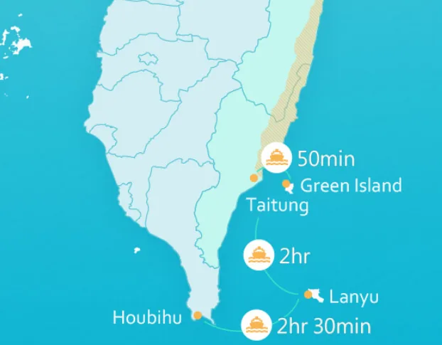
There are two places that offer ferry rides to Green Island: Houbihu Harbor (恆春後壁湖漁港) in Pingtung and Fugang Harbor in Taitung (臺東富岡漁港). However, to get there from Houbihu, you need to stop at Orchid Island, and the trip takes much longer. Ferries may be cancelled during Typhoons and winter months from October to March.Taitung to Green Island 台東到綠島
This is the most direct route to Green Island and the route that most people take.
Ferry from Fugang Harbor (富岡漁港) in Taitung to Nanliao Harbor (南寮漁港) on Green Island:
- Price: 1200 NT (600 NT per single trip)
- Total travel time: 50-minute trip one way
- Boats leave about every two hours, five times a day
- The first boat leaves Taitung at about 7:00 AM, and the last boat leaves Green Island at about 4:30 PM.
Ferry Boat costs:
There are also about three ferry companies that operate at both harbors. Both companies leave from both harbors at the same time and arrive at about the same times for the same prices (1200 NT per person round trip/600 NT per single trip).
You can purchase tickets through a tour agency such as Klook here or KKday here.Ferry Boat Times:
- 7:30 AM departure from Fugang Harbor, 8:20 AM arrival to Green Island.
- 8:30 AM departure from Green Island, 9:20 AM arrival to Fugang Harbor.
- 9:30 AM departure from Fugang Harbor, 10:20 AM arrival to Green Island. (permanent set time)
- 10:30 AM departure from Green Island, 11:20 AM arrival to Fugang Harbor. (permanent set time)
- 11:30 AM departure from Fugang Harbor, 12:20 PM arrival to Green Island.
- 12:30 PM departure from Green Island, 9:20 PM arrival to Fugang Harbor.
- 13:30 PM departure from Fugang Harbor, 14:20 PM arrival to Green Island. (permanent set time)
- 14:30 PM departure from Green Island, 15:20 PM arrival to Fugang Harbor. (permanent set time)
- 15:30 PM departure from Fugang Harbor, 16:20 PM arrival to Green Island.
- 16:30 PM departure from Green Island, 17:20 PM arrival to Fugang Harbor.
- *Note: the above times change according to the seasons. There may only be one boat per day during winter (October to March), or cancelled altogether, while all the boat times may be available during summer break and weekends (except during Typhoons).
Please double-check which times are available before you go:
Feiyu Company Timetable: https://ferry.tw/time-table/lyudao
Green Island Star No. 3 Timetable: https://greenstar.okgo.tw/multimedia4.html
Taitung/Pintung to Orchid Island to Green Island 屏東到蘭嶼到綠島
This route is ideal if you want to visit both Orchid Island and Green Island. However, the whole trip takes about 5.5 hours and can be very rocky. Also, during the winter months (October to March), the route can be cancelled.
Booking to visit Green Island via Houbihu can be hard, and I don’t recommend taking that route unless you can speak Chinese or have a Chinese-speaking friend with you (the boat schedules are not as predictable).
For most tourists wanting to visit Green Island, I suggest departing from Taitung.Ferry from Fugang Harbor (富岡漁港) in Taitung via Kaiyuan Fishing Port (開元漁港) on Orchid Island:
- Price: 2400 NT. You can purchase ferryboat tickets at a discount on Klook here or KKday here.
- Total travel time: Over 5.5 hours with stops on Orchid Island and Green Island
- Boats leave about every two hours
- The first boat leaves at about 7:00 AM, and the last boat leaves at about 4:30 PM.
- Your round-trip ticket may include a stop at Green Island. Make sure the second ticket stops in Green Island, because not all do. Usually, the Green Island stop is on the afternoon Ferry that leaves Orchid Island at 3 PM.
- There is no single ticket between Green Island and Lanyu. It needs to be included in a package to or from Taiwan.
- Booking a ticket from Houbihu to Orchid Island may be difficult. I could not find a place to buy them online at the time of writing this blog. A safer option would be to buy a ticket from Taitung to Orchid Island that circles back to Green Island.
Ferry from Houbihu Harbor (恆春後壁湖漁港) in Pingtung via Kaiyuan Fishing Port (開元漁港) on Orchid Island:
- Price: 2400 NT. You can purchase ferryboat tickets at a discount on Klook here or KKday here.
- Total travel time: Over 5.5 hours with stops on Orchid Island and Green Island
- Boats leave about every two hours
- The first boat leaves at about 8:00 AM, and the last boat leaves at about 4:50 PM.
- Note you will need to purchase two tickets: Houbihu to Orchid Island, then Orchid Island to Taitung. Make sure the second ticket stops in Green Island, because not all do. Usually, the Green Island stop is on the afternoon Ferry that leaves Orchid Island at 3 PM.
- There is no single ticket between Green Island and Lanyu. It needs to be included in a package to or from Taiwan.
- Booking a ticket from Houbihu to Orchid Island to Green Island may be difficult. I could not find a place to buy them online at the time of writing this blog. A safer option would be to buy a ticket from Taitung to Orchid Island that circles back to Green Island.
Ferry Prices:
There are two ferry companies that operate this route. Both companies leave from both harbors at the same time and arrive at the same time for the same price (2400 NT per person round trip/1150 NT per single trip).
Ferry Boat costs:
You can book tickets for a discount on Klook here or KKday here.Ferry Times:
7:30/7:00 AM departure, 9:30 AM arrival to Lanyu.
12:00/12:30 PM departure, 3:00 PM arrival to Lanyu.
9:30 AM departure from Lanyu, 11:30 arrival to Taitung or Pingtung.
3:00 PM departure from Lanyu, 5:00 PM arrival to Taitung or Pingtung.
Usually, the boat that stops on Green Island departs at 3 PM.
Both ferry companies depart and arrive at the same time at both locations.
You can purchase ferryboat tickets for a discount on Klook here or KKday here.Taitung’s Fugang Harbor 富岡漁港
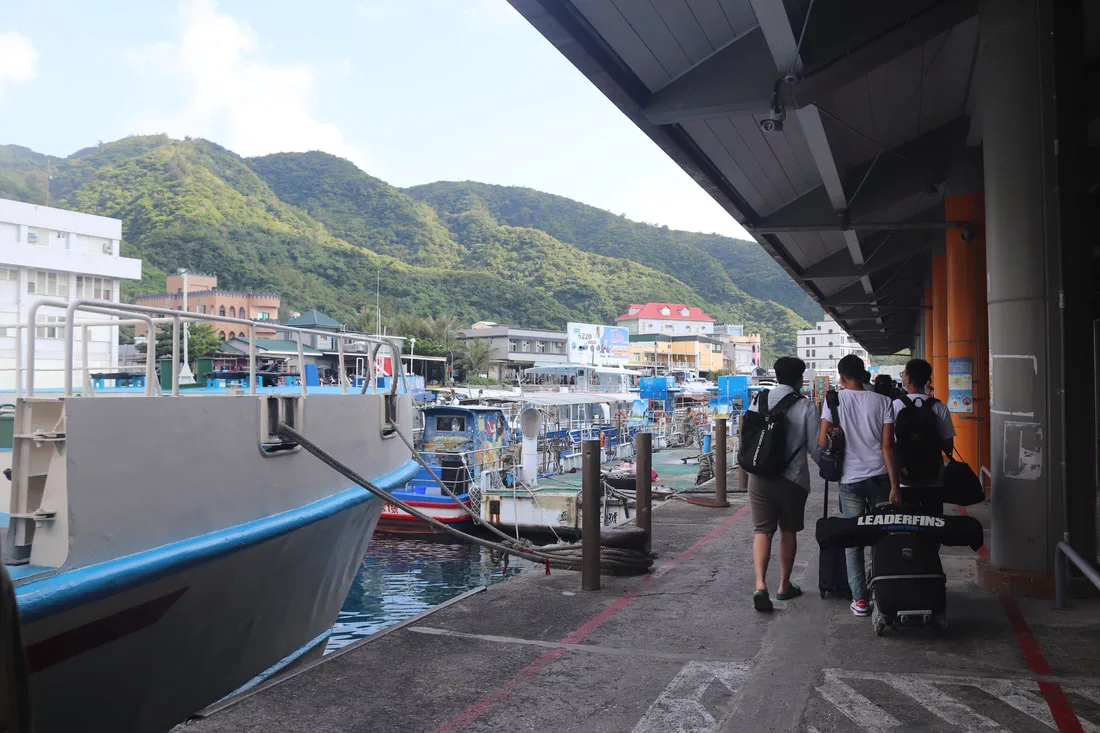
One of the hardest decisions for us was picking which ferry time to leave. We decided to visit in October when there were fewer people but still warm temperatures. However, there were also fewer ferries. Because we were traveling with kids, we couldn’t leave too late or early from Taipei, so we stopped halfway in Hualien and spent a night there. We planned to take the 3:30 PM ferry to Green Island, but we got an early start and ended up driving down to Fugang Harbor in time for the 1:30 PM Ferry.
Parking next to Fugang Harbor is pretty much impossible unless you want to pay someone nearby 200 NT a day. I ended up parking up the hill on a country road for free for four days, and my car was fine when I got back.
We got to the main ticket hall, picked up our tickets, went to the bathroom, and then waited in the hot sun for the boat to arrive.
You can purchase ferry boat tickets for a discount through a tour agency such as Klook here or KKday here.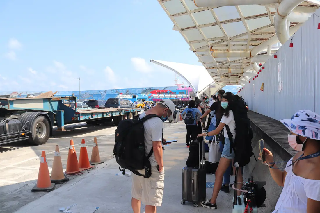
There is some shade as you wait in line if you get there early. The boat finally came, and we were able to board.
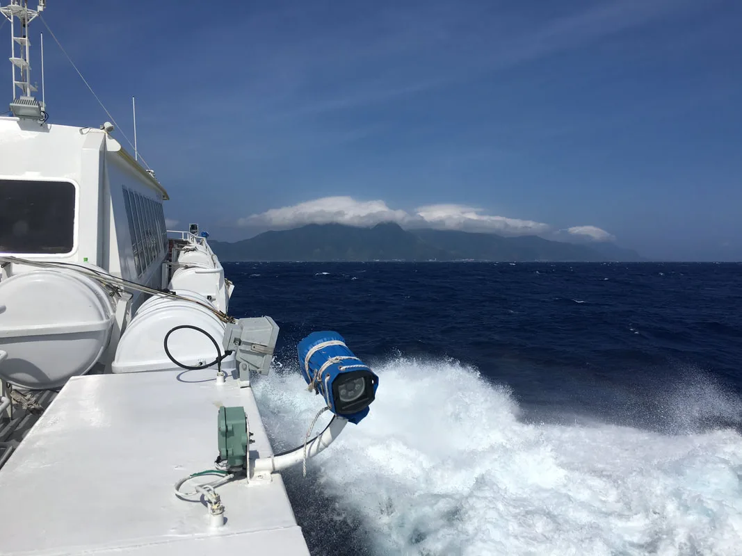
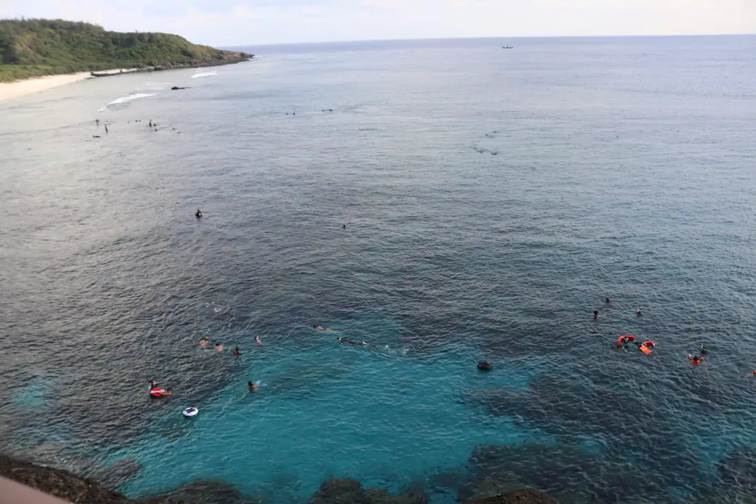
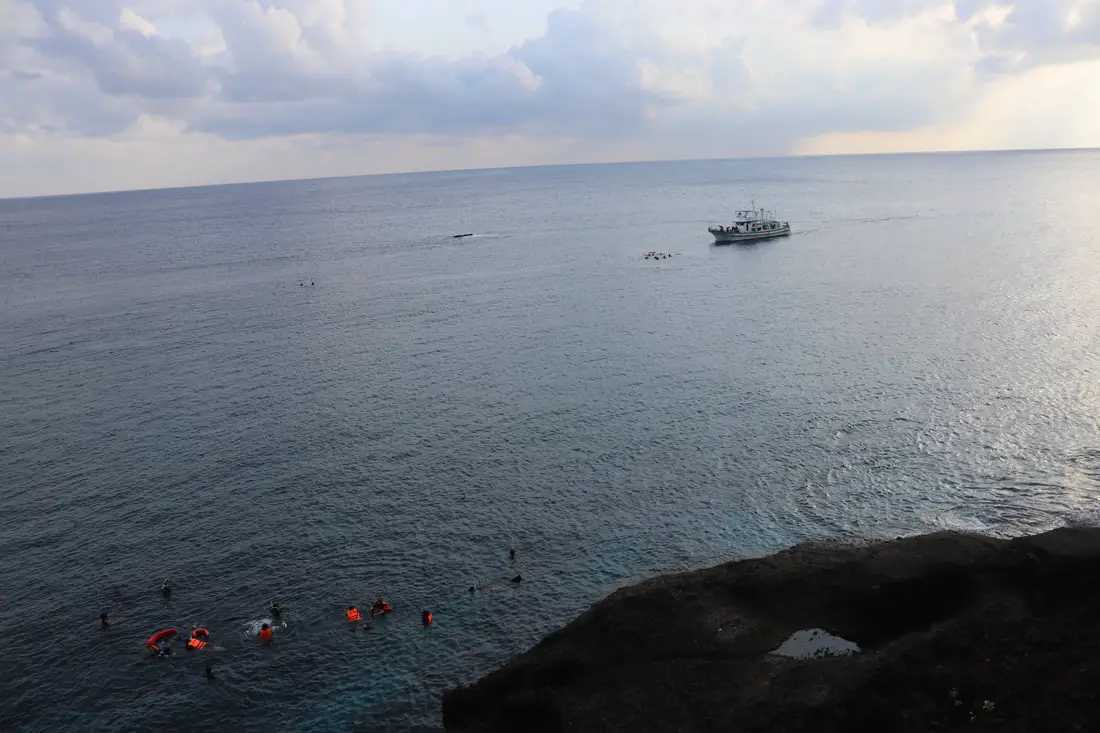
The boat ride over can be very shaky. Best to take some seasick pills, I’m serious. Also, it is best to sit on the bottom near the back of the boat for less movement. This boat goes on the open Pacific, and it can be like a roller coaster ride. Also, make sure your luggage is secure.
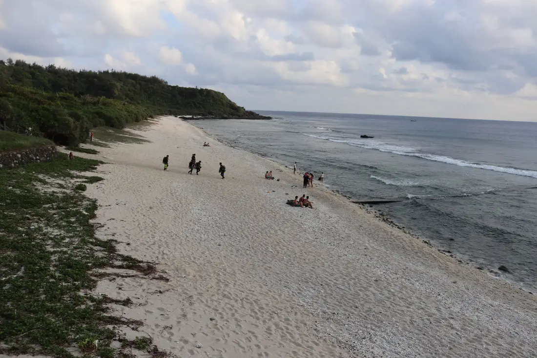
Both there and back, our kids threw up. There are plastic bags on the seats to throw up in. The adults around us also threw up. Those 50 minutes were long, but they eventually passed.Nanliao Harbor 南寮漁港
We finally made it to Nanliao Harbor. I went to the first scooter shop I could see and rented a scooter for 400 NT for a day, and he only charged me for three days instead of four. He also offered a free van ride to our hostel to transport our luggage for free.
We stayed at and can recommend Fire Island Guesthouse, which is a high-quality B&B right on the east coast of the island.
You can book a scooter rental for Green Island on Klook here or KKday here.Houbihu Harbor (恆春後壁湖漁港) in Pingtung
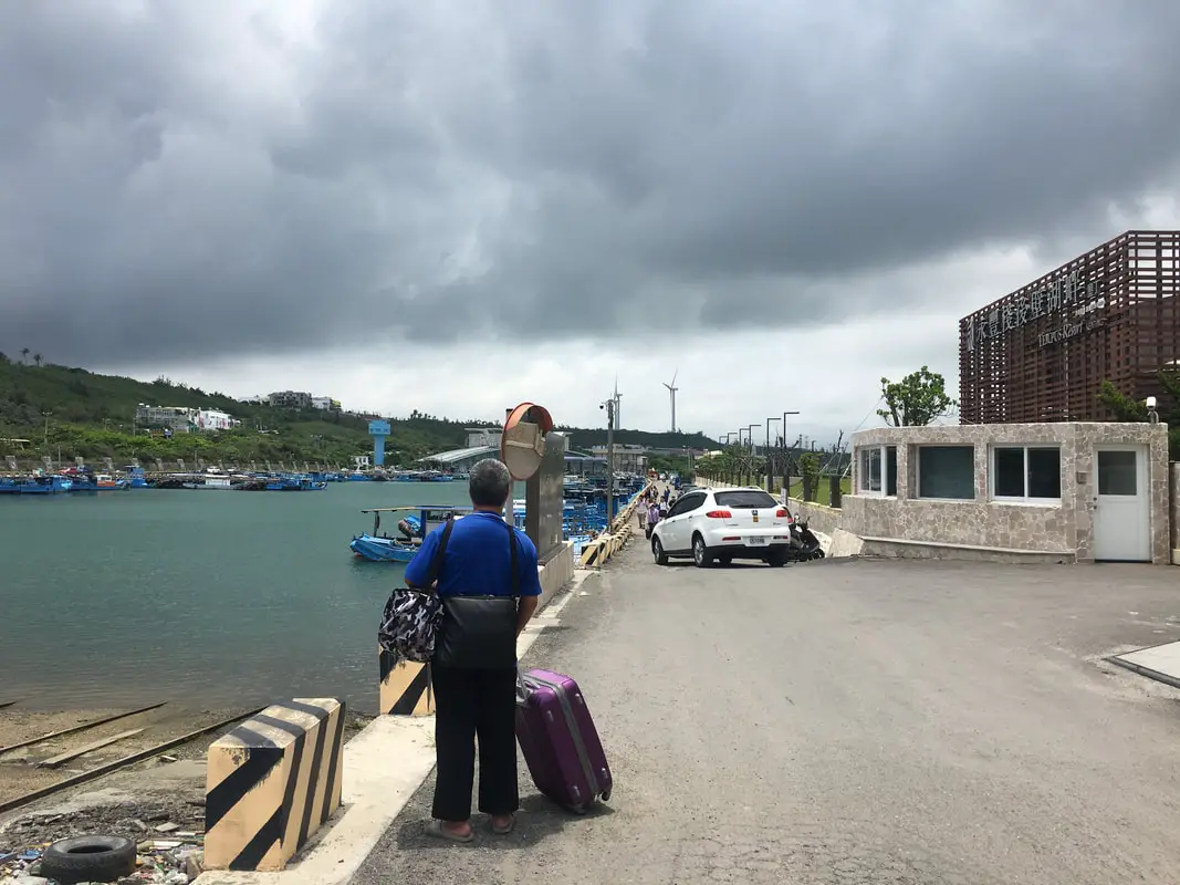
We decided to take the ferry from Kenting (technically Hengchun, Houbihu Harbor) because we knew the flights to Taitung would be hard to book and might be canceled, and because we had just recently vacationed in Taitung and I wanted to go back to Kenting. After three days in Kenting, we decided it would be okay to do an overnight trip to Orchid Island. We departed on the 1:00 PM boat. The dock was hard to find, but eventually, a lady told us to go to the yellow building on the west end of the harbor. We had booked our tickets online and already paid half.
You can purchase ferryboat tickets for a discount on Klook here or KKday here.We took the Green Island Star No. 3 (綠島之星3號) to Lanyu, which sucked; it was way too hot, A/C had problems, and there were huge waves. Coming back, we took a different boat from the same company, the Green Island Star (綠島之星), which was much cooler and more comfortable. This line has three ships that run from Kenting to Orchid Island to Green Island, then to Taitung, and back again.
We were told there would be parking at the dock, but it was scarce. We ended up driving through a huge crowd of people and parking on the side of the road.
The boat ride was long, and there was no TV. Our hostel owner told us to bring a coat because it would be cold on the boat. That was a complete lie; it was freaking hot (mid-May), and to make things worse, there was some wind, which meant huge waves. My daughter barfed within half an hour, and after two hours, we all felt sick. Some of her barf unfortunately got stuck on the seat, which I don’t know whether or not it will ever come out. After that, I tried to take her on deck (where we saw the first sign of Lanyu above), but it was even hotter outside.
Kaiyuan Fishing Port (開元漁港) on Orchid Island
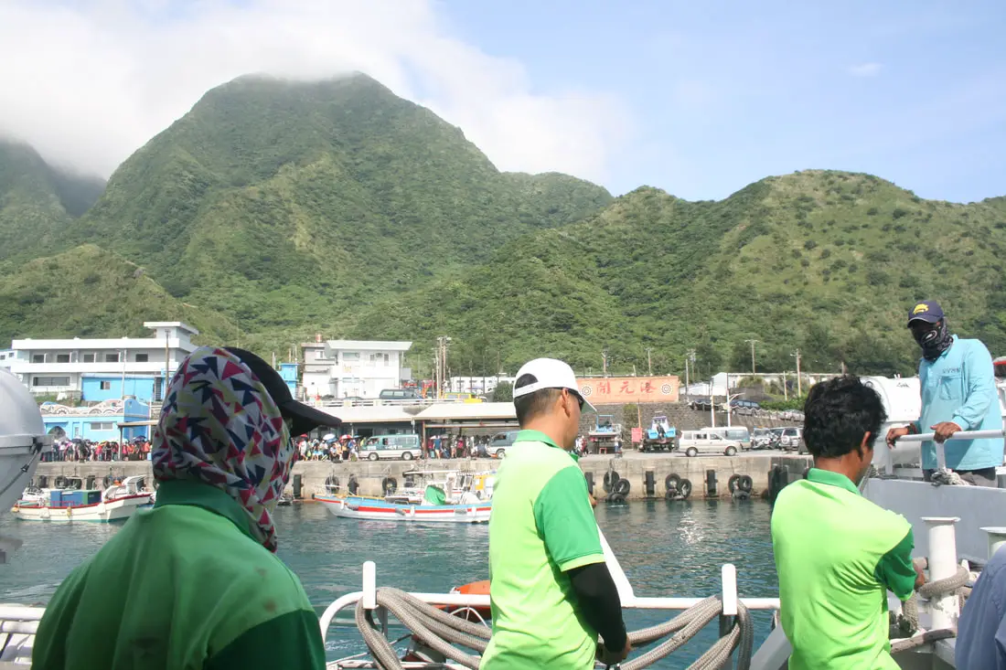
We were anxious to get off the boat. There is room for you to store your luggage at the back of the boat. Then, after getting your luggage, you have to walk on a boardwalk to get to shore. Our hostel owner was waiting for us in a van at the dock, along with about 20 other hostel owners. We had to wait for the crowds to clear before we could move. There are also many scooter rental places next to the harbor entrance.
I have never taken the last ferry leg between Green Island and Orchid Island, so that will be a tale for another time.
Map of Ferry Harbors in this Blog
The map above shows the four ferry harbors in this blog: Fugang Harbor (富岡漁港) in Taitung to Nanliao Harbor (南寮漁港) on Green Island, Houbihu Harbor (恆春後壁湖漁港) in Pingtung, and Kaiyuan Fishing Port (開元漁港) on Orchid Island.
How to Buy Ferry Tickets to Green Island and Orchid Island (怎麼買傳票去綠島或蘭嶼):

There are a few ways to buy ferry tickets:
- Klook: Taitung to Green Island
- KKday: Taitung to Green Island, or Houbihu to Lanyu/Orchid Island to Green Island
- Trip.com: Taitung to Green Island
- Feiyu Company Website: No English
- Kaixuan Company Website: Very limited English
- Green Island Star Website: Very limited English
- Book through your Hotel/Hostel owner
- Buy tickets in person at the counter (credit cards are accepted)
We recommend buying through Klook here or KKday here because they sell tickets at a discount, for quite a bit cheaper than buying through the company website or the counter.
Getting to Green Island By Plane
The only planes to and from Green Island come from Taitung City in Southeastern Taiwan. From Taipei, there are daily flights from Songshan Airport to Taitung, where you can switch to Daily Air which will take you the rest of the way to Green Island.
You can book discount tickets from Taipei to Taitung on KKday here.
Flight times: As of the time of this blog, there were six flights per day by Daily Air Corporation from about 8 AM to 4 PM (Please note their website is only in Chinese). The flight from Taitung to Green Island takes about 15 minutes. Please note that the aircraft are small and flights can be canceled due to high winds or unfavorable weather.
Costs: NT 1428 to Green Island and NT 1360 from Green Island.Getting around the island:
Rent a scooter! The island is small, so you should not need to rent a car. You can rent bicycles, but you will not be able to travel as fast. You can also hire a driver to take you on tours.
Ask your hostel for more rental information. They can help you book a rental in advance.Scooter Rental:
Price: expect 400 NT per day.
You can book a scooter rental for Green Island on Klook here or KKday here.
It may be better to book your scooter rental in advance, especially during summer weekends. Ask for help from your hostel owner if needed.
I am 100% percent certain you do not need a Taiwan local license to rent scooters here, however, they may ask for an international license (but I’m fairly sure they will let you rent without one).
Helmet wearing is not enforced at all as you will quickly find, but it’s still the law.
Also, be careful to not hit any goats because they wander as they please.
There is only one gas station next to Nanliao Fishing Harbor.Car Rental:
Price: expect 2000 NT per day.
You can rent a car for Green Island using KKday here.By Bicycle:
Cycling is the best way to enjoy Taiwan’s landscapes if you have the time and energy. Looking for bicycle rentals in Taiwan? You can search on KKday here and search for tours on Klook here. You can also check out our Taiwan cycling guide here.
Where to Stay:
Booking accommodation on the island can be difficult in the summer months and on weekends, when rooms can be fully booked for months in advance. Airbnb has the most choices; however, there is also a better quality selection on Agoda.com.
We stayed at and can recommend Fire Island Guesthouse, which is a high-quality B&B right on the east coast of the island.
My hostel did not require that I pay for my room in advance via bank wire transfer (as was the case on Lanyu), but they required me to pay in cash.
Expect to pay 2000 – 4000 NT per night for a standard double room on Green Island.Tours and Activities:
There are many companies offering snorkeling, diving, SUPing, and other tours on Green Island. You can search for tours on Klook here or KKday here.
You can also book discount tickets to Zhaori Hot Spring on KKday here.
You can also book Wifi and SIM cards for Taiwan on Gigago here.
Just to let you know, if you book using the links above, we get some commission at no cost to you, and you can help support our blog.
You can click here to receive $5 USD on your first Klook purchase.Tourist Guide to Green Island:
Green Island is a paradise off the southeastern coast of Taiwan. Once a prison for political enemies of the KMT, it is now a tourist hotspot. It is one of the best places to snorkel and dive in Taiwan, one of only three saltwater hot springs in the world, and it also includes amazing volcanic rock formations and scenery all around the island. In this blog, we will explain how to get there, what to do, where to go, and how to enjoy this island.
Check out our full tourist guide to Green Island here.For more of Taiwan’s outer Islands, you can check out our full guides to Xiaoliuqiu here, Penghu here, Kinmen here, Matsu here, and Orchid Island here.
You can also check out our full guide to all of Taiwan’s outer islands here.
You can also check out our full guide to Taiwan here. - Orchid Island (Lanyu) Ferry Guide – Travel Smart and Save Money
Orchid Island has the best-preserved aborigine culture in Taiwan, and it also has an amazing coastline, great diving and snorkeling, and historical and geological sites to explore. Despite this, the only way for most tourists to get to Orchid Island is via a 2-hour ferry ride. There is an airplane option, but seats are limited and often booked months in advance. Many ferries travel to and from the island daily with plenty of extra seats available, and there are two ports to choose from. The whole process may seem complicated, but in this guide, we will make traveling to Orchid Island via ferry easy for you.
I have travelled the Orchid Island Ferry twice. There are a few things I wish I had known earlier regarding taking the ferry that would have made the trips easier, which is why I have created this guide.
Orchid Island Ferry Routes:
You can purchase boat ferry tickets through a tour agency such as Klook here or KKday here.
There are two places that offer ferry rides to Green Island: Houbihu Harbor (恆春後壁湖漁港) in Pingtung and Fugang Harbor in Taitung (臺東富岡漁港). You cannot get to Orchid Island from Green Island that I know of.Taitung to Orchid Island 台東到綠島
This is the most direct route and the shortest route to Orchid Island, and the route that most people take.
Ferry from Fugang Harbor (富岡漁港) in Taitung to Kaiyuan Fishing Port (開元漁港) on Orchid Island:
- Price: 2400 NT. You can purchase ferryboat tickets at a discount on Klook here or KKday here.
- Total travel time: 2.5 hours (unless you stop on Green Island on the way back), and 3 hours back.
- Boats leave about every two hours
- The first boat leaves at about 7:00 AM, and the last boat leaves at about 12:30 PM.
- There are only about 2 boats that leave a day, or more, during the peak season.
Ferry Prices:
- Price: 2400 NT for a round trip, or 1200 for a single trip. The Ferry boat that leaves at 3 PM to Taitung is likely to stop at Green Island. You can purchase ferryboat tickets at a discount on Klook here or KKday here.
Ferry Times:
7:30/7:00 AM departure, 9:30 AM arrival to Lanyu.
12:00/12:30 PM departure, 3:00 PM arrival to Lanyu.
9:30 AM departure from Lanyu, 11:30 arrival to Taitung or Pingtung.
3:00 PM departure from Lanyu, 5:00 PM arrival to Taitung or Pingtung.
Usually, the boat that stops on Green Island departs at 3 PM.
Both ferry companies depart and arrive at the same time at both locations.
You can purchase ferryboat tickets for a discount on Klook here or KKday here.Ferry From Orchid Island to Green Island
- If you want to visit Green Island too, make sure the second ticket stops in Green Island, because not all do.
- Usually, the trip to Green Island departs at 3 PM.
- There are usually only tickets from Orchid Island to Green Island, not the other way around.
- In general, there is no single ticket between Green Island and Lanyu. It usually needs to be included in a package to or from Taitung.
- Booking a ticket from Houbihu to Orchid Island to Green Island may be difficult. I could not find a place that sells this route online at the time of writing this blog. A safer option would be to buy a ticket from Taitung to Orchid Island that circles back to Green Island.
Pintung to Orchid Island 屏東到蘭嶼
This trip is only two hours, compared to 2.5 hours on the Taitung to Orchid Island route. There are also usually more times and boats available. However, during the winter months (October to March), the route can be cancelled.
Ferry from Houbihu Harbor (恆春後壁湖漁港) in Pingtung via Kaiyuan Fishing Port (開元漁港) on Orchid Island:
- Price: 2400 NT. You can purchase ferryboat tickets at a discount on KKday here.
- Total travel time: Over 2 hours
- Boats leave about every two hours
- The first boat leaves at about 8:00 AM, and the last boat leaves at about 4:50 PM.
Ferry Prices:
There are two ferry companies that operate this route. Both companies leave from both harbors at the same time and arrive at the same time for the same price (2400 NT per person round trip/1150 NT per single trip).
Ferry Boat costs:
You can book tickets for a discount on Klook here or KKday here.Ferry Times:
7:30/7:00 AM departure, 9:30 AM arrival to Lanyu.
12:00/12:30 PM departure, 3:00 PM arrival to Lanyu.
9:30 AM departure from Lanyu, 11:30 arrival to Taitung or Pingtung.
3:00 PM departure from Lanyu, 5:00 PM arrival to Taitung or Pingtung.
Usually, the boat that stops on Green Island departs at 3 PM.
Both ferry companies depart and arrive at the same time at both locations.
You can purchase ferryboat tickets for a discount on Klook here or KKday here.Taitung’s Fugang Harbor 富岡漁港
One of the hardest decisions for us was picking which ferry time to leave. We decided to visit in October when there were fewer people but still warm temperatures. However, there were also fewer ferries. Because we were traveling with kids, we couldn’t leave too late or too early from Taipei, so we stopped halfway in Hualien and spent a night there. We planned to take the 3:30 PM ferry to Green Island, but we got an early start and ended up driving down to Fugang Harbor in time for the 1:30 PM Ferry.
Parking next to Fugang Harbor is pretty much impossible unless you want to pay someone nearby 200 NT a day. I ended up parking up the hill on a country road for free for four days, and my car was fine when I got back.
We got to the main ticket hall, picked up our tickets, went to the bathroom, and then waited in the hot sun for the boat to arrive.
You can purchase ferry boat tickets for a discount through a tour agency such as Klook here or KKday here.There is some shade as you wait in line if you get there early. The boat finally came, and we were able to board.
The boat ride over can be very shaky. Best to take some seasick pills, I’m serious. Also, it is best to sit on the bottom near the back of the boat for less movement. This boat goes on the open Pacific, and it can be like a roller coaster ride. Also, make sure your luggage is secure.
Both there and back, our kids threw up. There are plastic bags on the seats to throw up in. The adults around us also threw up. Those 50 minutes were long, but they eventually passed.Nanliao Harbor 南寮漁港 on Green Island
We finally made it to Nanliao Harbor. I went to the first scooter shop I could see and rented a scooter for 400 NT for a day, and he only charged me for three days instead of four. He also offered a free van ride to our hostel to transport our luggage for free.
We stayed at and can recommend Fire Island Guesthouse, which is a high-quality B&B right on the east coast of the island.
You can book a scooter rental for Green Island on Klook here or KKday here.Houbihu Harbor (恆春後壁湖漁港) in Pingtung
We decided to take the ferry from Kenting (technically Hengchun, Houbihu Harbor) because we knew the flights to Taitung would be hard to book and might be canceled, and because we had just recently vacationed in Taitung and I wanted to go back to Kenting. After three days in Kenting, we decided it would be okay to do an overnight trip to Orchid Island. We departed on the 1:00 PM boat. The dock was hard to find, but eventually, a lady told us to go to the yellow building on the west end of the harbor. We had booked our tickets online and already paid half.
You can purchase ferryboat tickets at a discount on Klook here or KKday here.We took the Green Island Star No. 3 (綠島之星3號) to Lanyu, which sucked; it was way too hot, A/C had problems, and there were huge waves. Coming back, we took a different boat from the same company, the Green Island Star (綠島之星), which was much cooler and more comfortable. This line has three ships that run from Kenting to Orchid Island to Green Island, then to Taitung, and back again.
We were told there would be parking at the dock, but it was scarce. We ended up driving through a huge crowd of people and parking on the side of the road.
The boat ride was long, and there was no TV. Our hostel owner told us to bring a coat because it would be cold on the boat. That was a complete lie; it was freaking hot (mid-May), and to make things worse, there was some wind, which meant huge waves. My daughter barfed within half an hour, and after two hours, we all felt sick. Some of her barf unfortunately got stuck on the seat, which I don’t know whether or not it will ever come out. After that, I tried to take her on deck (where we saw the first sign of Lanyu above), but it was even hotter outside.
Kaiyuan Fishing Port (開元漁港) on Orchid Island
We were anxious to get off the boat. There is room for you to store your luggage at the back of the boat. Then, after getting your luggage, you have to walk on a boardwalk to get to shore. Our hostel owner was waiting for us in a van at the dock, along with about 20 other hostel owners. We had to wait for the crowds to clear before we could move. There are also many scooter rental places next to the harbor entrance.
I have never taken the last ferry leg between Green Island and Orchid Island, so that will be a tale for another time.
Map of Ferry Harbors in this Blog
The map above shows the four ferry harbors in this blog: Fugang Harbor (富岡漁港) in Taitung to Nanliao Harbor (南寮漁港) on Green Island, Houbihu Harbor (恆春後壁湖漁港) in Pingtung, and Kaiyuan Fishing Port (開元漁港) on Orchid Island.
How to Buy Ferry Tickets to Orchid Island (怎麼買傳票去綠島或蘭嶼):
There are a few ways to buy ferry tickets:
- Klook here: Taitung to Orchid Island
- KKday: Taitung to Orchid Island, or Houbihu to Lanyu/Orchid Island to Green Island
- Trip.com: Taitung to Orchid Island, or Houbihu to Orchid Island
- Feiyu Company Website: No English
- Kaixuan Company Website: Very limited English
- Green Island Star Website: Very limited English
- Book through your Hotel/Hostel owner
- Buy tickets in person at the counter (credit cards are accepted)
We recommend buying through Klook here or KKday here because they sell tickets at a discount, for quite a bit cheaper than buying through the company website or the counter.
Historical and Cultural Background of Orchid Island:
Orchid Island became inhabited about 800 years ago by the Tao indigenous people (達悟族) (aka Yami people 雅美族, which is a name coined by the Japanese, but the native people prefer Tao), who are thought to have traveled from the Batanes Islands in the Philippines, which are a little less than 200 KM away, cut off by the Bashi Channel. However, Orchid Island is very different than the Philippines.
Beginning in 1644, some Dutch Sailors were sent to investigate the island, and some settled there among the natives. Because of this, the Island was known as Red Head Island (紅頭嶼) by the Chinese and the Japanese.
After the Dutch were defeated in Taiwan, Lanyu was claimed but not controlled by the Qing Dynasty.
The Japanese claimed the Island shortly after the Sino-Japanese War in 1895, but protected it as an “ethnological research site” and forbade outsiders from entering.
After the Republic of China took over Taiwan following the end of WWII, it continued to ban visitors to the island until 1967, after which tourists were allowed to enter, and public schools were built there.
Christian missionaries began preaching and living on the island starting in the 1950s, and now basically all native people on the island are Christian (mixed with traditional beliefs). However, Christianity was introduced much earlier, starting with the Dutch in the 1600s, although to a lesser extent.
In 1982, a nuclear waste storage plant was built on the south side of the Island without the islanders’ consent, causing protests from the inhabitants. Also, because of this, the Island inhabitants receive free electricity.
The island is volcanic in nature, with the last major eruption being over 5 million years ago. The highest mountain is 552 meters (1,811 feet).
Currently, there are 2,400 people permanently living on the island, 90% of them being of native Tao descent.Tao Culture:
The Tao people number about 2,000 living on Orchid Island, with about another 2,000 living on the Taiwan mainland. The Tao people rely on the sea for survival, and much of their traditions and lifestyle are centered on fishing.
The Tao people are mostly Christian, but also still practice many of their traditional beliefs. However, their ancestral religion included a pantheon of Gods.
Traditional roles for men are fishing, while roles for women include harvesting taro and sweet potato and weaving. The men usually fish at night or early morning and rest on traditional wooden platforms during the day.
Boats are made from planks of wood and are painted red, white, and black. The boat usually has human figures, waves, and the traditional sun image (red and black circles and sun rays), which is said to ward off evil spirits. Boats are considered sacred and the ultimate human creation. There is also a launching ceremony for new boats in which traditional clothes and headgear (such as silver helmets for men and wooden hats for women) are worn, pigs are slaughtered, and the boat is lifted into the air multiple times before being set in the water. Traditional clothes include loincloths and vests for men, and aprons and vests for women. Young people on the street usually do not wear traditional dress.Flying Fish Festival:
There are three basic seasons on Lanyu: one is the flying fish season, when flying fish can be easily caught and used, and lasts from February to May. The other seasons are from May to October and from October to February, when flying fish cannot be caught for ceremonial use. There are many taboos during the flying fish season, which are discussed below.
The Flying Fish Festival lasts from about March to October, when flying fish are caught. During this time, many ceremonies take place, such as the beginning of the festival, the plentiful harvest, etc. During the festival, there are multiple migrations of flying fish species near Lanyu. There are many taboos during this time, especially when it comes to catching and eating flying fish, which are the main source of life for the Tao people.Weather and Climate:
The island has a tropical rainforest climate, with average high temperatures between 20 and 30 degrees year-round. The rainy months are in summer, especially due to Typhoons, but the sunniest days are also in summer (expect a lot of sun), and the rainiest days are in winter. Summer is the tourist season, but spring and fall are also popular times to visit. Winters are said to be dreary and cold, and have constant northeastern winds that can stop airplanes and ferries from departing to the island.
When to go:
The best time to go, they say, is around May when it is not too hot, and there are no northeasterly winds or typhoons which can cancel your transportation to the island.
The typhoon season lasts from around June to October. The busy season is during summer break from June to August, during which time it can be hard to book a hostel or airplane ticket. Winter is the less crowded season, but the water will be cold, there will be constant wind (which could cancel transportation), and it will rain more often.Taboos:
General Taboos:
- Do not take pictures of or enter any of the underground houses without permission.
- Do not use any of the resting pavilions without permission, and if you are given permission, take off your shoes before entering.
- Do not visit schools when they are in session.
- Do not speak loudly or shout while inside the villages.
- When villagers are performing traditional rituals, watch from a distance and keep quiet.
- Do not touch or enter traditional canoes
- Do not disturb the ecology or habitat when snorkeling, hiking, etc.
- Do not bring any plants or animal parts with you when you leave Lanyu.
Flying Fish Season Taboos (February to June):
- Do not take photos or get near the fisherman or catch when they are coming ashore
- Do not touch or get into canoes to take photos.
- Women should keep away from canoes due to traditional beliefs.
- Do not bring oranges to beaches or harbors or give oranges as gifts, as this is believed to be a curse.
- Do not ask the fisherman what they are doing, as this is thought to bring them bad luck for their catch.
- Do not try to fish without asking locals the proper time and place to do so.
- Avoid swimming and snorkeling in or near traditional fishing harbors. Always ask your hostel owner or other locals where it is okay to swim and snorkel.
- Do not fish for flying fish, especially using nets or motorboats
- Do not harm or remove coral
Basic Courtesy:
- Know the taboos above before coming to Lanyu.
- Do not photograph local people or things without permission.
- Come to Lanyu with an open mind, and try to understand and sympathize with the people’s culture and way of life.
How to get to Orchid Island by Plane:
You can book discount air tickets from Taipei to Taitung on KKday here.
The only planes to and from Orchid Island come from Taitung.
Flight times: As of the time of this blog, there were six flights per day by Daily Air Corporation from about 8 AM to 4 PM (Please note their website is only in Chinese). The flight from Taitung to Lanyu takes about 25 minutes. Please note that the aircraft are small and flights can be canceled due to high winds or unfavorable weather.
Costs: NT 1428 to Lanyu and NT 1360 from Lanyu.
You can purchase plane tickets through a tour agency such as Klook or a similar website.Getting around the island:
Rent a scooter! The island is small, so you should not need to rent a car. You can rent bicycles, but you will not be able to travel as fast. You can also hire a driver to take you on tours.
Ask your hostel for more rental information. They can help you book a rental in advance.Tours:
You can book multiple tours and activities such as a Tribal Tour, Underground House Tour, day hiking, night hiking, snorkeling, scuba Diving, SUPing / Paddle Boarding, and Freediving. You can search for more tours through Klook here or KKday here.
Scooter Rental:
Price: expect 500 NT per day.
You can book a scooter through Klook here or KKday here.
Be sure to book your rental in advance, especially during summer weekends. Ask for help from your hostel owner if needed.
I am 100% percent certain you do not need a Taiwan local license to rent scooters here; however, they may ask for an international license (but I’m fairly sure they will let you rent without one).
Helmet wearing is not enforced at all, as you will quickly find, but it’s still the law.
Also, be careful to not hit any goats because they wander as they please.
There is only one gas station next to Kaiyuan Fishing Harbor.Car Rental:
Price: expect 2000 NT per day.
You can rent a car for Lanyu on KKday here.Bicycle Rental:
Price: Bike rental is about 400 NT per day.
You can rent a bike for Lanyu on KKday here.Accommodation:
Booking accommodation on the island can be difficult in the summer months and on weekends when rooms can be fully booked for months in advance.
There is a nice selection of rooms on Agoda.
Here is a list of every registered hostel on the island, but it is in Chinese.
My hostel required that I pay for my room in advance via bank wire transfer (this may not be an option if you are a foreign traveler, so make sure they accept credit cards if you do not have a Taiwan bank account).
Expect to pay 2000 – 4000 NT per night for a standard double room on Lanyu.You can also book Wifi and SIM cards for Taiwan on Gigago here.
Just to let you know, if you book using the links above, we get some commission at no cost to you, and you can help support our blog. You can click here to receive $5 USD on your first Klook purchase.
Tourist Guide to Orchid Island:

Orchid Island (not to be confused with the Fijian Island of the same name), known in the local Tao language as Ponso No Tao (Island of the people), and in Chinese as Lanyu (蘭嶼) is a secret indigenous people’s paradise off the southeastern coast of Taiwan. It is different than any other place in Taiwan and has the best-preserved indigenous culture anywhere in the country. If Taiwan’s best tourist activity is experiencing the culture of Taiwan’s indigenous peoples, then Lanyu has the best tourist experience anywhere in Taiwan.
Check out our full travel guide to Orchid Island here.For more of Taiwan’s outer Islands, you can check out our full guides to Xiaoliuqiu here, Penghu here, Kinmen here, Matsu here, and Orchid Island here.
You can also check out our full guide to all of Taiwan’s outer islands here.
You can also check out our full guide to Taiwan here. - Green Island 綠島, The Best Place for Diving in Taiwan

Green Island is a paradise off the southeastern coast of Taiwan. Once a prison for political enemies of the KMT, it is now a tourist hot spot. It is one of the best places to snorkel and dive in Taiwan, one of only three saltwater hot springs in the world, and it also includes amazing volcanic rock formations and scenery all around the island. In this blog, we will explain how to get there, what to do, where to go, and how to enjoy this island.
Background:
Green Island is the remnant of a volcano that formed millions of years ago and is part of the Luzon Volcanic Arc. Today you can see lots of volcanic rock all along the shoreline.
Green Island is the seventh largest Island in Taiwan.
Green Island became inhabited hundreds of years ago by the Tao indigenous people (達悟族) (aka Yami people 雅美族, which is a name coined by the Japanese, but the native people prefer Tao), which are thought to have traveled from the Batanes Islands in the Philippines, and then to Orchid Island. It was called Jitanasey by the Tao people. It was also known to be inhabited by the Amis Tribe (阿美族) who reside today in Taitung. It was known by the Amis people as Samasana Island.
The Island was first settled by Han Chinese fisherman from Xiaoliuqiu Island in 1813, who called the island Huoshandao (火燒島) or Bonfire Island. More Han settlers from Donggang arrived in 1850.
In 1937 the American Steamship SS President Hoover ran ground at Green Island and all aboard were saved. To thank the people of Green Island, the US donated to build the Green Island Lighthouse which was designed by the Japanese and finished in 1938, at 33.3 meters or 109 feet high.
Green Island also served as a penal colony for political prisoners during the martial law era of Taiwan, which lasted from the late 9140s to the late 1980s. Some prisoners went on to help form the Democratic Progressive Party. The prison is now open to the public.
Currently, the Island is powered by one diesel generator. It also includes an airport.
Currently, about 4500 people live on the island, and the main industries are tourism and fishing.Weather and Climate:
The island has a tropical rainforest climate, with average high temperatures between 20 and 30 degrees year-round. The rainy months are in summer, especially due to Typhoons, but the most sunny days are also in summer (expect a lot of sun), and the most rainy days are in winter. Summer is the tourist season, but spring and fall are also popular times to visit. Winters are said to be dreary, and cold, and have constant northeastern winds that can stop airplanes and ferries from departing to the island.
When to go:
The best time to go they say is around May when it is not too hot and there are no northeasterly winds or typhoons which can cancel your transportation to the island.
The typhoon season lasts from around June to October. The busy season is during summer break from June to August, during which time it can be hard to book a hostel or airplane ticket. Winter is the less crowded season, but the water will be colder, there will be constant wind (which could cancel transportation), and it will rain more often.Rules to Consider:
- Do not go snorkeling or diving during bad weather, low tide, or big waves.
- Do not trespass private property or government property that is off limits (such as military base, weather station, reservoir, or garbage dump)
- Always snorkel or dive with a buddy
- Have fun
How to get there:
By Plane:
The only planes to and from Green Island come from Taitung City in Southeastern Taiwan. From Taipei, there are daily flights from Songshan Airport to Taitung, where you can switch to Daily Air which will take you the rest of the way to Green Island.
You can book discount tickets from Taipei to Taitung on KKday here.
Flight times: As of the time of this blog, there were six flights per day by Daily Air Corporation from about 8 AM to 4 PM (Please note their website is only in Chinese). The flight from Taitung to Green Island takes about 15 minutes. Please note that the aircraft are small and flights can be canceled due to high winds or unfavorable weather.
Costs: NT 1428 to Green Island and NT 1360 from Green Island.By Boat:
You can purchase boat ferry tickets through a tour agency such as Klook here or KKday here.
There are two places that offer ferry rides to Green Island: Houbihu Harbor (恆春後壁湖漁港) in Pingtung and Fugang Harbor in Taitung (臺東富岡漁港). However, to get there from Houbihu you need to stop in Lanyu, so I will focus this blog on departing from Fugang Harbor. There are also about three ferry companies that operate at both harbors. Both companies leave from both harbors at the same time and arrive at the about same times for the same prices (1200 NT per person round trip/600 NT per single trip).
Ferry Boat costs:
1200 NT per person round trip (600 NT per single trip) from Taitung. Ferry companies have roughly the same price.
Ferry Boat Times*:
7:30 AM departure from Fugang Harbor, 8:20 AM arrival to Green Island.
8:30 AM departure from Green Island, 9:20 AM arrival to Fugang Harbor.
9:30 AM departure from Fugang Harbor, 10:20 AM arrival to Green Island. (permanent set time)
10:30 AM departure from Green Island, 11:20 AM arrival to Fugang Harbor. (permanent set time)
11:30 AM departure from Fugang Harbor, 12:20 PM arrival to Green Island.
12:30 PM departure from Green Island, 9:20 PM arrival to Fugang Harbor.
13:30 PM departure from Fugang Harbor, 14:20 PM arrival to Green Island. (permanent set time)
14:30 PM departure from Green Island, 15:20 PM arrival to Fugang Harbor. (permanent set time)
15:30 PM departure from Fugang Harbor, 16:20 PM arrival to Green Island.
16:30 PM departure from Green Island, 17:20 PM arrival to Fugang Harbor.
*Note: the above times change according to the seasons. There may only be one boat per day during winter, while all the boat times may be available during summer break and weekends. Please double-check which times are available before you go.
You can purchase tickets through a tour agency such as Klook here or KKday here.Check out our expanded and in-depth Green Island Ferry Guide here!
Getting around the island:
Rent a scooter! The island is small so you should not need to rent a car. You can rent bicycles but you will not be able to travel as fast. You can also hire a driver to take you on tours.
Ask your hostel for more rental information. They can help you book a rental in advance.Scooter Rental:
Price: expect 400 NT per day.
You can book a scooter rental for Green Island on Klook here or KKday here.
It may be better to book your scooter rental in advance, especially during summer weekends. Ask for help from your hostel owner if needed.
I am 100% percent certain you do not need a Taiwan local license to rent scooters here, however, they may ask for an international license (but I’m fairly sure they will let you rent without one).
Helmet wearing is not enforced at all as you will quickly find, but it’s still the law.
Also, be careful to not hit any goats because they wander as they please.
There is only one gas station next to Nanliao Fishing Harbor.Car Rental:
Price: expect 2000 NT per day.
You can rent a car for Green Island using KKday here.By Bicycle:
Cycling is the best way to enjoy Taiwan’s landscapes if you have the time and energy. Looking for bicycle rentals in Taiwan? You can search on KKday here and search for tours on Klook here. You can also check out our Taiwan cycling guide here.
Where to Stay:
Booking accommodation on the island can be difficult in the summer months and on weekends, when rooms can be fully booked for months in advance. Airbnb has the most choices; however, there is also a better quality selection on Agoda.com.
We stayed at and can recommend Fire Island Guesthouse, which is a high-quality B&B right on the east coast of the island.
My hostel did not require that I pay for my room in advance via bank wire transfer (as was the case on Lanyu), but they required me to pay in cash.
Expect to pay 2000 – 4000 NT per night for a standard double room on Green Island.Tours and Activities:
There are many companies offering snorkeling, diving, SUPing, and other tours on Green Island. You can search for tours on Klook here or KKday here.
You can also book discount tickets to Zhaori Hot Spring on KKday here.
You can also book Wifi and SIM cards for Taiwan on Gigago here.
Just to let you know, if you book using the links above, we get some commission at no cost to you, and you can help support our blog.
You can click here to receive $5 USD on your first Klook purchase.Map:
Please see a map of places we will cover in this blog below:
Our Journey:
We have been to Green Island once. We planned to go there on our first round island trip to Taiwan in 2014, but at the time we did not have as much cash and it would have added too much time and cost to our trip so we skipped it then.
We finally visited in October 2021, and it was the last major outer island for us to visit. We saved the best for last.
I should also mention we were traveling with two toddlers. Let me assure you, if you take toddlers on the ferry ride, they will throw up, and it will be miserable (there are no seasick pills available for toddlers). To avoid that, try and take the plane. Other than that this trip was pretty amazing.Drone Video:
Check out our drone video below for an overview of the Island.
Snorkeling Video:
And of course, the main reason people visit is to dive and snorkel, so below is a video of my non-professional snorkeling experience there, in some of the more shallow snorkeling areas.
Okay, let’s begin with a list of places you should visit!
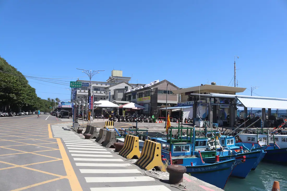
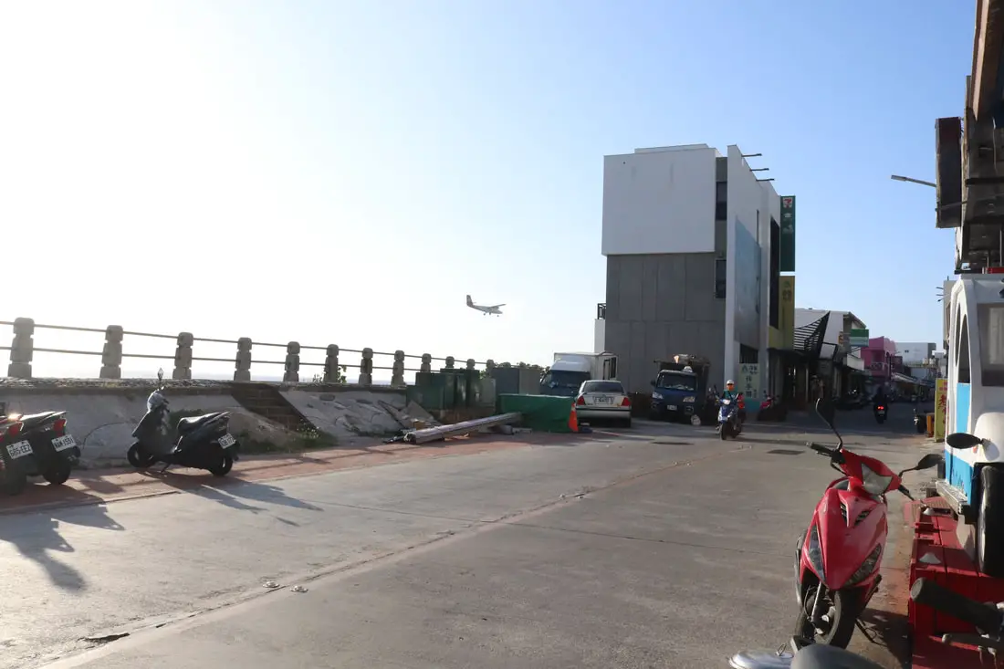
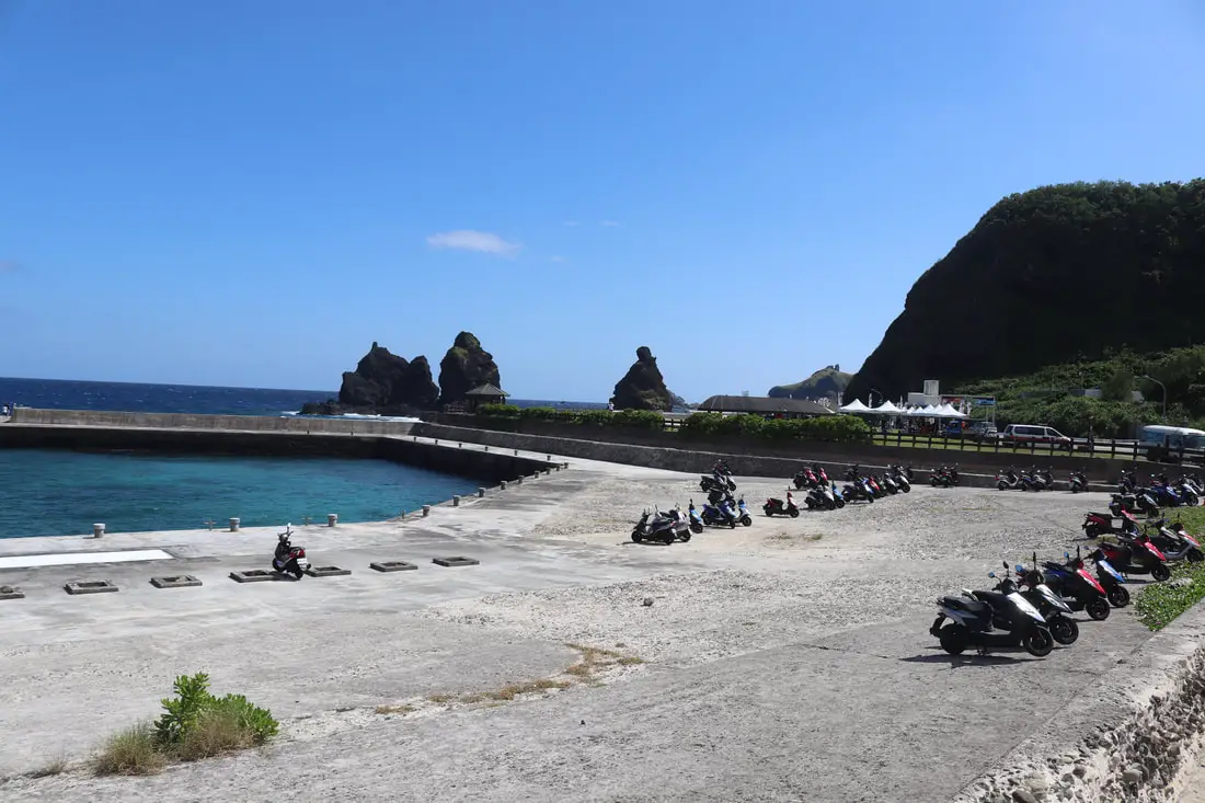
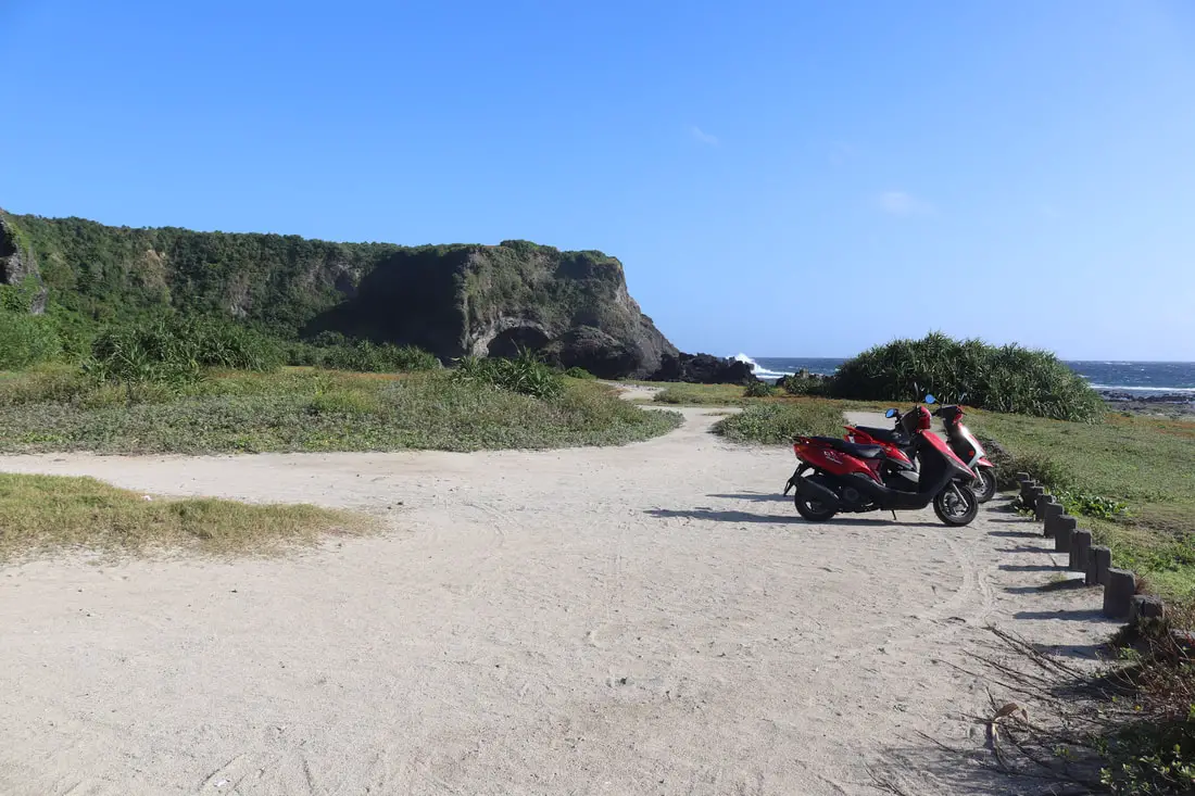
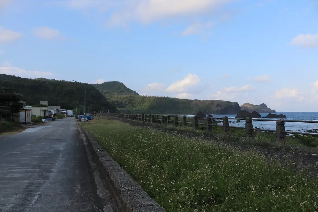
Fugang Harbor 富岡漁港
One of the hardest decisions for us was picking which ferry time to leave. We decided to visit in October when there were fewer people but still warm temperatures. However, there were also fewer ferries. Because we were traveling with kids, we couldn’t leave too late or early from Taipei, so we stopped halfway in Hualien and spent a night there. We planned to take the 3:30 PM ferry to Green Island, but we got an early start and ended up driving down to Fugang Harbor in time for the 1:30 PM Ferry.
Parking next to Fugang Harbor is pretty much impossible unless you want to pay someone nearby 200 NT a day. I ended up parking up the hill on a country road for free for four days, and my car was fine when I got back.
We got to the main ticket hall, picked up our tickets, went to the bathroom, and then waited in the hot sun for the boat to arrive.
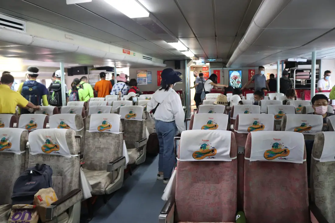
You can purchase ferry boat tickets for a discount through a tour agency such as Klook here or KKday here.There is some shade as you wait in line if you get there early. The boat finally came, and we were able to board.
The boat ride over can be very shaky. Best to take some seasick pills, I’m serious. Also, it is best to sit on the bottom near the back of the boat for less movement. This boat goes on the open Pacific and it can be like a roller coaster ride. Also make sure your luggage is secure.
Both there and back, our kids threw up. There are plastic bags on the seats to throw up in. The adults around us also threw up. Those 50 minutes were long but they eventually passed.Nanliao Harbor 南寮漁港
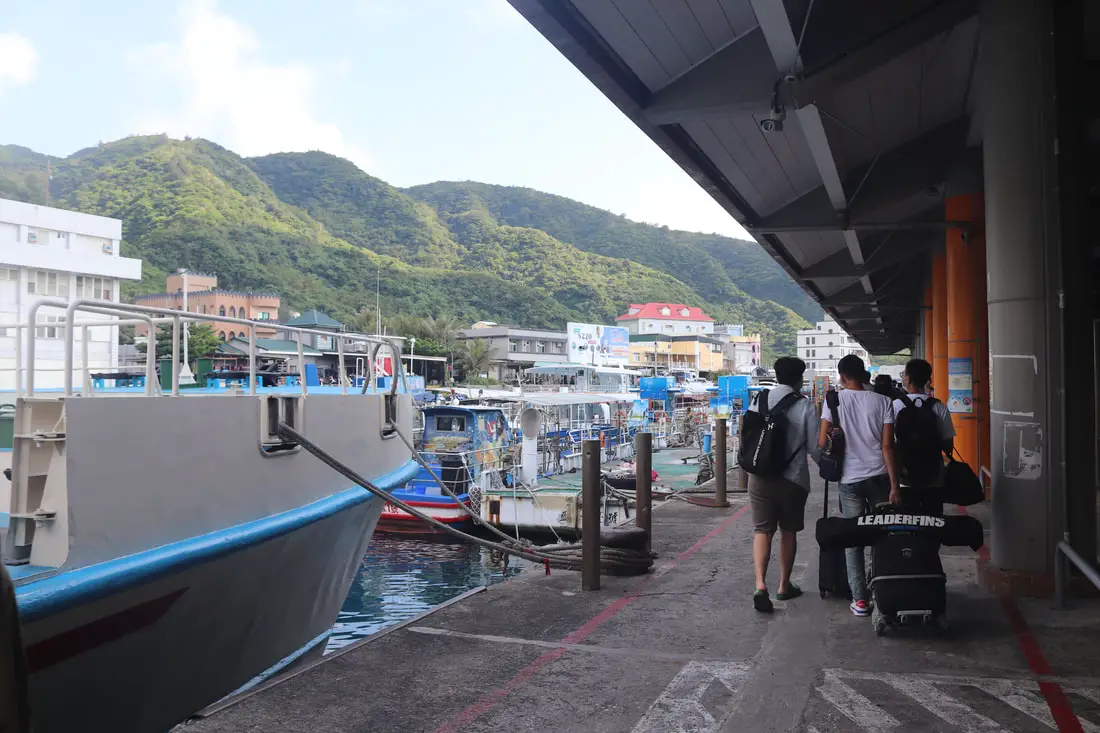
We finally made it to Nanliao Harbor. I went to the first scooter shop I could see and rented a scooter for 400 NT for a day, and he only charged me for three days instead of four. He also offered a free van ride to our hostel to transport our luggage for free.
We stayed at and can recommend Fire Island Guesthouse, which is a high-quality B&B right on the east coast of the island.
You can book a scooter rental for Green Island on Klook here or KKday here.
I will now introduce the island starting from Nanliao Harbor and moving clockwise.Green Island Old Street 綠島老街
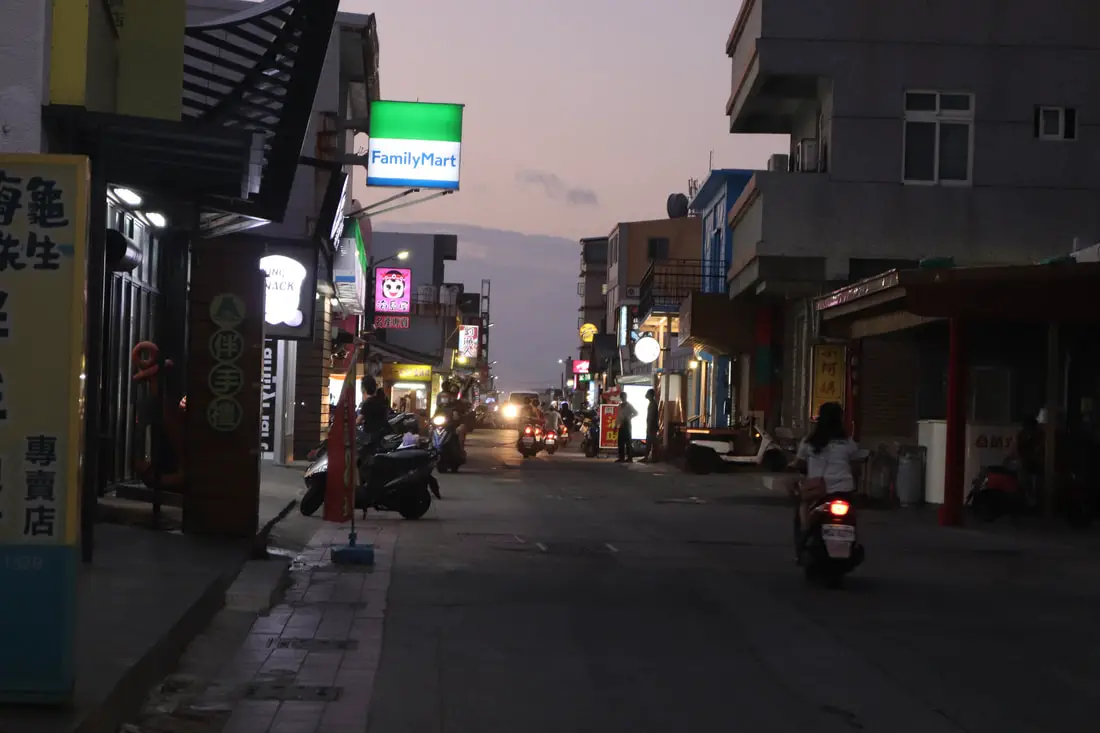
Green Island Old Street refers to the section of Huandao Road between Nanliao Fishing Port and the Airport. It is not an official name, but I have seen it be called Green Island’s Old Street a few times. Here you can find the most restaurants and eating options. There is even a small night market that appears here sometimes. Also, 7-11, Family Mart, the post office, and the agricultural association are all on this road. There are also multiple seafood restaurants, ice shops, and breakfast shops on this road.
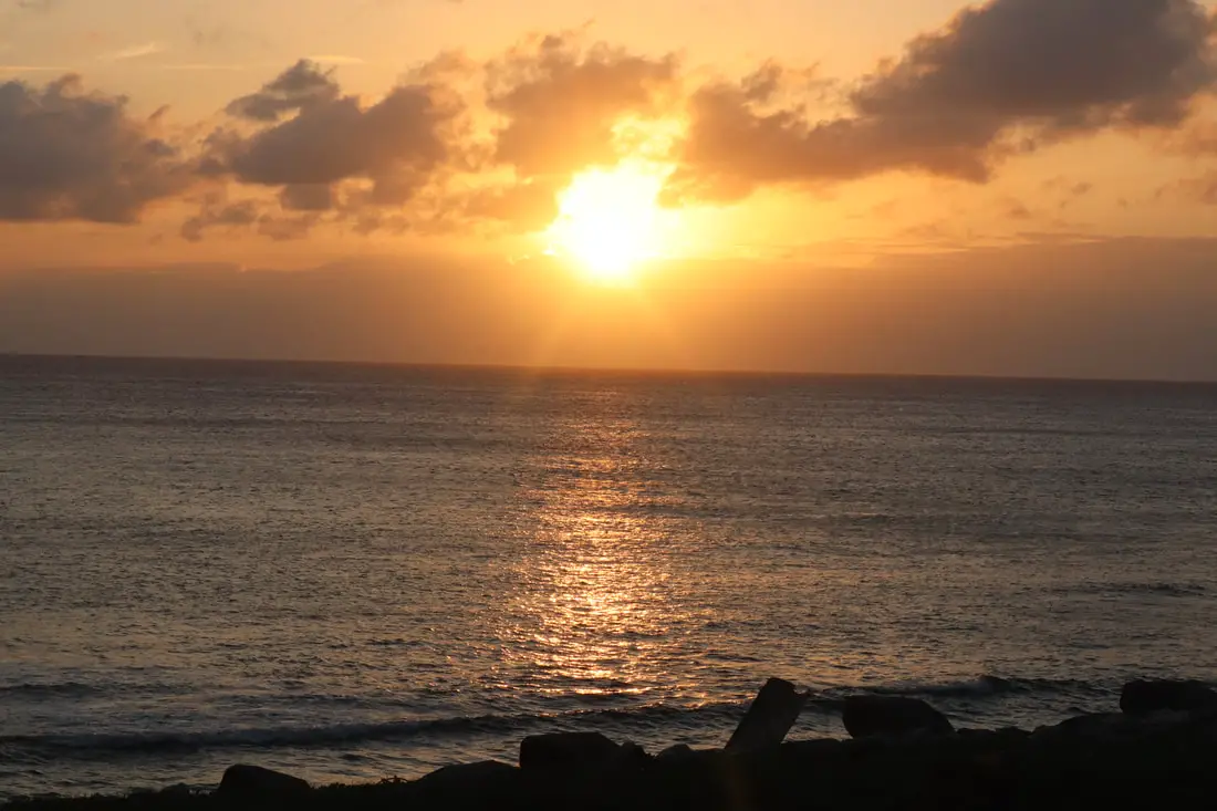
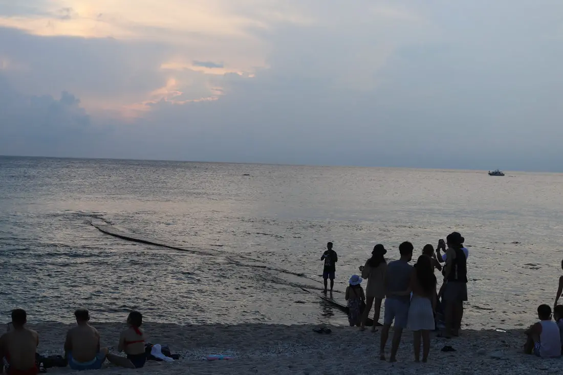
The old street is also a great place to watch the sunset over Taiwan.
Last rays of sun over the ocean.
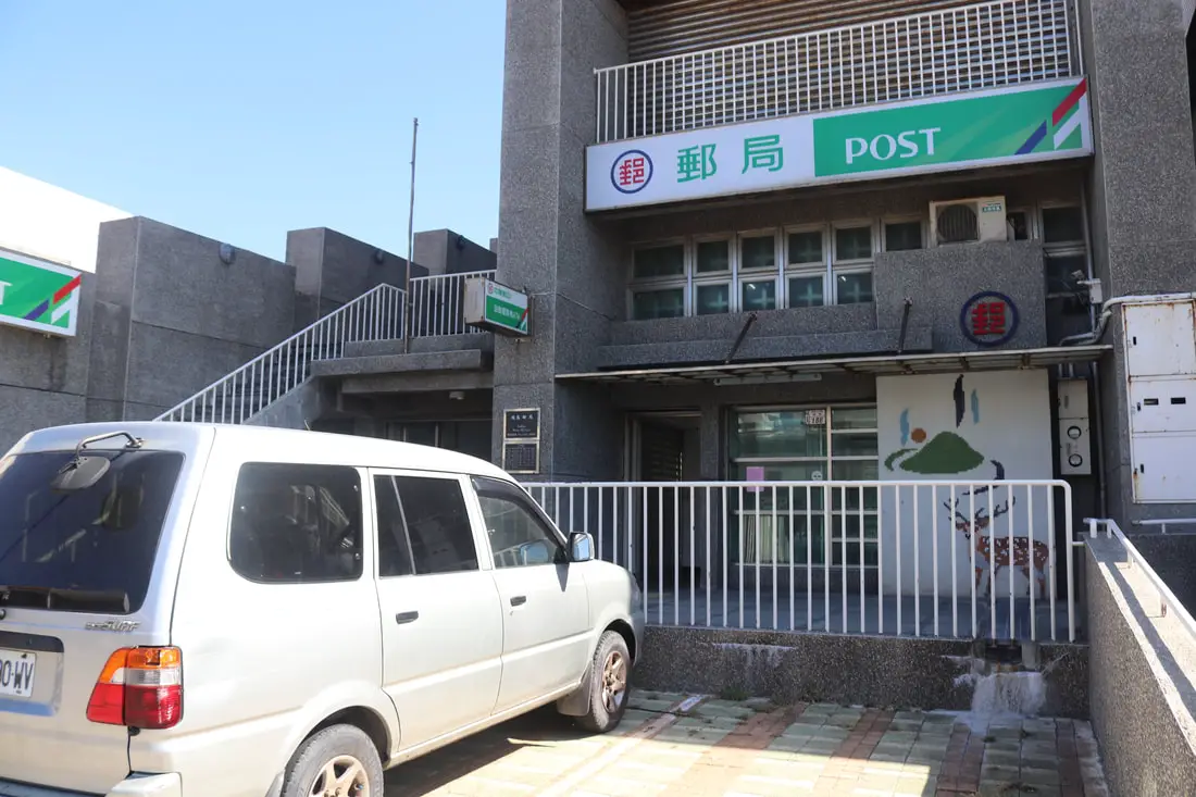
Also don’t forget that the post office has the only ATM on the island. If you don’t want to run to the post office ATM, make sure you bring plenty of cash with you to the island.
Green Island Airport 綠島機場
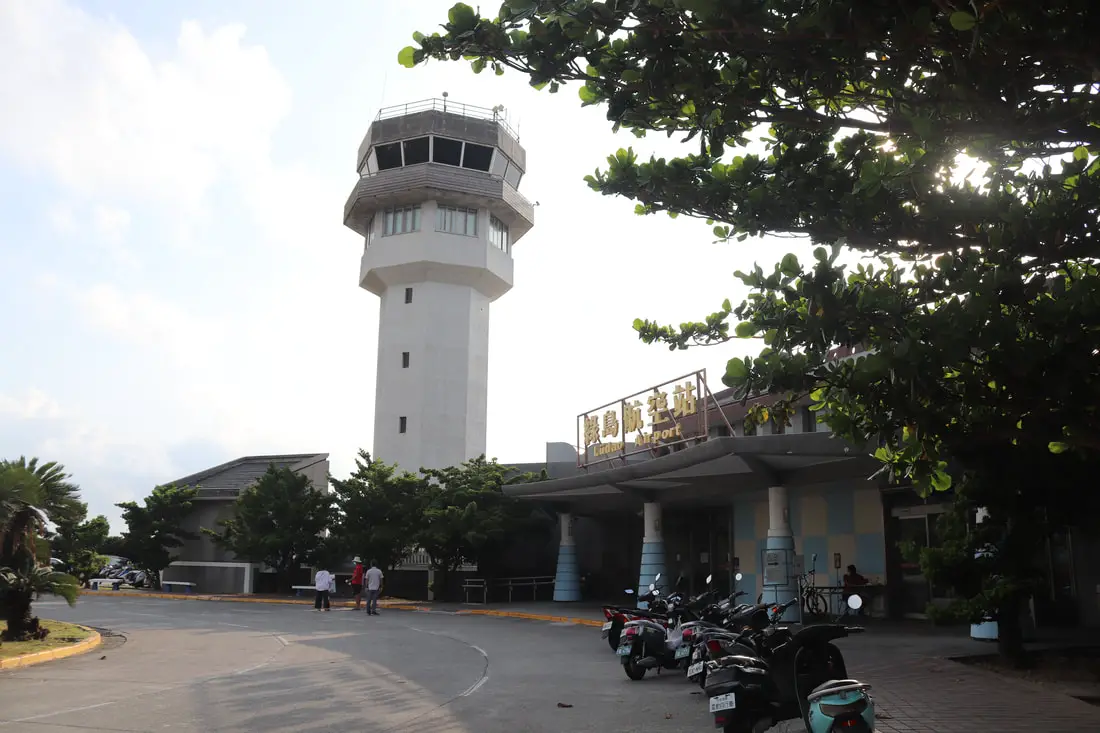
At the end of the old street, you will come to Green Island Airport, which is very small and only services small planes from Daily Air. Due to strong winds in the winter, flights can be canceled with short notice. There are also few seats available each day, so you may have to book far in advance to get a flight.
The plane is coming into the land as seen from the old street.
Green Island Lighthouse 綠島燈塔
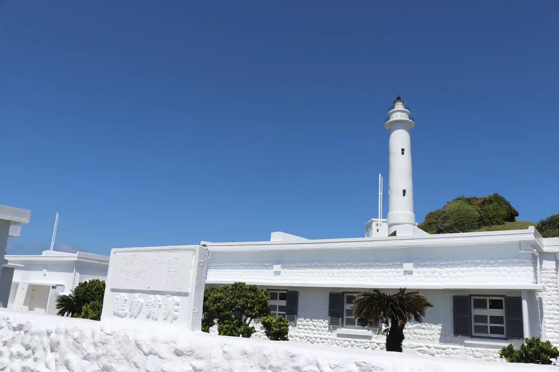
Near the airport is Green Island Lighthouse
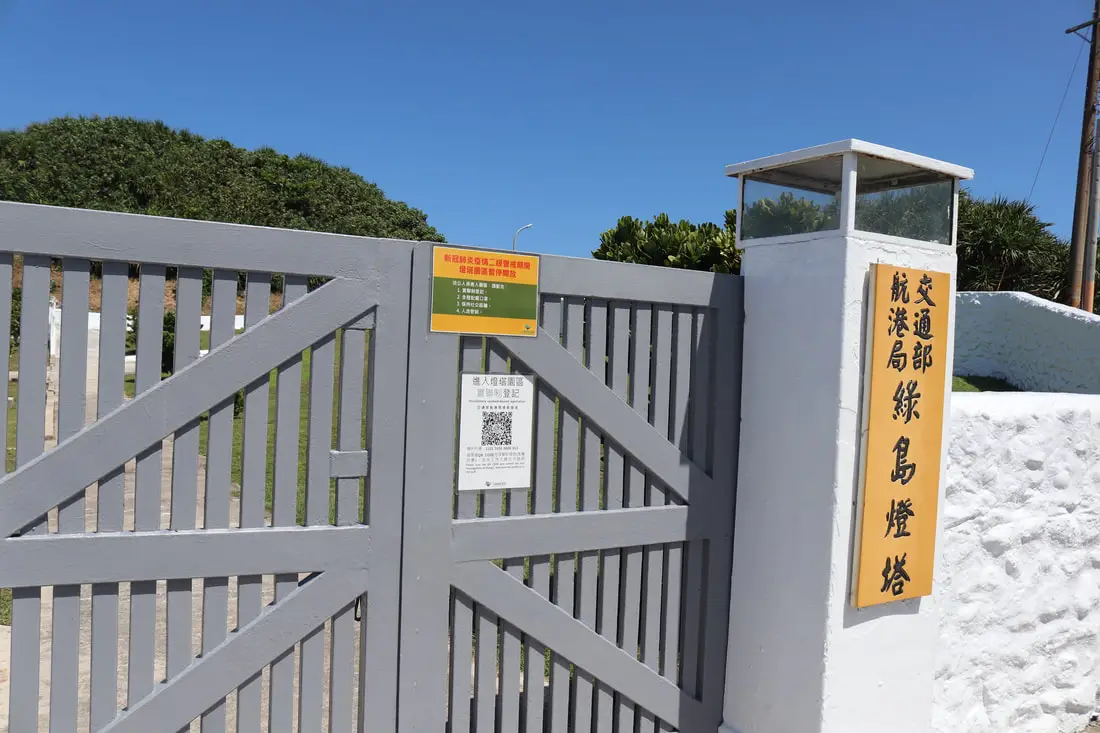
Unfortunately, no one was allowed inside when we visited. But even if you could go inside, they will not let visitors walk to the top of the lighthouse.
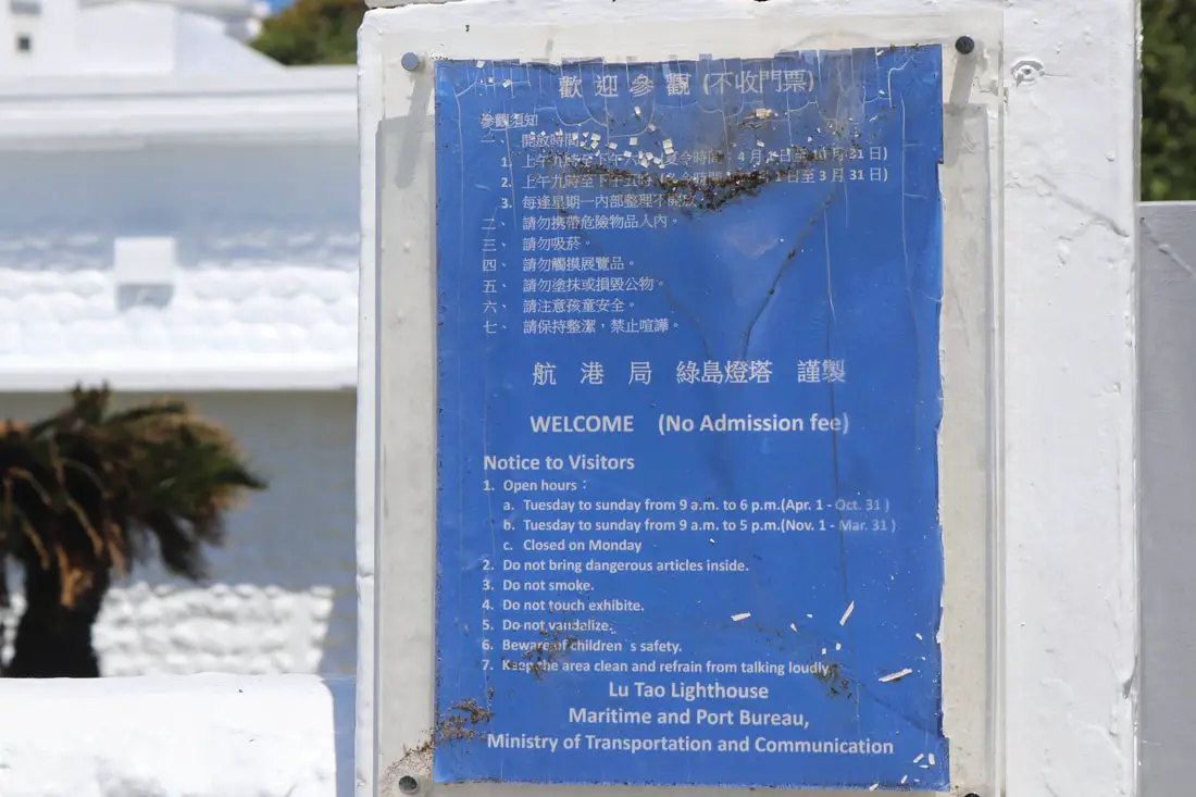
If you do come, the lighthouse is closed on Mondays and admission is free.
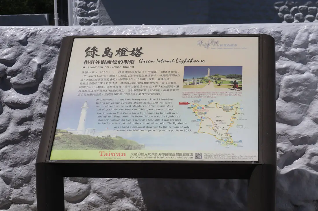
In 1937 the American Steamship SS President Hoover ran ground at Green Island and all aboard were saved. To thank the people of Green Island, the US donated to build the Green Island Lighthouse which was designed by the Japanese and finished in 1938, at 33.3 meters or 109 feet high.

Another view of the lighthouse.
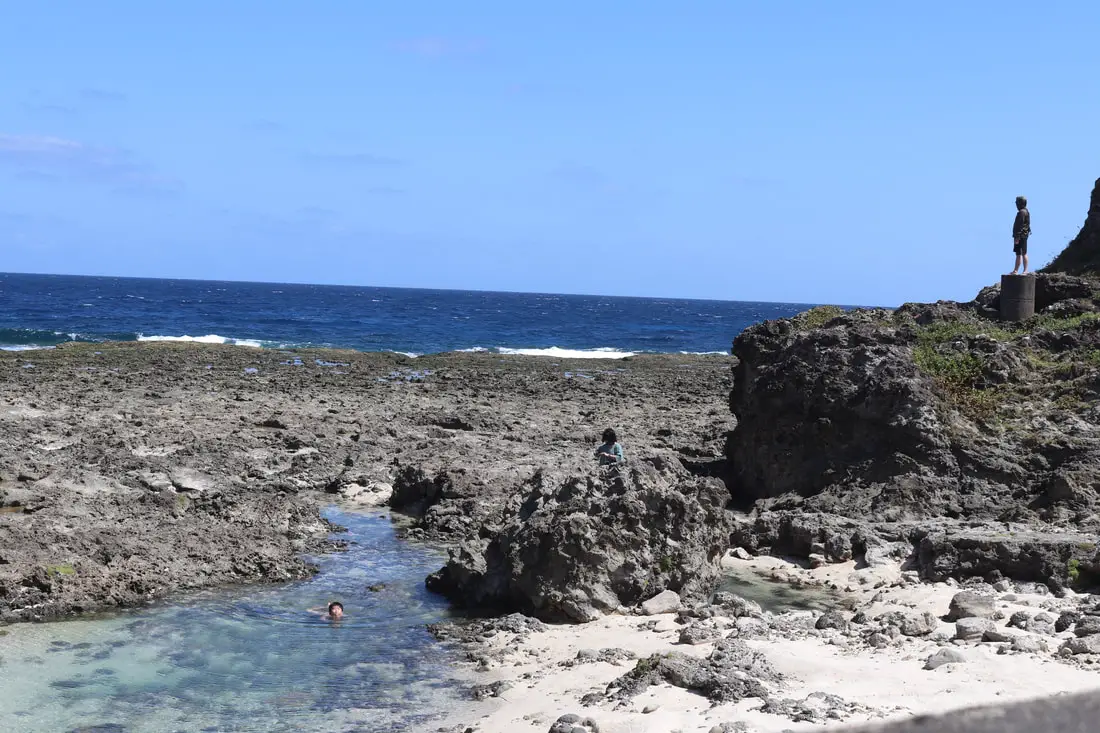
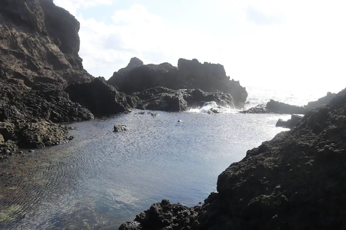
Wuyouku 烏油窟
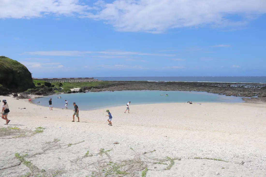
One of the best swimming spots on the island is Wuyouku near the lighthouse. It is a small pool of seawater with white sand.
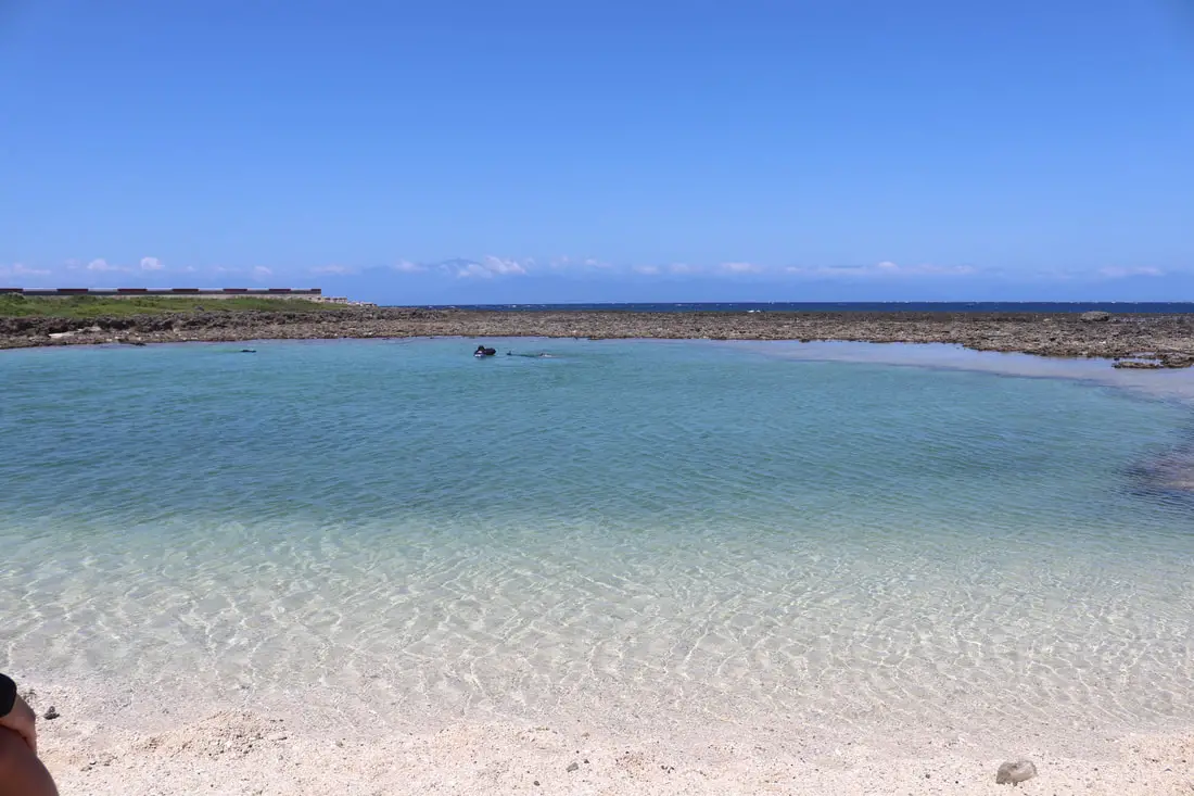
It is best to visit here during high tide when the water is cleaner. At low tide, the water pretty much has no flow with the ocean, and if there are a lot of people swimming there the water can get dirty.
The water here is not very deep, and you can see lots of little fish in the water too.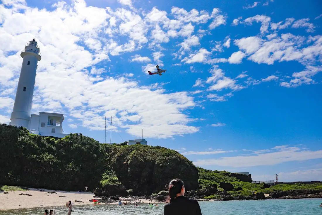
You can also see Daily Airplanes take off and land from here.
Chaikou Snorkeling Area 柴口浮潛區
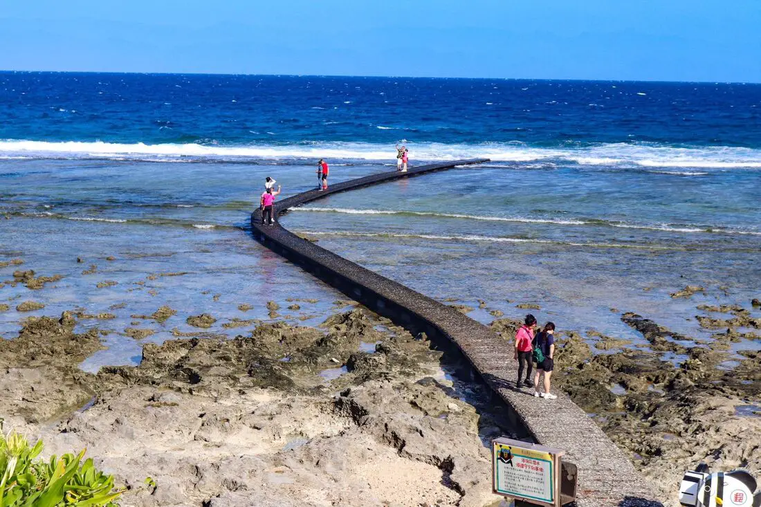
There are four concrete bridges that lead out into the ocean on Green Island, and they are all great places for snorkeling and diving. At Chaikou, there is also an underwater mailbox.
There are many companies offering snorkeling, diving, SUPing, and other tours on Green Island.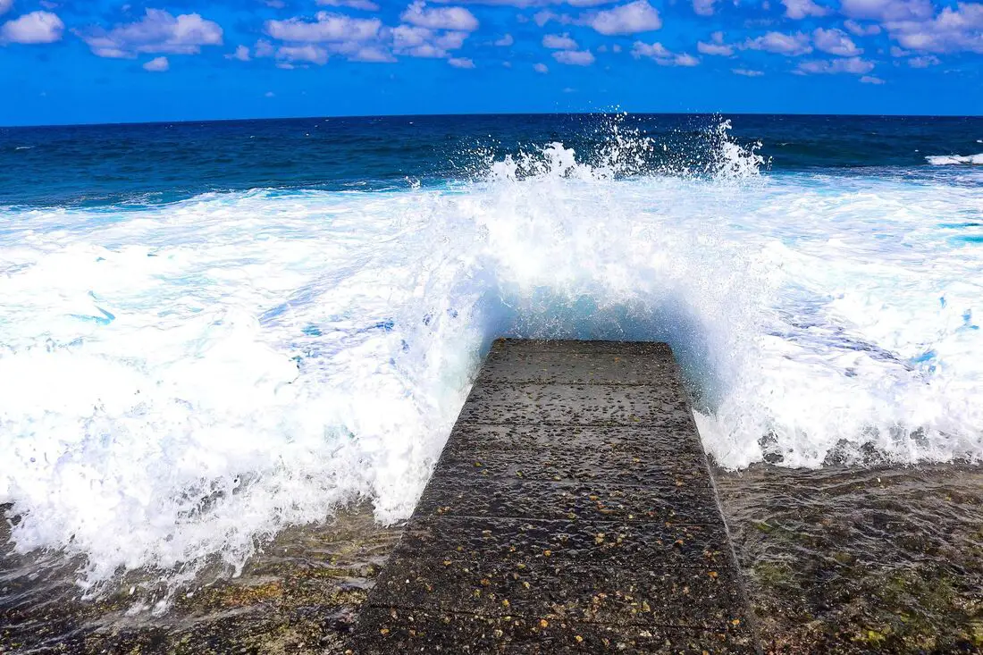
Be careful to only go snorkeling and diving here at low tide and low winds, and bring a buddy. If you go at high tide, the waves will eat you alive here. There is also some sand here but not much.
There are actually tons of places to snorkel and dive along this stretch of coast, but walking along the concrete path is the most convenient and most beneficial to the sea life.
You can search for tours of Green Island on Klook here or KKday here.Gongguan Rock 公館鼻
Gongguan Rock is a popular spot for locals to go fishing and has great views of the ocean. However the sign said tourists were not allowed, so I did not go any further.
Gongguan Fishing Harbor 公館漁港
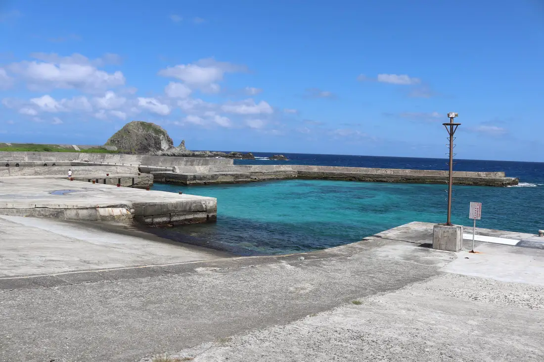
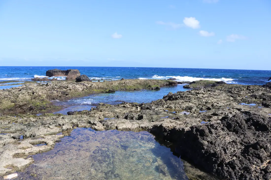
Near the rock is a fishing port which has pristine water and is a good place to practice snorkeling.
View of the right side of the port.
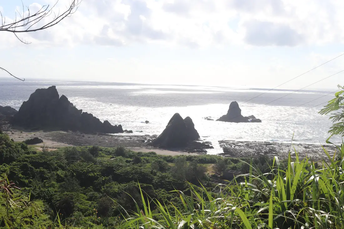
General Rock and Triple Rocks 三峰岩及將軍岩
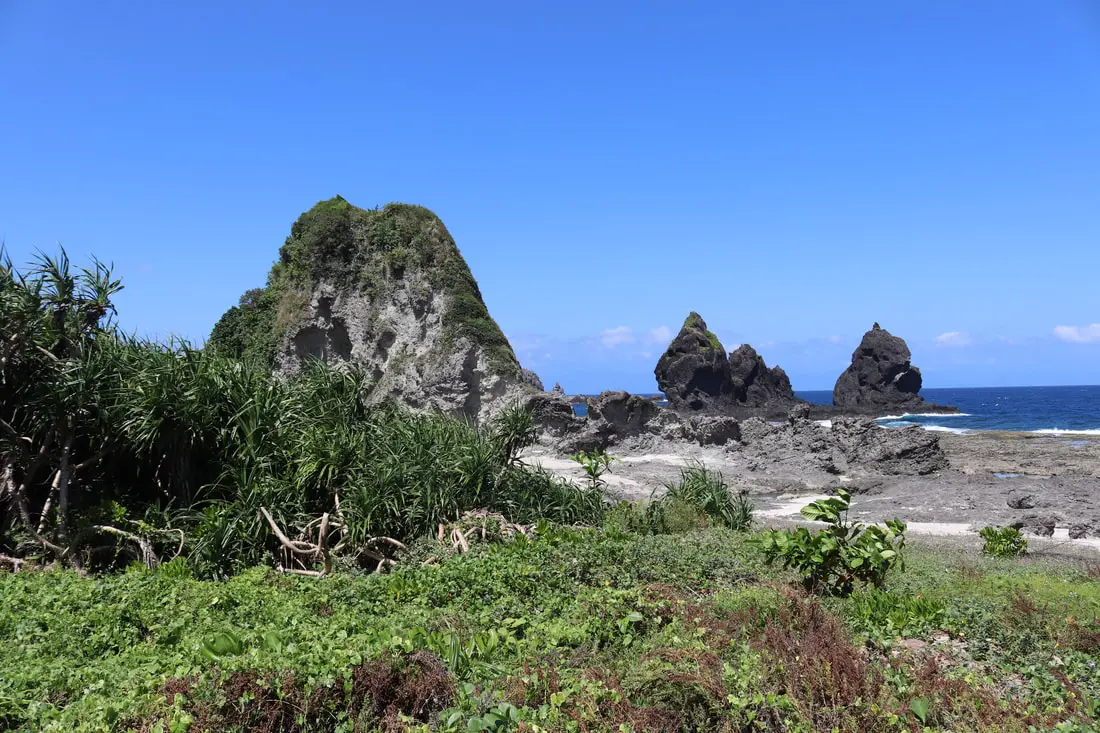
If you want to venture out here, you can reach general rock in the foreground, and triple rocks in the background.
Near this area, there are also quite a few swimming holes and places to snorkel.
Elephant Rock 象鼻岩
Another cool rock in the area to see is Elephant Rock, shaped like its namesake. It is a popular Instagram spot.
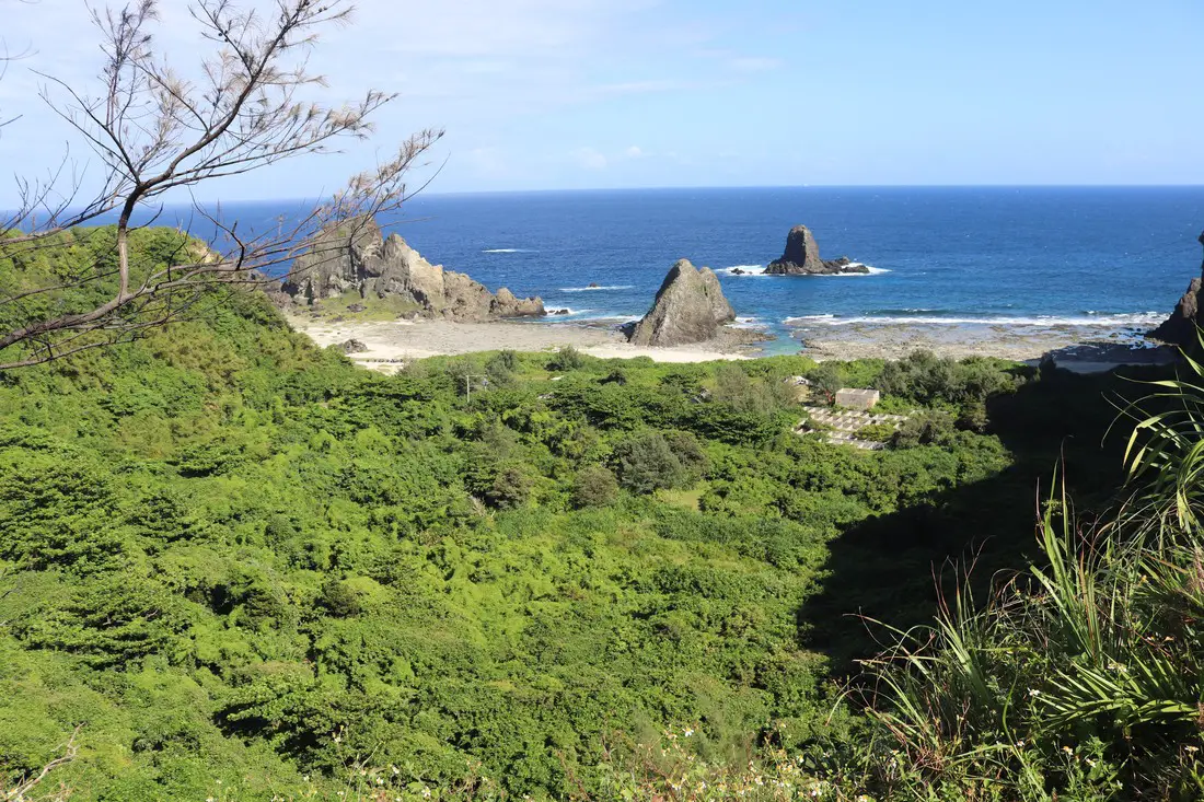
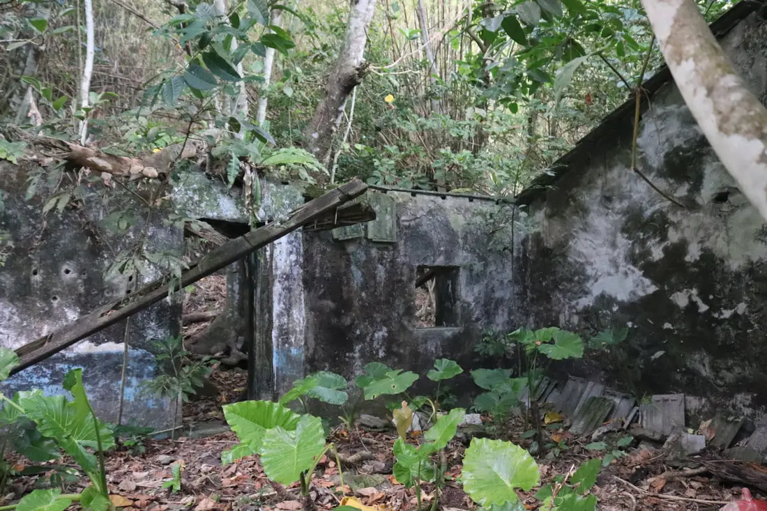
Green Island White Terror Memorial Park 白色恐怖綠島紀念園區
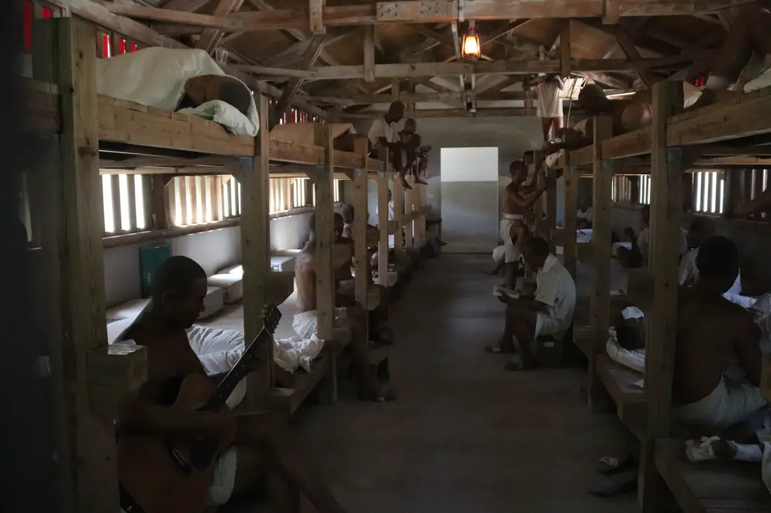
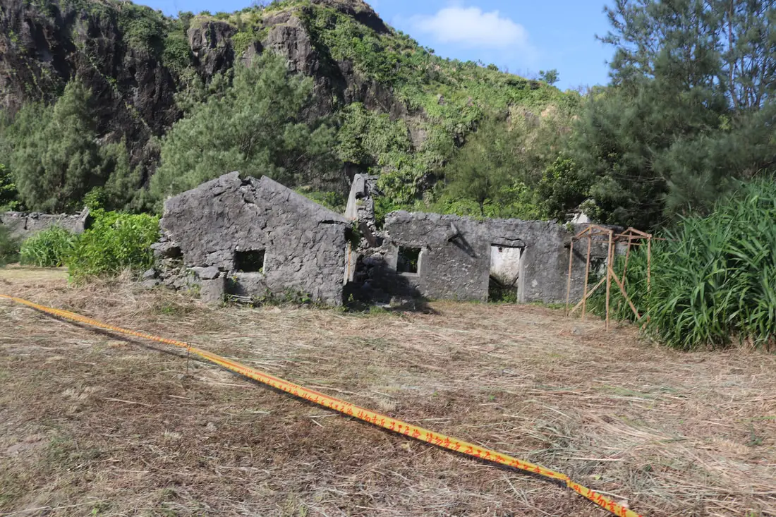
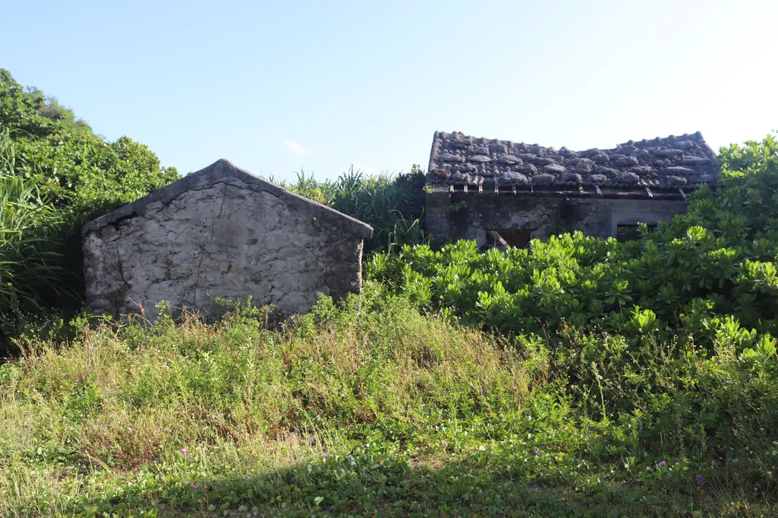
One of the most popular tourist attractions on the island is the White Terror Museum, which is an old prison for political prisoners during the white terror or martial law period of Taiwan, that has now been opened to the public. There are now quite a few exhibits set up in these buildings.
I find it ironic that the dictator responsible for the white terror massacre and unjust imprisonment of prisoners here (Chiang Kai-shek) is still proudly displayed on a pedestal here. There are also quite a few abandoned buildings and cells that you can explore.
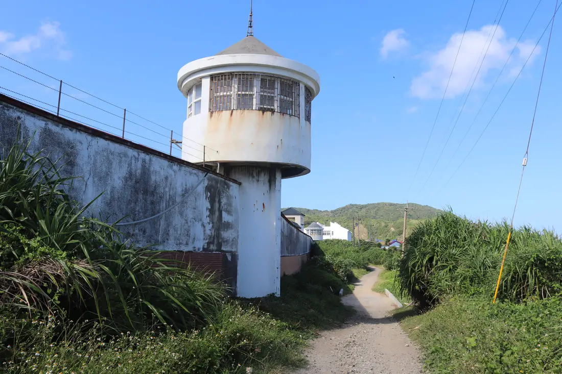
Outside wall and guard tower that once kept prisoners inside.
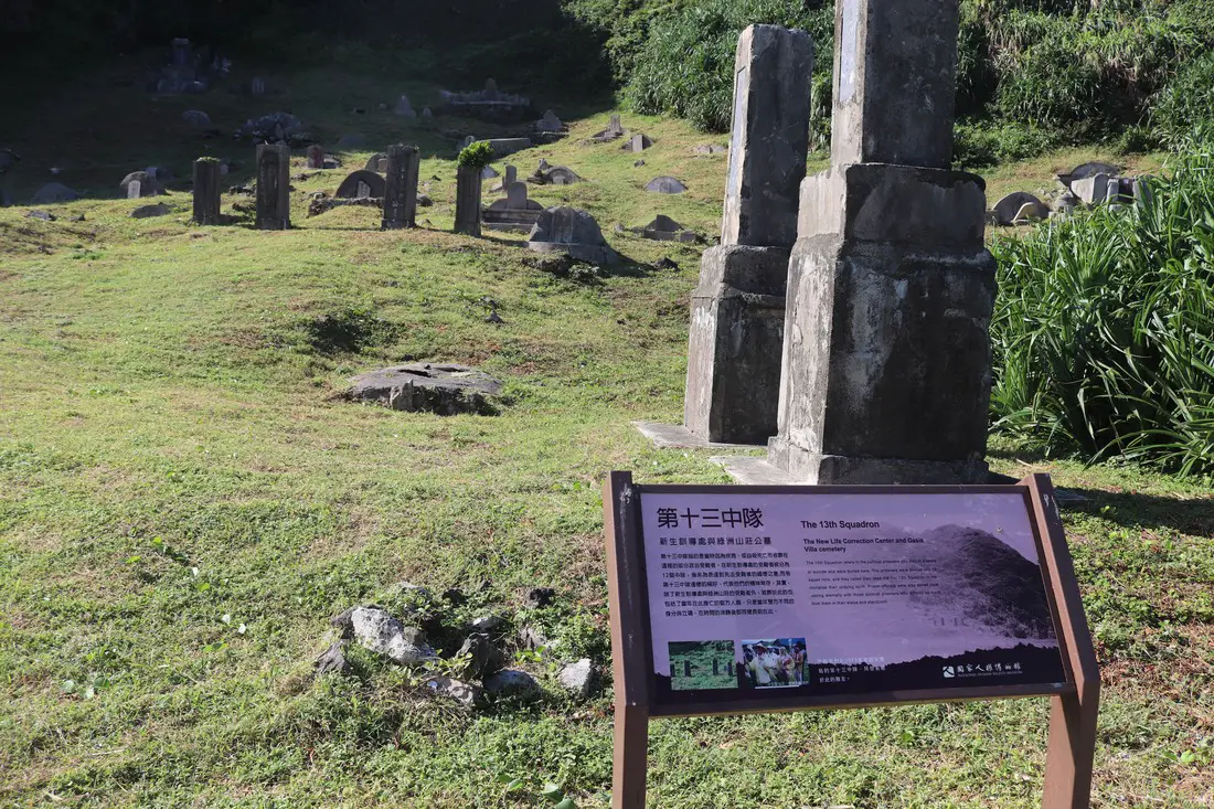
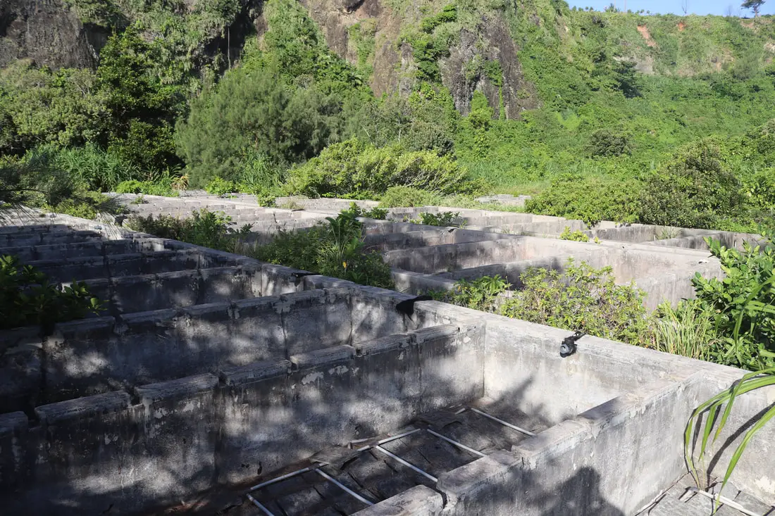
Outside the prison, you can find the 13th Squadron cemetery, which was a cemetery for the political prisoners here who died from disease or suicide. They are called the 13th Squadron to moralize their undying spirit.
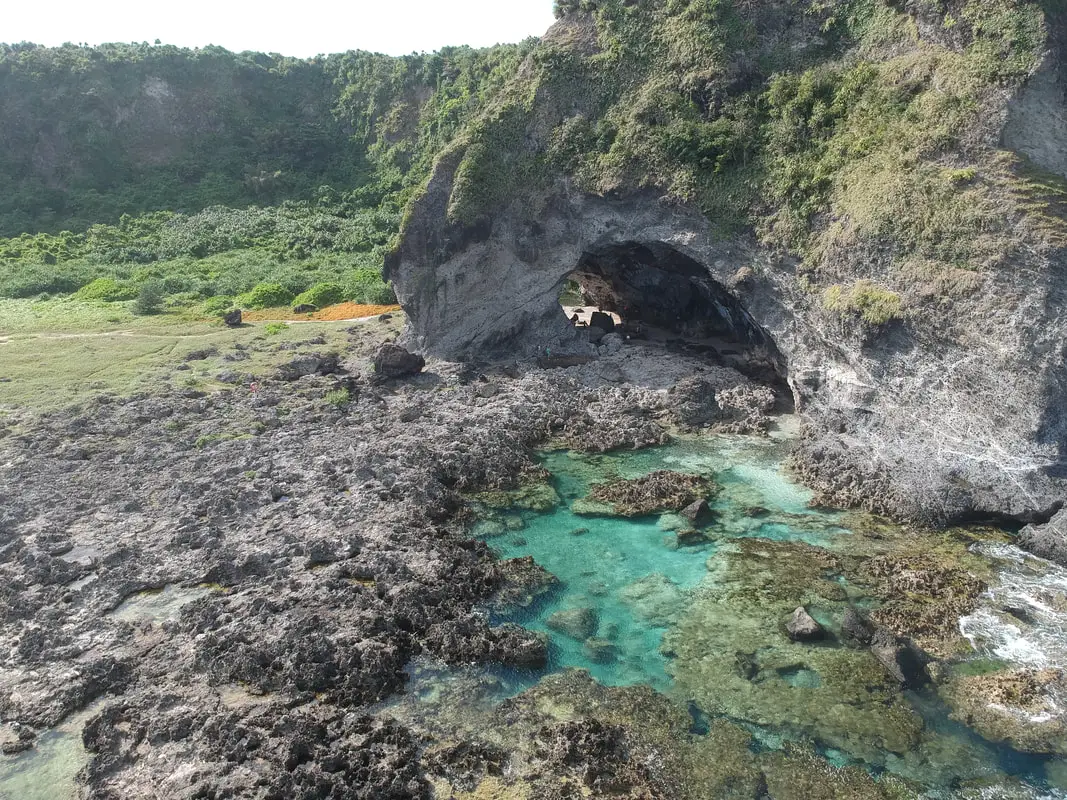
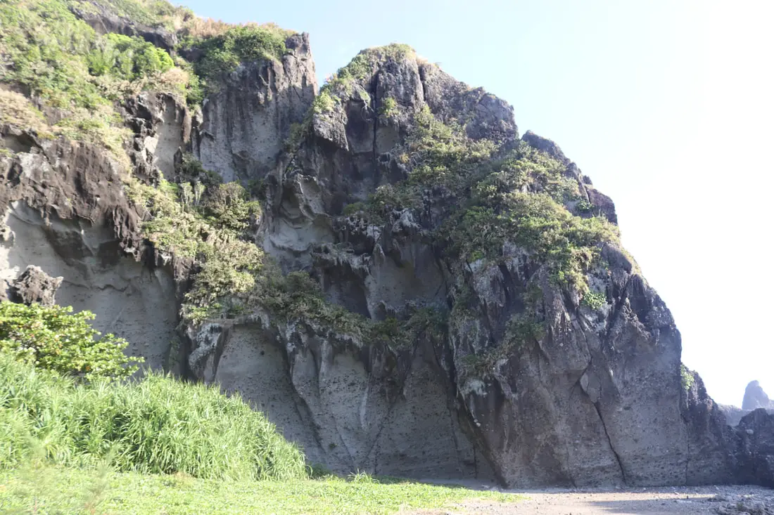
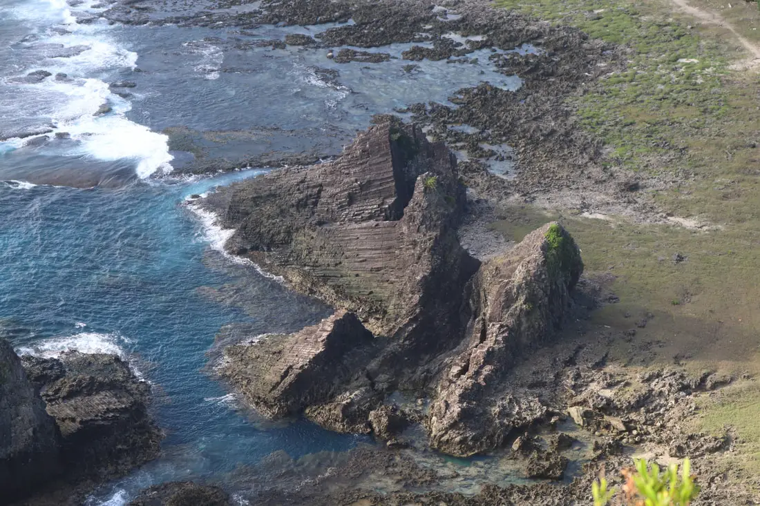
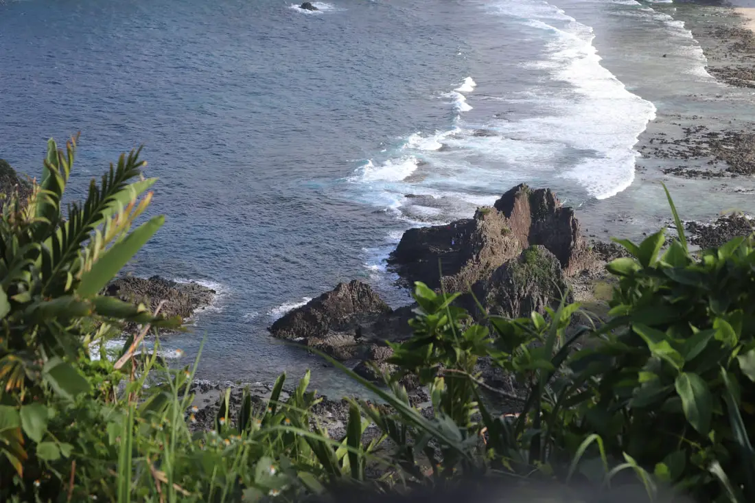
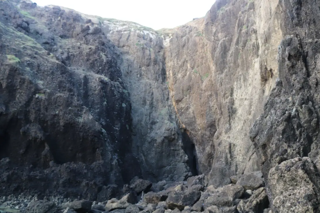
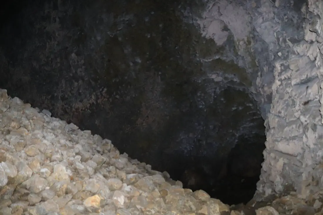
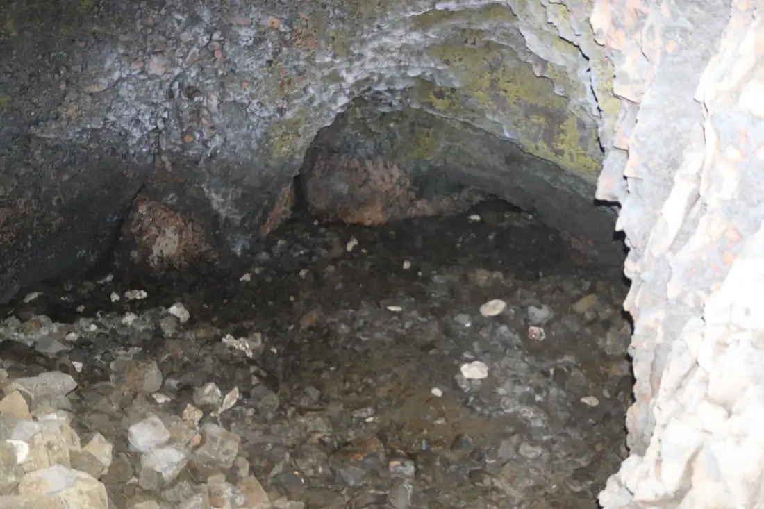
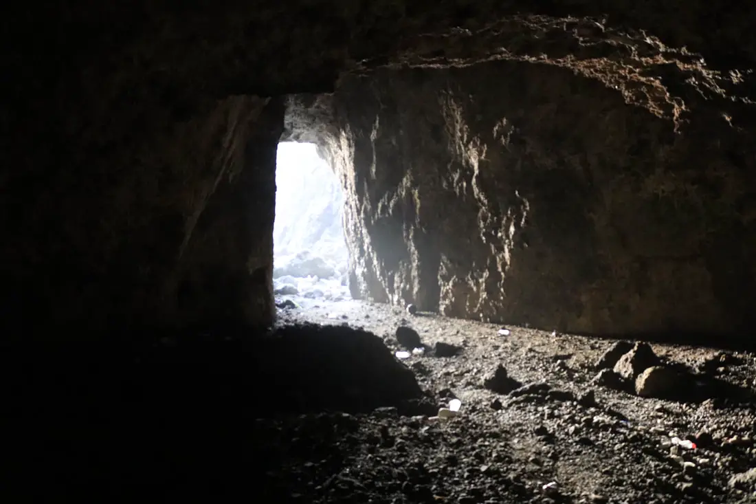
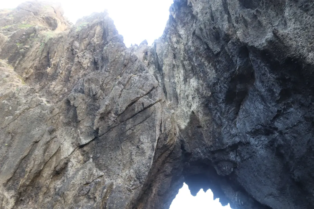
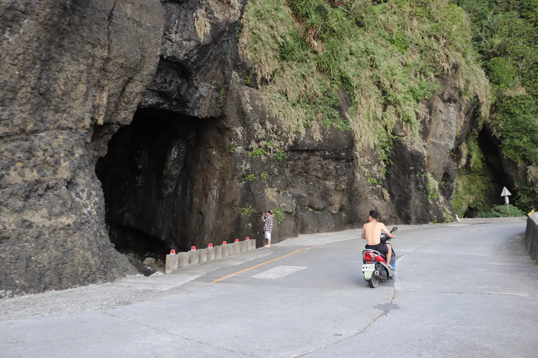
Swollow Cave (Yanzidong 燕子洞)
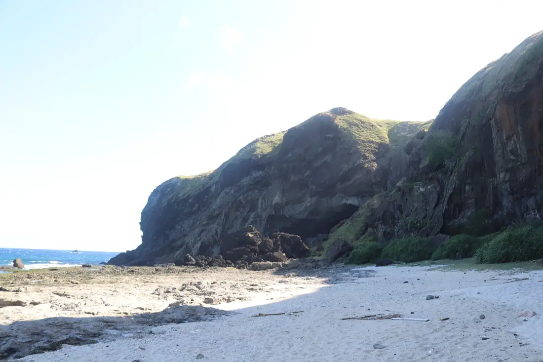
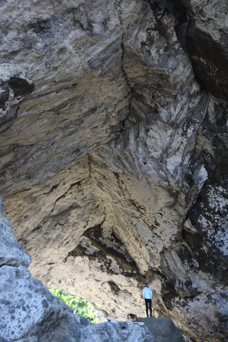
Past the cemetery, if you keep walking down the beach you will reach Swallow Cave, which was once used as an auditorium for performances by the political prisoners.
Here you can see the rocks tell an interesting story of erosion mixed with other layers of lava.
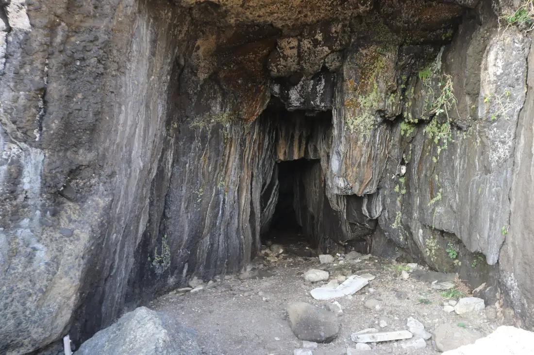
There are also some swimming and snorkeling holes here too. Inside the cave, you can see remnants of the amphitheater and stone steps. There is also an interesting eye-shaped light that enters the cave.
Green Island Marine Research Station 綠島海洋研究站
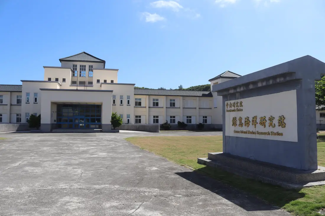
Part of the old prison had been converted into the Green Island Marine Research Station, which is run by Academia Sinica. This is off-limits to tourists.
Ch’ou-Ch’in Reservoir 綠島酬勤水庫

Just up the road, you can spot Green Island’s main source of clean water, the Chou Qing Reservoir. Also off-limits to tourists.
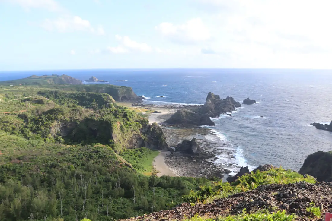
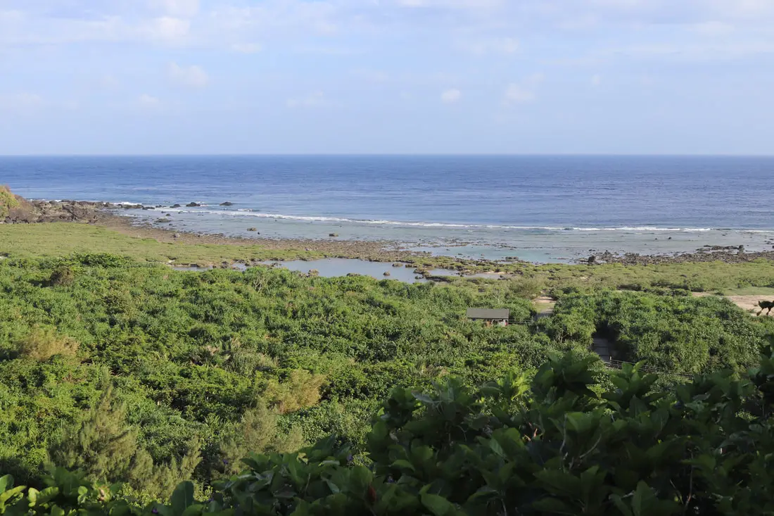
Niutoushan (Cow Head Mountain) 牛頭山

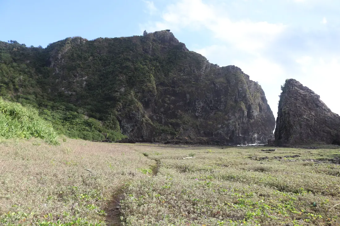
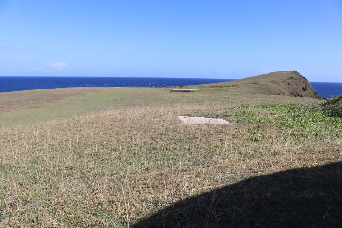
One of the most popular hikes on the island is Niutoushan, which includes a grassland and a few small hills on the east coast of the island. The hike does not take very long to complete.
Check out our drone video of Niutoushan above. 360 degree view from Niutou (cow head) Mountain on the East Coast of Green Island, Taiwan. Here there is a large grassy plain surrounded by precipitous cliffs. #牛頭山 #綠島 #台灣 #爬山 #空拍
Posted by Foreigners in Taiwan 外國人在台灣 on Monday, October 11, 2021Or check out a 360-degree view of the area above or the link here.
Guanyin Cave 觀音洞
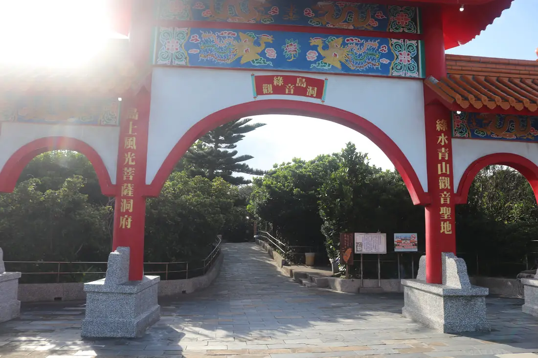
Guanyin Cave is a small limestone cave on the east side of the island, with a rock that looks like Guanyin. The local people here have also constructed a temple to Guanyin.
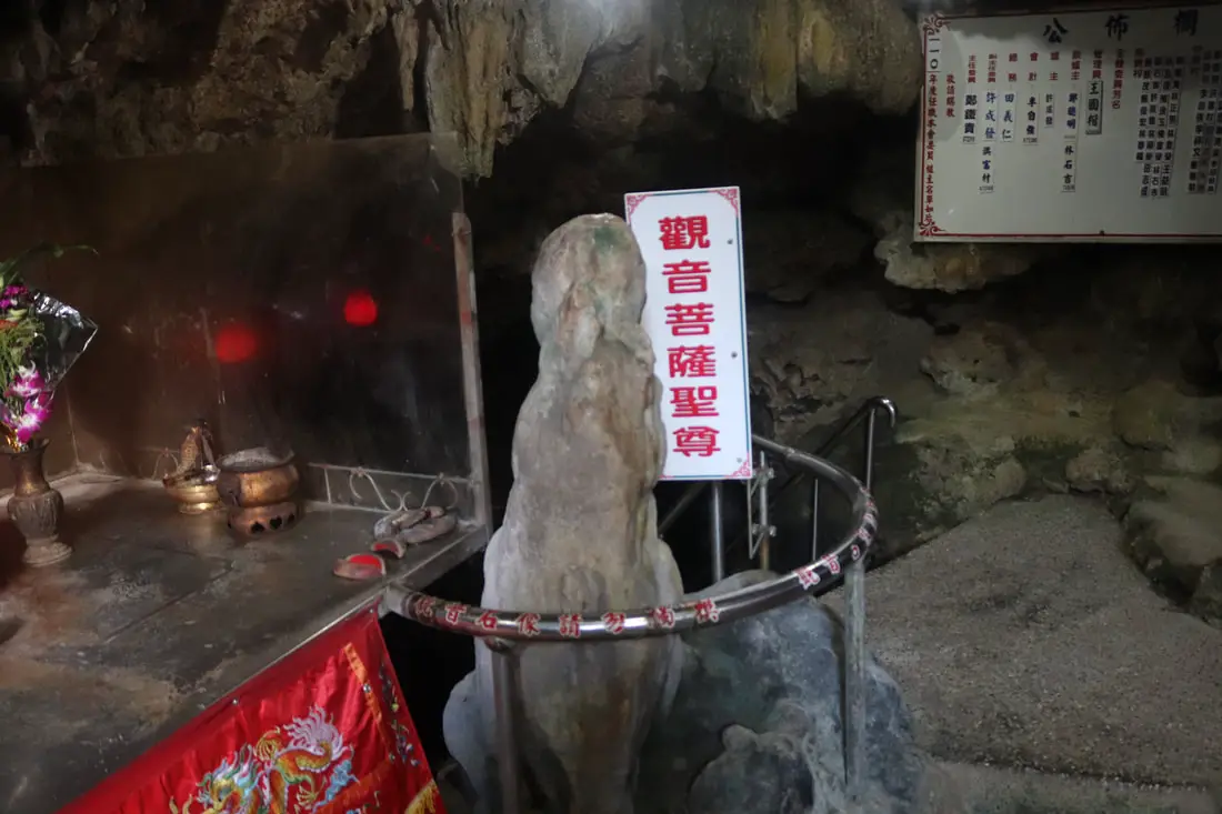
View of the Guanyin-shaped rock worshiped by the locals. Be careful not to hit your head on a rock while exploring the cave, it is not very high.
Green Island Sika Deer Preserve 綠島梅花鹿生態園區
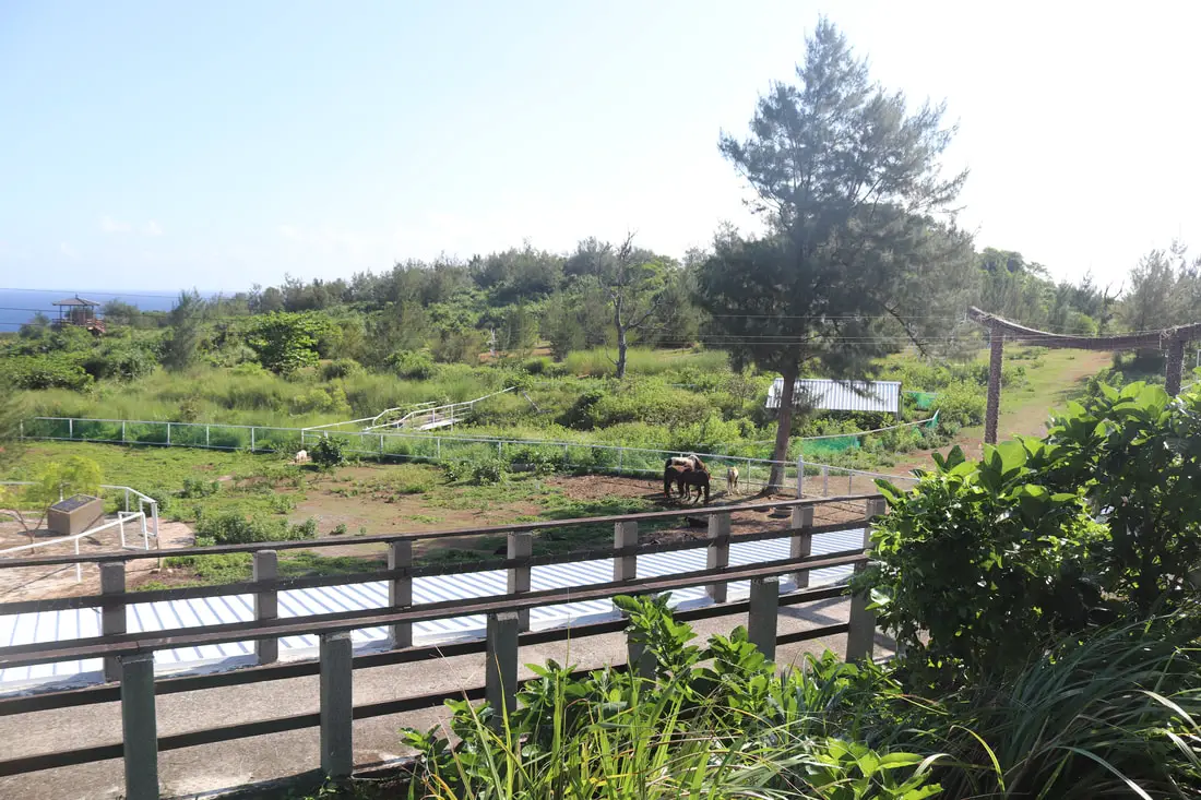
You may notice advertisements for a sika deer preserve on the island. Frankly, the preserve is out of business and is now a private farm not open to the public.
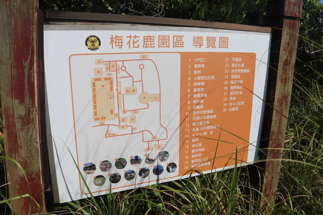
Tourist map of the area in its heyday.
It seems that most of the deer have left, probably to become dinner for the many all-you-can-eat venison restaurants around the island. The farm seems to have been open a year ago but may have closed due to the pandemic. Hopefully, it will open again. But until then, best to stay away. Here is a review from Google: “Dogs came running full speed and bite us. They are NOT in the chain! The gate was open so we walked in. Because of this, We had to go hospital. Totally ruined our day. Don’t come!”Youzihu 柚子湖
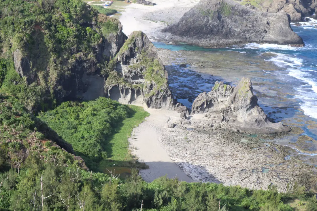
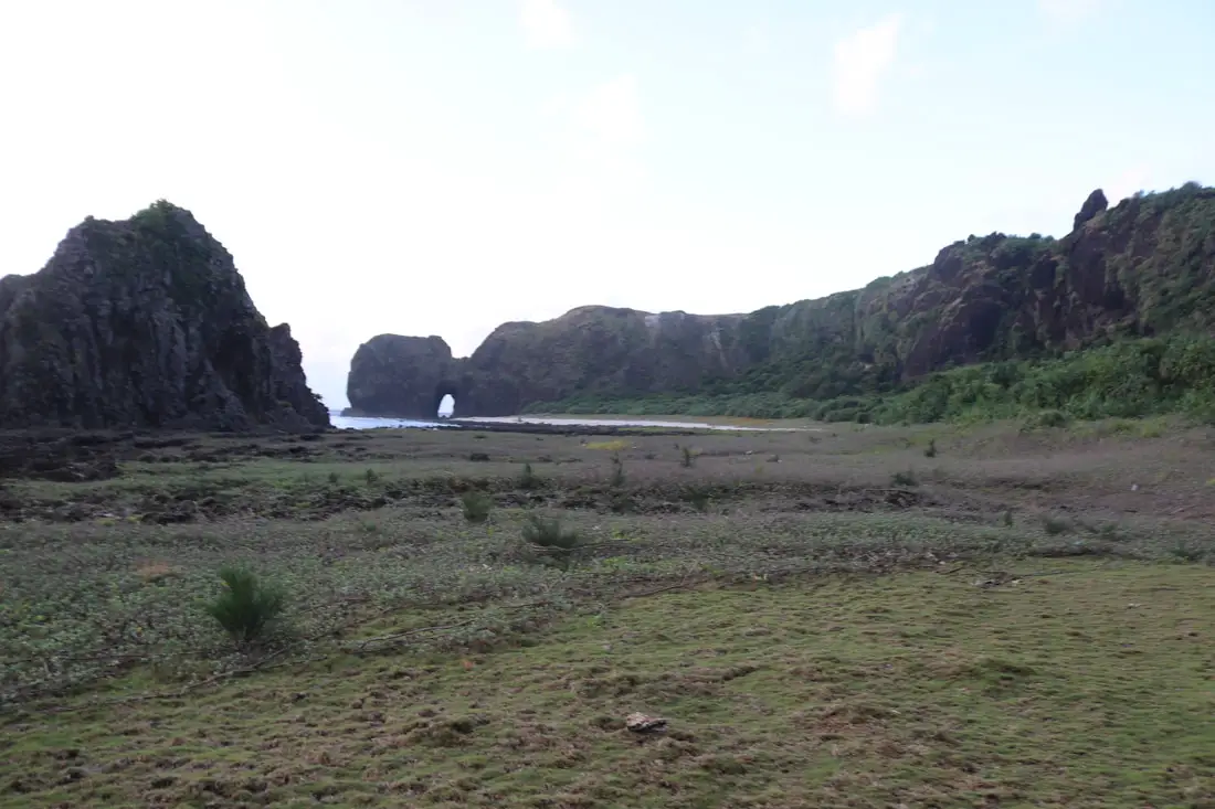
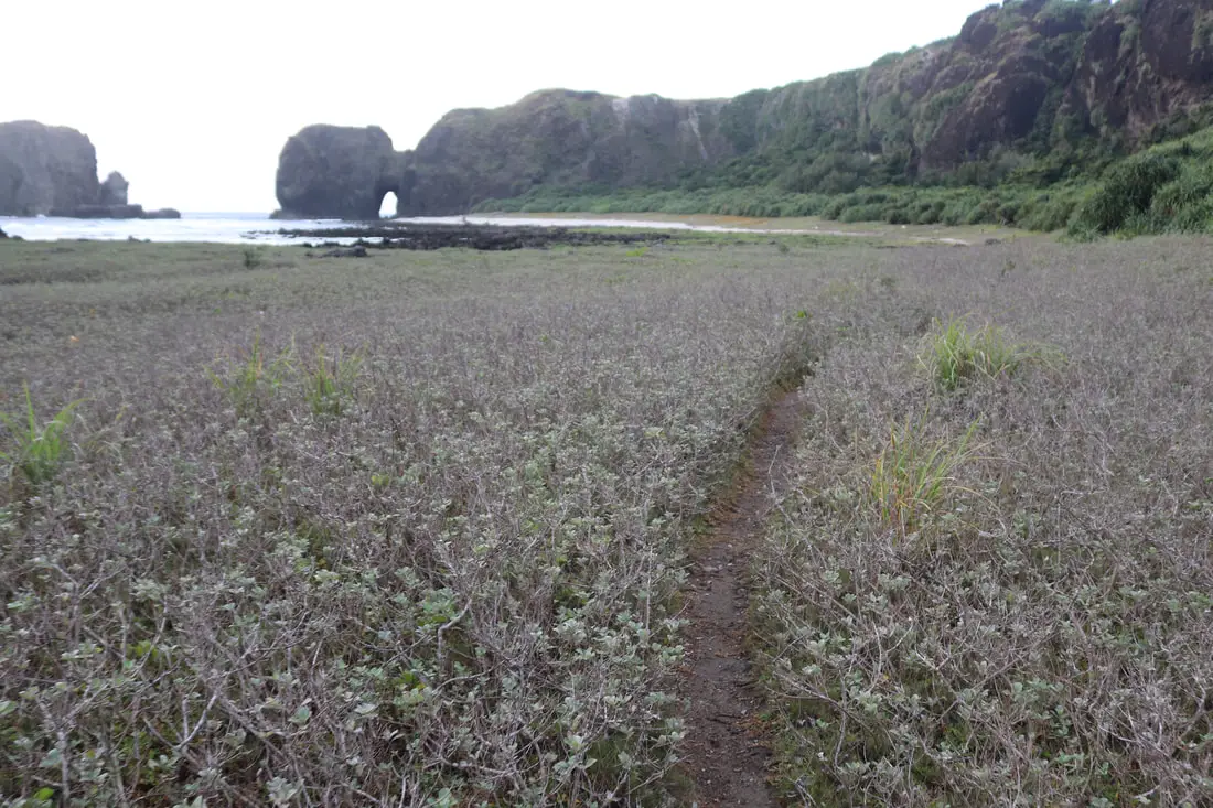
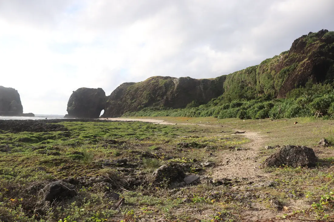
Youzihu is a seaside valley on the east side of the island, featuring a large sea cave, swimming holes, and an abandoned fishing village and aquaculture farm.
For an overview of the area, see our drone video above. 360 degree view from Wangong Cave at Youzihu, on the east coast of green island. This island is full of amazing sea caves. #彎弓洞 #柚子湖 #綠島 #台灣 #空拍
Posted by Foreigners in Taiwan 外國人在台灣 on Monday, October 11, 2021Or check out our 360-degree panorama of the area above or the link here.
Laogu Stone Village 咾咕石古厝
One of the more interesting areas of Youzihu is the abandoned stone house village. Some of the earliest settlers to Green Island lived here. I’m not sure why it was abandoned since there is a road here, but it seems that people lived here up until a few years ago.
There is also a large abandoned fish farm out back with empty cement basins.
There are quite a few abandoned stone houses, this is one of the few with an intact roof.
In the middle of the valley, there is a spot to park your scooters on the sand.
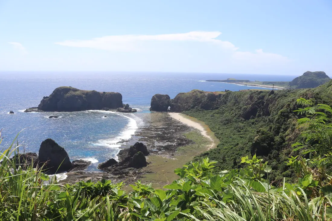
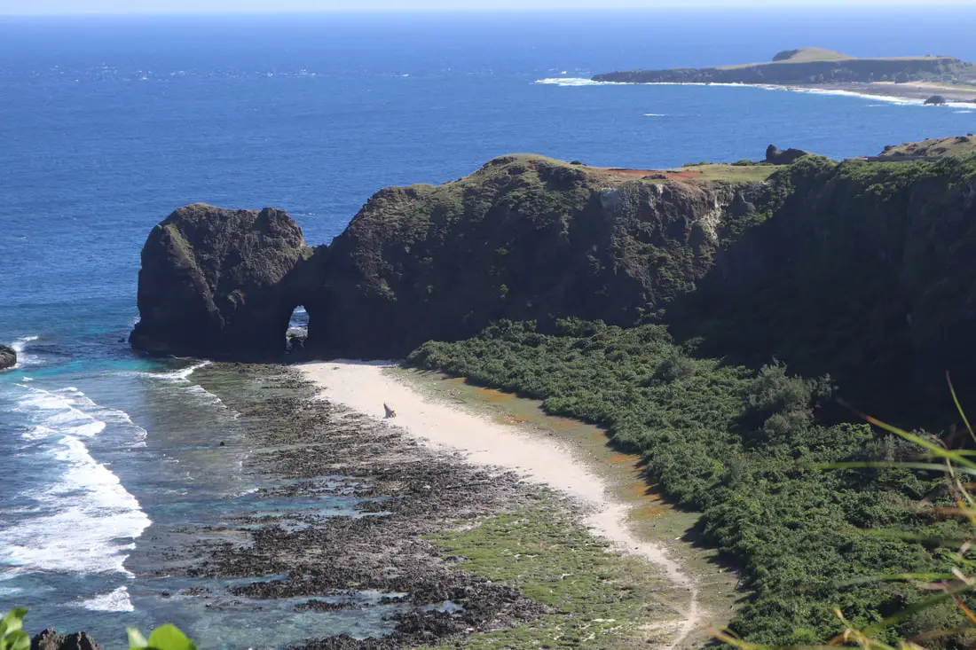
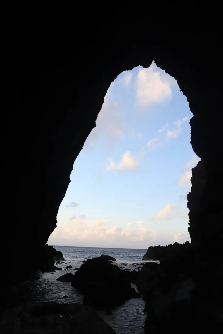
Wangong Dong Sea Cave 彎弓洞
Wangong Cave is one of the largest and most beautiful caves on Green Island. It attracts tons of Instagrammers and is a great spot for a photo.
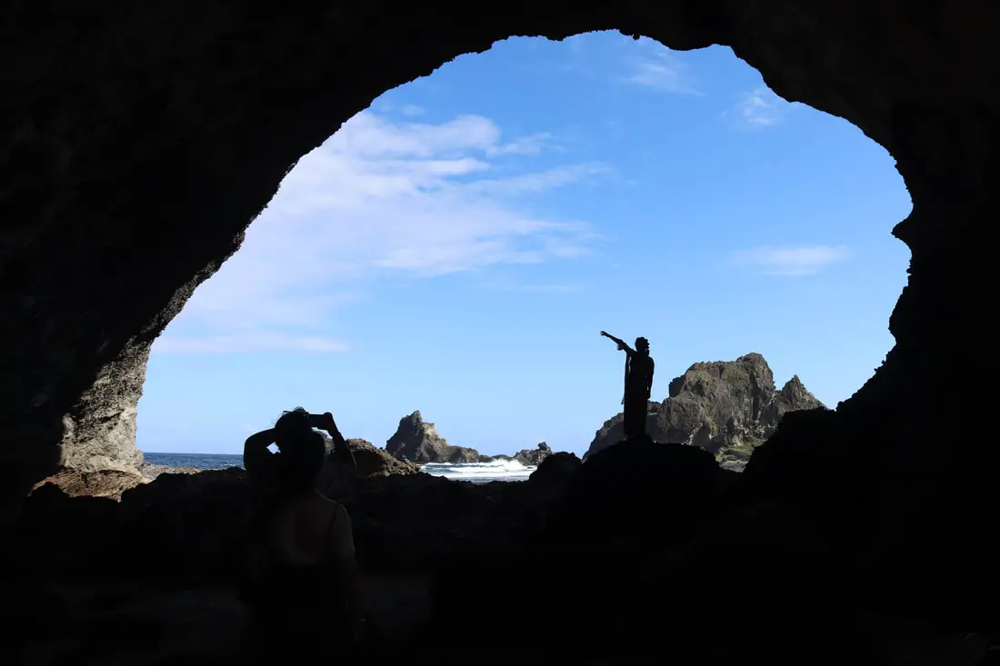
Lots of people like to get a silhouette image from inside the cave.
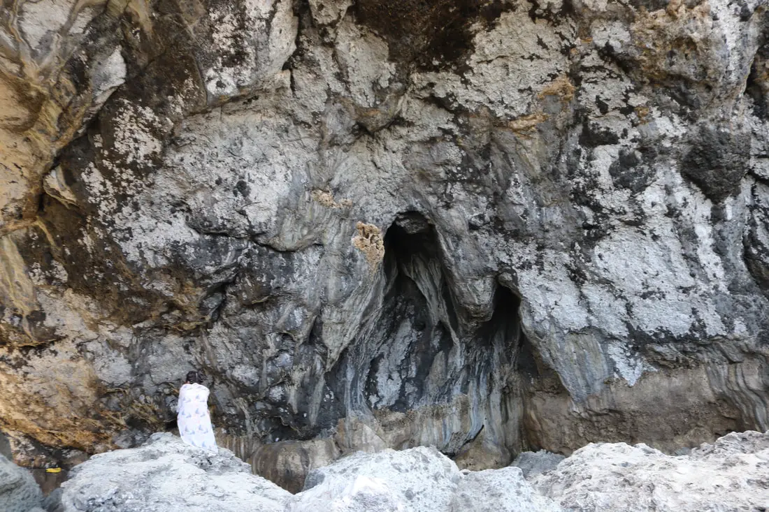
There are also some interesting rock formations on the cave roof.
Another view of the cave.
Near Wangong Cave there is also a secret swimming spot, which is really only swimmable at high tide. The swimming spot sits in between these rocks and it is a really pointy, rocky, walk to get there.
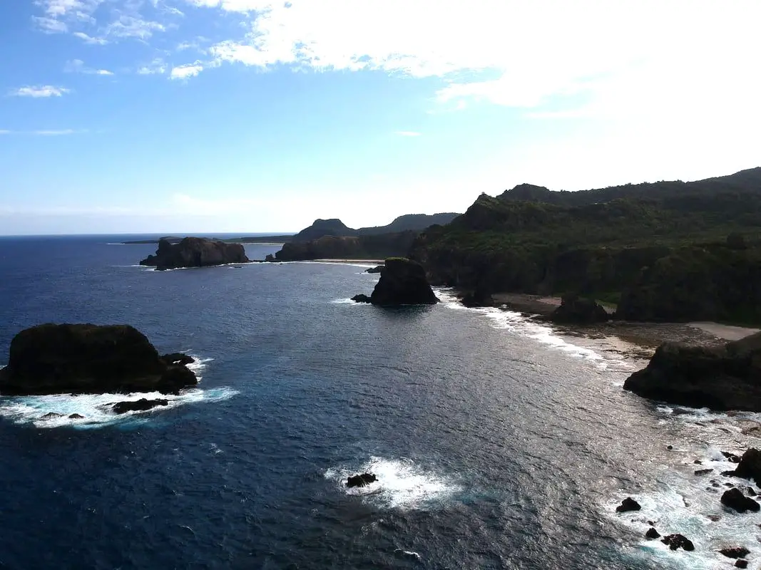
View of Youzihu to the south via drone.
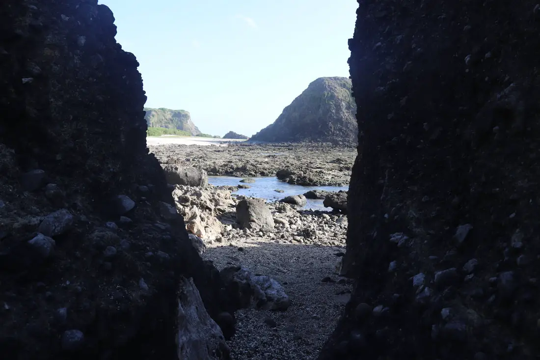
Further south along the beach, there is another volcanic wall and a small passageway that leads to another cove.
The most impressive thing here is the rock formations, that look like a giant natural cathedral.
Last view of Youzihu from the plateau above.
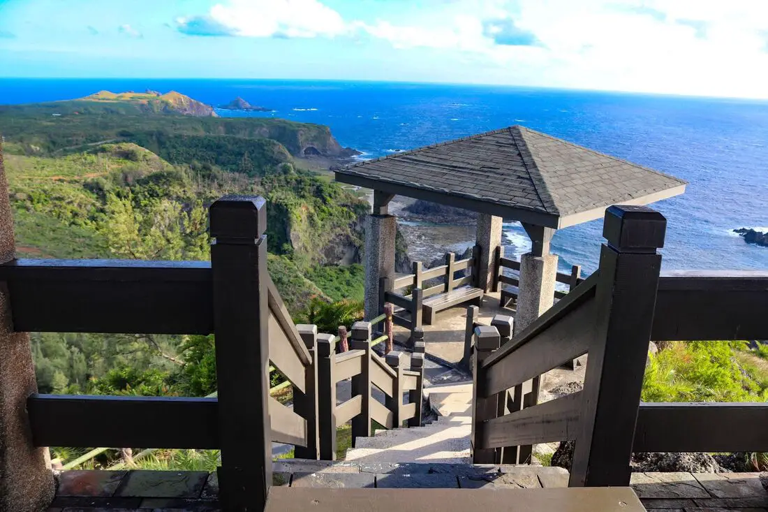
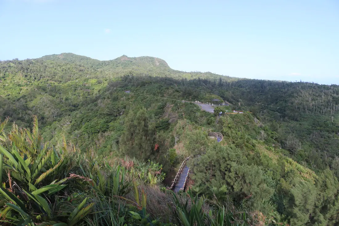
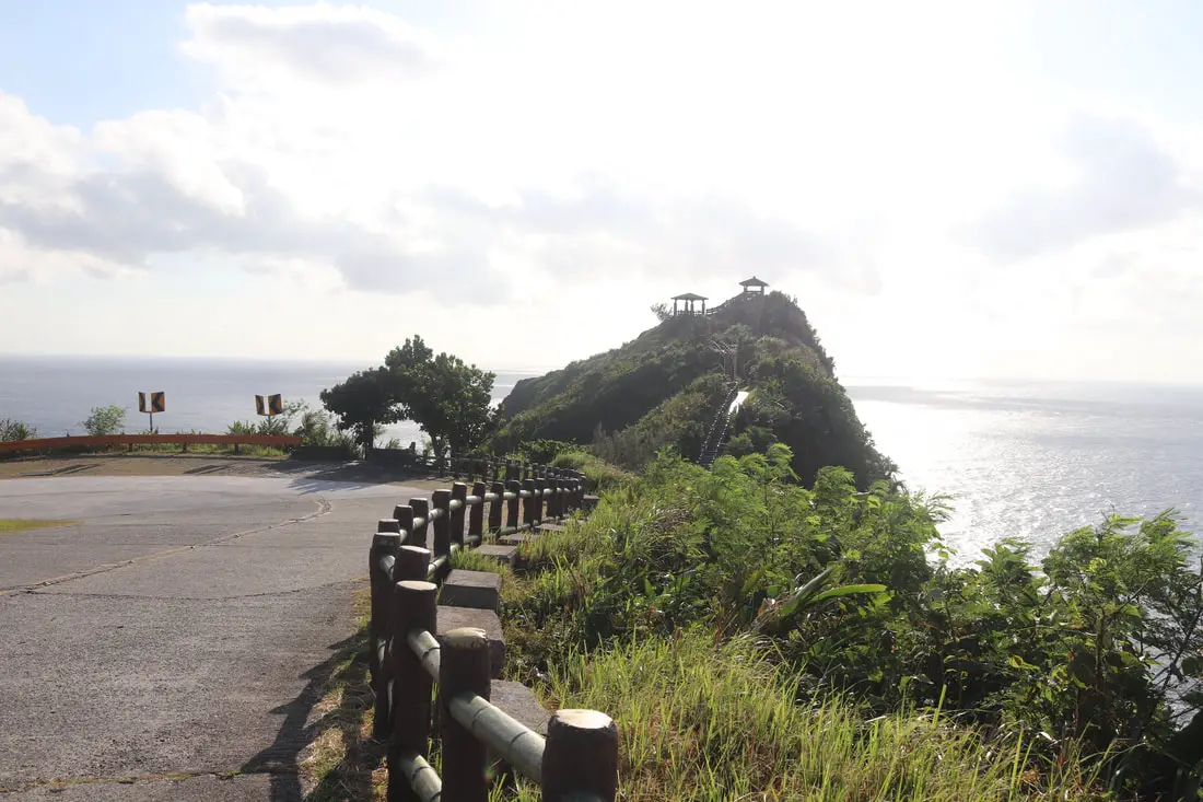
Little Great Wall 小萬里長城
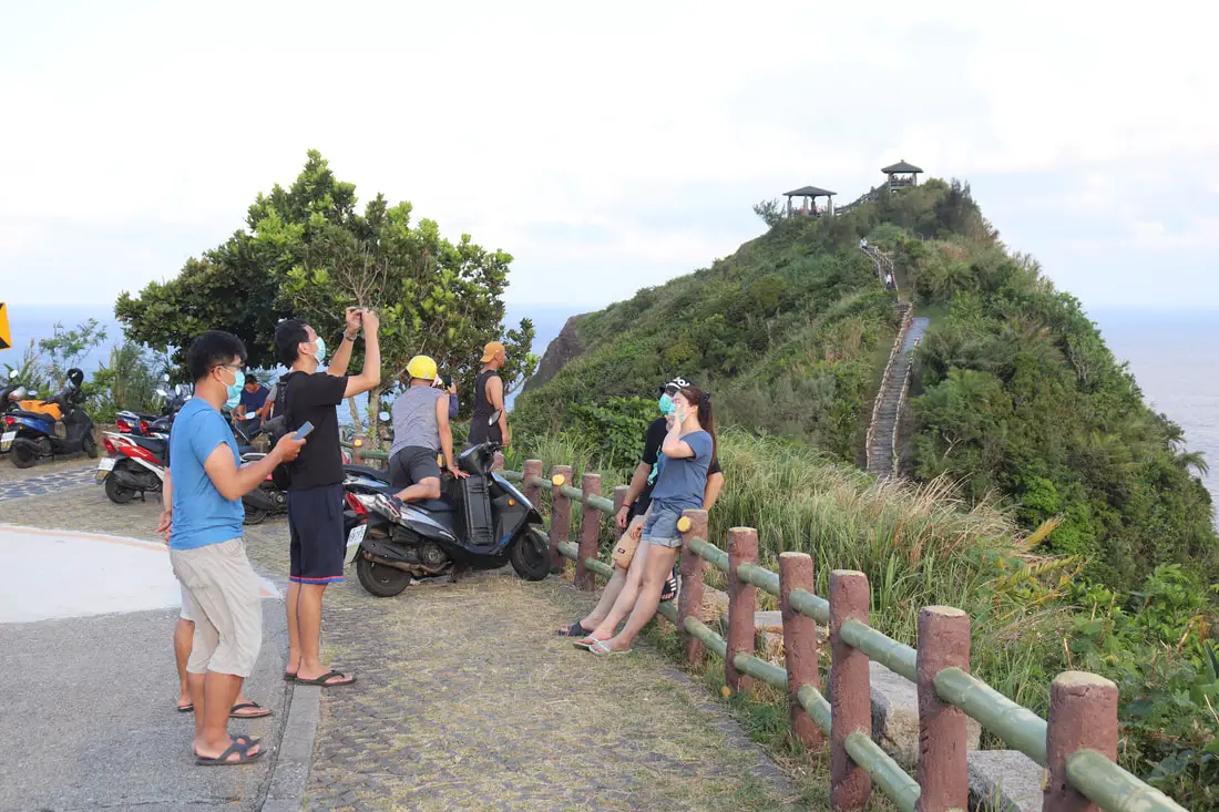
A must-see on Green Island is the little Great Wall. It provides some of the most amazing views anywhere in Taiwan for very little effort.
View of Niutoutshan in the distance from the trailhead.
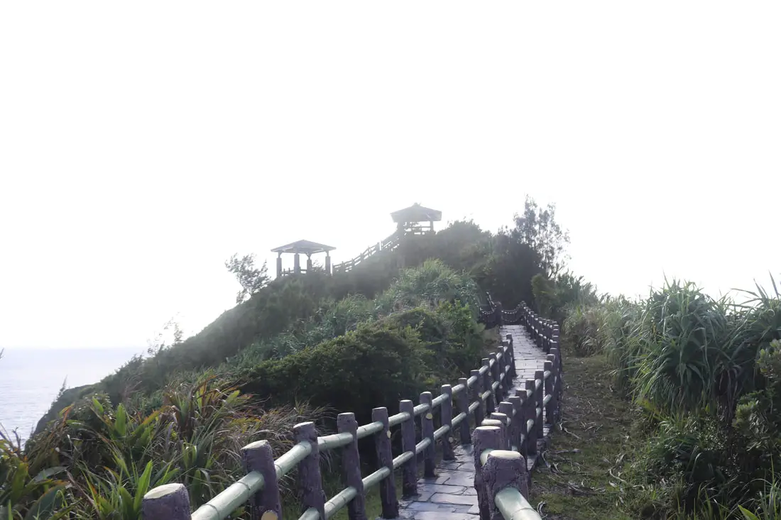
The trail here is not very steep or long, but there is a sheer dropoff on either side.
View of Haishengping Valley.
From here you can see Sleeping Beauty Rock, if you can’t see it the head is to the left.
If you have seen the Disney film Moana, it is kind of like that.
Down below are some volcanic rocks with natural steps on them, which are popular for people to climb.
Another view of the coastline below.
View of the open ocean from the top.
View of Youzihu.
Closeup on the rock formations at Youzihu.
View looking back down the trail.
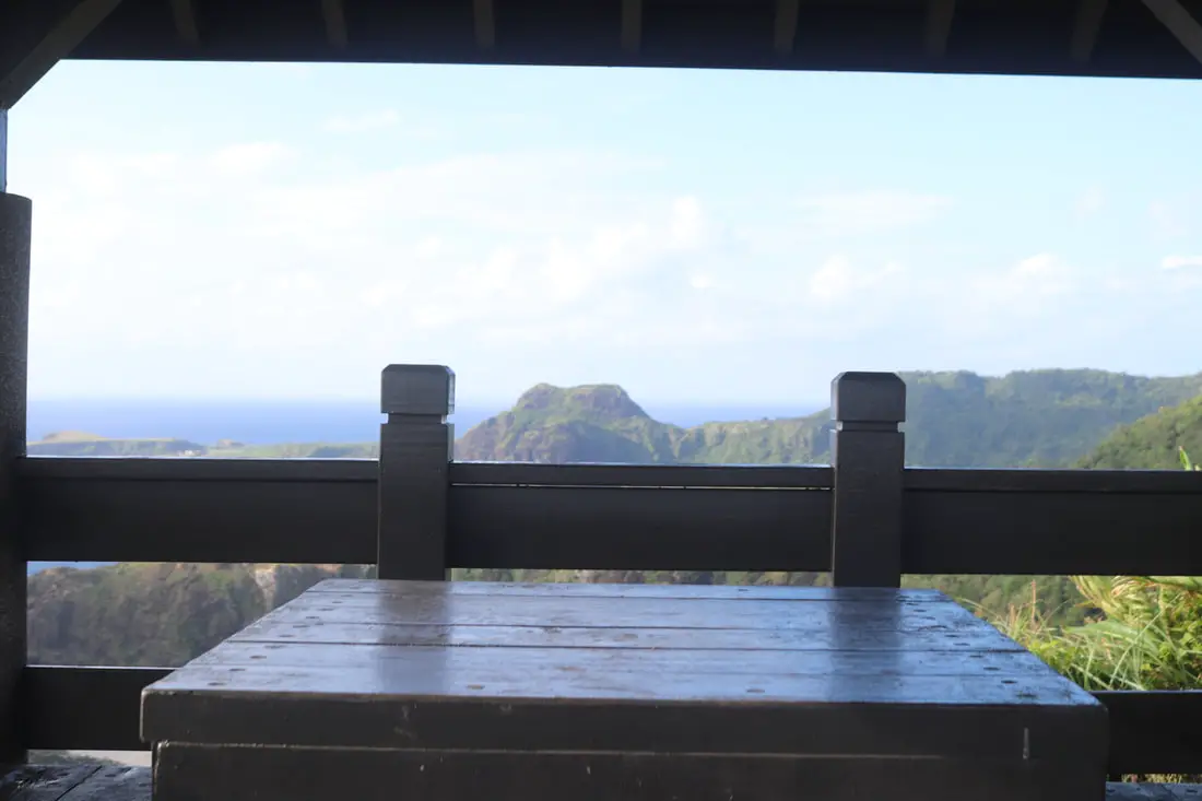
View looking south from the top pavilion.
Just a little way up the road about at the location where this photo was taken, you can find a small path leading down the mountain to Haishengping.
Haisenping 海蔘坪
The path is well hidden so not many people find their way down there. It is the only way to get to sleeping beauty rock. Originally there was a village down there, but due to difficulty in walking up and down the hill, the village was abandoned. The last resident finally gave up and moved away. But there are still concrete steps that lead down to the village.
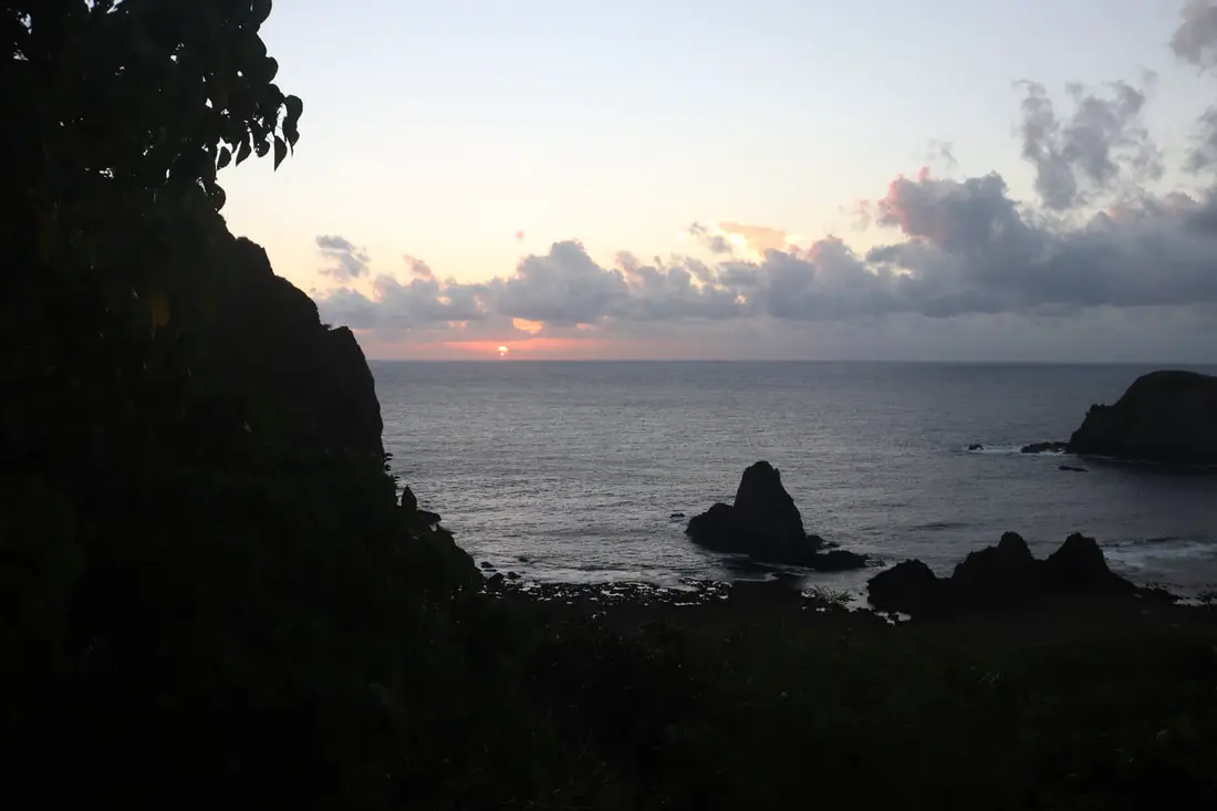
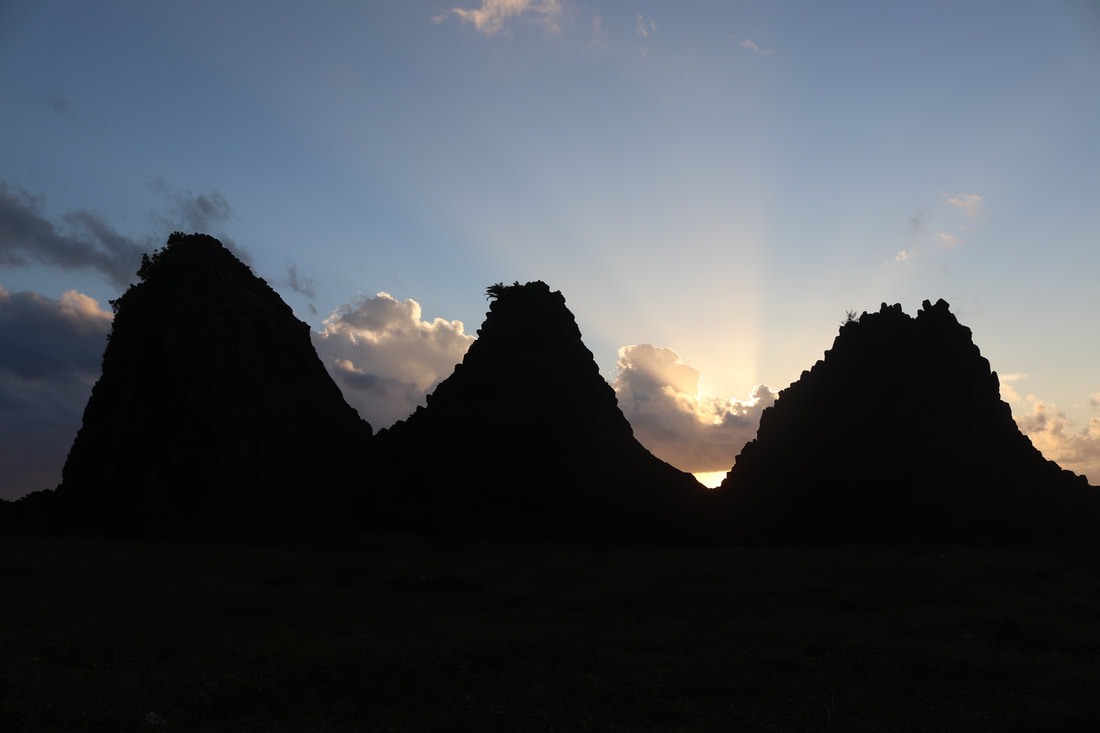
And this is where I saw the sunrise.
Video of the sunrise that morning above. 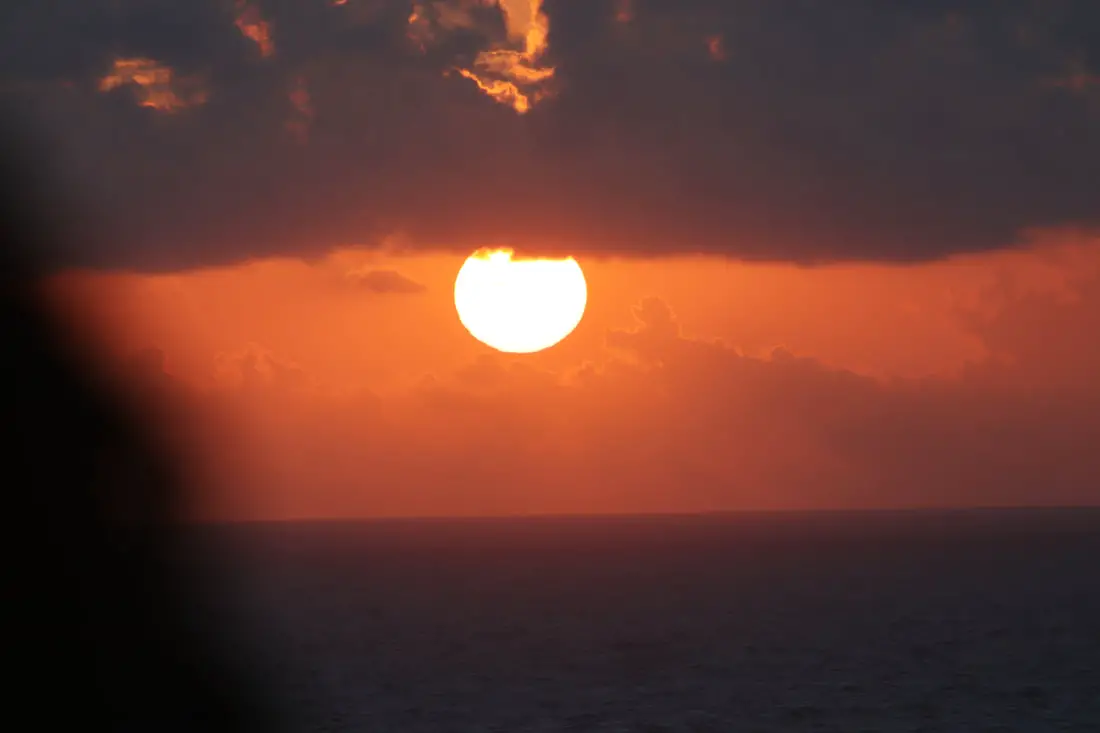
View of the sun in between the clouds. No filter.
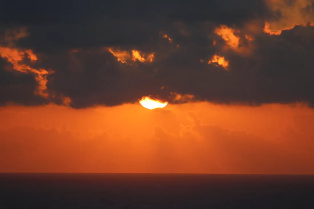
Sun rising into the clouds.
Sun disappears behind the clouds.
Further down, you will run into about four or five abandoned houses, all with their roofs collapsed.
Getting down to the beach was an amazing experience. I had the whole beach to myself the whole time, and I knew it was a place few people would visit. It felt almost like a sacred place.
There is a path along the beach through this thick brush, which will hurt if you are wearing shorts.
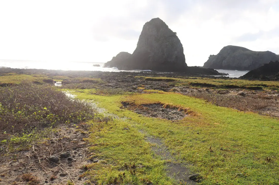
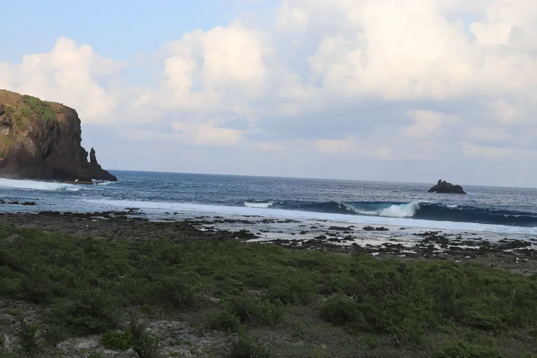
The three volcanic rocks that peak out of the ocean on the north shore.
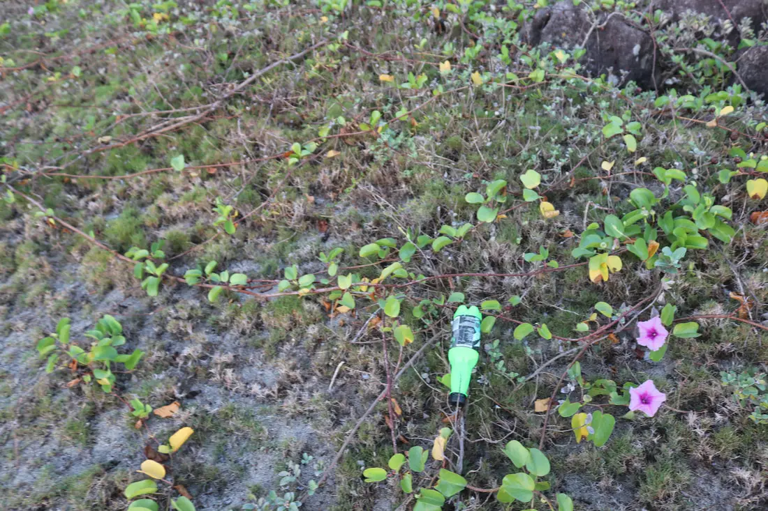
A not-so-unfamiliar artifact in what I assumed was an untouched paradise.
Morning sun behind the clouds.
Sleeping Beauty Rock 睡美人岩
As explained above, Sleeping Beauty Rock reminded me of Moana. Once you see it, you can’t un-see it.
View looking toward the Little Great Wall from the beach.
Pekingese Dog Rock 哈巴狗岩
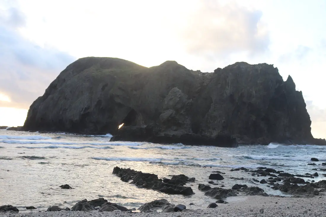
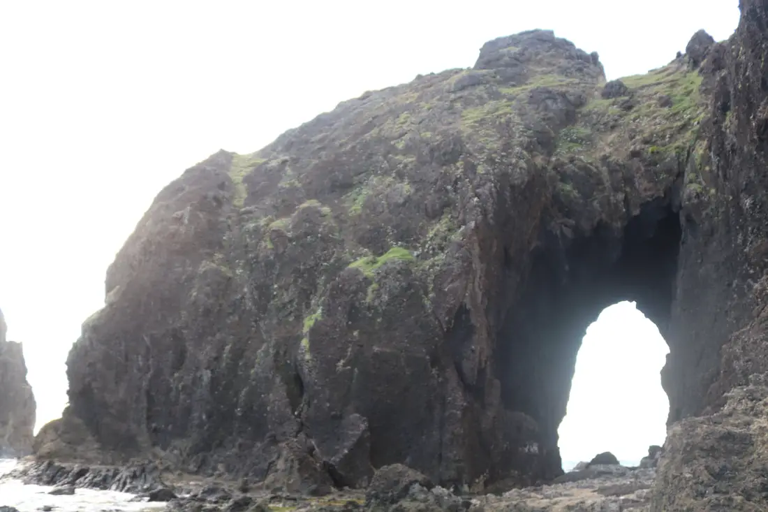
Another amazing rock here is Pekingese Dog Rock, which is an island that has a sea cave that goes through the entire island.
Closeup of Sleeping Beauty Rock.

View inside the cave.
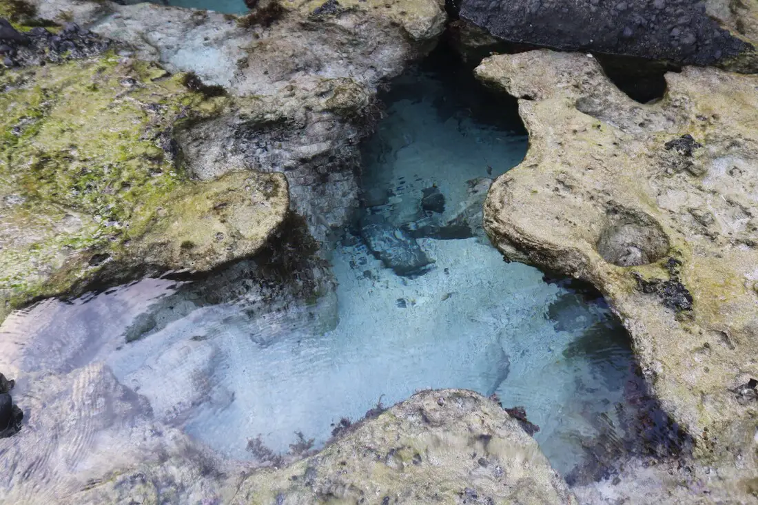
The water here is pristine.
Looking into the cave.
Looking back at the great little wall.
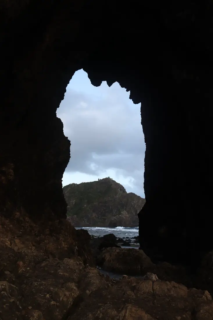
Behind Sleeping Beauty Rock, there are two more sea caves. I only explored one.
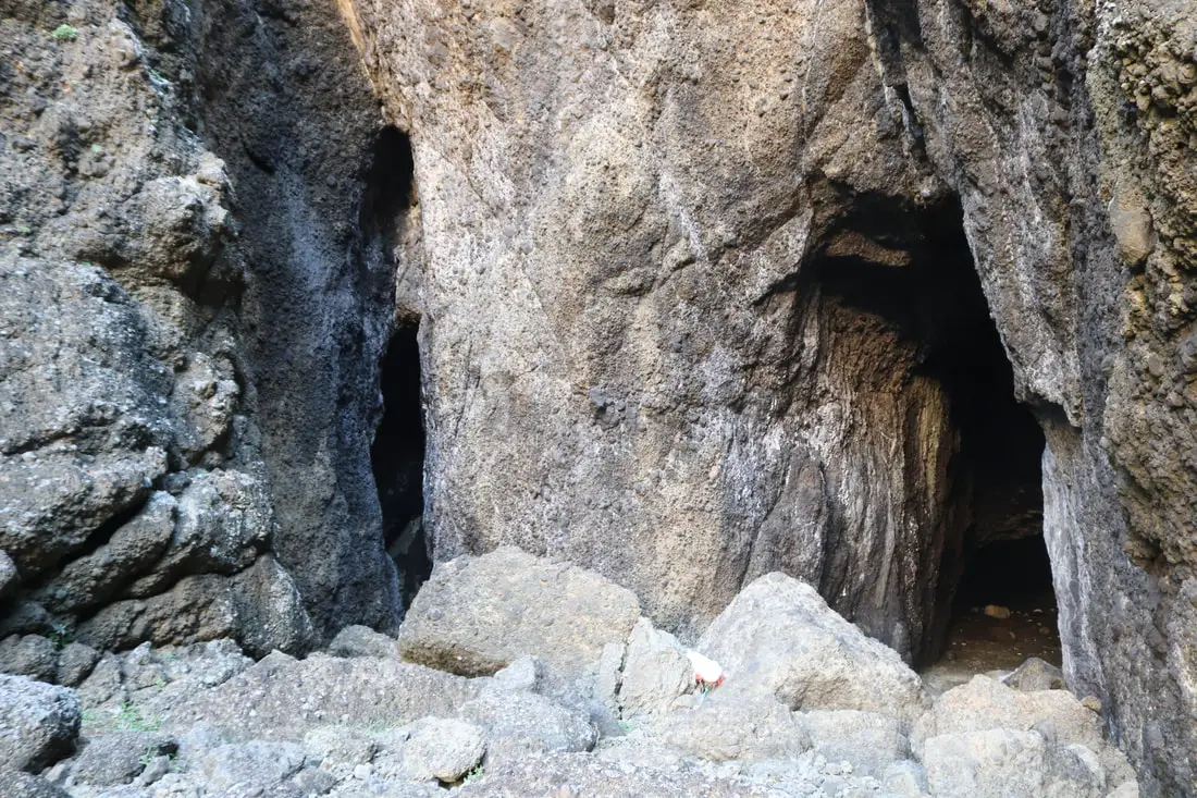
View of the entrance to the two caves.
Inside the right cave, there were tons of rubble, and it was really damp.
View of the end of the cave. The cave is constantly eroded by seawater.
View looking back at the cave entrance.
Another view of Sleeping Beauty Rock.
Walking back toward the little Great Wall.
Pine trees growing on the beach, perhaps washing up from the western United States?
There is also a stream running from the abandoned village to the beach here which is beautiful.
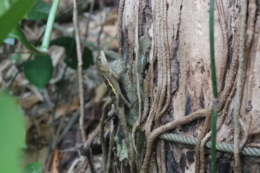
Dinosaur spotted on the trail.
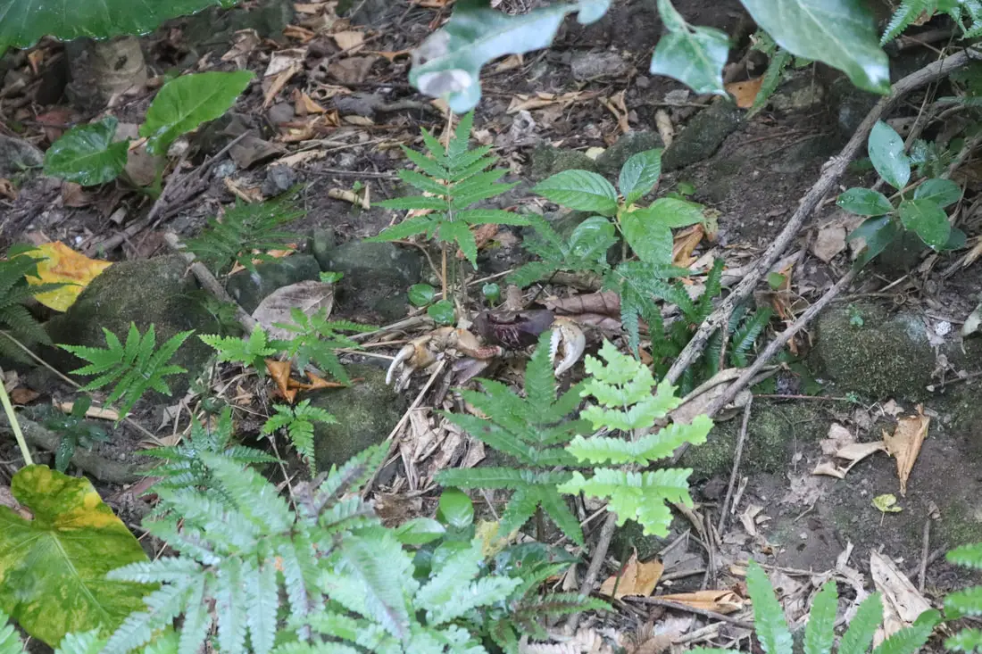
There were also tons of land crabs everywhere. They were big and loud
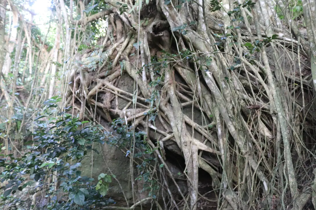
Huge banyan tree growing on a rock near the village.
At first, I thought the way to Sleeping Beauty Rock was through the garbage dump here, but that is not the case. You have to go down the trail mentioned above.
Confucius Rock 孔子巖
Once you come down from the dump, you can see Confucius rock from the seashore, on the left.
Hot Spring Village 溫泉村
On this shore, you will find Hot Spring Village.
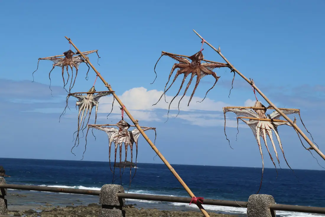
When I was there they were hanging eight octopuses out to dry.
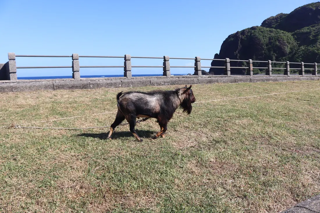
Also, there are usually goats grazing here.
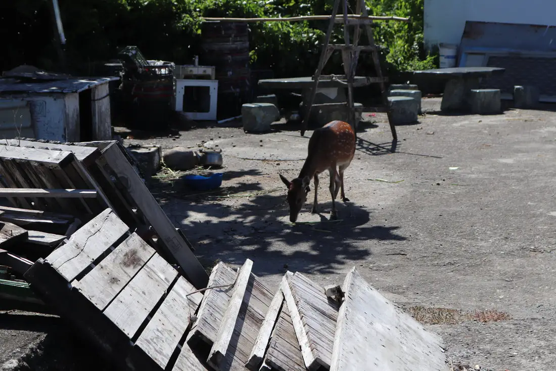
Also, this was the only Skia deer I saw here, and it had a broken leg.
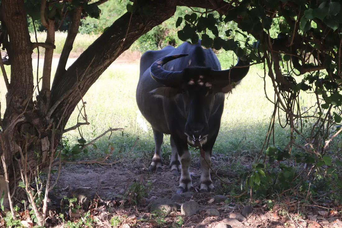
Also saw a water buffalo here.
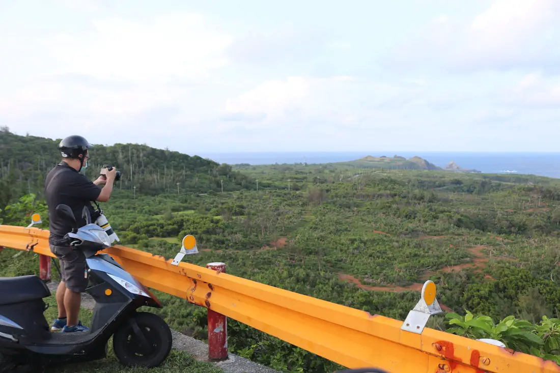
Guoshan Old Trail 過山古道
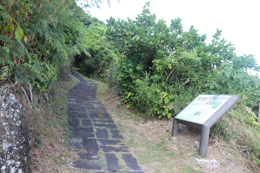
Perhaps the best trail on the Island is the Guoshan Old Trail. It traverses the mountains through the middle of the island and was once a major transportation route for the locals. Unfortunately, I did not walk the whole thing because I was too busy snorkeling. The entire walk will take a few hours.
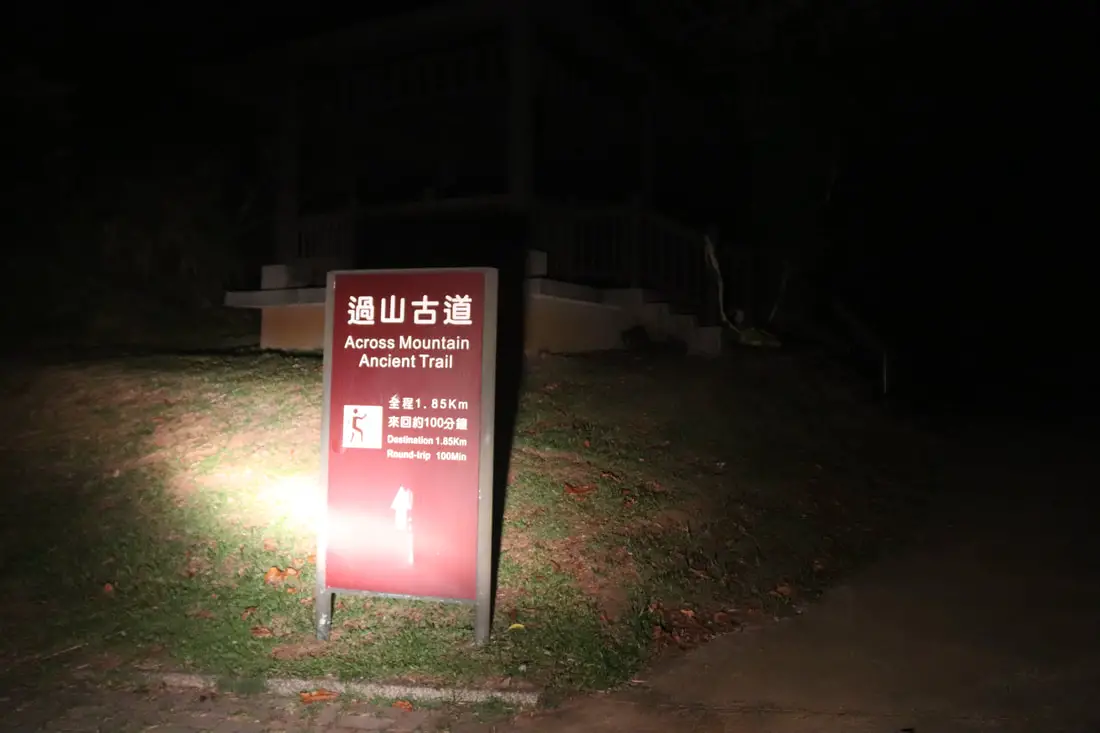
The trail ends near the top of the island, next to the weather station. This is the view at night. It’s about 2 km long and takes about two hours.
Ocean View Trail 綠島觀海步道
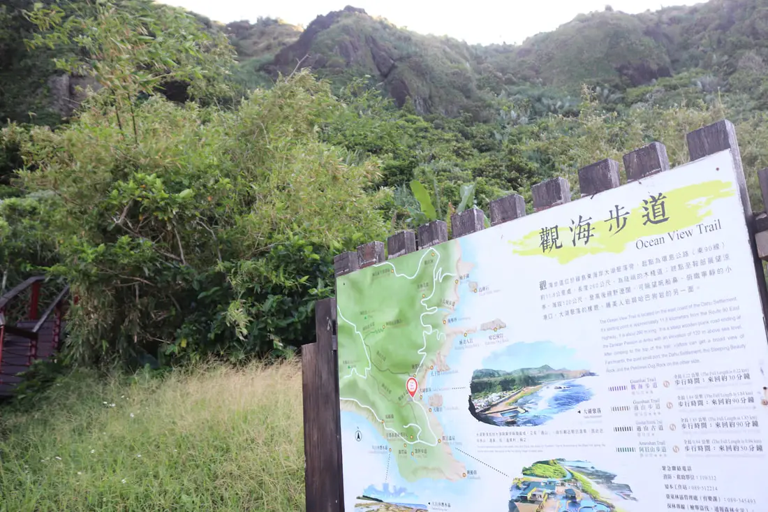
Another nice trail is the ocean view trail that also starts from Hot Spring Village.
This trail seems newer and also has great views. I didn’t have time to finish it though.
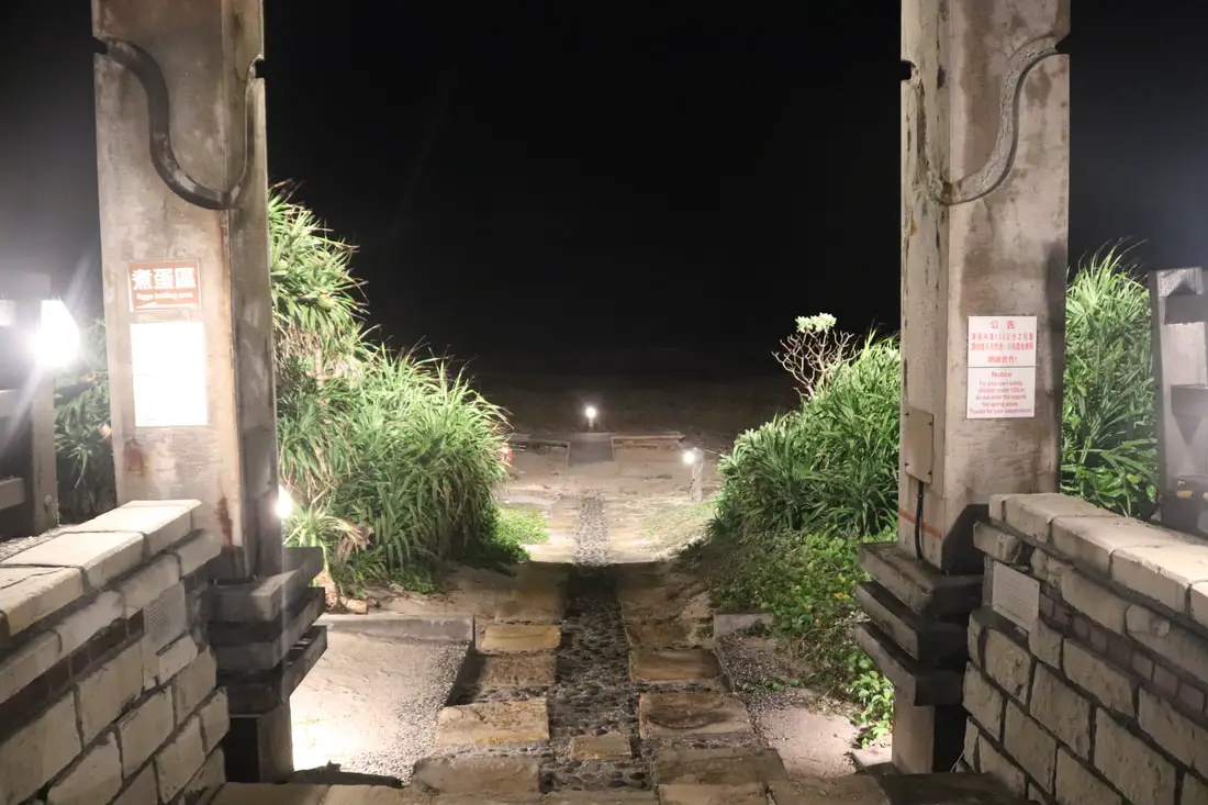
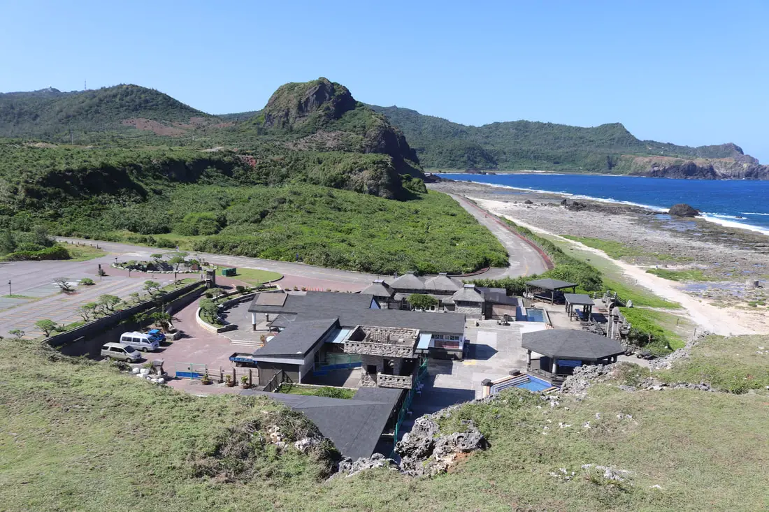
Zhaori Hot Springs 朝日溫泉
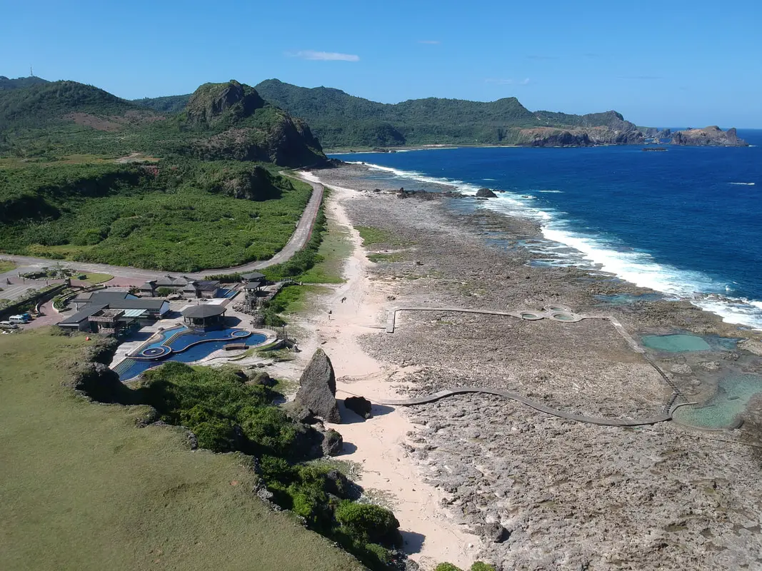
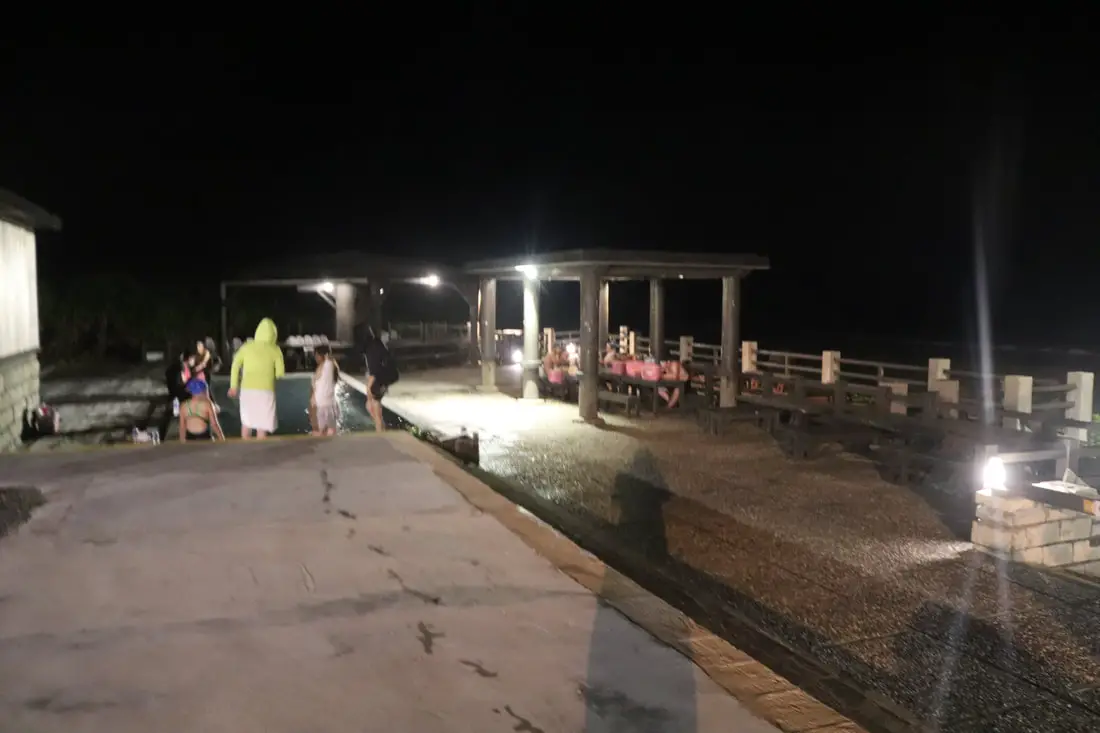
Zhaori (or Chaori) Hot Springs is one of only three saltwater hot springs in the world. It is truly a world-class location worth checking out. The hot springs have also been turned into hot tubs and swimming pools above, and below is a more close-to-nature experience.
Admission is usually 200 NT per person.
You can also book discount tickets to Zhaori Hot Spring on KKday here. Unfortunately due to the pandemic, the hot springs closed for a while and threatened to shut down permanently. Thankfully it opened up again when we came, even if it was only open partially.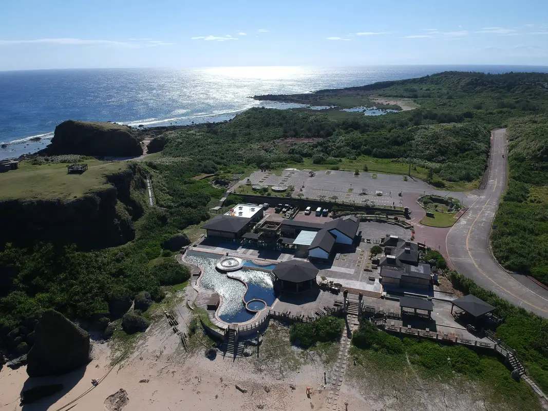
Another view of the hot spring from above.
Check out our drone video of the area above. 360 degree view of Chaori Hot Spring, one of only three known salt water hot springs in the world. #朝日溫泉 #鹽水溫泉 #綠島 #台灣 #溫泉
Posted by Foreigners in Taiwan 外國人在台灣 on Wednesday, October 6, 2021Or you can look at the 360-degree panorama of the area above or the link here.
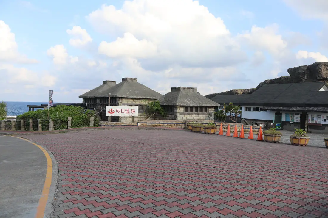
This is the entrance to the hot springs. There is plenty of parking around.
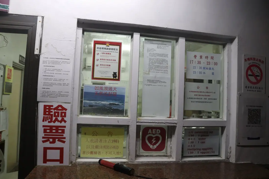
When I was there, tickets had to be purchased from KKday or a hostel owner, they did not sell tickets at the door.
View of the pools to the left.
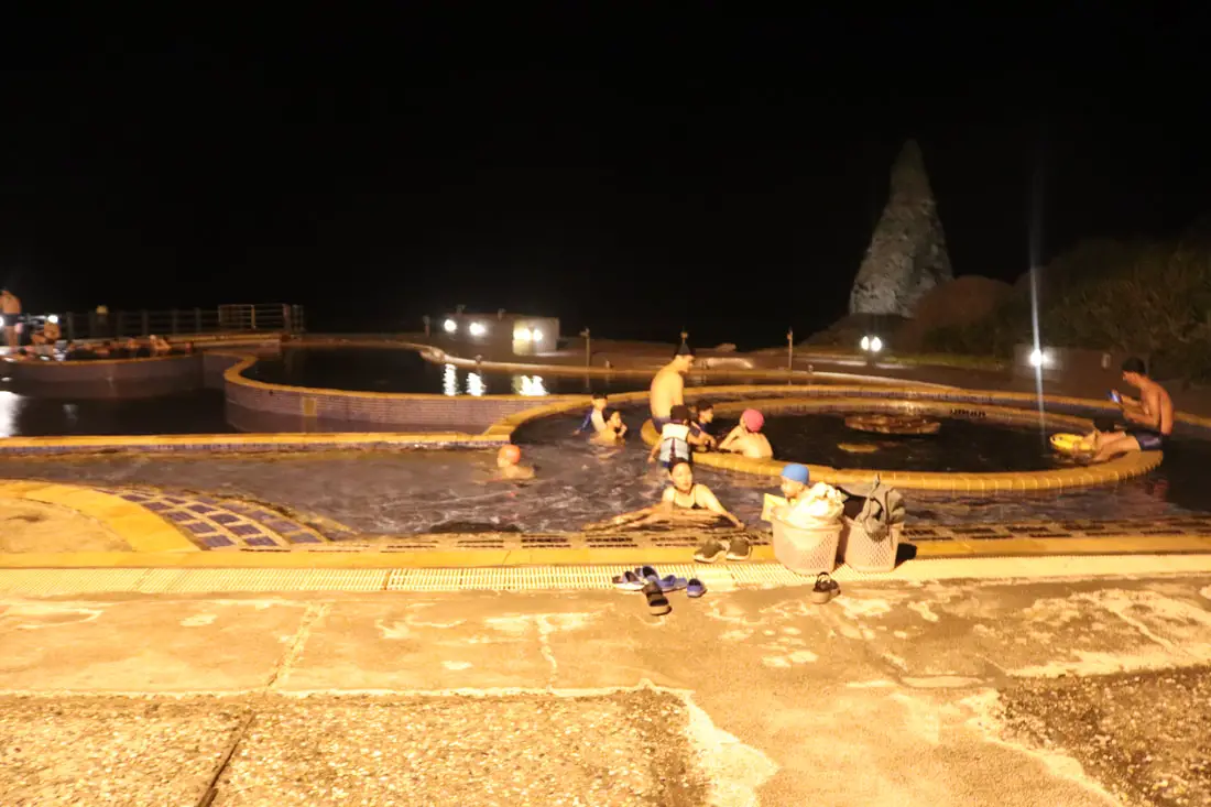
View of the pools to the right.
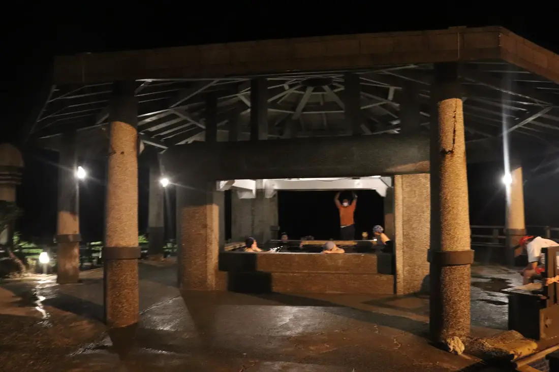
Large hot tub pool in the center.
View out to the ocean. The ocean part was closed when we went there because they were filming a movie. Also because of renovations, the entire park was only open after 5 PM. Usually, it is open all day.
Another view of the beach area with filming going on in the background.
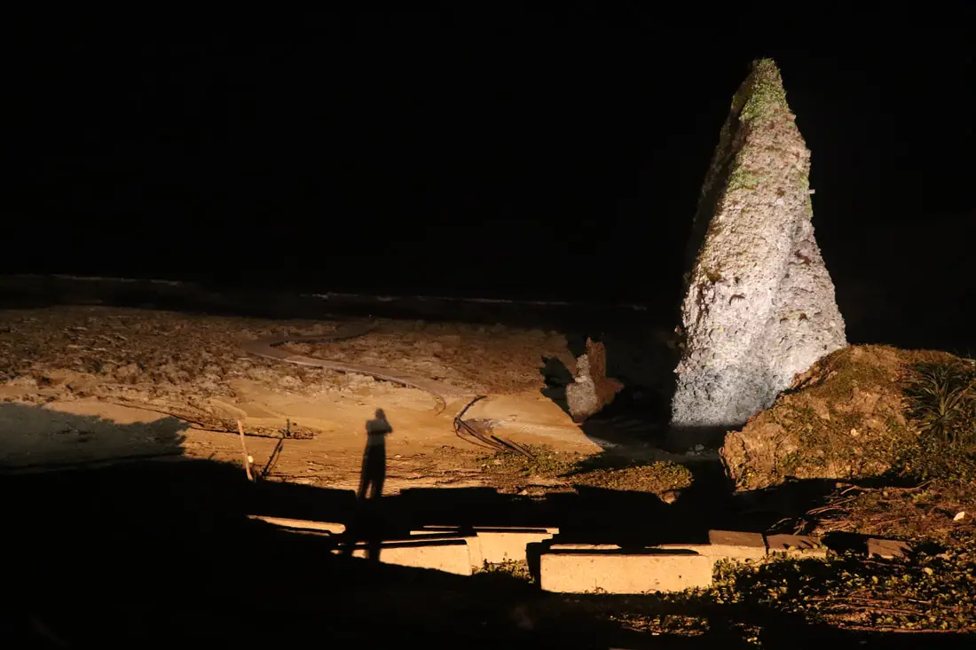
Giant laval pillar on the beach.
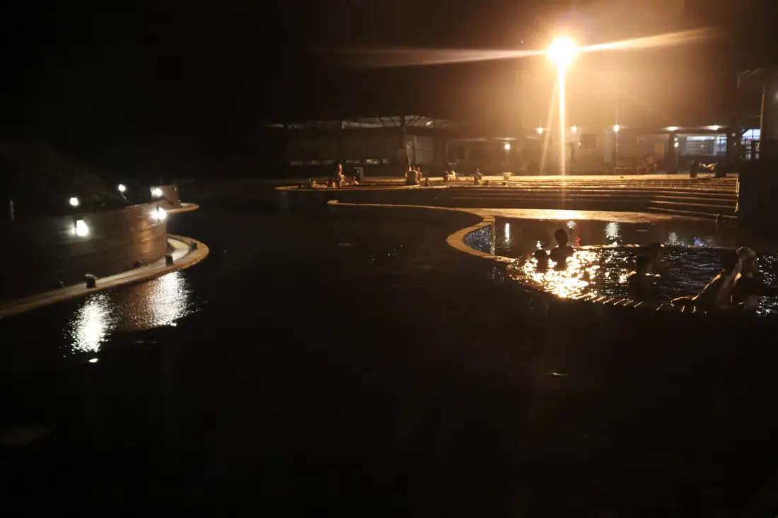
Looking back at the pools.
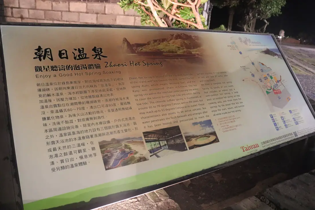
“Zhaori Hot Spring – Enjoy a Good Hot Spring Soaking”
Zhaori Hot Spring is located on the southern east side of the island and faces towards the east, named the hot spring Asahi, which means ‘Morning Sun’, and the Kanji was pronounced Zhaori in Chinese. The hot spring sits within the intertidal zone causing seawater to cover the source during high tide and emit during low tide. The chloride sulfate spring is maintained at around 60 to 70 degrees Celsius within the pool but may reach up to 93 degrees Celsius at its outlet. These characteristics also point to an active volcano. Sea water penetrates the fault beneath and emerges after it has been heated and pressurized to reach the surface, causing its high density in salt lack of sulfur odor, and tacky touch. We have a complete hot spring facility to satisfy all your needs that includes an indoor spa, a semi-outdoor hot spring, a large pool, an outdoor hot spring, an egg cooking area, and three more hot springs by the ocean that let you enjoy the stars, waves, and sunrise all while inside our hot spring.”
The indoor spa was also closed when we were there. Hopefully, the entire facility will open soon.Fanchuanbi Grassland 帆船鼻大草原
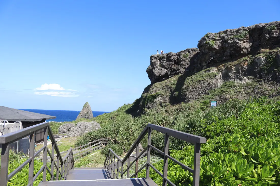
Another amazing place near the hot springs is Fanchuanbi Grassland. The trailhead is right inside the hot spring parking lot.
View of the hot springs from on top of the grassland.
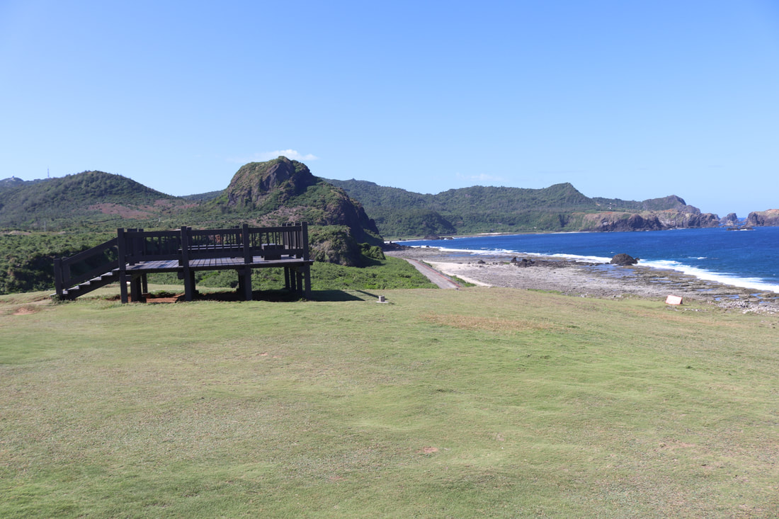
There is also a 360-degree viewing platform here.
The grass here is amazing. You could putt golf balls here. It would be a great place for golf. I imagine that it’s because goats graze here.
There is also a Hot Spring Visitors Center down the road which appeared to be shut down.
Ziping 紫坪
Ziping is an ecological area that has a large tide pool. It used to be inhabited, but the village there has now been abandoned too.
View of Ziping from above. We did not get a chance to walk down for a closer look.
Ziping Campground 紫坪露營區
At Ziping there is also a pretty nice campground with covered camping areas.
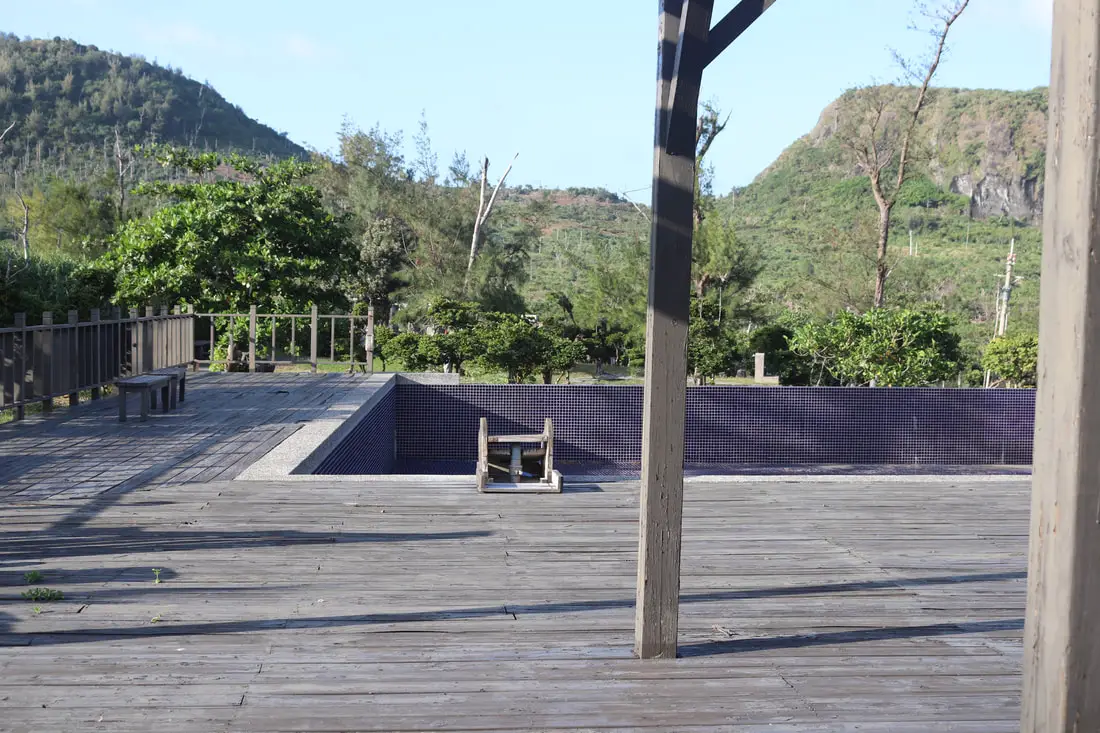
There is also a hot spring swimming pool here that was closed when we went.
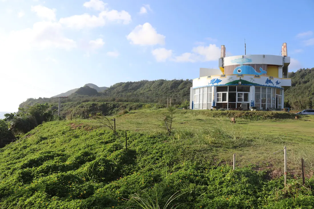
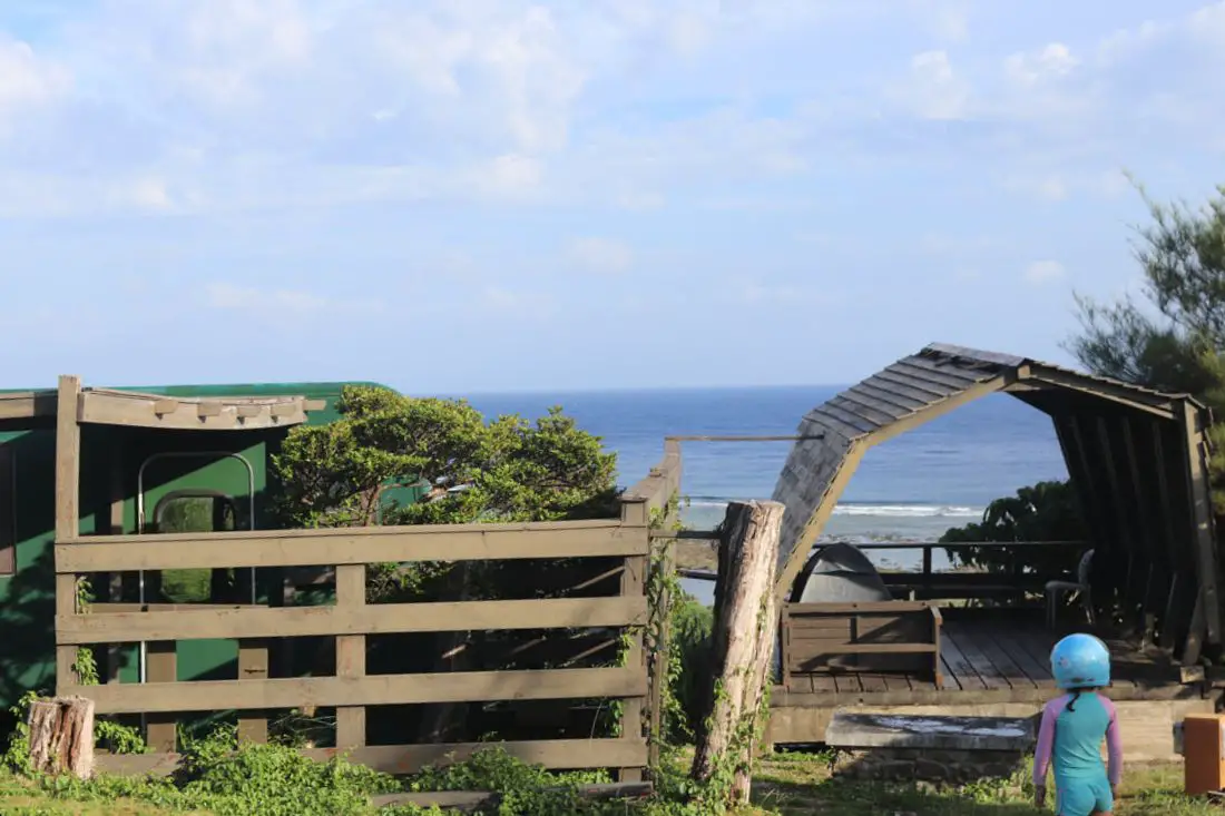
We also saw this amazing whale hostel on a hill nearby.
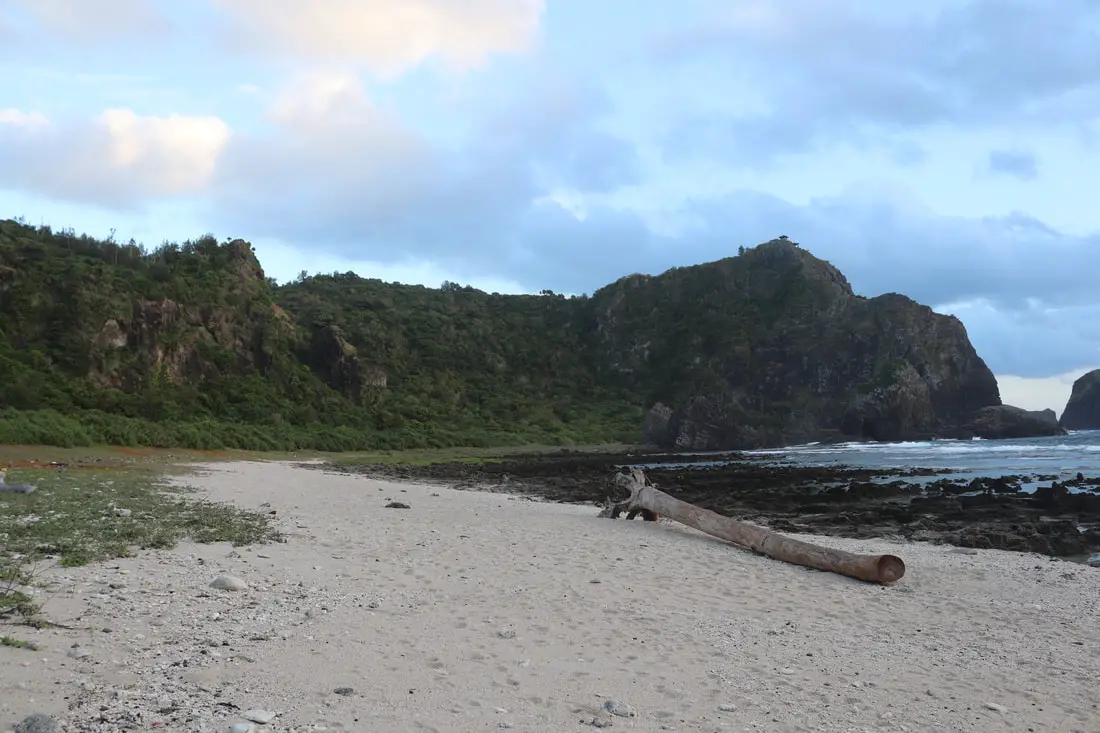
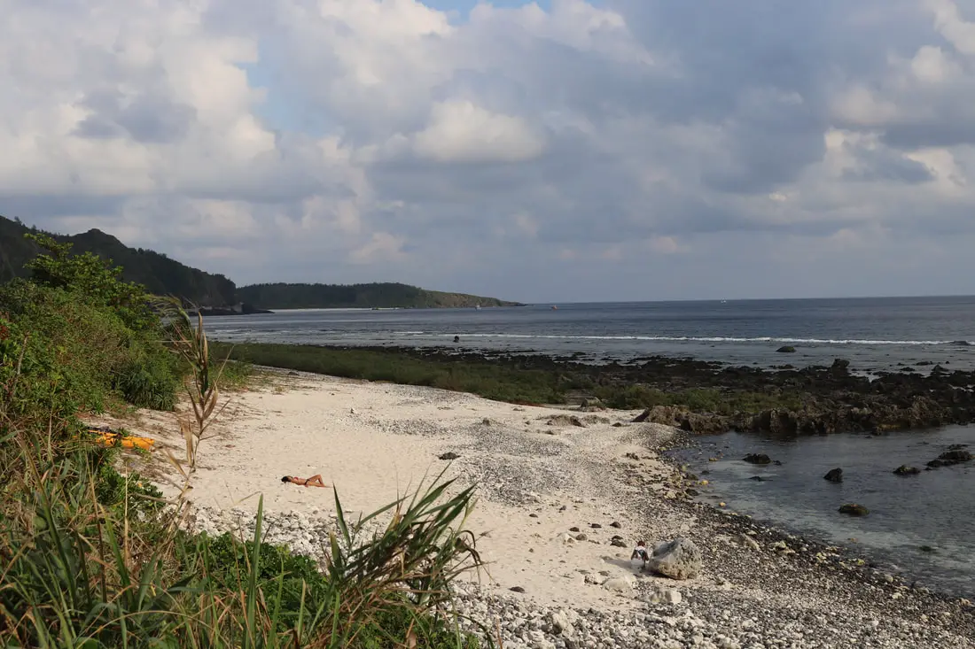
Da Bai Sha Beach 大白沙
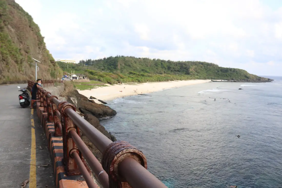
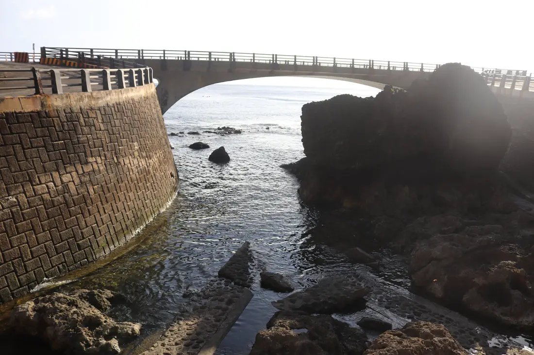
Dabaisha is the largest beach on Green Island. There is also a concrete bridge here, so it is busy with both beachgoers and divers.
There were tons of snorkelers and divers here when we visited.
There was also a diving boat here.
View of the beach. There are usually people sunbathing here.
There was also a long line of Instagrammers here waiting to take selfies.
View of the sand on the beach.
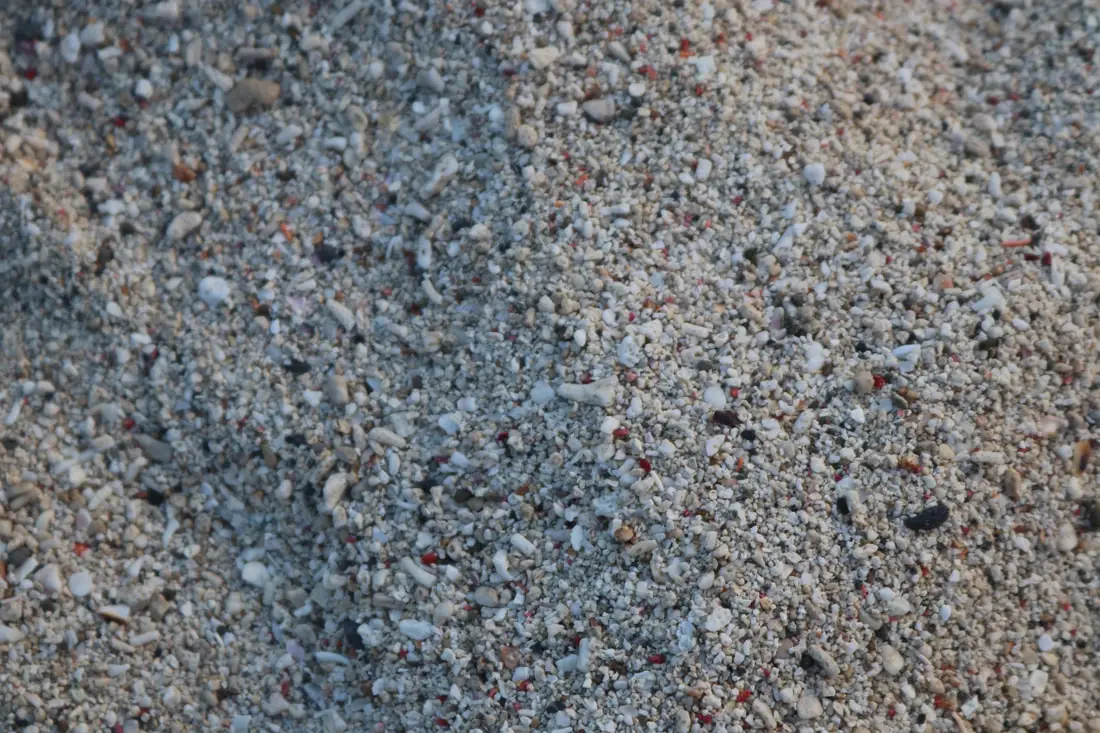
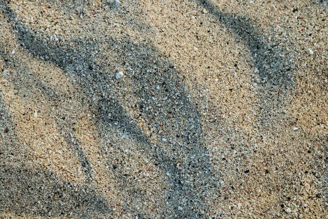
The sand here is not fine, it is quite coarse. But we were still able to make a sand castle out of it.
People walking on the concrete bridge.
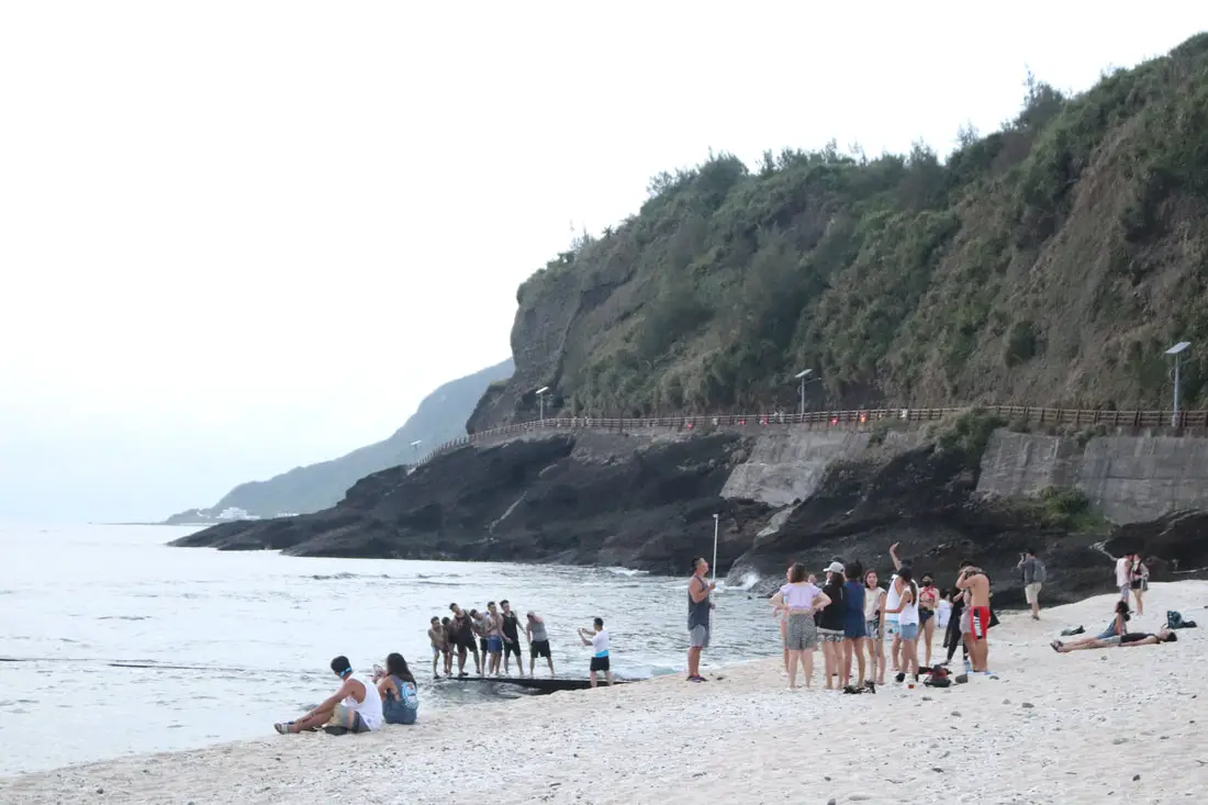 Another view of the crowd in front of the bridge.
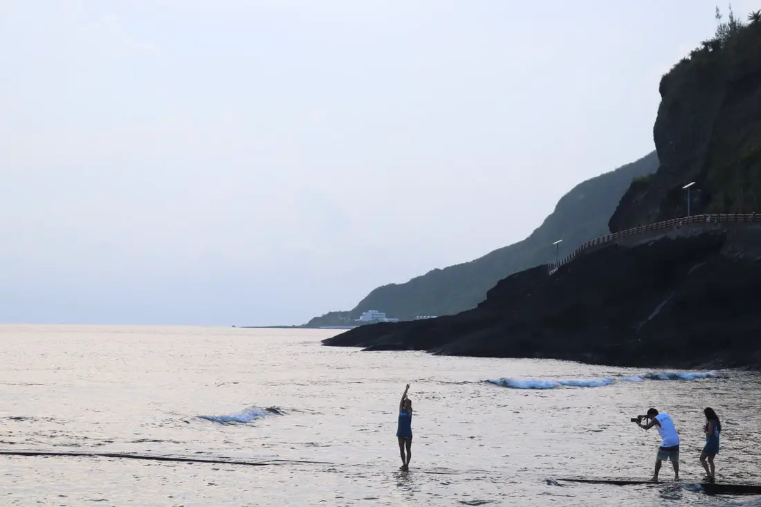
More Instagrammers.
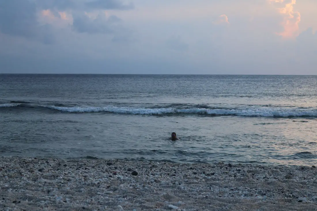
A lone swimmer.
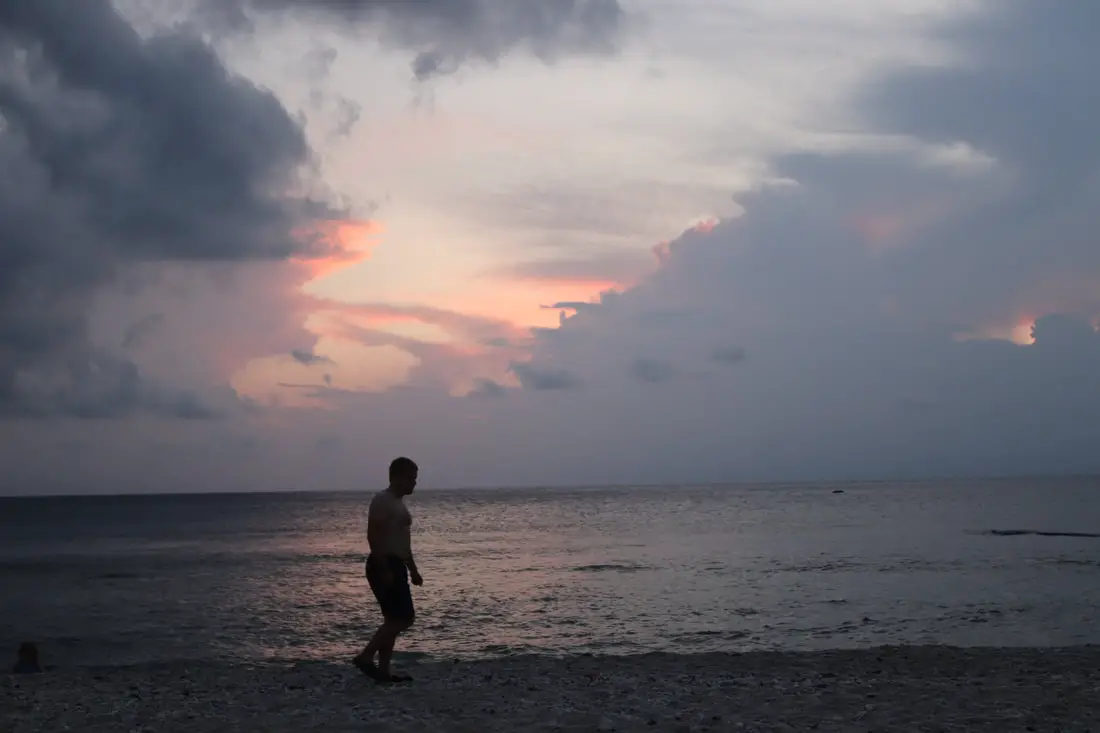
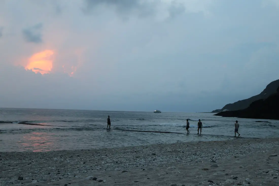
Walking in the sunset.
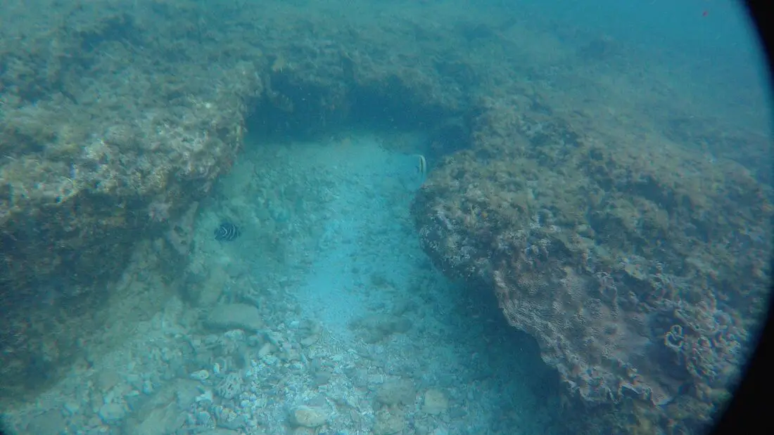
View under the water at the beach. You can see an angelfish.
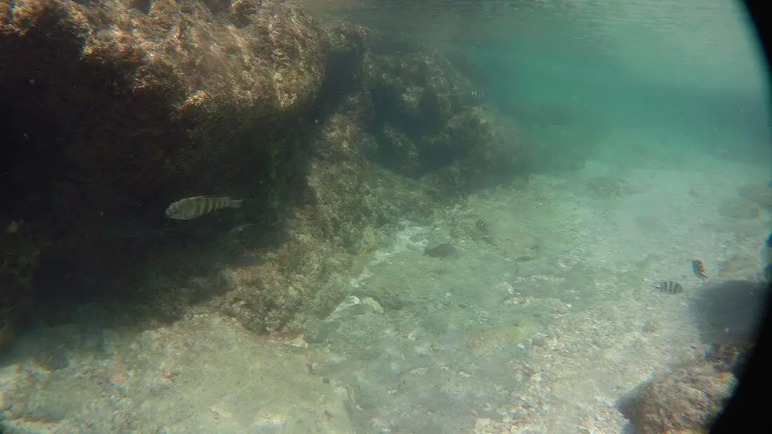
This is about the best view of fish I have there.
Fudi Dongtian 福地洞天
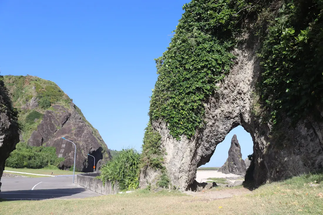
Another amazing place on the island is Fudidongtian. Here the road passes many sea caves and even passes through one.
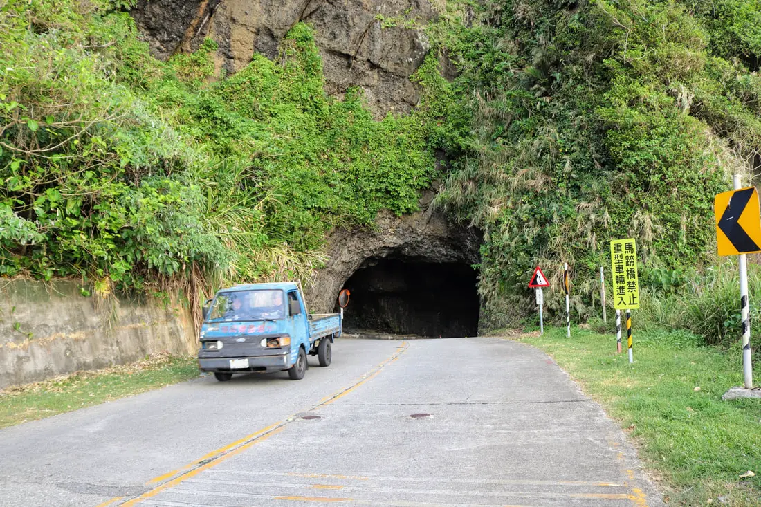
The road here passes through a sea cave.
Also under the bridge here, there is another stone walkway that you can walk to go diving or snorkeling.
There are also a few large caves here.
View inside the cave.
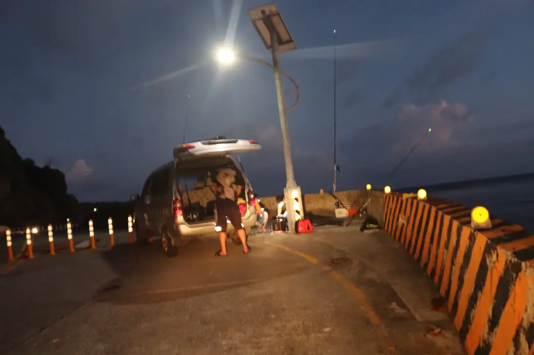
People came fishing here at night.
Another view at dusk.
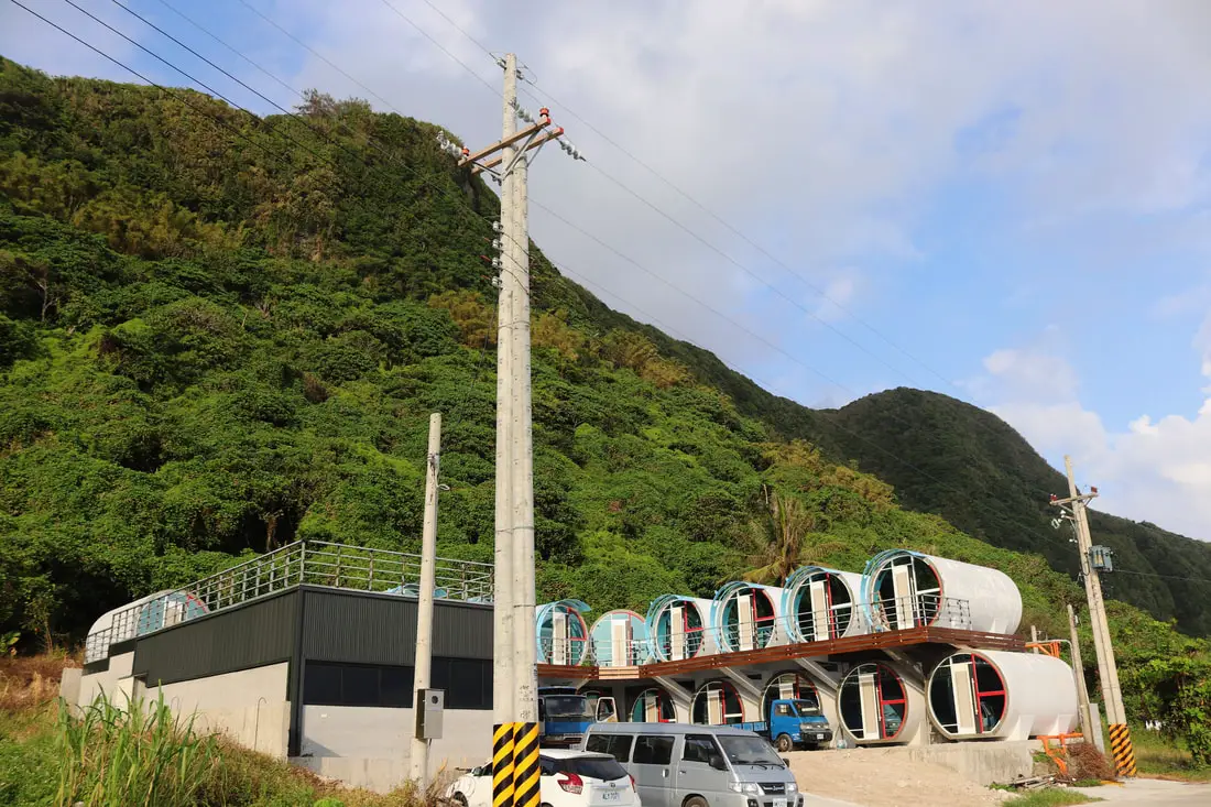
Also near there we came across this concrete pipe hotel.
A lone sunbather on this somewhat rocky beach in front of the pipe motel.
Shilang Snorkeling Area 石朗潛水區
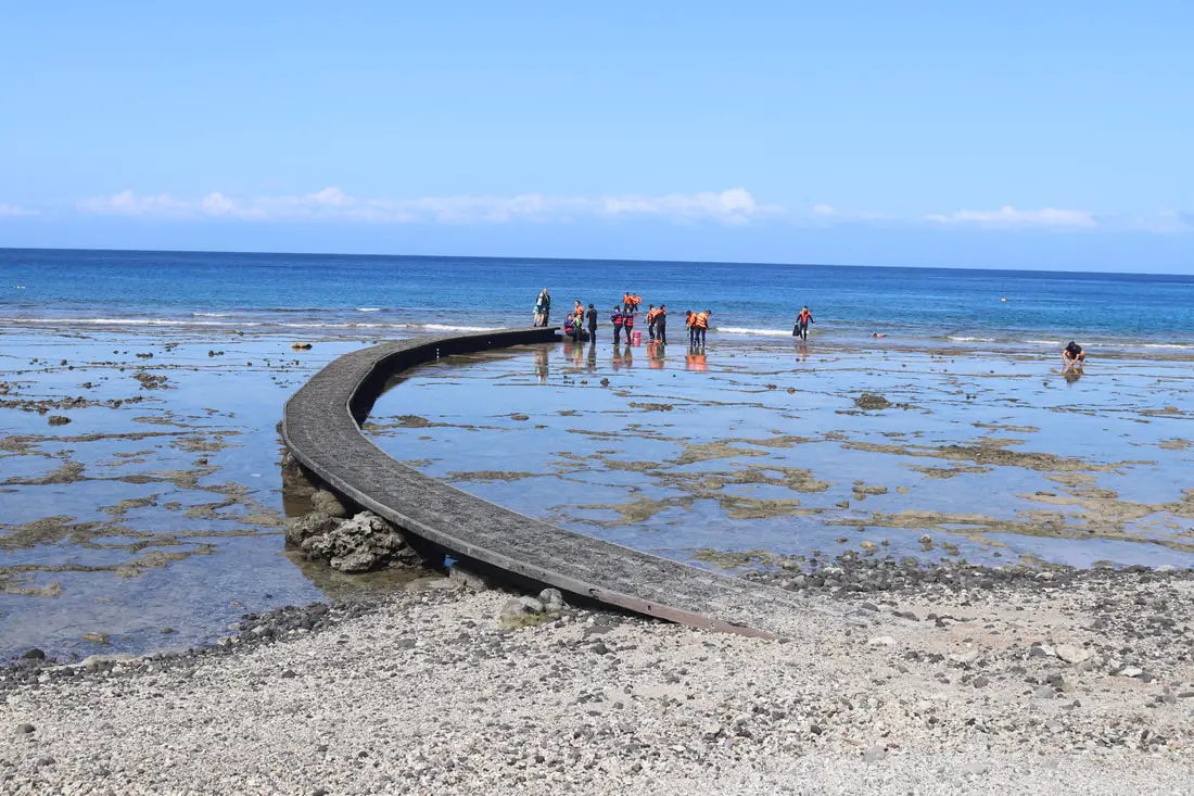
Shilang is perhaps the premier diving destination on Green Island. It also has a concrete bridge and was the first place on Green Island to feature an underwater mailbox.
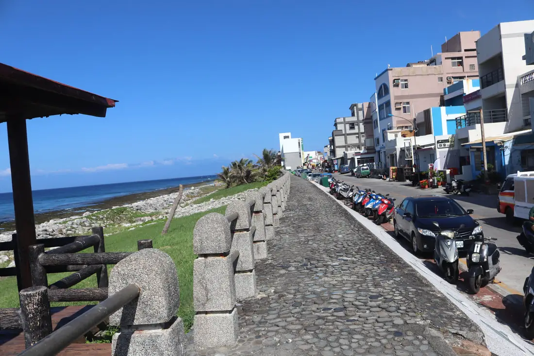
Levee and the street behind.
Now that we have circled the island, here are some night photos I took. Here is a giant frog I found on the road.
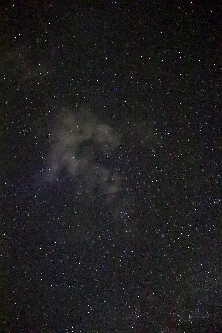
Starry night with Taiwan in the distance.
The stars here were bright and beautiful.

Venus and other stars.
The Milky Way was barely visible.
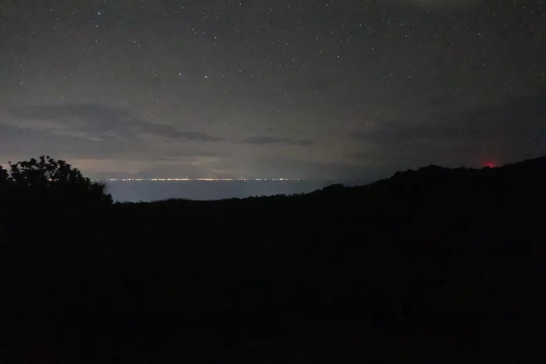
Another view of Taiwan from near the lighthouse.
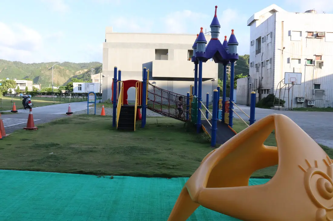
Also, if you are traveling with kids, there is a great playground at the elementary school.
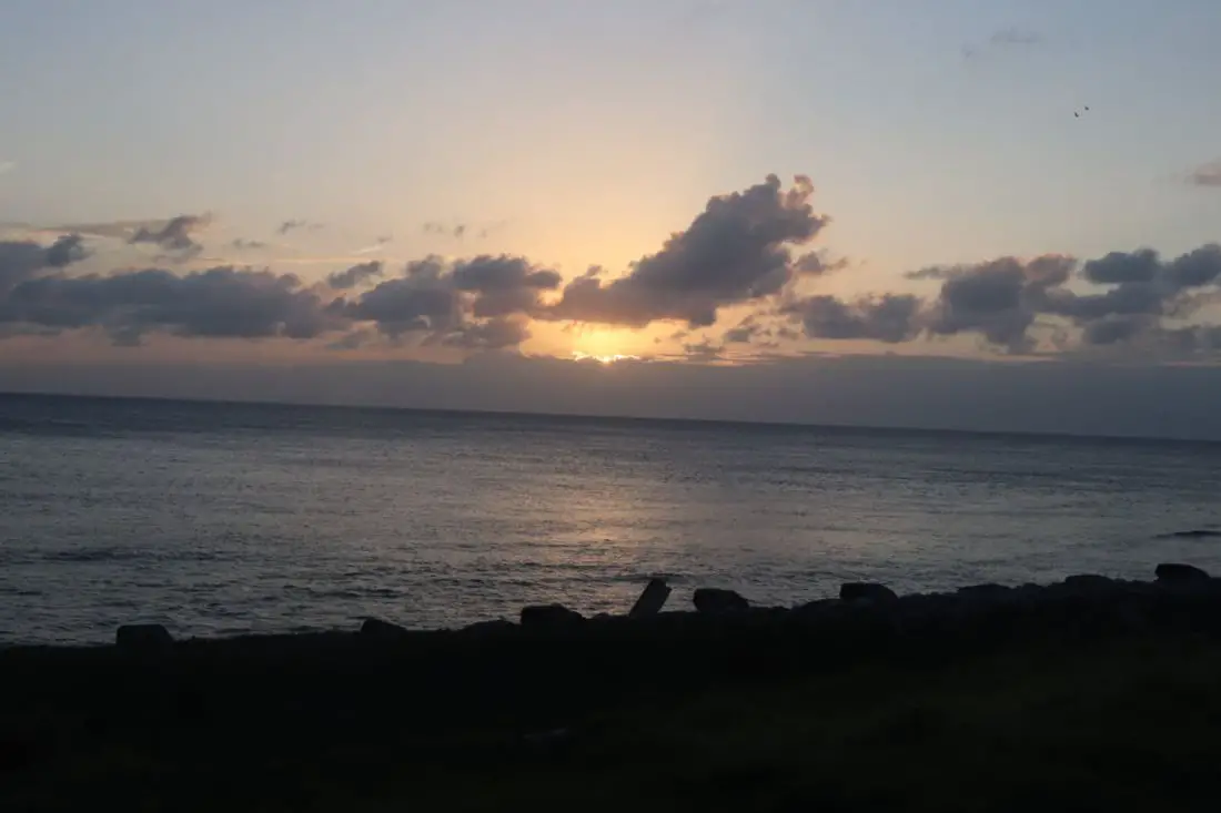
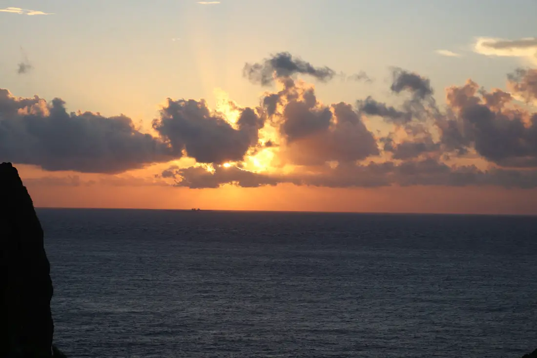
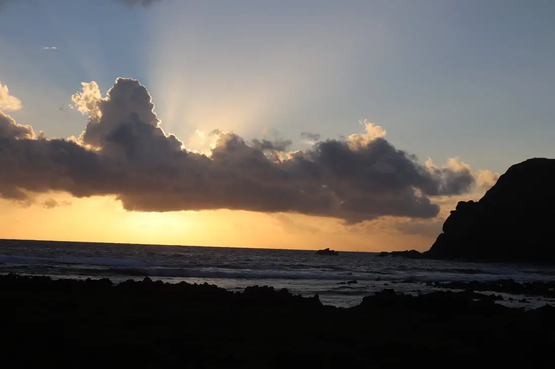
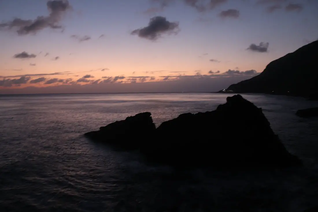
Last view over the island before we boarded the ferry.
Conclusion:
This concludes our journey to Green Island. The ferry journey back to Fugang Harbor was worse than the way over. We put our luggage on some seats downstairs and moved upstairs, and by the time we came down all our luggage was strewn all over the place. Then we drove 5 hours back to Taipei. Compared to other Islands, Green Island was much easier to explore. There is pretty much nothing stopping you from jumping into the ocean anywhere, and tourists can go pretty much anywhere on the island. Green Island probably has the most amazing natural scenery and rock formations of any other island I have seen in Taiwan. It also has great snorkeling and lots of places to dive. Zhaori Hot Spring is world-class, and going there alone is worth the entire trip. But there are no nice fine sandy beaches, and the journey there is rough and bumpy unless you take a place.
Places and things we missed:
There are many companies offering snorkeling, diving, SUPing, and other tours on Green Island. You can search for tours on Klook here or KKday here.
Hopefully, this blog was helpful to you. Good luck on your journey to Green Island!
You can check out more photos of Green Island in our original post here.
For more of Taiwan’s outer Islands, you can check out our full guides to Xiaoliuqiu here, Penghu here, Kinmen here, Matsu here, and Orchid Island here.
You can also check out our full guide to all of Taiwan’s outer islands here.
You can also check out our full guide to Taiwan here. - Tuku Peak 土庫岳
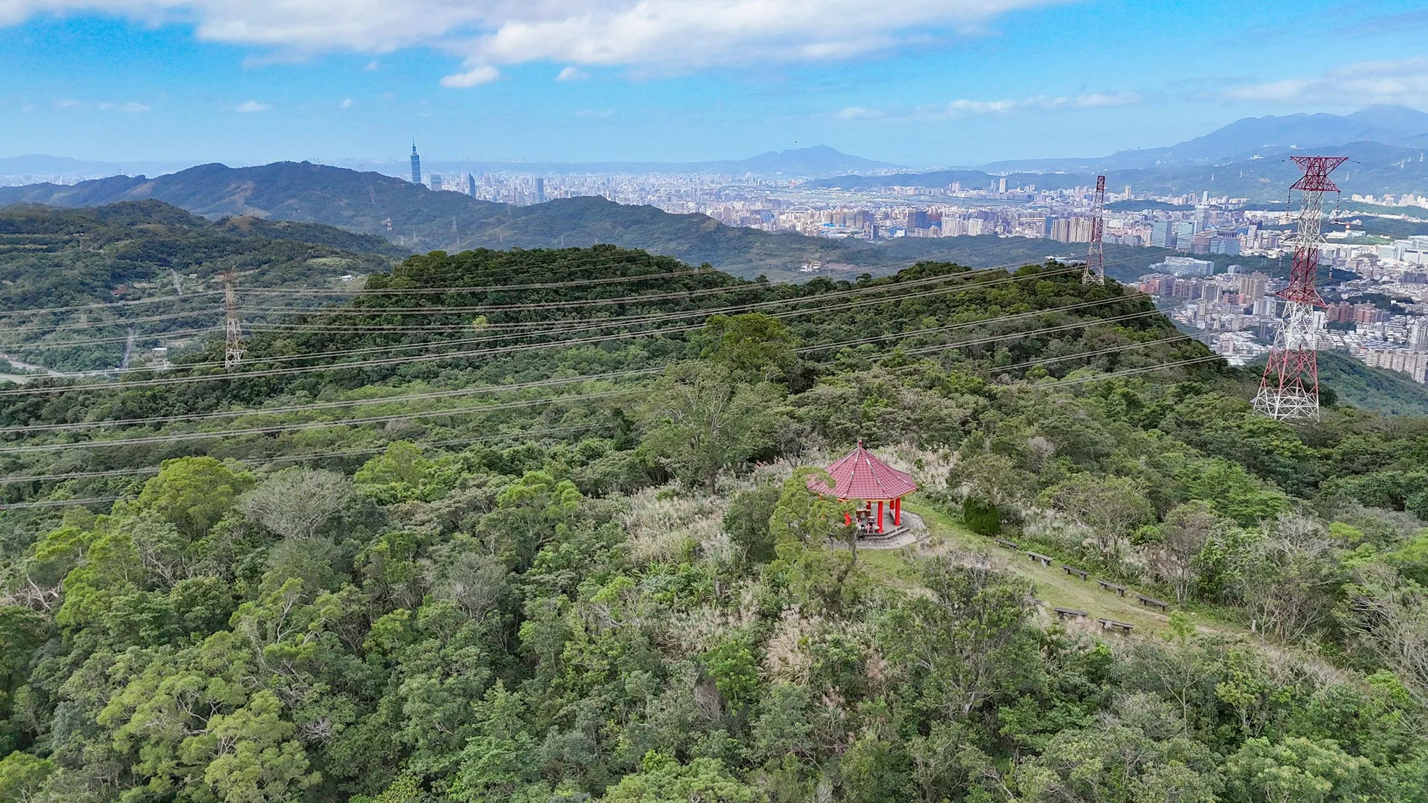
Tuku Peak is a scenic and beautiful hike in Taipei City, offering a panoramic view of East Taipei as part of the Gengliao Historic Trail. It is one of Taiwan’s lesser 100 peaks, and at 389 meters, it is the highest point in the Nangang District of Taipei City. Usually, the grass at the top is trimmed, so there are pretty good views most of the time.
🏯 Planning your trip to Taipei? 🏮
Here are some top travel tips for you:
- Best time to visit: March-May, and October – November when the temperatures are nice and there is not as much rain
- You can buy tickets to Taipei’s Science Museum for a discount on Klook here
- How to get there: Taiwan High Speed Railway and Inter-City Bus
- Best places to stay: Yuanshan Grand Hotel or Fu Chang Hotel
- Book tours and activities in Taipei on Klook
- Stay connected with a local SIM
- Rent a car to explore distant sights
Historical Background:
Tuku Peak, also known as Tukujian (土庫尖) or Daping Mountain (大坪頂山), is a 389-meter (1,276-foot) mountain located in the northeastern Shenkeng District near the border with Nangang District. Recognized as one of Taiwan’s 100 Minor Peaks (小百岳 Xiaobaiyue), it contains both a first-order triangulation point and Triangulation Stone No. 1134. During the Qing Dynasty, it served as the border marker between Han Chinese settlers and aboriginal tribes. Nearby is the historic Gengliao Historic Trail, once an important route connecting Nangang and Shenkeng and now the primary access path to the summit. In recent years, the trail has been developed into a well-maintained hiking route, making the area an attractive destination for outdoor recreation and local history enthusiasts.
Hours:
24/7
Price:
Free.
Difficulty:
Moderate – there are some steep parts with lots of steps.
344 Meter elevation gain.Length:
4 KM one way
Takes about 2-3 hours for a round trip, or 1-2 hours one way.Where to stay:
We have stayed at and recommend the Nangang Marriott (book on Booking.com here or Agoda here). We have also stayed at and recommend the Yuanshan Grand Hotel, once the tallest building in Taiwan and still the most grand (book on Booking.com here or Agoda here).
Looking for a hotel? We recommend booking through Booking.com here, which provides the best quality selection of accommodation in Taiwan.
Find out where to stay in our Taiwan hotels guide or search for the best hotel deals in Taiwan here.Activities in Taipei:
There are many activities available to enjoy in Taipei, such as kayaking, canoeing, snorkeling, SUP / paddle boarding, water biking, and more activities, which you can book on Klook here or KKday here.
How to get there:
By Car/Scooter: From Nangang Road at Nangang Exhibition Center MRT station, turn south toward the mountains and keep going straight on Academia Sinica Road until it turns into Jiuzhuang Street. Keep going all the way up the mountain. There are multiple trail entrances along Jiuzhuang Street Section 2 to Gengliao Historic Trail, which connects with Tuku Peak.
Looking for scooter rental in Taipei? You can search on Klook here or KKday here to search for options. You can also check out our scooter rental guide here.
If you are looking for car rentals, you can also search Qeeq here, Klook here, or KKday here. You can also check out our car rental guide here.
By MRT/Bus: Take the Southeast Little 5 bus from Nangang Exhibition Center MRT station. It takes about half an hour to get to Jiuzhuang Street Section 2. There are multiple trail entrances along Jiuzhuang Street Section 2 to Gengliao Historic Trail, which connects with Tuku Peak. You can also book an MRT travel pass on Klook here.
By Bicycle:
Cycling is the best way to enjoy Taiwan’s landscapes if you have the time and energy. Looking for bicycle rentals in Taiwan? You can use Taiwan’s many Youbike sharing stations, or search for rentals on KKday here, and search for tours on Klook here. You can also check out our Taiwan cycling guide here. You can also book a Sunset Riverside Bike Ride and Historical Tour, 4 Hour Cycling in Taipei, Ultimate 8-Hour Cycling City Tour, or Taipei City Bike Tour with Night Market Experience on TripAdvisor here.
For more information, check out our Taiwan transportation guide here.Map:
Please see below:
There are multiple trailhead entrances to Tuku Peak from both Shenkeng and Nangang. This blog will cover the closest entrance from the road in Nangang.
Drone Footage:
Check out our drone footage of Tuku Peak above. Aerial view from Tuku Peak, the highest point in Nangang District of Taipei City Aerial view from Tuku Peak, the highest point in Nangang District of Taipei City at 389 meters above sea level. They recently cut the grass up here so there are pretty good views from the top. #土庫岳 #南港
Posted by Foreigners in Taiwan 外國人在台灣 on Saturday, November 15, 2025Or check out our 360-degree aerial panorama of the area above.
Our Journey:
Despite being a long-time Nangang resident and having made hundreds of visits to Gengliao Historic Trail, I have only visited Tuku Peak twice. Every time I visit, there are always hiking groups that are there at the top.
For this hike, we started at the closest possible entrance to Jiuzhuang Street Section 2.
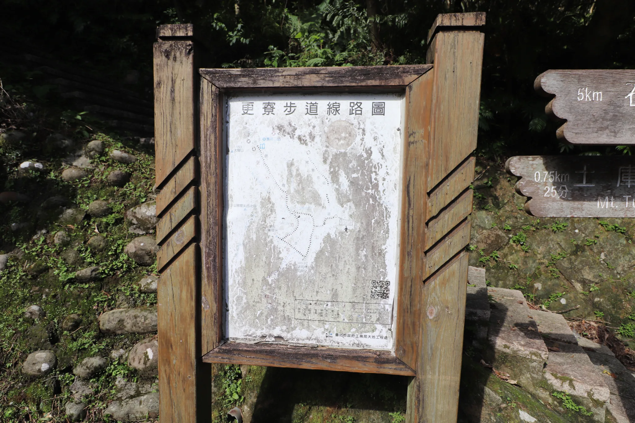
And here is a faded map of Gengliao Historic Trail for your viewing pleasure.
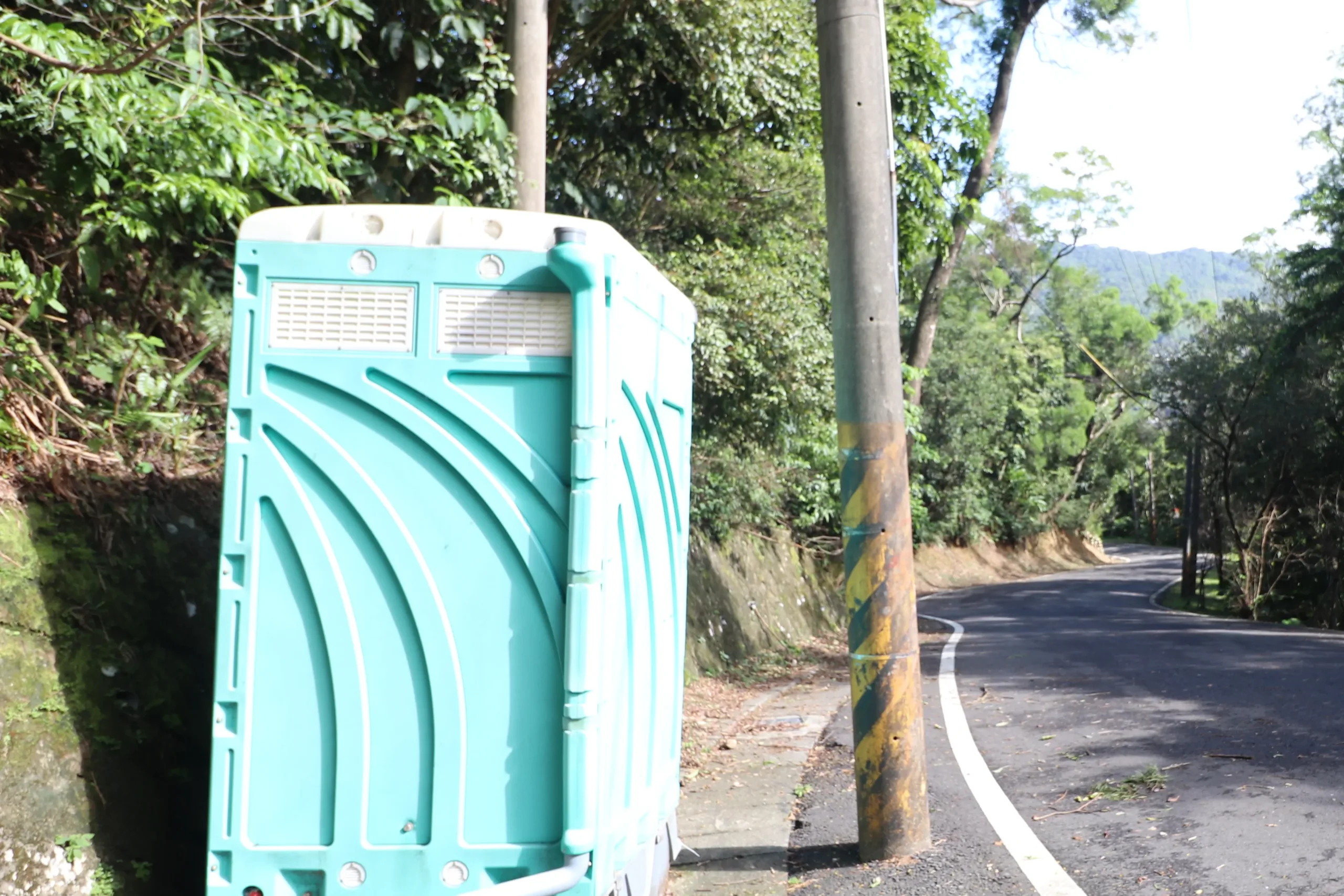
There is a little John here if you need it.
View up the road from the trailhead.
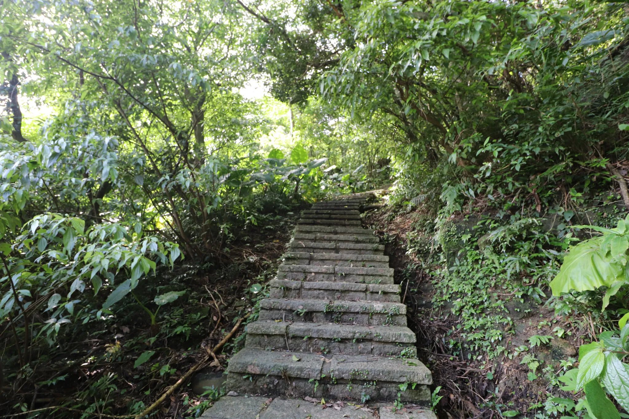
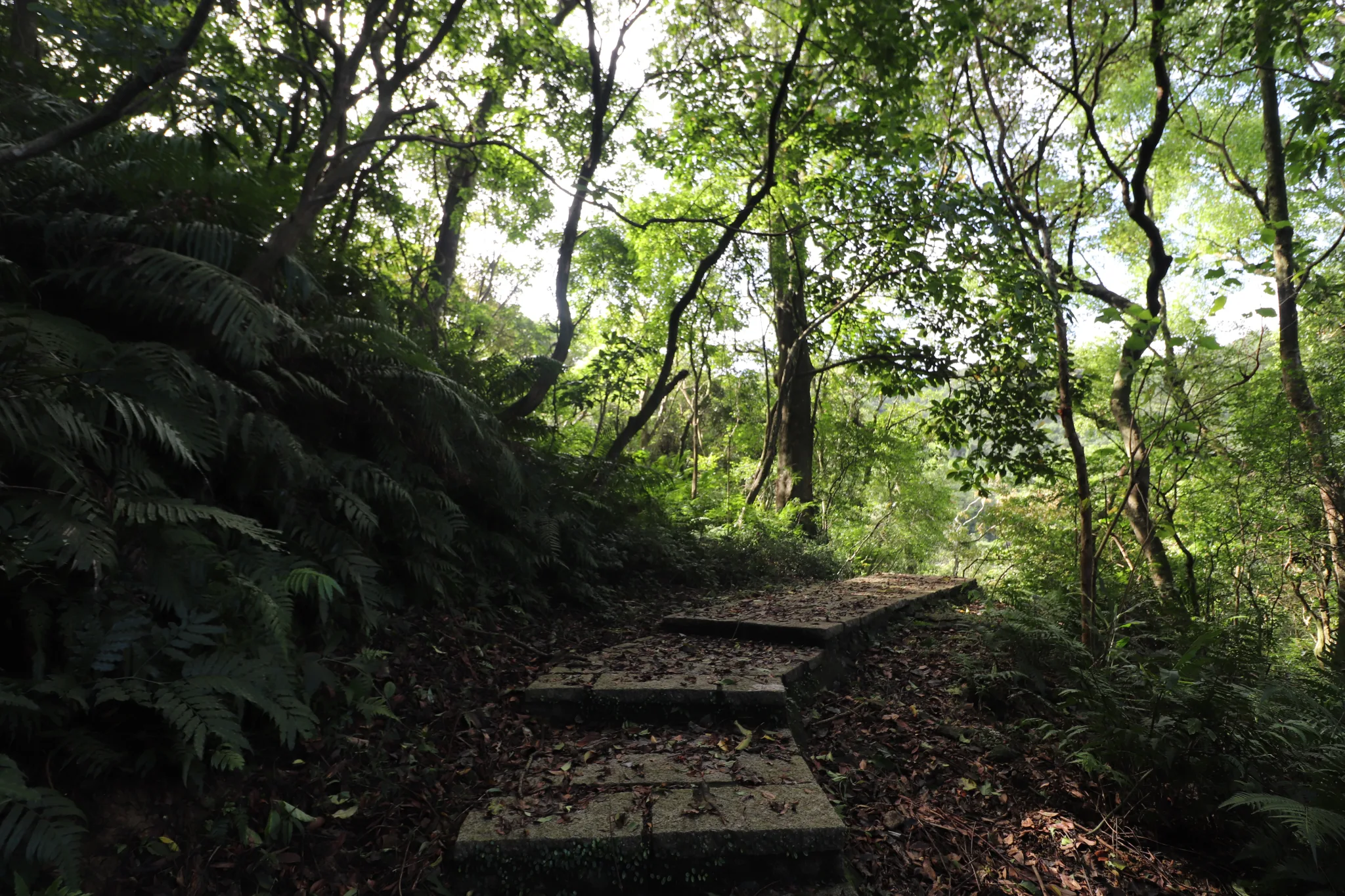
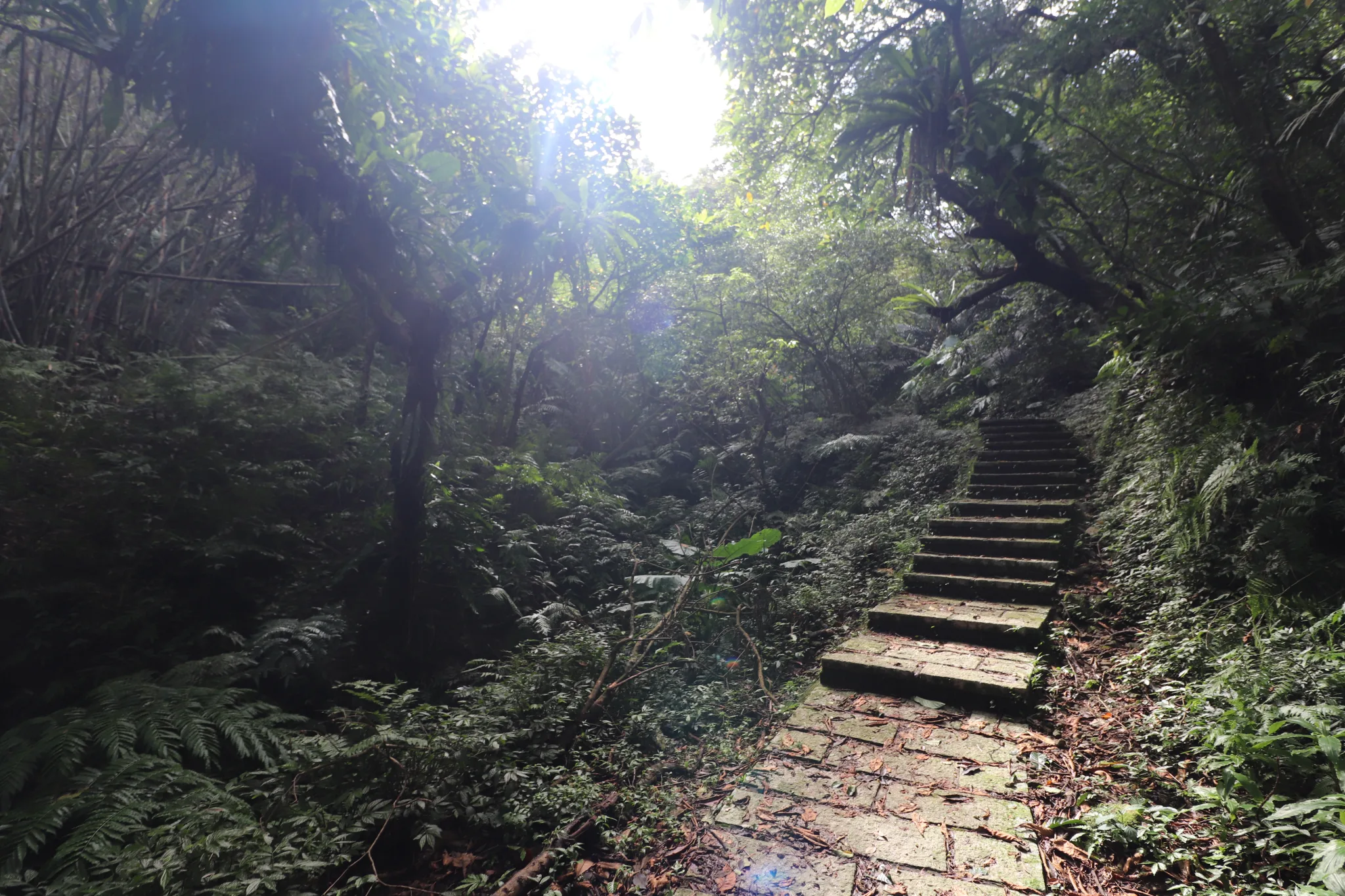
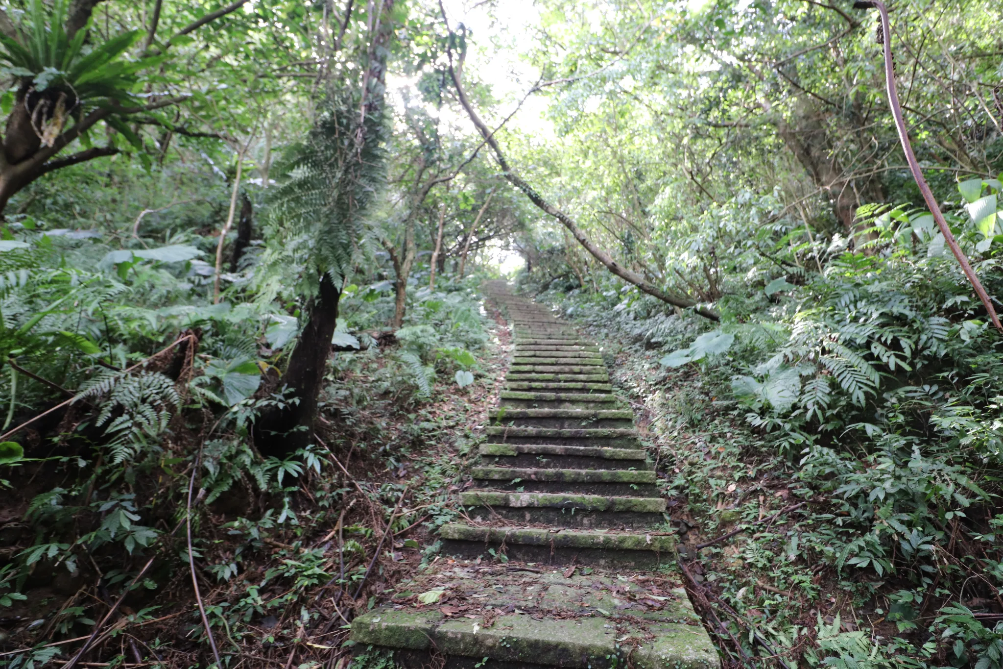
And then we started the climb. Most of the trail is made of these stone steps, which may make it such a popular hiking trail.
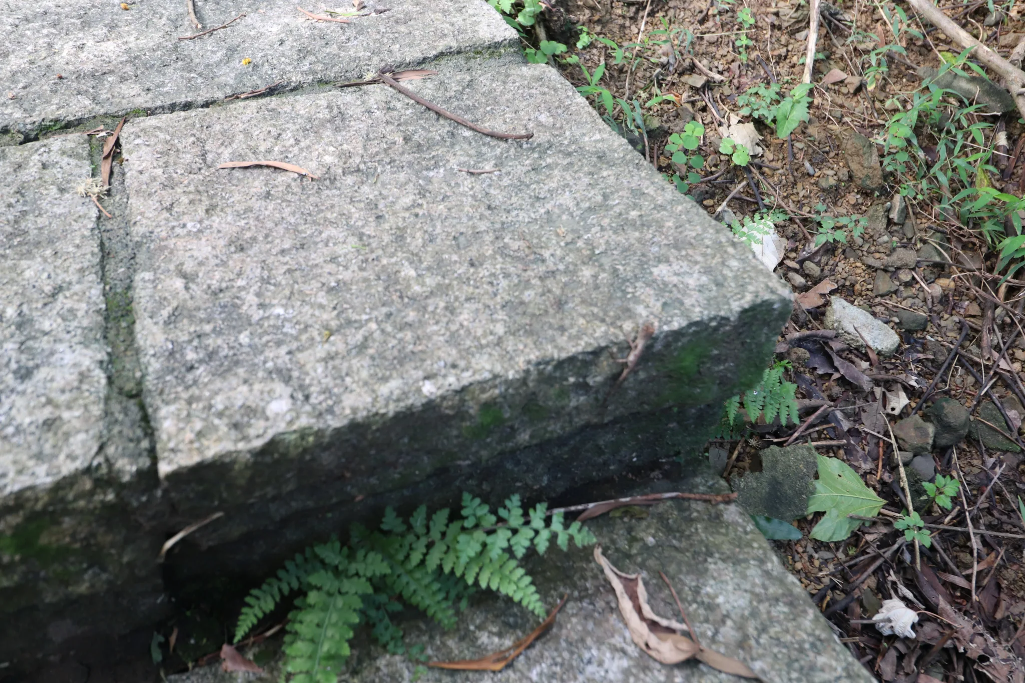
And we spotted our first wildlife creature: a lizard.
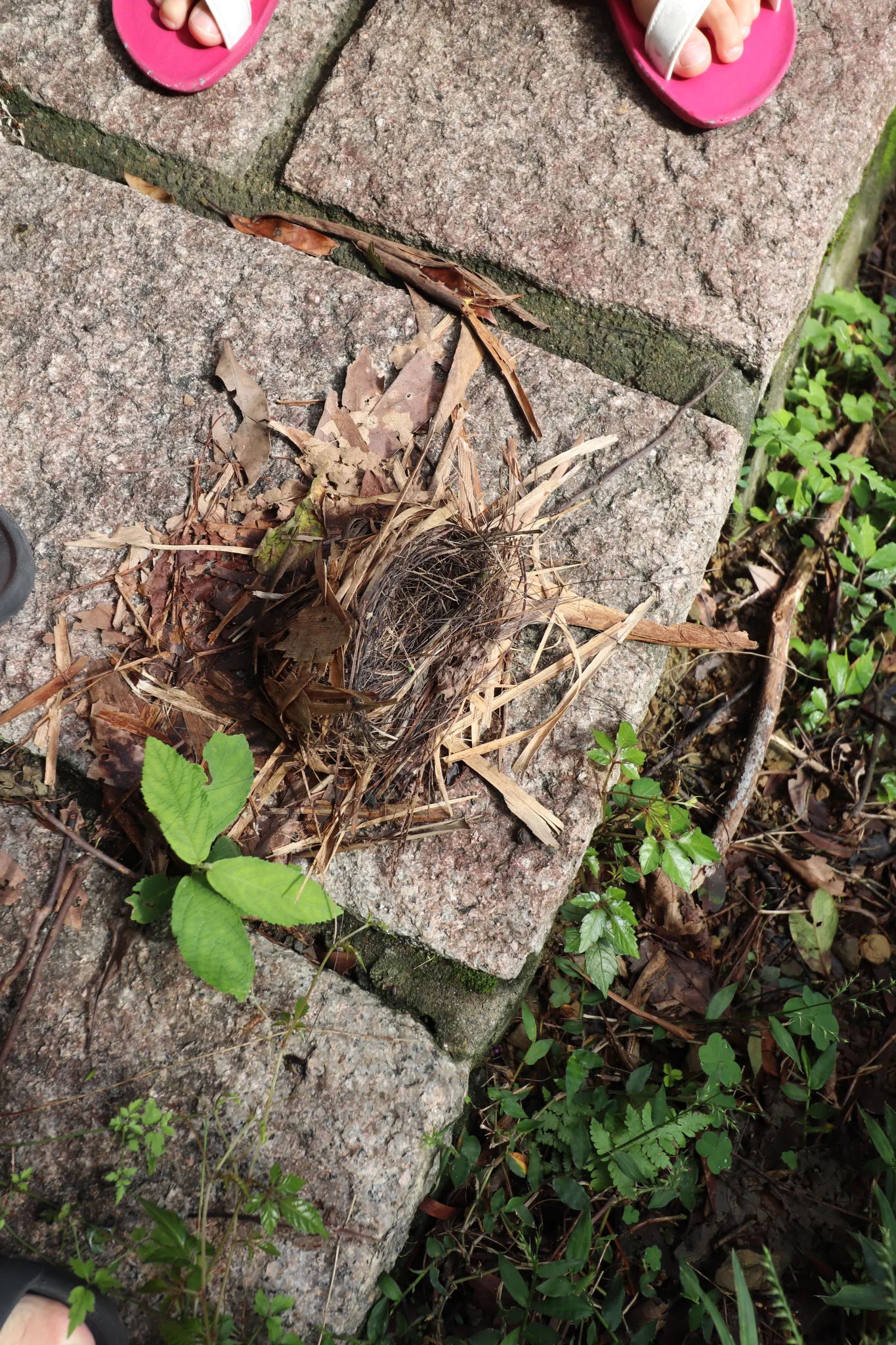
A fallen bird’s nest on the trail. I have seen monkeys in this area, too.
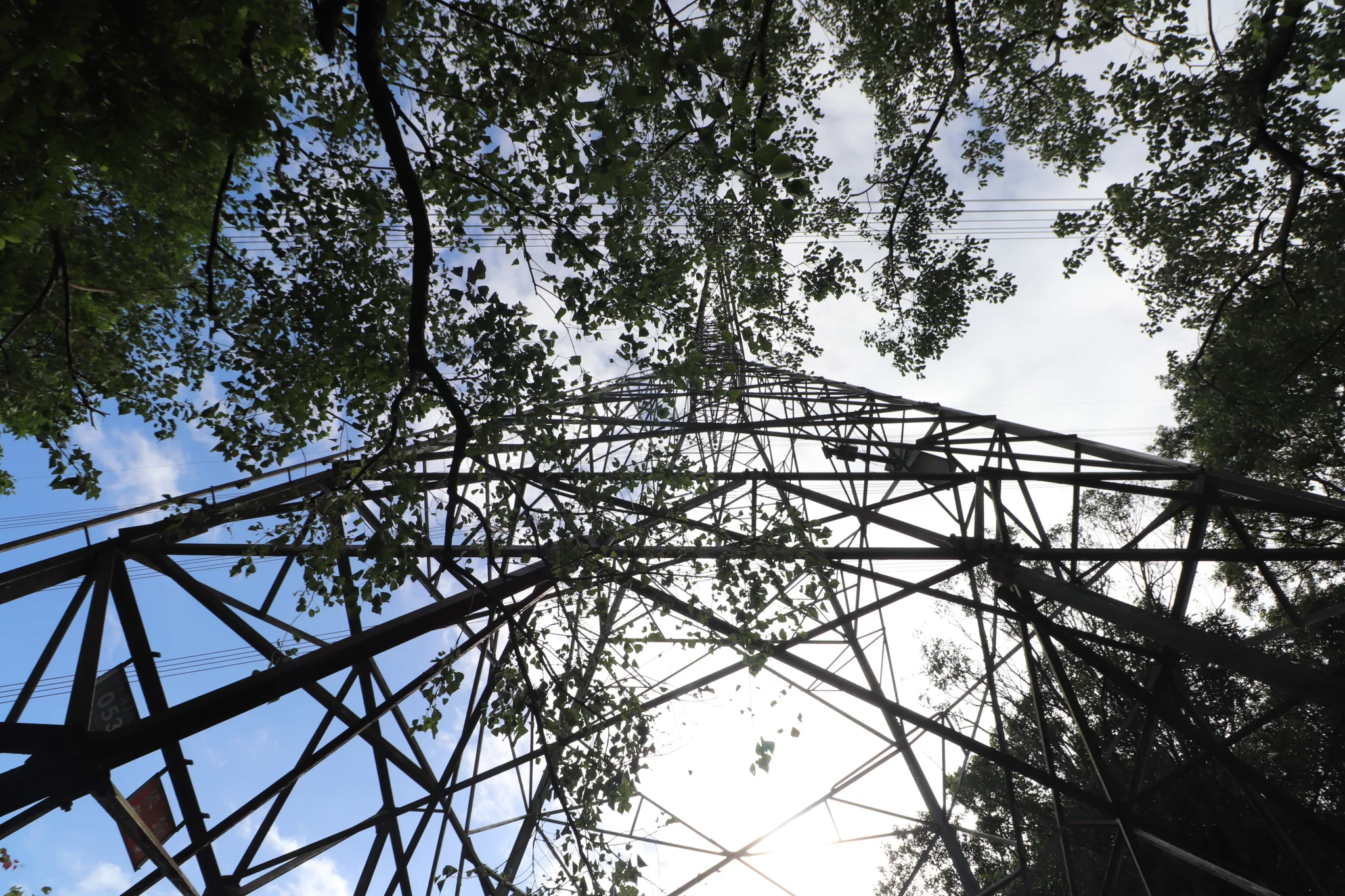
We reach the first power line tower.
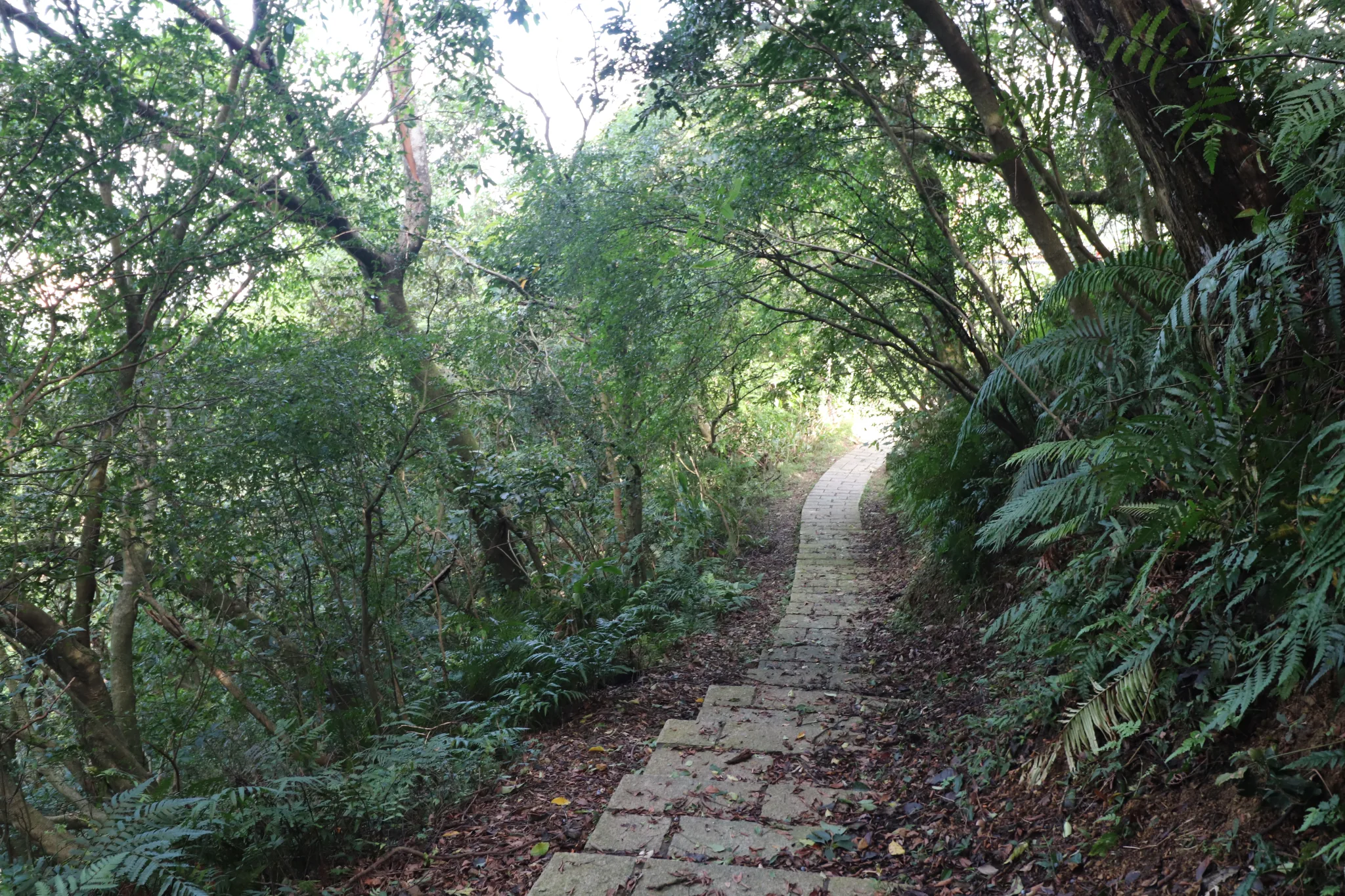
View looking back down the trail.
Then we saw some rays of sunshine through the forest.
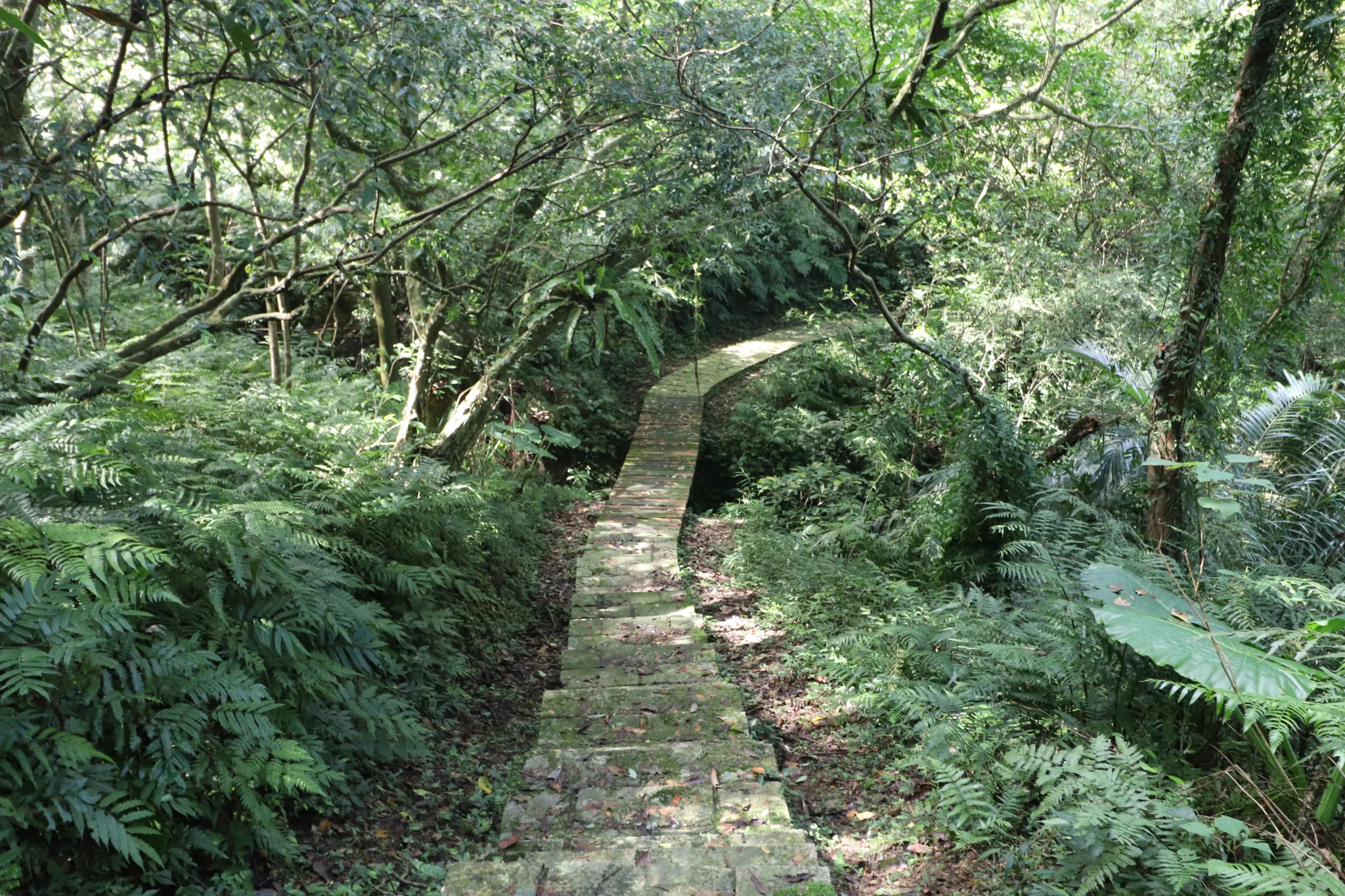
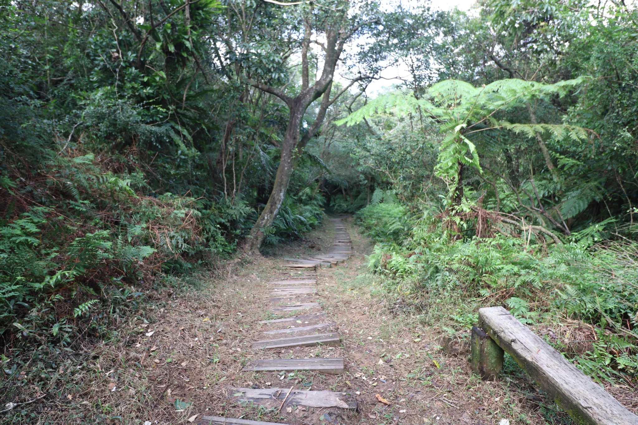
Then we came across the first wooden bridge.
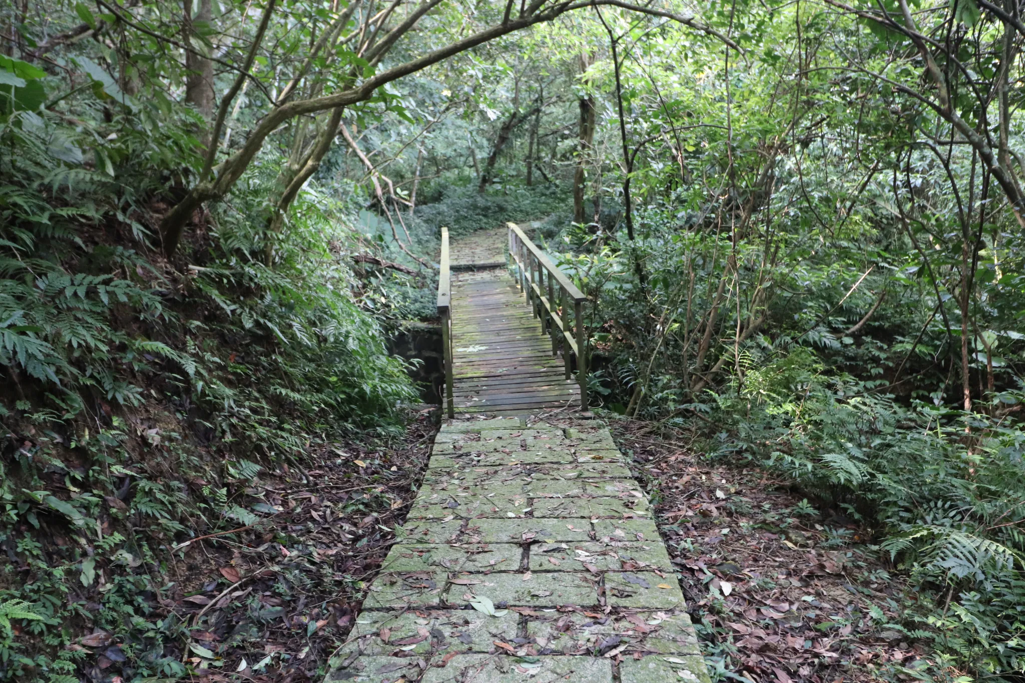
Second wooden bridge.
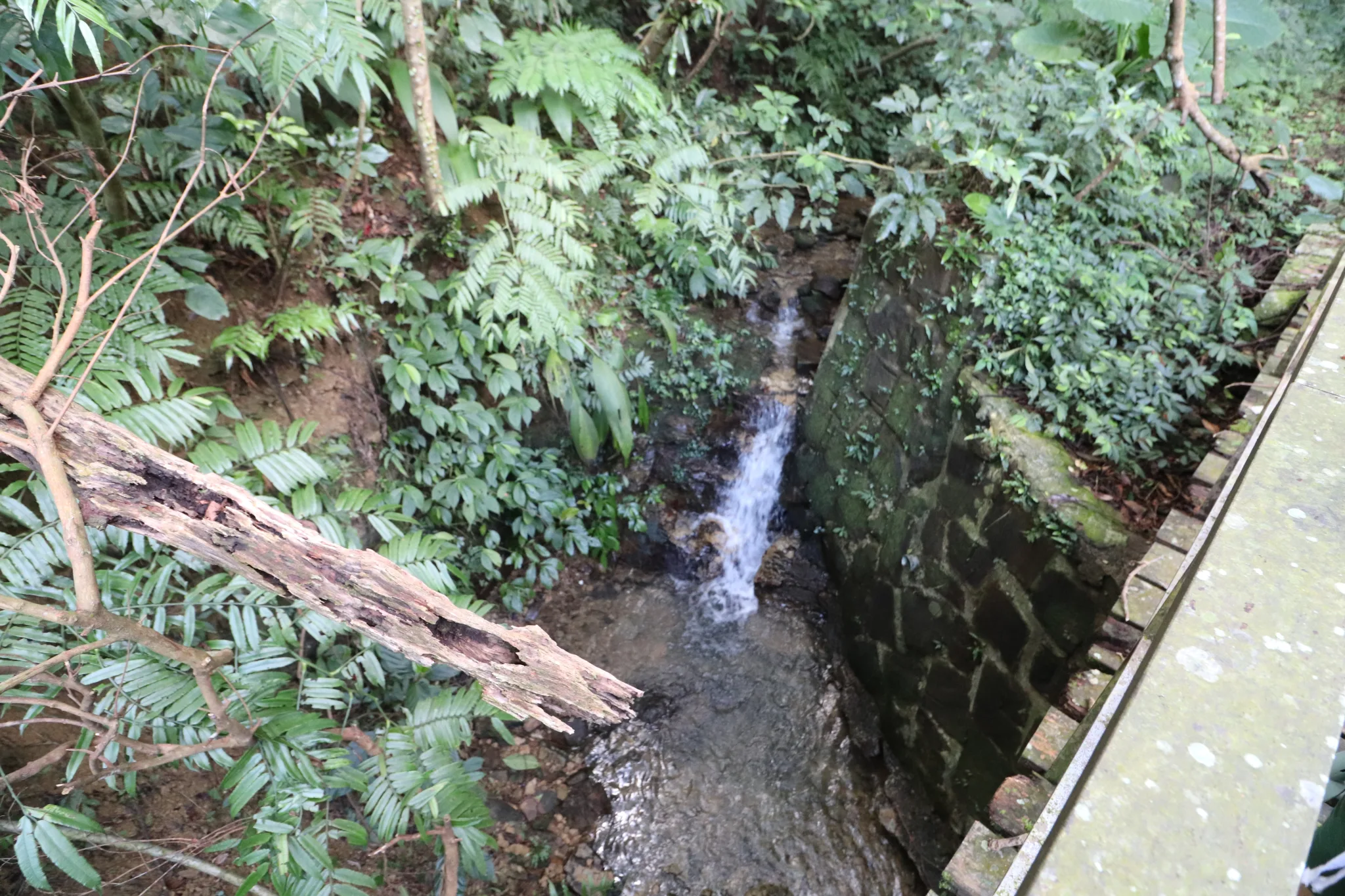
Under the second bridge is this man-made ditch.
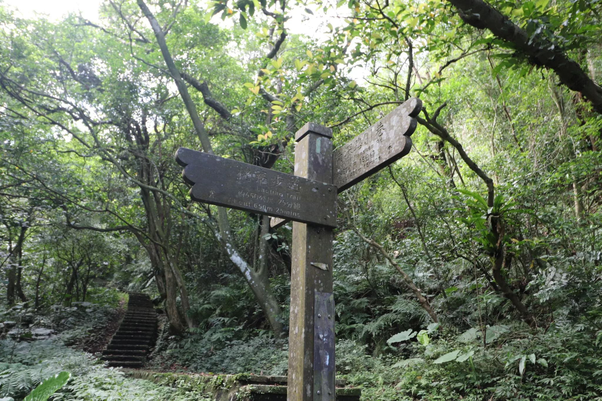
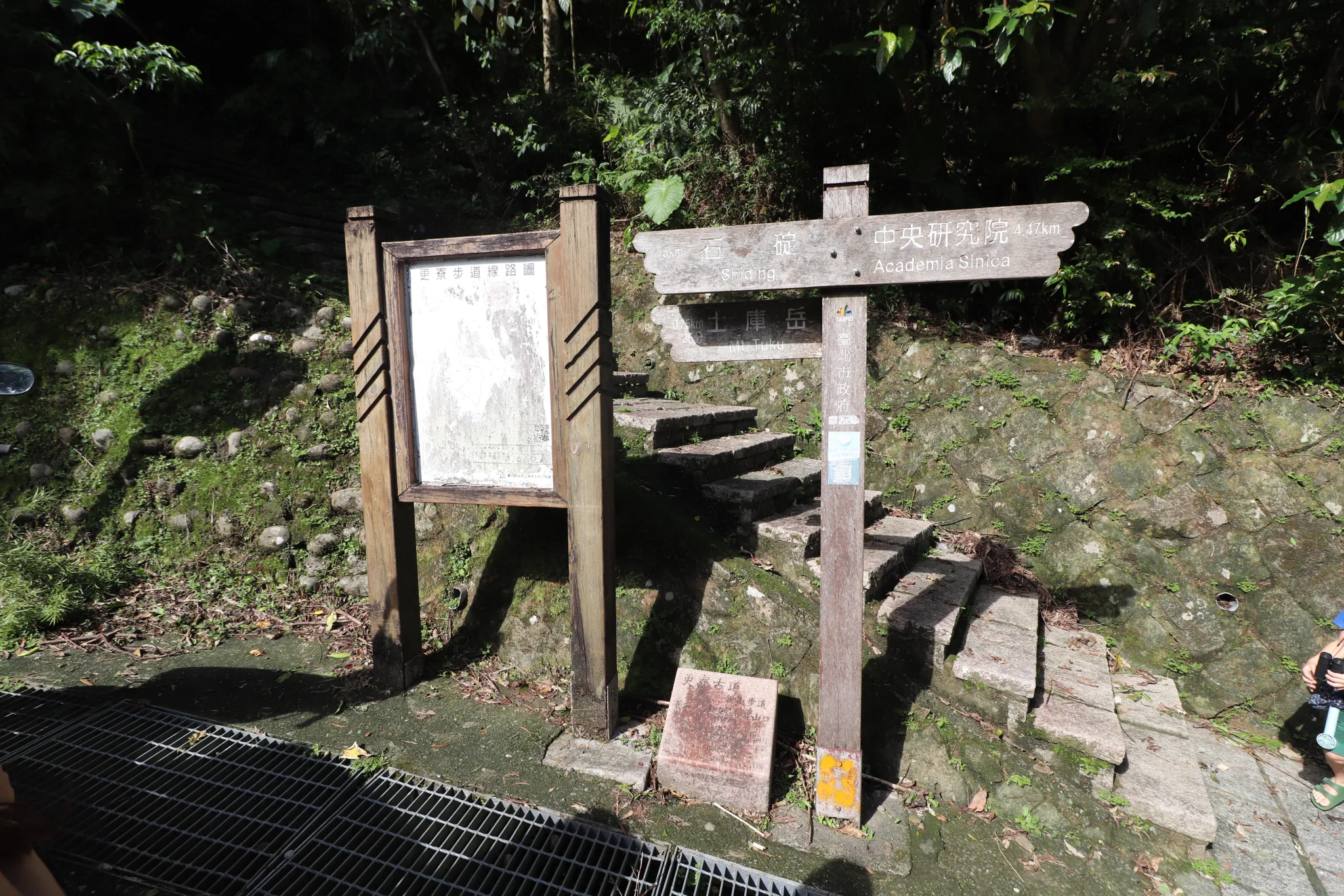
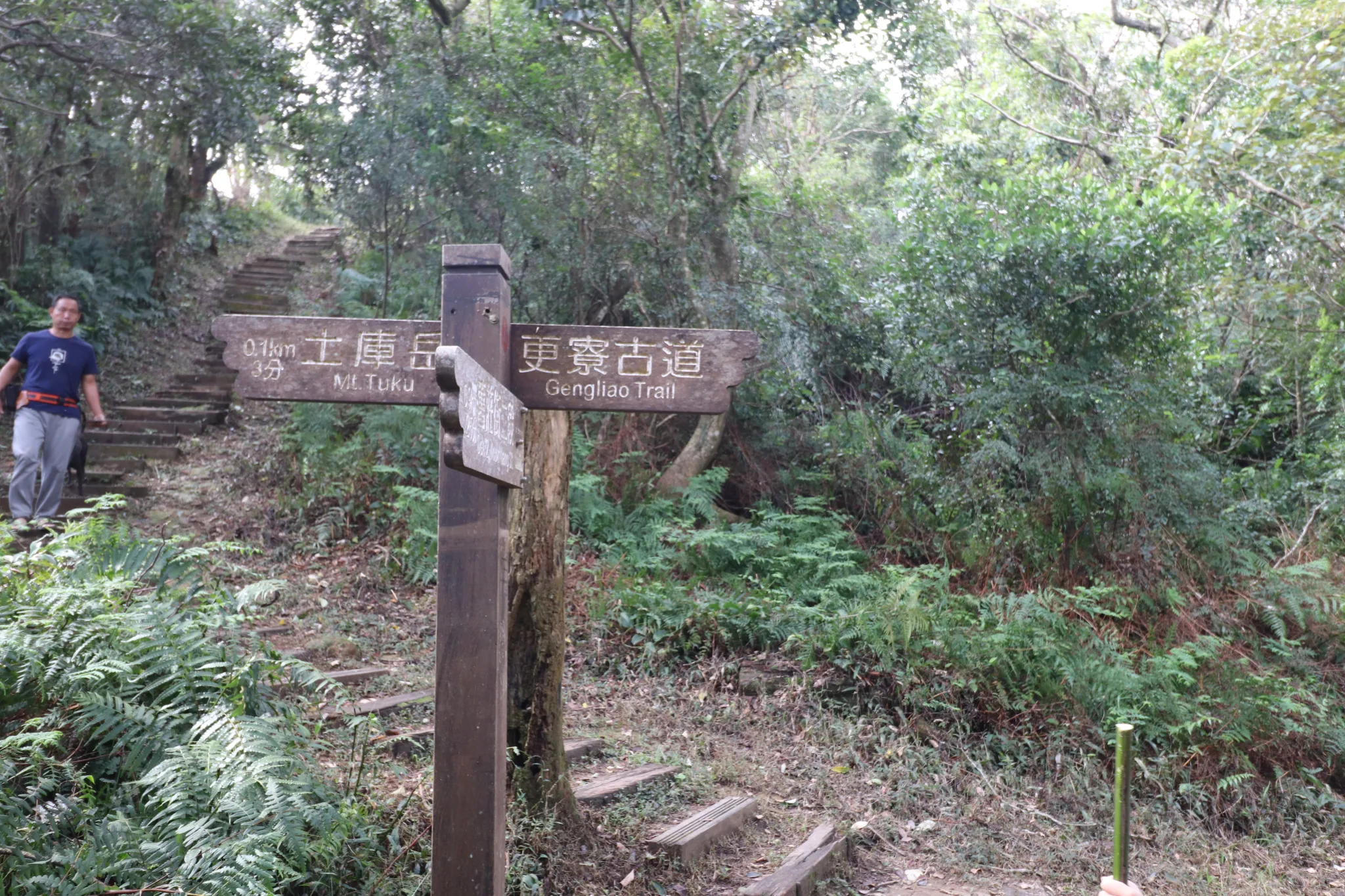
We then came to this fork in the Gengliao Historic Trail. Go up from here to get to Tuku Peak.
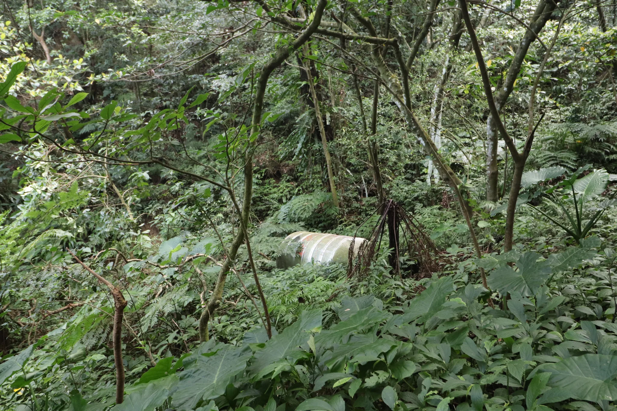
An old water tank in the forest for some reason.
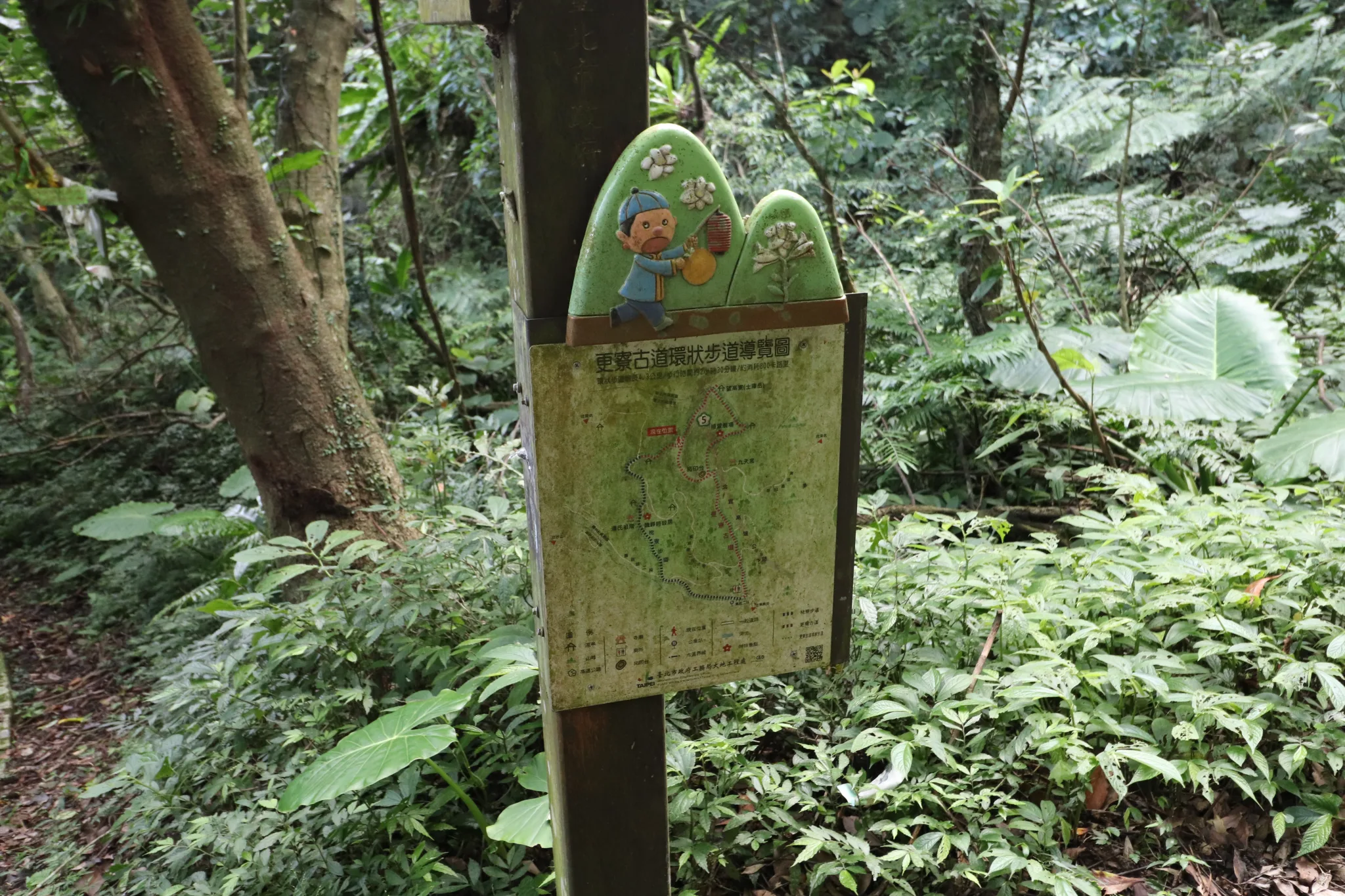
Another map of Gengliao Historic Trail.
We then continued up the trail.
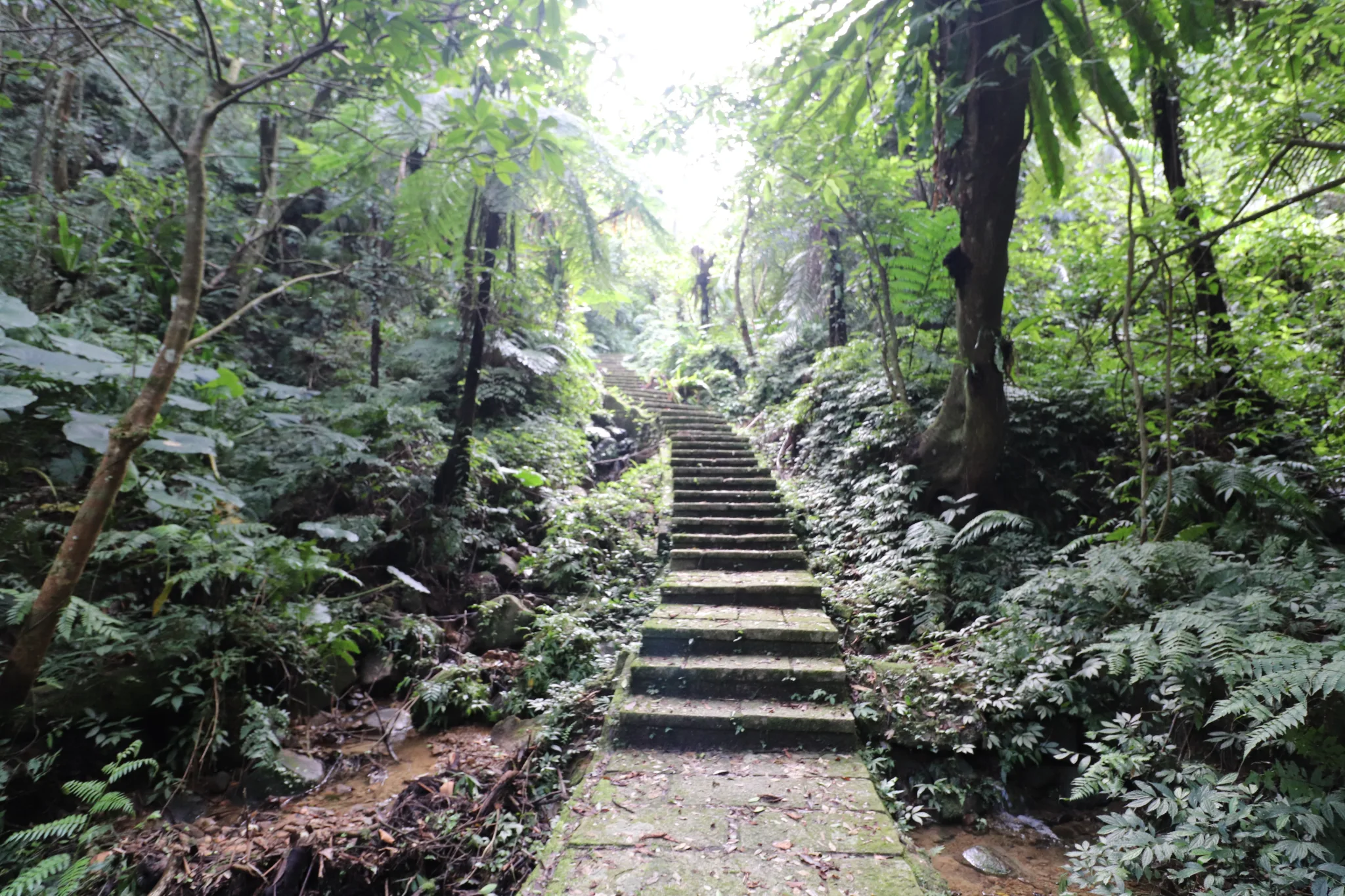
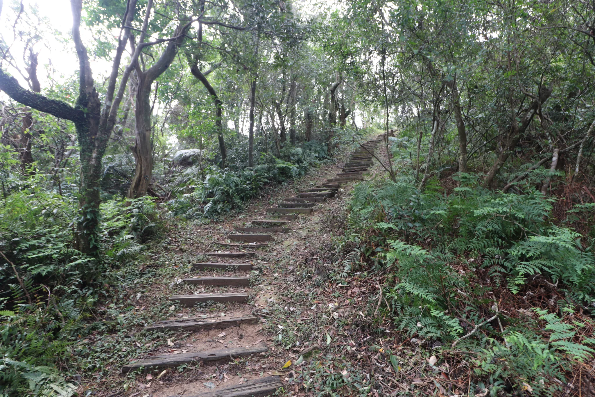
More steps up the mountain. You can tell the area recently had some heavy rains.
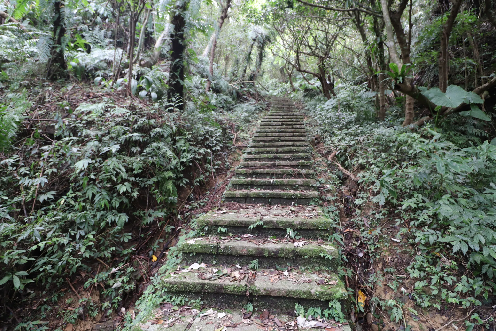
This is the hardest part of the trail. Steep stairs all the way to the top.
View looking down from further up the stairs.
We could almost see the top from here.
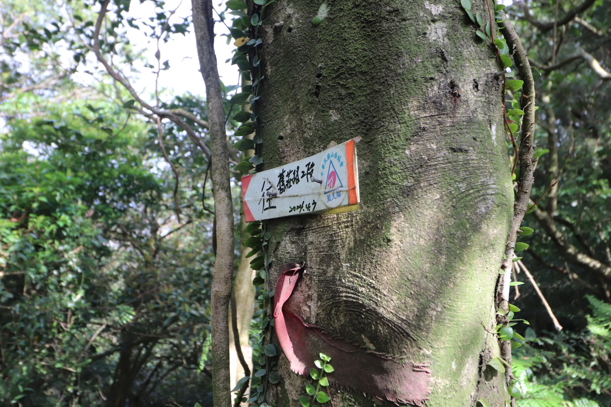
Follow this arrow to get back to where we came from.
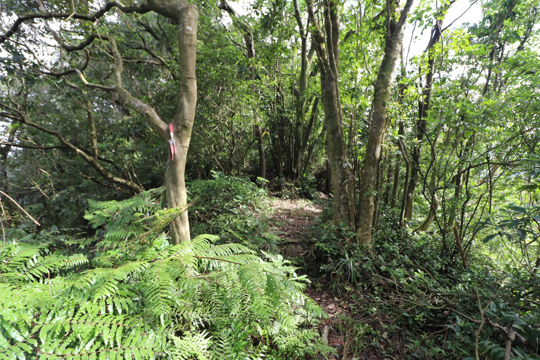
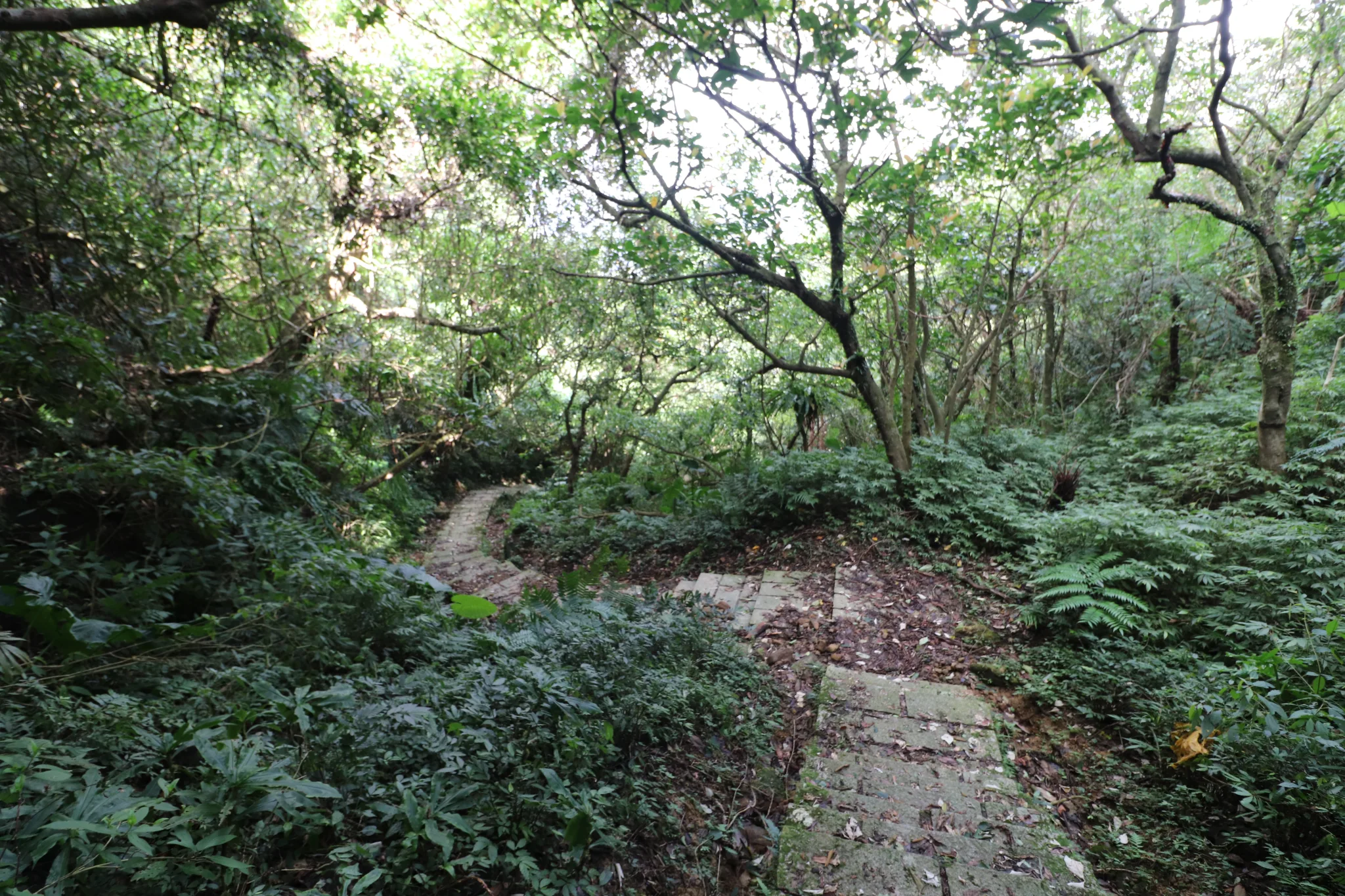
There is another dirt trail on this ridgeline that we did not follow.
Finally, Tuku Peak was in sight.
It connected with yet another part of the Gengliao Historic Trail. This part is made of wooden boards.
The last few steps up to Tuku Peak.
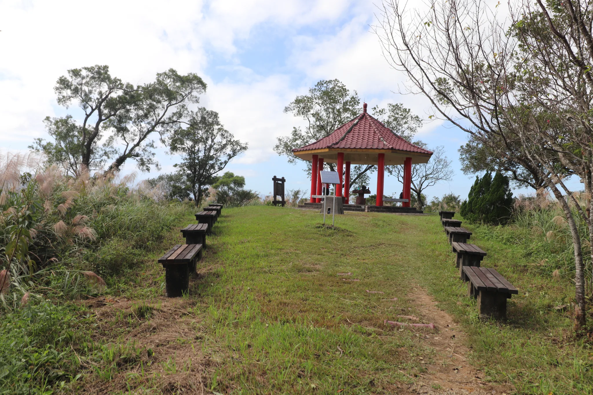
On the top of Tuku Peak is this grassy area with benches and a pavilion.
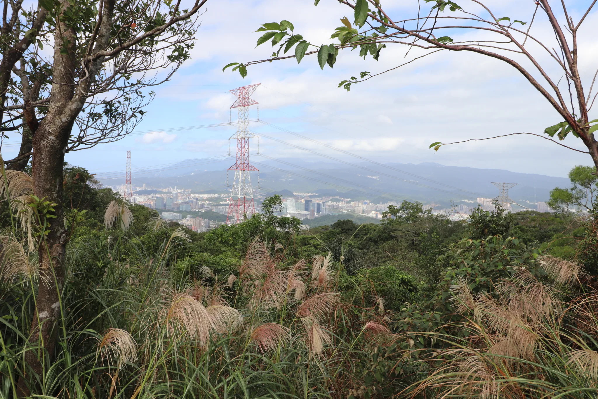
View of Nangang and Neihu below.
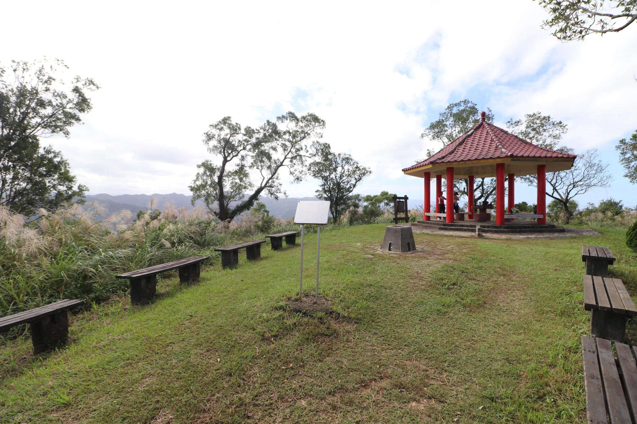
Another view of the pavilion area.
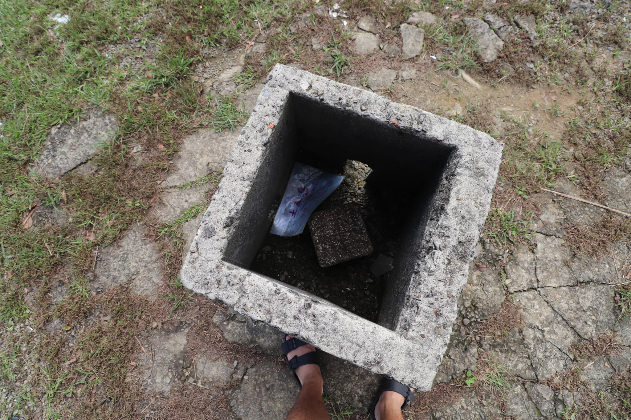
View inside the triangulation stone.
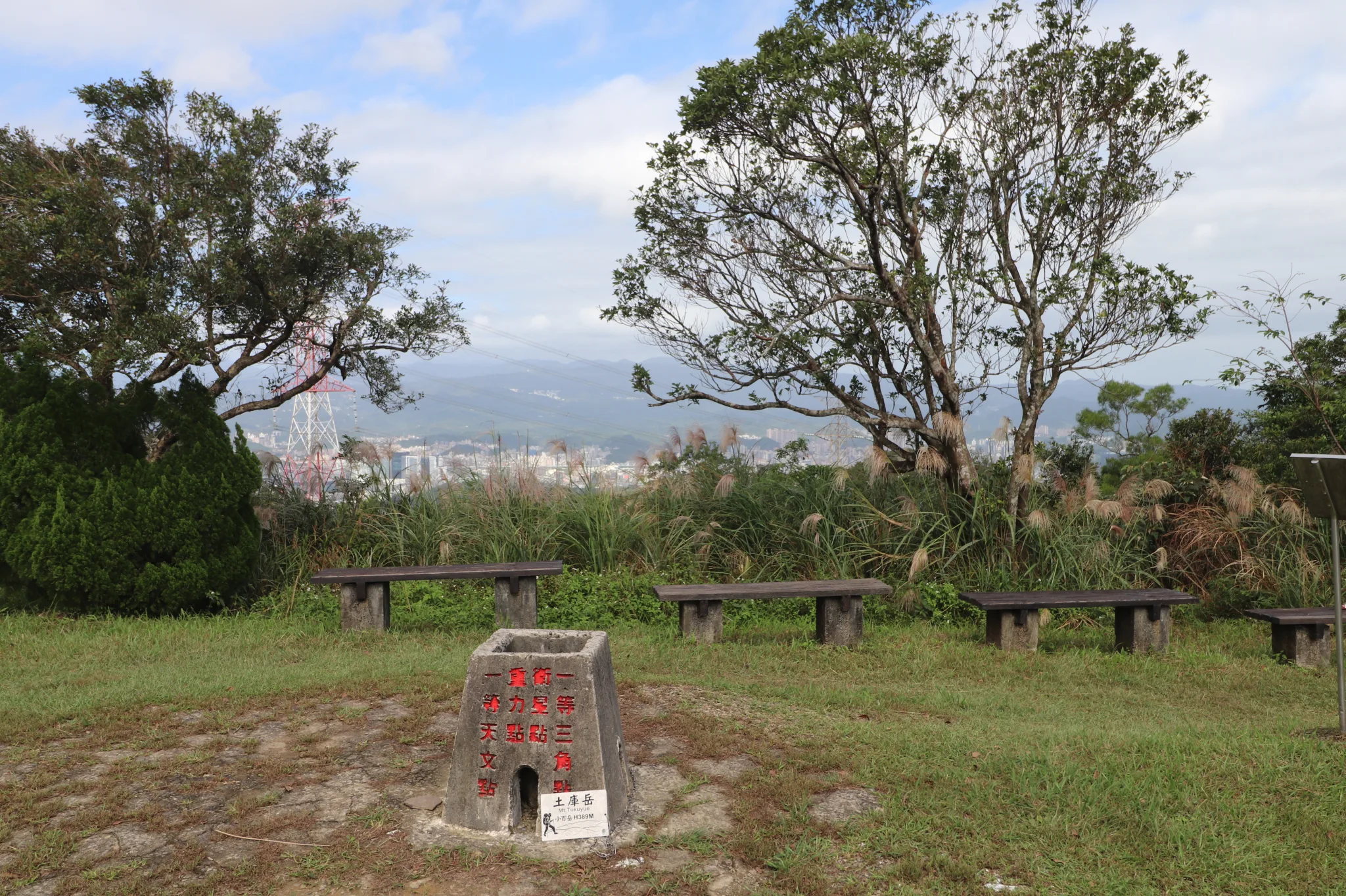
Triangulation stone and some scenery.
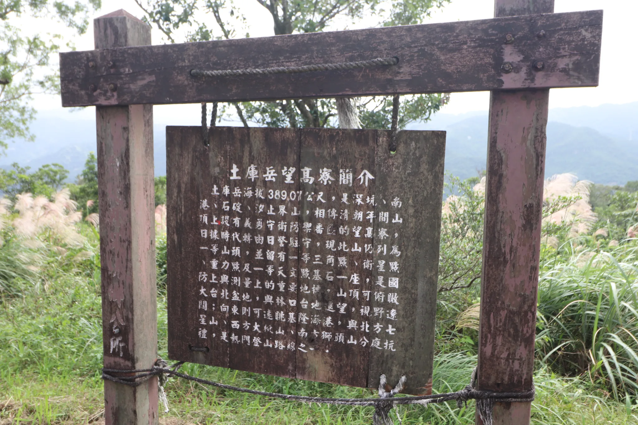
“Introduction to the Tuku Yue Viewpoint”
Tuku Yue has an elevation of 389.07 meters and stands on the boundary between Shenkeng District and Nangang District. During the Qing Dynasty, it was an important lookout point used to monitor movement across the Taipei Basin. The summit offers views in all directions and was formerly known as Wanggaoliao (Lookout Ridge). The mountain is marked by both a first-order triangulation point and a third-order triangulation stone (No. 1134). A military observation post once stood here, making it a strategically important location. Although tree growth now limits some of the views, visitors can still enjoy the scenery extending toward the Taipei Basin. Looking west, one can see the ridges of Nangang Mountain, while to the north lies the route leading toward Shenkeng. The area also served as an important defensive position during historical conflicts (with the aborigines).
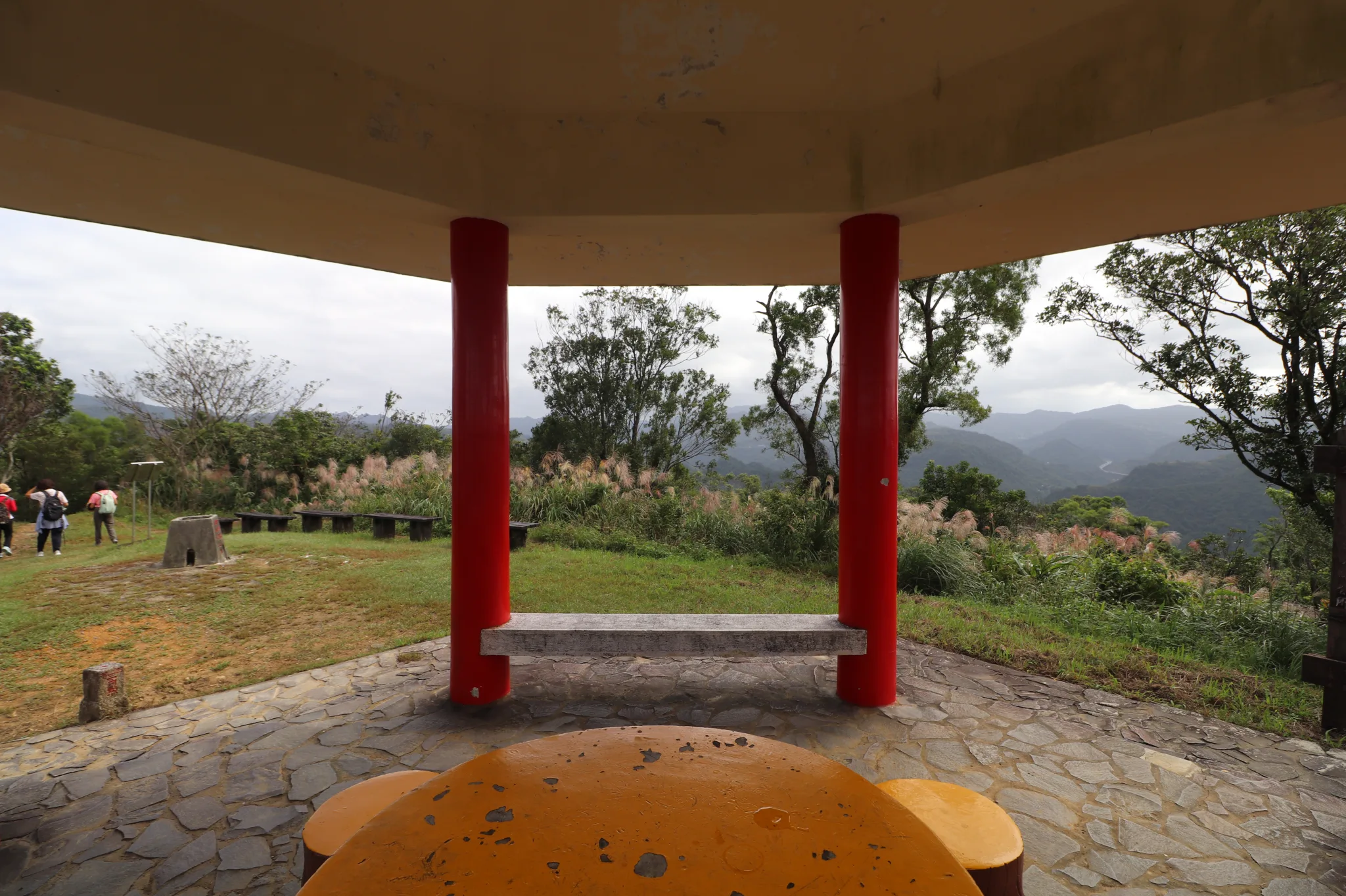
View from the table in the pavilion.
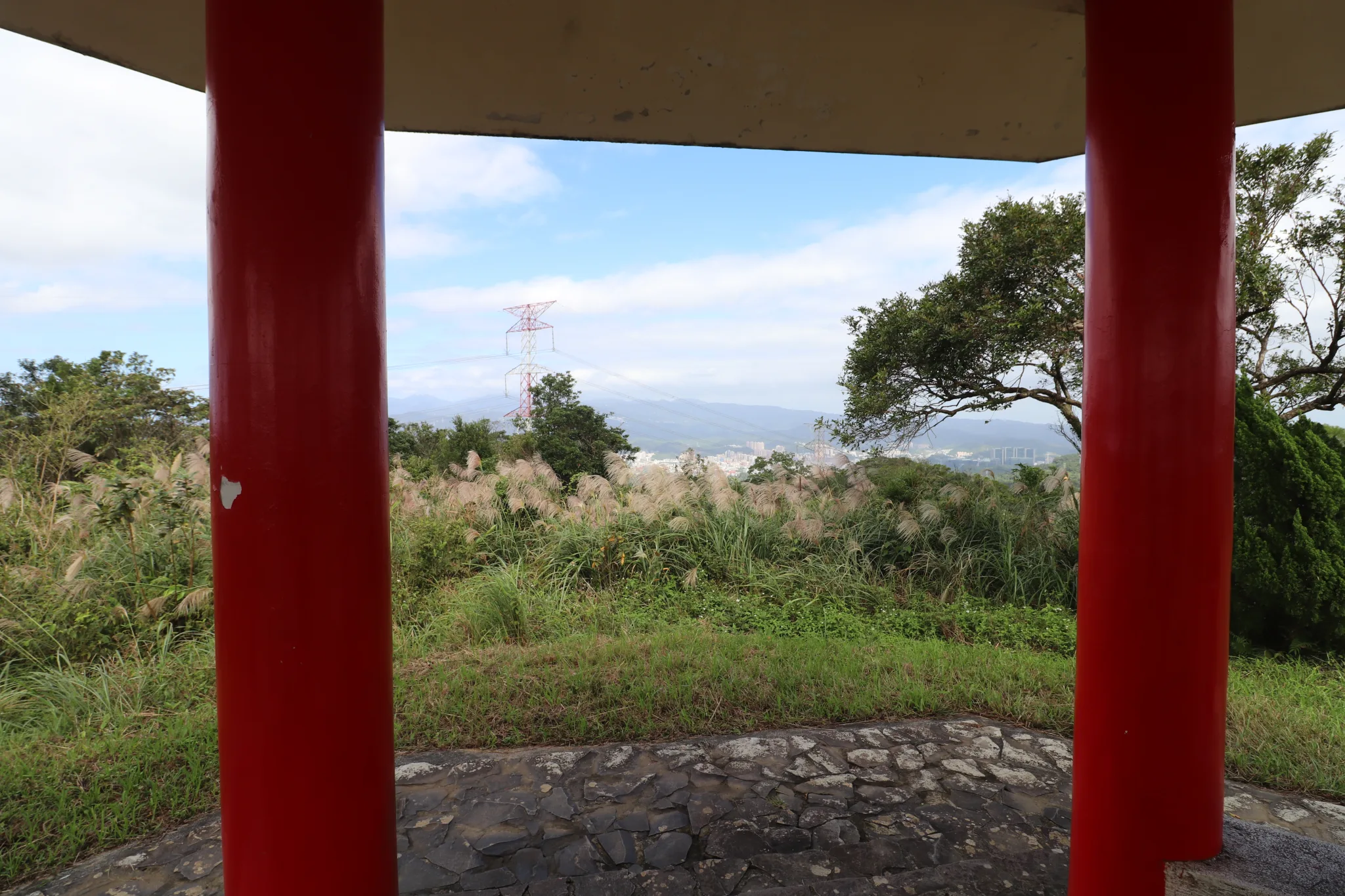
View of downtown video from the pavilion.
View of Tuku Peak with Taipei in the background.

Top-down view of Tuku Peak.
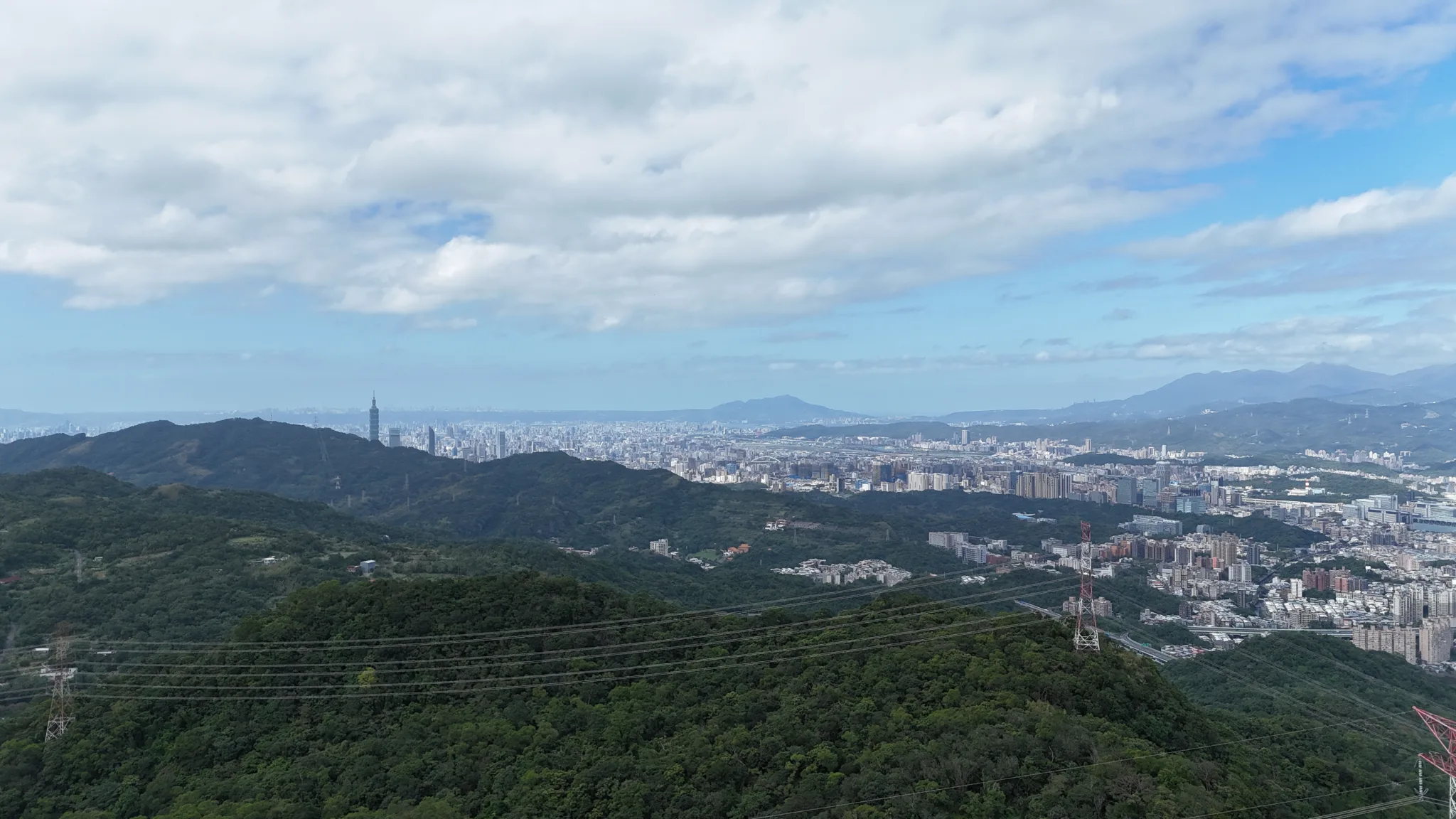
View from higher up of downtown Taipei.
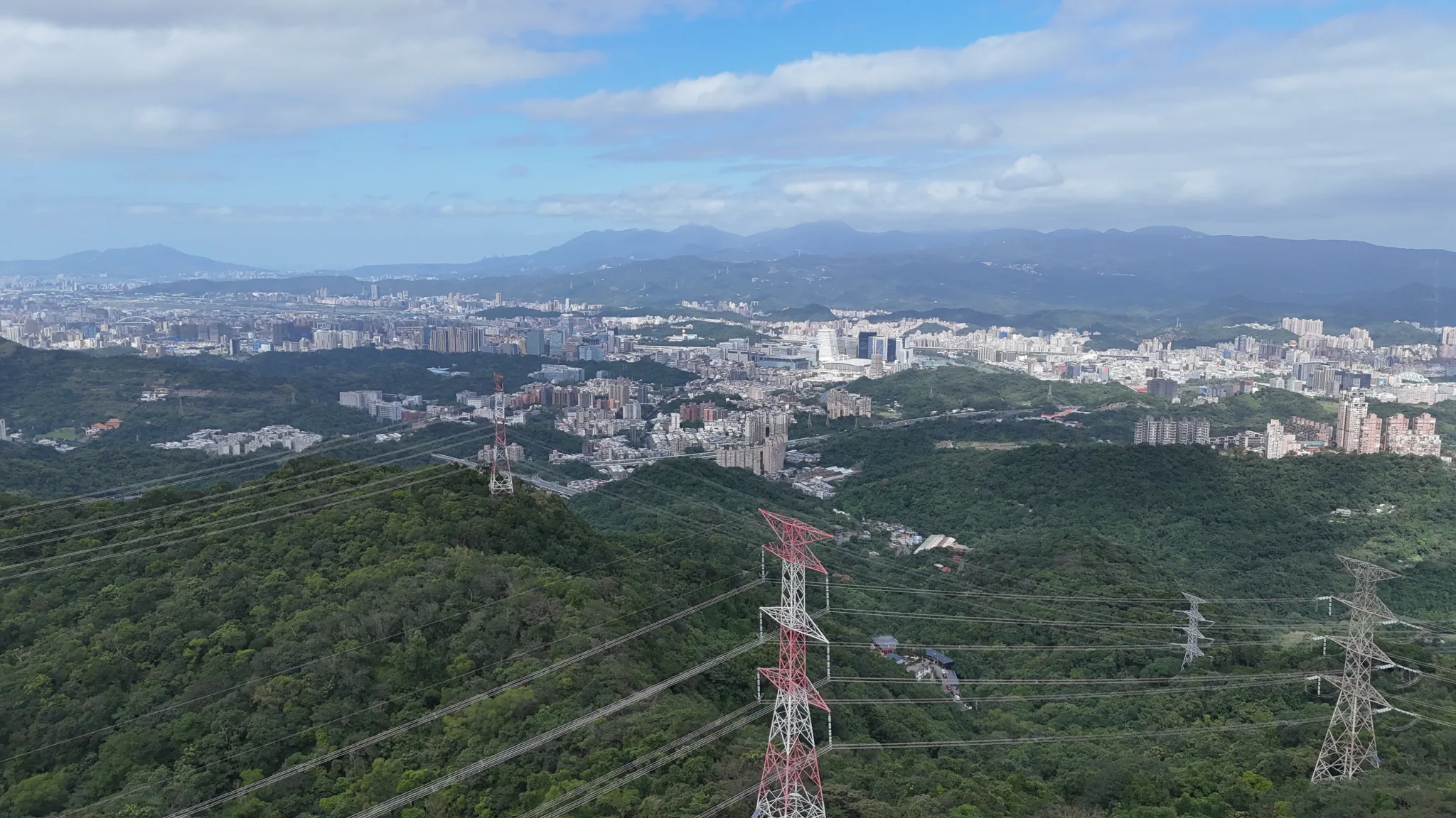
View of Nangang.
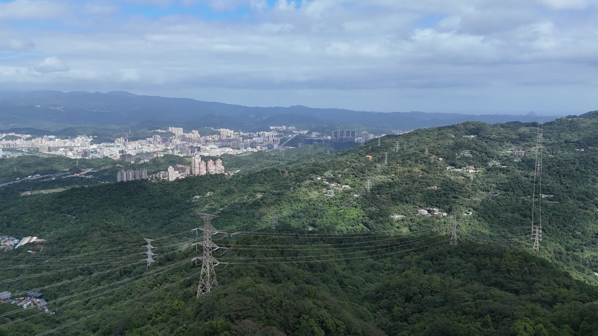
Aerial view via drone looking toward Xizhi.
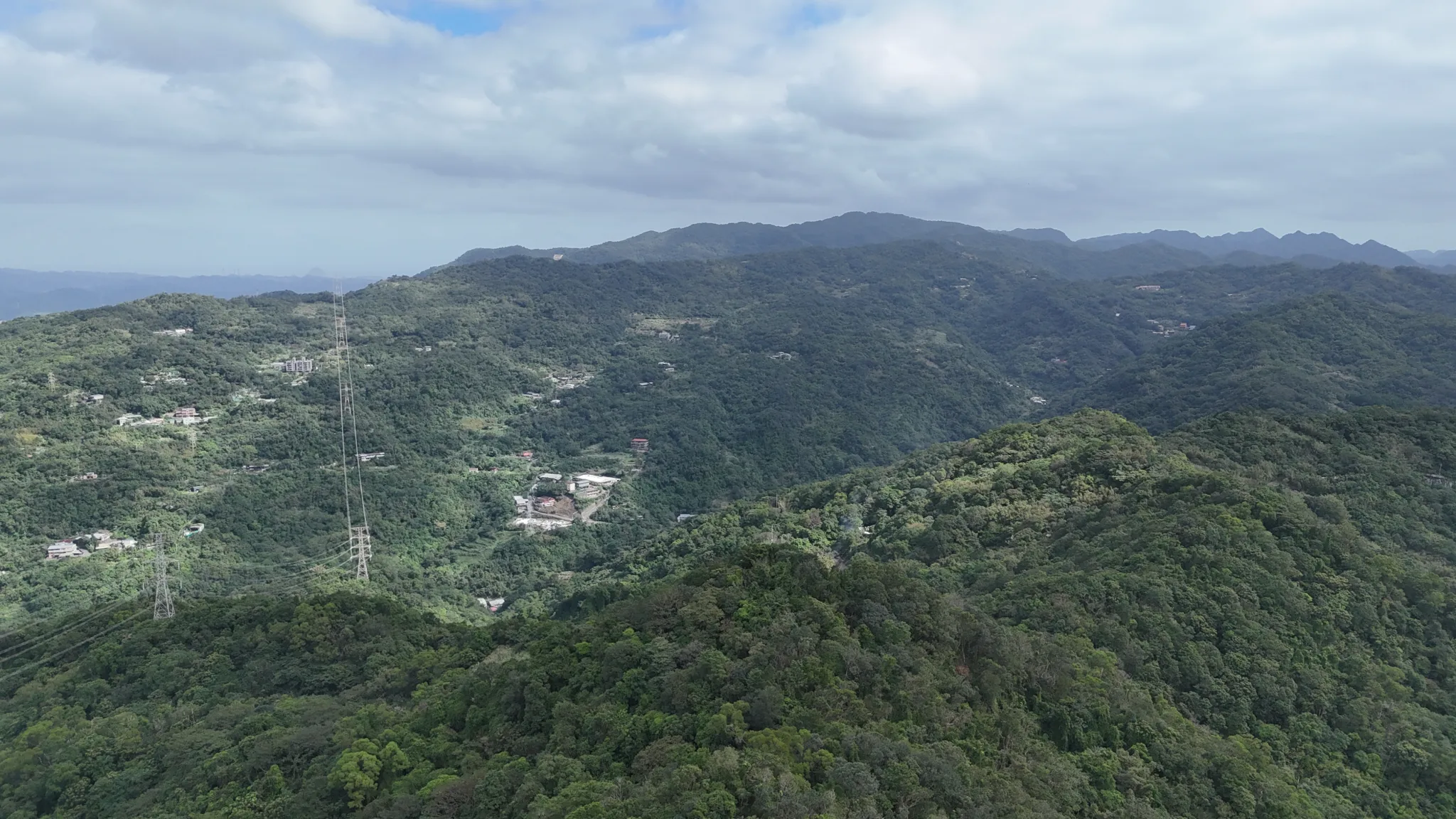
View looking toward Dajianshan. This is part of the Snow Mountain Range.
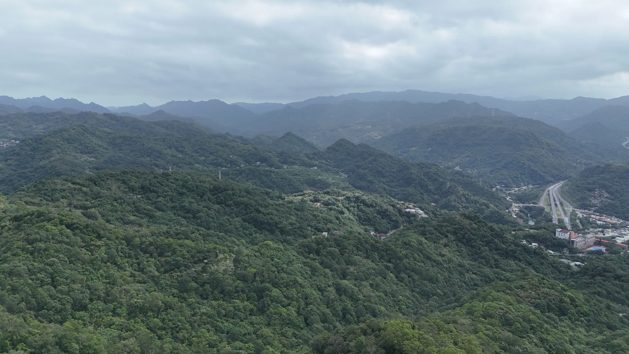
View looking toward Shiding.
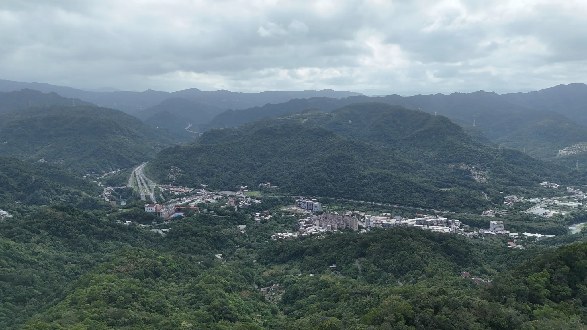
View toward downtown Shiding.
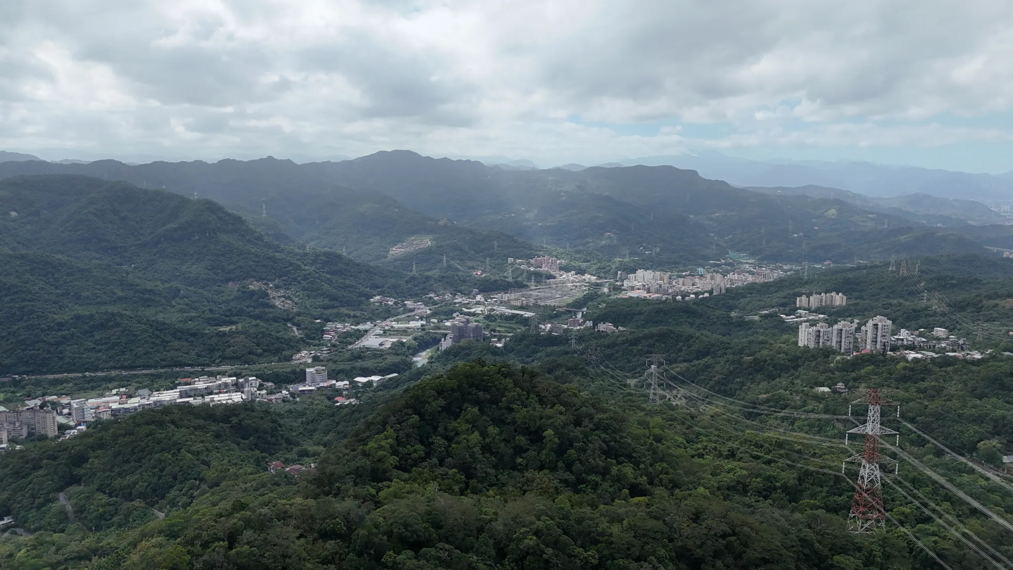
View toward Shenkeng.
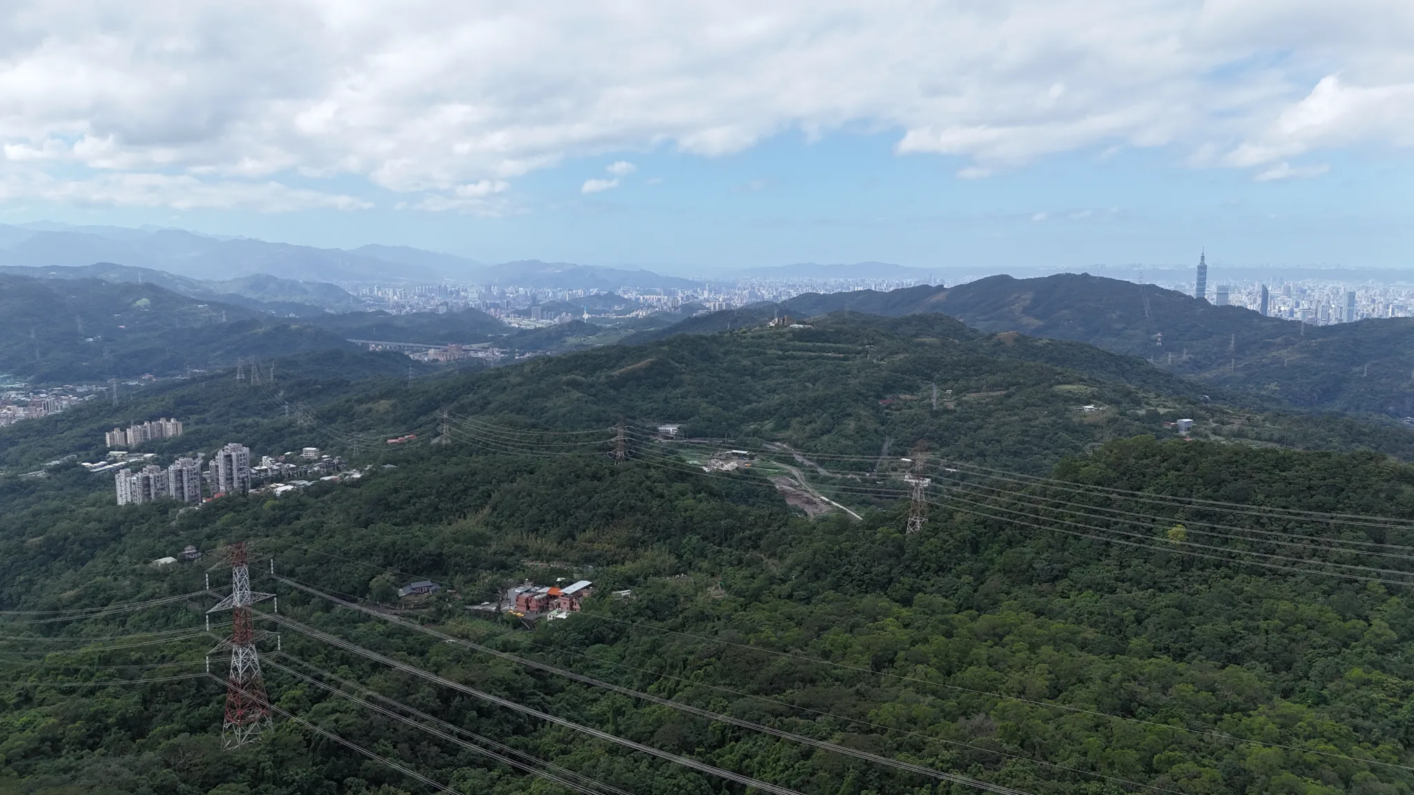
View looking directly west.
Check out our hiking guide to Taipei here.
Check out our full guide to Taipei here.

Taiwan is a place that should be explored not just with public transportation (as convenient as it is). If you only take public transportation everywhere you go, you are missing out on a huge part of Taiwan. You could take taxis everywhere to see these sights, like a rich Chinese person, or you can take the cheaper option and rent a vehicle. Many of the scenic and rural sights of Taiwan can’t be experienced except by hiring your own vehicle.
Taiwan is the scooter capital of the world, so driving a car can be dangerous here because you need to be more aware of your surroundings. However, if you are looking to get around the island faster, are traveling with multiple people, have lots of luggage, or are afraid that scooters are dangerous, I would suggest renting a car.
We recommend using Klook here or KKday here to rent or charter cars in Taiwan for the best deals.
🏯 Planning to rent a car in Taiwan? 🌊
Here are some quick car rental travel tips for you:
- An international driver’s permit or local Taiwanese license is required
- Price: 1000-3000+ NT per day depending on the vehicle
- We recommend booking on Klook or KKday for the best deals
- Drive on the right lane, no turns on red, and obey light arrows
- Look out for speed cameras, red light cameras, freeway tolls, small roads, and lots of scooters
- Best places to stay can be found on Agoda
- Stay connected with a local SIM
Car Rental FAQ:
Where can I rent a car in Taiwan?
Car rental places can be found next to most airports and in all major cities. But don’t expect them right next to every small train station. If you rent online through a platform such as Klook here or KKday here, they will work with local rental companies to provide cars at locations throughout Taiwan.
How much does renting a car in Taiwan cost?
Cheap would be 1000-1500 NTD a day (30-45 USD), average would be 2000 NTD a day (60+ USD), and expensive would be 3,000+ NTD a day (100+ USD). Discounts are often given for multiple-day rentals and for weekdays.
Do I need a local license?
No. However, you should get an international driver’s permit. If you don’t have an international driver’s permit there is no guarantee that you can rent a car. Check with the rental agency beforehand and make necessary preparations.
How do I get a local Taiwanese license?
Check out our guide on getting a driver’s license in Taiwan here.
You can also check out our guide to getting an International Driver’s Permit here.
Does Taiwan have Uber?
Yes, Taiwan has Uber. However, it is just as expensive as a Taxi. Uber was banned and fined multiple times because their business model was deemed illegal. Uber drivers were required to have a professional driver’s license. Now they work with local rental car companies to keep the app going in Taiwan.
What side of the road does Taiwan drive on?
The Right side.
How much is the price of gas?
As of 2025, it is around 30 NT (1 USD) per liter for 95 octane gas.
What is the standard taxi fare in Taiwan?
About 85 NT for the first 1.25 KM, and then 5 NT for every 200 meters after that. A short trip within Taipei City is around 200 NT (6 USD).
Anything else I should be aware of when driving in Taiwan?
Yes!
- Driving on National Highways will incur a fee of about 1.5 NT per kilometer, so don’t be surprised when the rental company throws this extra fee at you.
- Turning right at a red light is against the law.
- If the streetlight has arrows instead of plain color lights, that means you have to wait for an arrow to turn left, even if there is a green arrow pointing straight.
- When turning right, check your blind spot and the space behind your car for scooters. There are scooters everywhere. To make a safe right turn, make sure to signal early, turn slowly, and check your mirrors and blind spots.
- Check for speed cameras and red light cameras. These are the only effective ways of traffic enforcement in Taiwan, and they are everywhere! But, most GPS systems in Taiwan will tell you where they are and will warn you when you approach them.
- Make sure to buy additional insurance in case of an accident where you cause damage.
- Getting in an accident can be messy and involve a long litigation process. If it’s just a minor accident, consider paying cash to the other person and avoid calling the police if at all possible. However, always consult with your rental company on their accident policies.
- There are a few lanes in Taipei City that are just for buses. Don’t drive on them.
- Some lanes are only meant for scooters or motorcycles.
- Avoid small alleys if at all possible. You can get stuck and might have to end up backing out.
- If you come to a blind corner, there should be a round mirror at the intersection to let you see if there is any oncoming traffic from the right or left
Comparison of Rental Car Companies in Taiwan:
Klook
website: https://www.klook.com/
- English Capable – Yes
- Relatively Cheap – Yes
- Cheapest Car is about 1380 NT per day (43 USD).
- Locations – Multiple cities throughout Taiwan (airport pickup possible)
Discover Cars .com
website: https://www.discovercars.com/
- English Capable – Yes
- Relatively Cheap – Yes
- Cheapest Car is about 1500 NT per day (45 USD).
- Locations – Multiple cities throughout Taiwan (airport pickup possible)
If you’re planning to rent a car in Taiwan, it’s worth comparing prices and rental conditions before making a booking. We recommend using DiscoverCars.com, the world’s leading car rental comparison and booking website. The platform is easy to use and allows travelers to compare offers from multiple rental companies in one place, including well-known international brands such as Hertz, Avis, and Sixt, as well as trusted local suppliers.
DiscoverCars was named World’s Best Car Rental Booking Website and World’s Best Car Rental Booking App at the World Travel Tech Awards, and it’s easy to see why. The platform offers a wide range of useful filters that make finding the right vehicle much easier, whether you’re looking for an automatic transmission, a specific fuel type, or even an electric car. We also appreciate the transparent pricing and clear rental conditions, with no hidden fees, helping travelers avoid unexpected charges when picking up a vehicle.
KKday
website: https://www.kkday.com/
- English Capable – Yes
- Relatively Cheap – Yes
- Cheapest Car is about 800 NT per day (25 USD).
- Locations – Multiple cities throughout Taiwan (airport and HSR pickup possible)
Qeeq
website: https://www.qeeq.com/
- English Capable – Yes
- Relatively Cheap – Yes
- Cheapest Car is about 1,240 NT per day (39 USD).
- Locations – Multiple cities throughout Taiwan (airport and HSR pickup possible). This website works with multiple car companies in Taiwan to find the cheapest deals.
Trip.com
website: https://trip.com/
- English Capable – Yes
- Relatively Cheap – Yes
- Cheapest Car is about 1,500 NT per day (45 USD).
- Locations – Multiple cities throughout Taiwan (airport and HSR pickup possible). This website works with multiple car companies in Taiwan to find the cheapest deals.
Gogoout
website: https://www.gogoout.com
- English Capable – Yes
- Relatively Cheap – Yes
- Cheapest Car is about 1,000 NT per day (45 USD).
- Locations – Multiple cities throughout Taiwan. This website works with multiple car companies in Taiwan to find the cheapest deals.
Expedia
website: https://expedia.com/
- English Capable – Yes
- Relatively Cheap – Yes
- Cheapest Car is about 1,500 NT per day (45 USD).
- Locations – Multiple cities throughout Taiwan (airport and HSR pickup possible). This website works with multiple car companies in Taiwan to find the cheapest deals.
Just to let you know, if you book using the links above, we get some commission at no cost to you, and you can help support our blog.
Kayak
website: https://kayak.com/
- English Capable – Yes
- Relatively Cheap – Yes
- Cheapest Car is about 2,200 NT per day (69 USD).
- Locations – Multiple cities throughout Taiwan (airport and HSR pickup possible). This website works with multiple car companies in Taiwan to find the cheapest deals.
Good Cars
website: https://www.goodcars.com.tw/
- English Capable – No
- Relatively Cheap – Yes
- Cheapest Car is 1440 NT (44 USD) but can be as cheaper over multiple days.
- Locations – New Taipei City and Taoyuan (airport pickup possible)
Avis Taiwan 安維斯租車
website: https://www.avis-taiwan.com/us/
- English Capable – Yes
- Relatively Cheap – No
- Cheapest Car is 2900 NT (90 USD) per day.
- Locations – Multiple locations are on all major cities, including the East Coast.
HLC 和運租車
website: https://www.easyrent.com.tw/
- English Capable – Yes
- Relatively Cheap – No
- Cheapest Car is 2500 NT (78 USD) per day.
- Locations – Multiple locations are on all major cities, including the East Coast. Most locations of any car rental company are in Taiwan.
Jinfeng Car Rental 進豐租車
website: http://www.1car-rent.com.tw/service.php
- English Capable – No
- Relatively Cheap – Yes
- Cheapest Car is 1300 NT (40 USD) per day on a weekday and 1500 NT (45 USD) per day on weekends.
- Locations – One location in Taipei
Budget
website: https://www.budget.com/en/locations/tb
- English Capable – Yes
- Relatively Cheap – No
- Cheapest Car is 2500 NT (75 USD) per day
- Locations – 4 locations in Taipei, Taoyuan, Taichung, and Kaohsiung.
CarPlus 格上租車
website: https://www.car-plus.com.tw/EN/ugC_AboutUs.asp
- English Capable – Yes
- Relatively Cheap – No
- Cheapest Car is 1750 NT (55 USD) per day with cheaper options for longer rentals.
- Locations – multiple locations in all major cities including the east coast
Private Vehicle Charter / Hiring a Driver
In Taiwan if you don’t want the hassle of renting, driving, or getting licensed, you can hire your own driver for roughly 3000 NT or 100 USD per day.
Some taxi drivers or Uber drivers will may agree to day rates.
There are many options for private chartered vehicles on Klook here or KKday here.
Comparison of Taiwan Car-Sharing Apps
There are a few car sharing apps available in Taiwan, however these are only available to Taiwan residents with a local Taiwanese license.
In other words, we do not recommend car sharing apps to foreign tourists.
Nevertheless, we still get asked about these services, and they can be a convenient option for Taiwan residents, so here is an overview of car sharing apps in Taiwan:
iRent (run by HLC 和運租車)
website: https://www.irentcar.com.tw/irent/web/
- English Capable – No, the website and App are all in Chinese.
- Relatively Cheap – No
- Cheapest Car is about 230 NT per hour (sometimes the price may go down to 125 NT on weekdays during a promotion) and charged maximum 10 hours per day. That means if you rent for one day the lowest price is about 2300 NT (1250 NT during a promotion). Other special promotions may be applicable.
- Can rent with local Taiwanese residence card (ARC/Taiwan National ID): yes, foreigners with a Taiwan ARC can use the app.
- Taiwan license required: Yes
- Locations – All over Taiwan wherever there is a free car. This is Taiwan’s largest car sharing app. Therefore it may be the most convenient way to rent a car if you are a Taiwan resident.
Go Smart (run by CarPlus 格上租車)
website: https://www.car-plus.com.tw/gosmart/
- English Capable – No, the website and App are all in Chinese.
- Relatively Cheap – Yes
- Cheapest Car is about 99 NT per hour / 990 NT per day for an electric car, or 110 NT per hour / 990 NT per day for a small gas car. Other special promotions may be applicable.
- Local Taiwanese residence card (ARC/Taiwan National ID): no, foreigners with a Taiwan ARC can not use the app. Only Taiwan nationals can.
- Taiwan license required: Yes
- Locations – Available only in major cities such as Taipei and New Taipei, Taoyuan, Hsinchu, Kaohsiung, and Taichung.
Zipcar
website: https://zipcar.com.tw/
- English Capable – No, the website and App are all in Chinese.
- Relatively Cheap – No
- Cheapest Car is about 250 NT per hour or 2500 NT per day. Other special promotions may be applicable.
- Can rent with local Taiwanese residence card (ARC/Taiwan National ID): yes, foreigners with a Taiwan ARC can use the App.
- Taiwan license required: Yes
- Locations – Only a few locations around Taipei and New Taipei.
Renting a Scooter?
Check out our blog about scooter rental in Taiwan here, or our scooter buying guide here.
You can also check out Klook here or Kday here to search for options.
Want to buy a car instead?
Please see our Taiwan car buying guide here.
Looking for a hotel? Find out where to stay in our Taiwan hotels guide or search for the best hotels through Agoda here, which provides the best quality selection of accommodation in Taiwan.
Check out our full travel guide to Taiwan here for ideas of where to visit in Taiwan.
You can also find more tours of Taipei on Klook here or KKday here.
Feel free to contact us with any specific questions about car or scooter rental in Taiwan, and please like, comment, and share!