Old Maolin (舊茂林 aka 得樂的卡 (Teredeka) aka Mangzai Village 「芒仔社」、aka Maya Village 瑪雅社)is was one of the original three villages of the Rukai Tribe in Maolin. Later, they abandoned it in the wake of an attack by Japanese police officers. Later, Maolin Village was relocated to its current location further down the Zhuokou River. The original Old Maolin Village is still abandoned, but is still relatively well kept and is accessible via a mountain road without the need for a permit.
🏖️ Planning your trip to Kaohsiung? 🐒
Here are some top travel tips for you:
- Best time to visit: Winter when temperatures are cooler and there is less rain
- How to get there: Taiwan High Speed Railway and Inter-City Bus
- Best places to stay: Mingli Hotel or IHI Sandup Hotel which are great value choices located downtown.
- Book tours and activities in Kaohsiung on Klook
- Stay connected with a local SIM
- Rent a car to explore distant sights
Historical Overview of Maolin:
During the Japanese occupation, the original inhabitants of Maolin Village lived in the mountains behind Wanshan Village in Old Maolin. However, later these aboriginals were forcibly moved to the current village due to relocation efforts by the Japanese. Others chose to move due to typhoons, lack of transportation, or unsafe terrain. There are a few abandoned villages above the current village that you can still hike to. I will explain further in the paragraph below.
The villages of Maolin District of Kaohsiung now have about 2000 total inhabitants, mostly aboriginals from the Rukai (魯凱族) tribe, as well as some Wulu Bunun (布農) and Paiwan (排灣) tribal people, as well as some Han Chinese people. The district also has one middle school and three elementary schools.
The Modern Maolin Village covers the area from Dajin Bridge 大津橋 to Maolin Valley 茂林谷, and has about 850 inhabitants, mostly aboriginals from the Rukai (魯凱族), Wulu Bunun (布農) and Paiwan (排灣) tribes, as well as some Han Chinese people. The village also has Maolin Middle School, the only middle school and highest educational institution in Maolin District.
Typhoon Morakot brought record floods to Taiwan because it slowly moved over the island, delivering torrential rain. Nearly 700 people were killed during the disaster (to see what Maolin looked like right after the flooding, check out this blog here).
Basically, all the bridges in Maolin were destroyed during Typhoon Morakot in 2009 except the Duona Suspension Bridge, which was built so high that it would never be affected by floodwater.
Most all the bridges currently in Maolin were reconstructed after the 2009 floods.
Duona is the most remote village in Maolin District of Kaohsiung City and is said to harbor the most complete version of the Rukai Aborigine culture.
The Rukai People first began to move into the area now known as Duona about 300 years ago (1700s), making it one of the oldest Aborigine villages in Taiwan.
Most of the people live in traditional stone houses made from nearby plentiful shale rock, which is characteristic of the Rukai Tribe. The stone houses are warm in the winter and stay cool during the summer.
Near the village is a small plain which is said to be the home of Taiwan’s indigenous species of black rice. The village was almost completely cut off from the outside world until the Japanese built the Duona Suspension Bridge, which helped to link it to the rest of Taiwan as well as better control the native population.
The actual District boundaries extend to Pingtung County and Taitung County, and include largely untouched and “virgin” forests and mountain wilderness areas such as Shuang-guei Lake, providing precious wildlife habitat for many of Taiwan’s Indigenous animals and plants.
History of the Old Maolin Village
The following information is mainly from the book called 原住民部落起源及部落遷移史:以魯凱族下三社群為例, which can be translated as The Origins of Indigenous Tribes and the History of Tribal Migration: A Case Study of the Three Lower Rukai Communities. This book has a very complete history of Maolin, and I highly suggest reading it to learn more, especially if you can read Chinese.
What is now Maolin District of Kaohsiung was once known as the “Lower Three Villages 下三社” of the Rukai Tribe, which were Maolin Village, Wanshan Village, and Duona Village; currently, Duona Village is the only one of the three that was not removed from its original location. I came to know about Old Maolin originally while researching Old Wanshan Village, which is famous for having the oldest stone carvings in Taiwan.
You can see above a map of Old Maolin Village, which had over 50 households and a few hundred people. Old Maolin Village is over 400 years old. Before that, the people lived in “Ancient Maolin”; no one knows for sure how old it is, but it is likely also a few hundred years old.
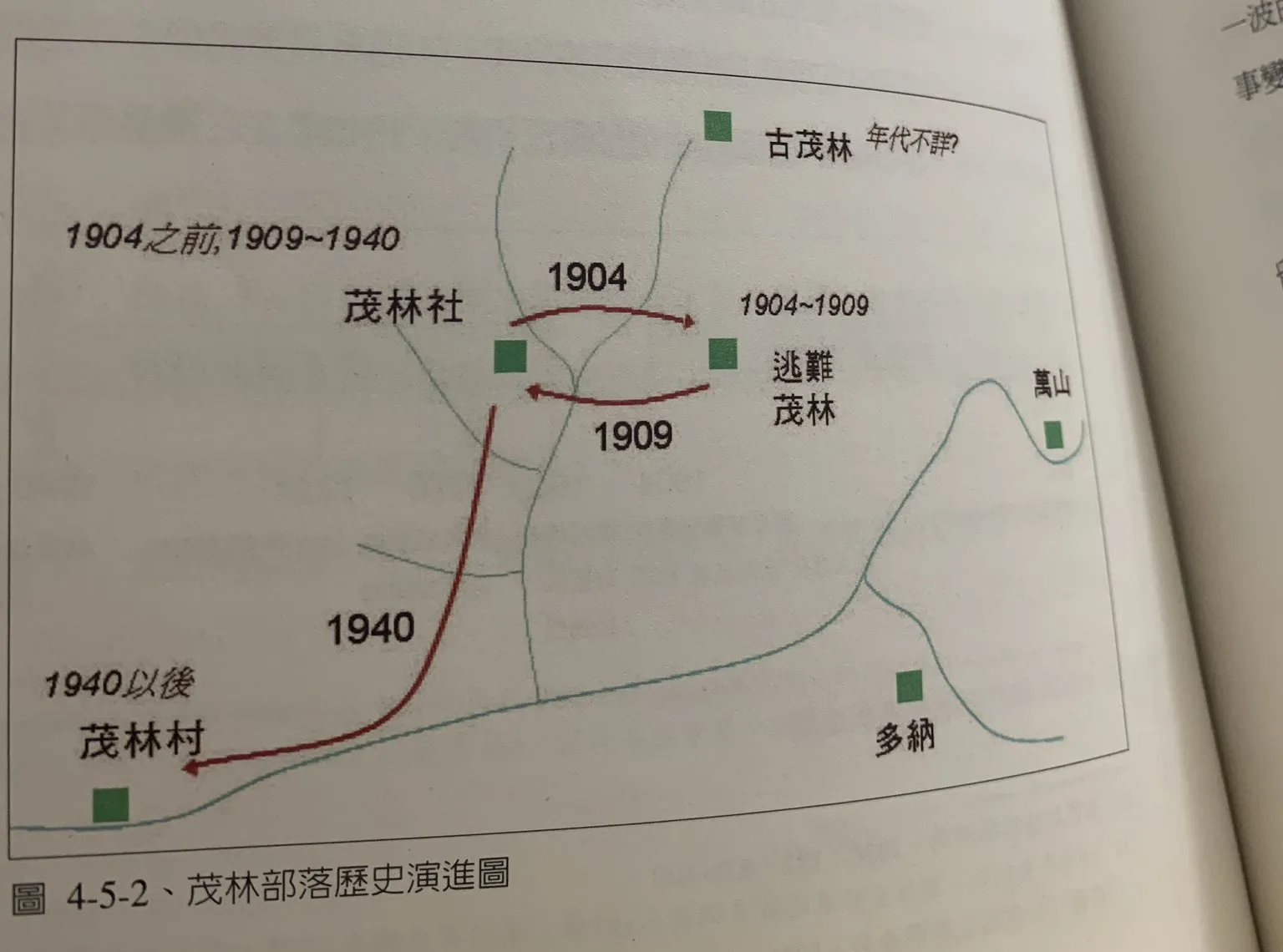
This map shows that near Old Maolin Village there are two other lost villages in the same valley: one is “Refuge Maolin 逃難茂林” and the other is “Ancient Maolin 古茂林.” I will discuss these migrations and “Refugee Maolin” further below.
Maolin and the Rukai Tribe were among the last areas in Taiwan to be controlled by the Japanese. The Rukai Tribe had lived in these mountains for hundreds of years before colonizers came to Taiwan, and before that, their ancestors likely hunted here for thousands of years. Originally, the Japanese had built an electric fence around what is now Maolin to keep the indigenous peoples in and trap them like cattle, perhaps as a way to coerce them to join the empire. The electric fence was built along the Tengzhi/ Liugui police line, basically locking in the Maolin Aborigines.
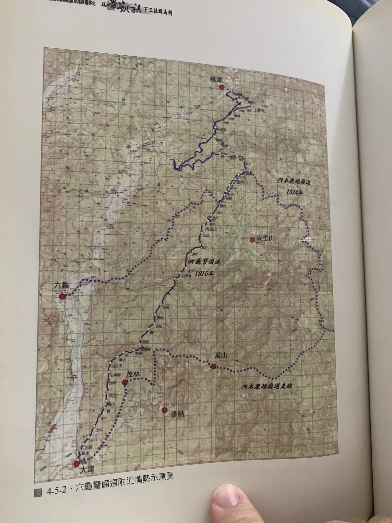
Here is a map of the original Tengzhi / Liugui Police line on top and trails connecting the three lower Rukai Villages. The trail went from Dajin to Old Maolin to Old Wanshan. The current road to Duona Village was built later. It would be interesting to trace the original trail from Old Maolin to Old Wanshan, which likely followed mountain ridges on the north side of the Zhuokou River.
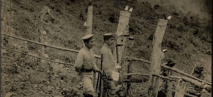
Here is an image of the original Japanese electrified fence along the mountain tops. You can still see some of the old wire and those white (ceramic?) bell-looking things along that trail. Not a lot of them left, but some are still around. Apparently land mines were put out there too. You can still hike along the old Ligui Security Path. It’s a fun hike with a lot of history. If you have a chance, go and hike at least part of it. Or do it as an overnight to get the full experience.
Lower Three Villages Incident 下三社事件
The reason the people of Maolin Village abandoned Old Maolin original village and moved to “Refuge Maolin” is because they were massacred by the Japanese as part of the “Lower Three Villages Incident.” This incident started when some nearby plains aborigines beheaded Japanese policemen in nearby Liugui. For some reason, the Japanese thought the attack came from Maolin Village.
In November 1903, Japanese police officers marched to Old Maolin and massacred the village, killing 30 people. This was the first time that the Japanese and the people of Maolin ever saw armed conflict. After this incident, the villagers abandoned Old Maolin for a few years and temporarily moved to “Refugee Maolin” which was across the valley from the original village. In 1909, they moved back to Old Maolin. “Ancient Maolin” is another older village in the same valley that is a few hundred years older, but was abandoned for Old Maolin. Fighting between the Japanese and Rukai ensued during the coming years, but Maolin Village gave in to Japanese rule. Also, the Japanese sent in a few air bomb raids just to keep the aborigines scared, to scare them into joining the empire. By 1940, the villagers abandoned “Old Maolin” and were relocated by the Japanese to what is now the current Maolin Village. Duona and Wanshan villages were never relocated by the Japanese, although the Japanese did build suspension bridges and trails to their villages. Wanshan Village was not relocated until the ROC era, when the people willingly relocated downriver for easier transportation. Only Duona Village has stayed in its original location.
Old Maolin used to be much easier to get to via the Meiyagu Falls trail. However, in 2009 the trail was washed out due to Typhoon Marokot. There is still a road to get to the old village, but part of it is not paved. I recommend taking a scooter or SUV if you plan to drive there.
Price:
Free. No police permit or Aboriginal tribe permission needed.
Hours:
24/7
When to go:
I recommend going in the summertime when the waterfalls have plenty of water and warm temperatures make it a great time to go swimming. In winter, it will be cold, and the waterfalls can dry up.
On the other hand, if you want to go just for hiking, winter would be a better time to go.
If there is a Typhoon, the inhabitants of Maolin will be evacuated, and you should not try to go in for your own safety.
When is Maolin Butterfly Season?
If you are coming to see butterflies, the butterfly migration begins in September and ends roughly in November.
Check out our full Maolin Butterfly Season Guide here.
How to get to Old Maolin:
If you tell Google Maps to take you to Old Maolin, it will take you the wrong way. Pay attention to the hand-drawn map below and the directions below as well. I also have photos and directions further down in the blog.
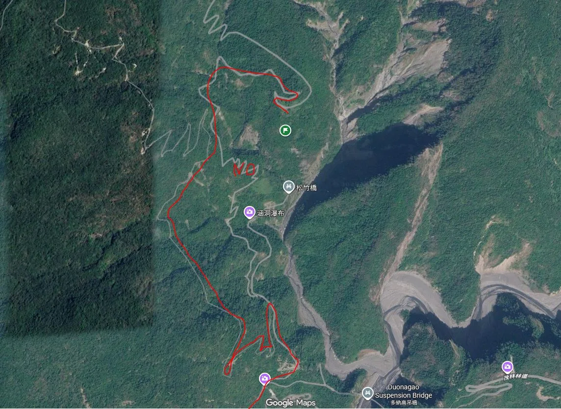
Follow the red path above. I tried to drive up the road where it says “NO” on the map. It is a dead end; do not attempt to go that way. Take a left at the fork in the road before you get to Meiyagu Trailhead. The road is pretty good and paved most of the way; it goes all the way to the old village, unlike what Google says. I do not recommend taking a sedan, but a sedan could probably make it with only bottoming out once or twice. A scooter or SUV is a safe bet.
By SUV/Scooter: Maolin can be reached via provincial highway 27 from Pingtung or Liugui. Once you come to Dajin Bridge, go straight up the mountain. After you pass Wanshan Village, turn off to Duona Suspension Bridge and go straight to Meiyagu. Before you go down the hill to Meiyagu, follow the red path above up the hill and to the left, and follow it until you reach Old Maolin, which is at the end of the road. Looking for scooter rental in Kaohsiung? You can check out Klook here or KKday here to search for options. You can also check out our scooter rental guide here.
If you are looking for car rentals, you can search Qeeq here, KKday here, or Klook here. You can also check out our car rental guide here.
By Bus: You can take a bus there, but I don’t recommend it. It’s a 3-hour bus ride from Pingtung Bus Station. If you can rent a car or scooter, it is about a 1 1/2 hour drive from Kaohsiung. You can book tickets to travel to Kaohsiung via inter-city bus on Klook here.
You can book tickets to Kaohsiung via high-speed rail (HSR) on Klook here or KKDay here.
Book tickets via the normal train (TRA) on Klook here.
You can also book a Kaohsiung Travel pass here.
Road Conditions:
The parking lot is solid; the rest of the road near it though, is grass, and before that was a lot of dirt and some mud. The lower part of the road is great, though. No big potholes anywhere on the upper or lower parts. A sedan could make it, but I would not recommend it.
Where to Stay:
We have stayed at and recommend Chao She Hotel (you can book on Agoda here, Booking.com here) IHI Sanduo Travel Hotel (you can book on Agoda here, Booking.com here), and Mingli Hotel (you can book on Agoda here, Klook here), which are three inexpensive and high-quality choices in downtown Kaohsiung. I have also stayed at and recommend Kaohsiung Meinong Rabbit Paul Homestay B&B (you can book on Agoda here, Booking.com here), a quiet B&B in rural Meinong, and Chengching Lakeside Resort (you can book on Agoda here, Booking.com ) and the Grand Hotel Kaohsiung (you can book on Agoda here, Booking.com) which both offer breakfast buffet and free entrance into Chenqing Lake Park. I have also stayed at the 85 Sky Tower which offers great views of the city; you can search for rooms in the 85 Sky Tower on Agoda here, Booking.com here)
Find out more about where to stay in our Taiwan hotels guide or search for the best hotel deals in Taiwan here. We recommend booking through Agoda here, which provides the best quality selection of accommodation on the islands.
Tours:
You can find more tours and activities in Kaohsiung such as Pier 2, Meinong Hakka Museum, Hamasen Railway Museum, Suzuka Circuit Park, i-Ride Kaohsiung Visual 5D Flying Theater, National Science and Technology Museum , Senya Village Restaruant, Austin Land, Ski School Indoor Ski Slope, and many more on Klook here or KKday here.
Map:
The exact coordinates for Old Maolin can be found in the above Google Map.
Drone Footage
You can also check out the 360 pano above.
Our Journey:
I learned about abandoned stone house villages the first time I visited Maolin. My friend, Ahbei, had hiked to the old Wanshan Village and had seen the oldest stone carvings in Taiwan. Since then, I have always wanted to trek out there, but visiting Old Wanshan is a three-day trek into the most remote part of Taiwan’s mountain wilderness. I had always planned to go, but never found the time. In the meantime, I read the book mentioned above and learned that there was another closer, easier-to-access abandoned stone house village in Maolin, Old Maolin. After finding Outrecording’s blog about it online, I found that it was actually a much easier trip than Old Wanshan. I made it! I drove my car up, and it was just fine, except for taking a wrong turn into a dead end, but my car has a little better clearance than a normal sedan.
We considered taking Outrecording’s advice to do the loop hike if someone had kept up the trail, but there was thick brush the whole way from Meiyagu Waterfall, and I did not bring a machete. It didn’t look like a family-friendly hike.
So we took the easy way and explored from top down, but we pretty much just stayed on the trail and didn’t venture down
The parking lot is solid; the rest of the road near it, though, is grass, and before that was a lot of dirt and some mud. The lower part of the road is great, though. No big potholes anywhere on the upper or lower parts. Also, we double-checked at the Maolin Police station that a permit is not required to travel to Old Maolin. You only need a permit to travel off-road deep into the mountains.
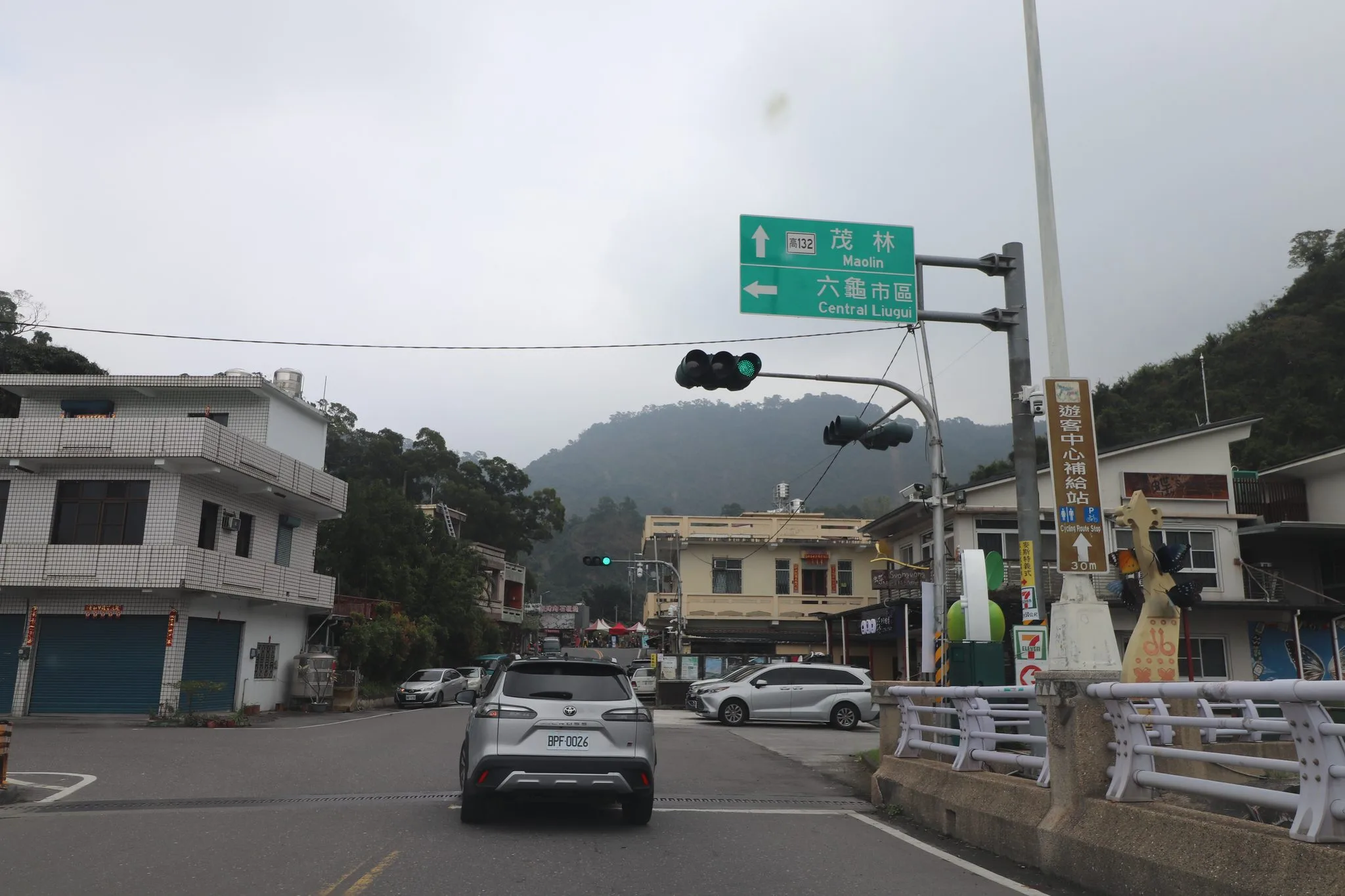
When you first get to Maolin, this is the view you have. The modern village of Maolin looks similar.
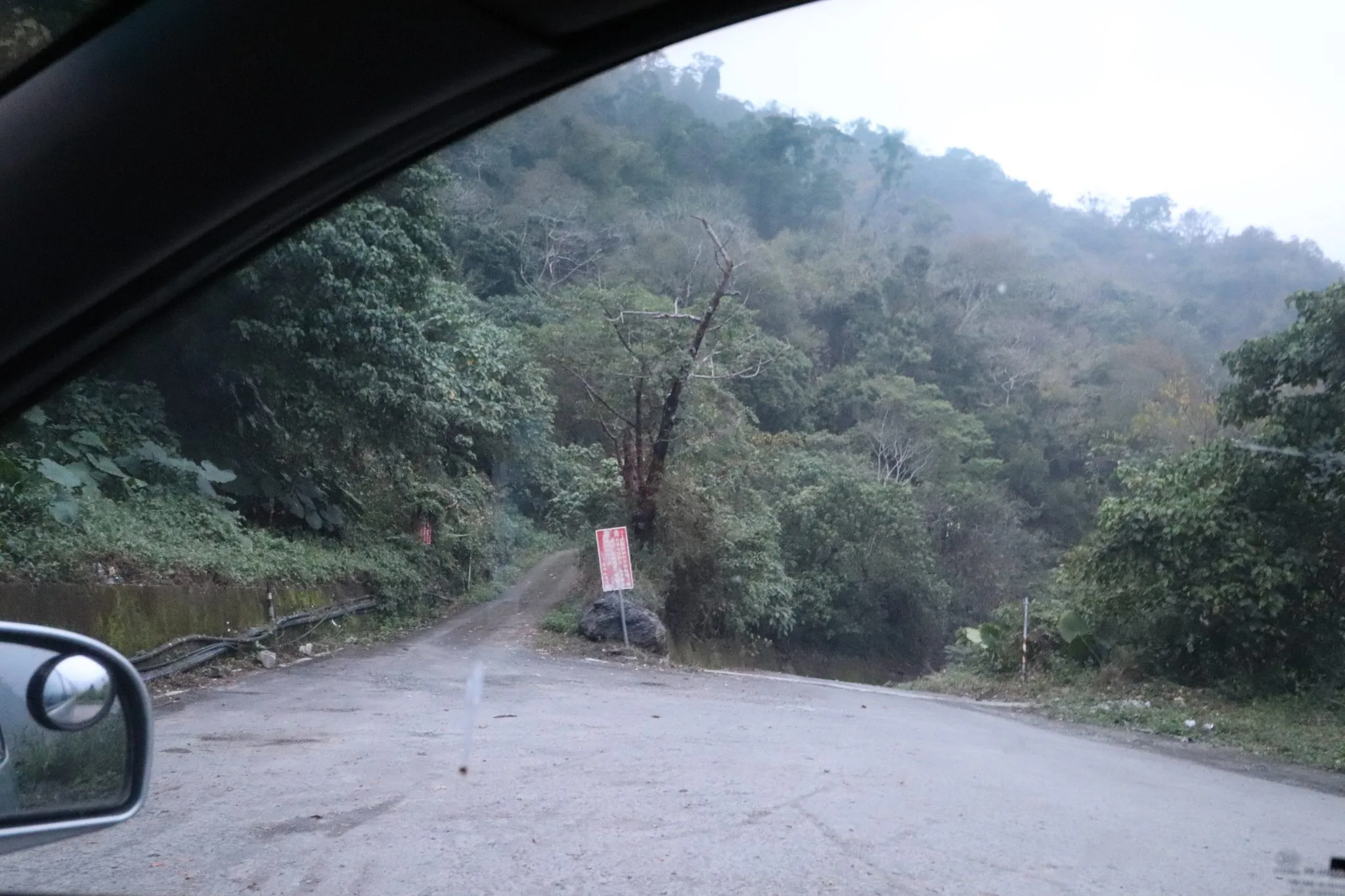
After you pass Maolin Village and right after Wanshan Village, before you go down the big hill to Duona Great Bridge, turn left toward Duona Suspension Bridge. Head toward Meiyagu Falls, but turn left here at the photo above. If you turn right here, it will take you to a dead end. That is what Google will tell you to do, and it is wrong.
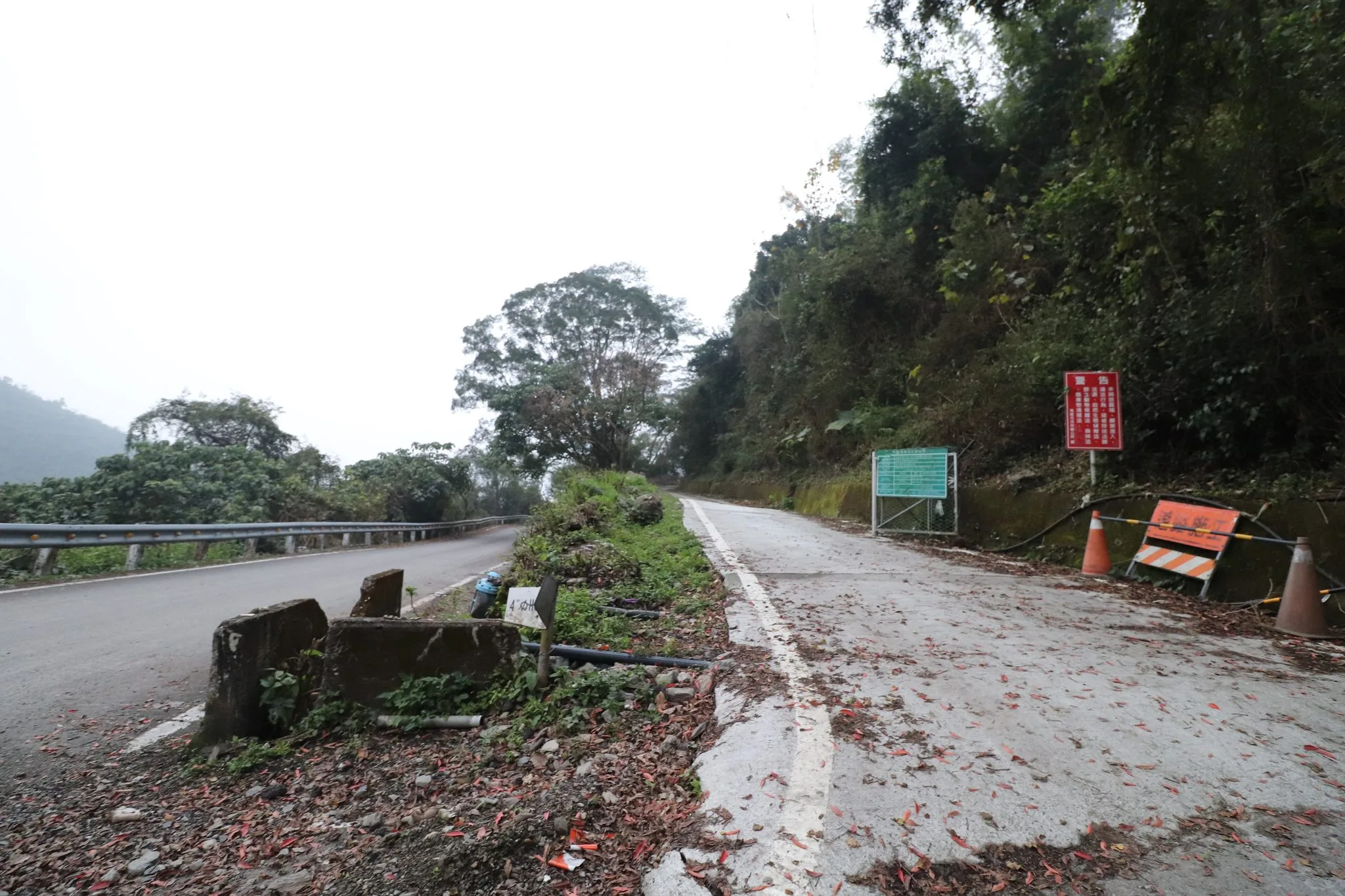
You must take a left and follow this road pictured above.
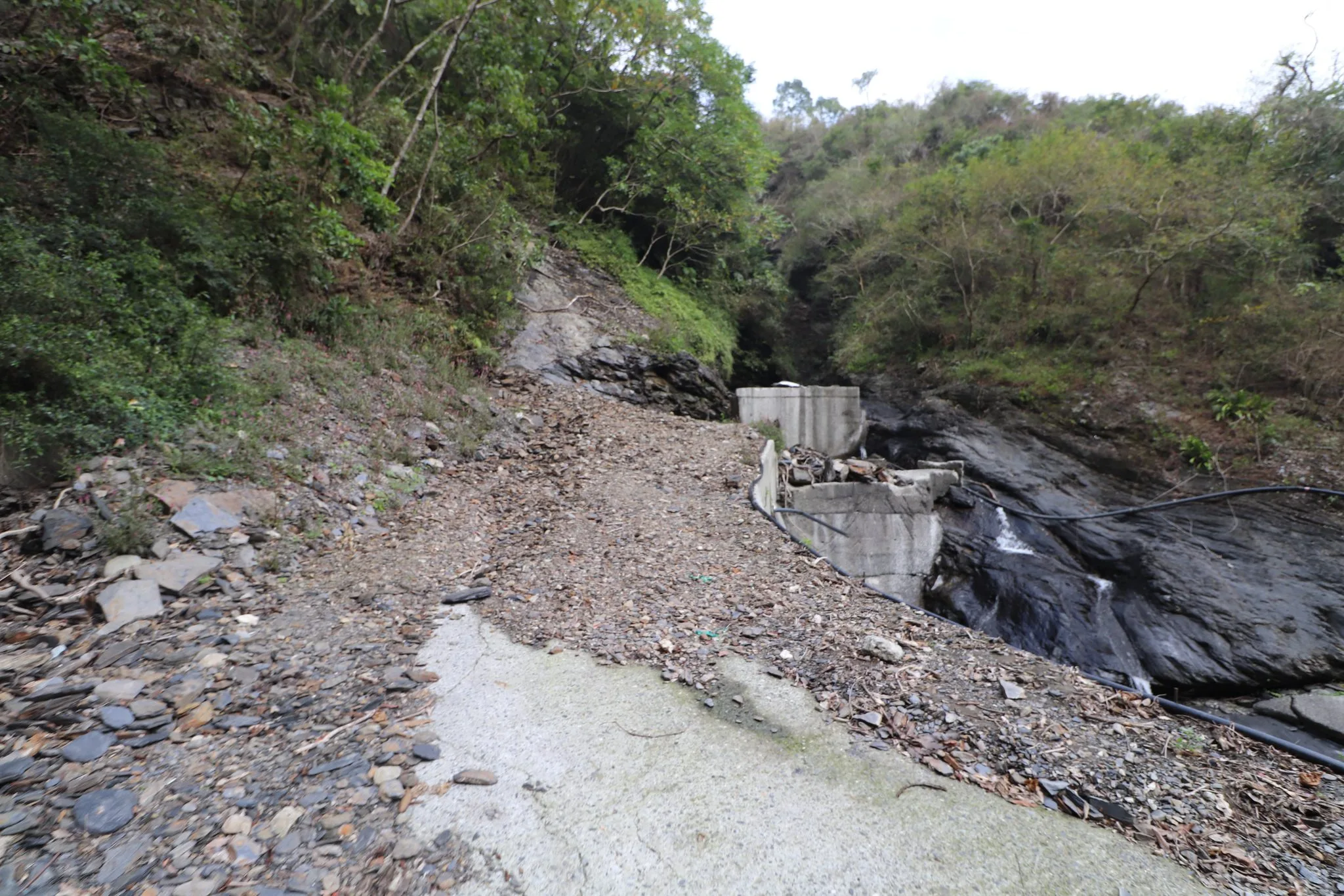
If you take the wrong turn to the right to try to get up as Google suggests, you will come to this dead end, which may have been a former road that has been washed out. It is a dead end and not fun to get out of. Also, there are quite a few ruts and potholes on this road, more than on the correct road to Old Maolin.
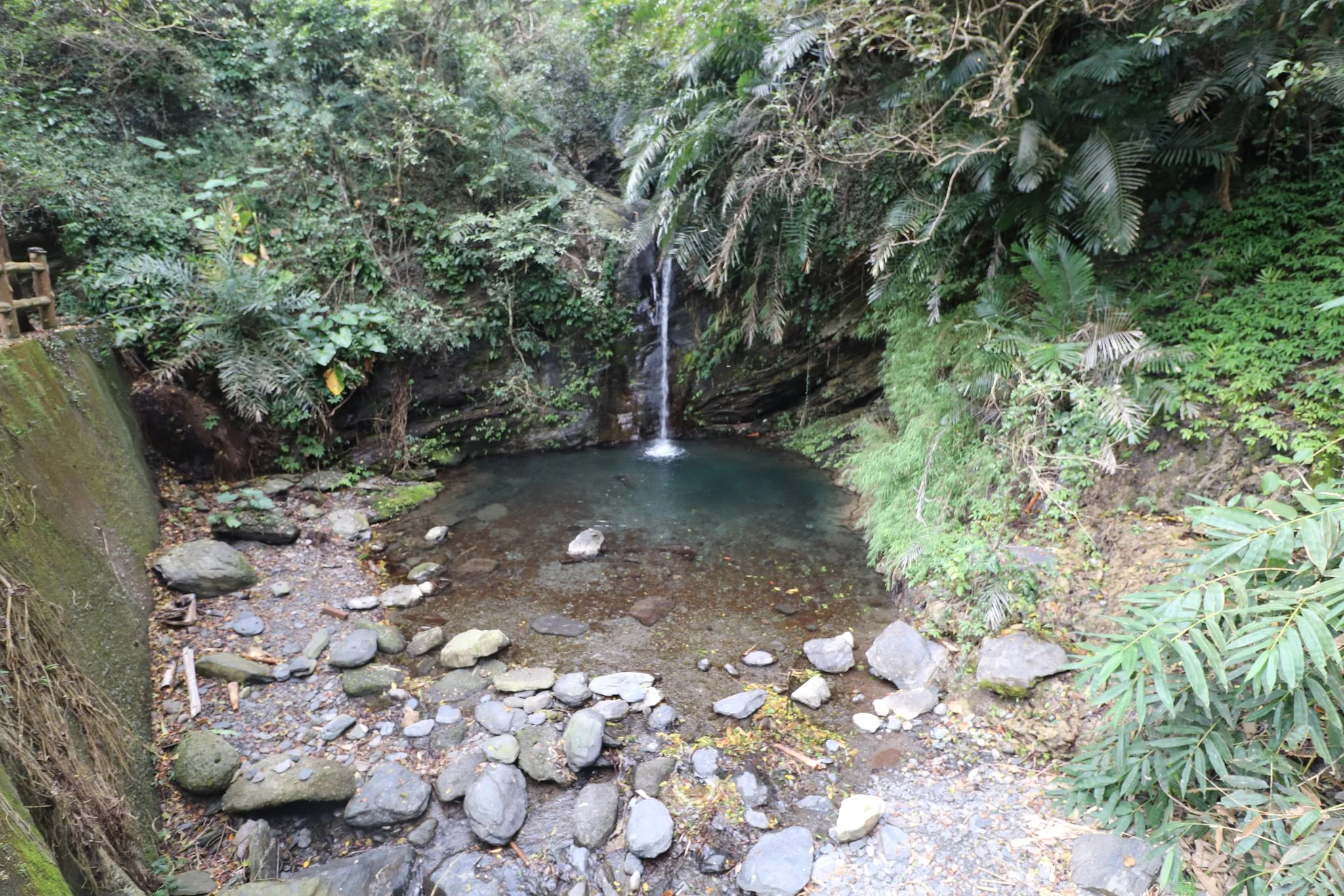
Also if you miss the turn altogether, you will get to the Meiyagu Parking lot which is this tiny waterfall known as Handong Waterfall next to it.
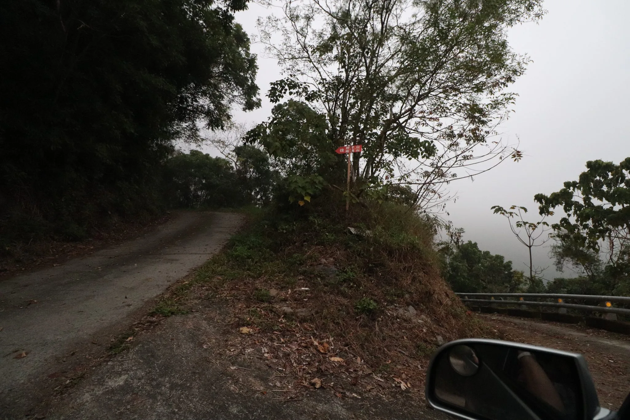
If you keep going up to the left, it is steep but paved for most of the way. Also, there are only one or two places that you need additional clearance for. Our Kia Carens did okay.
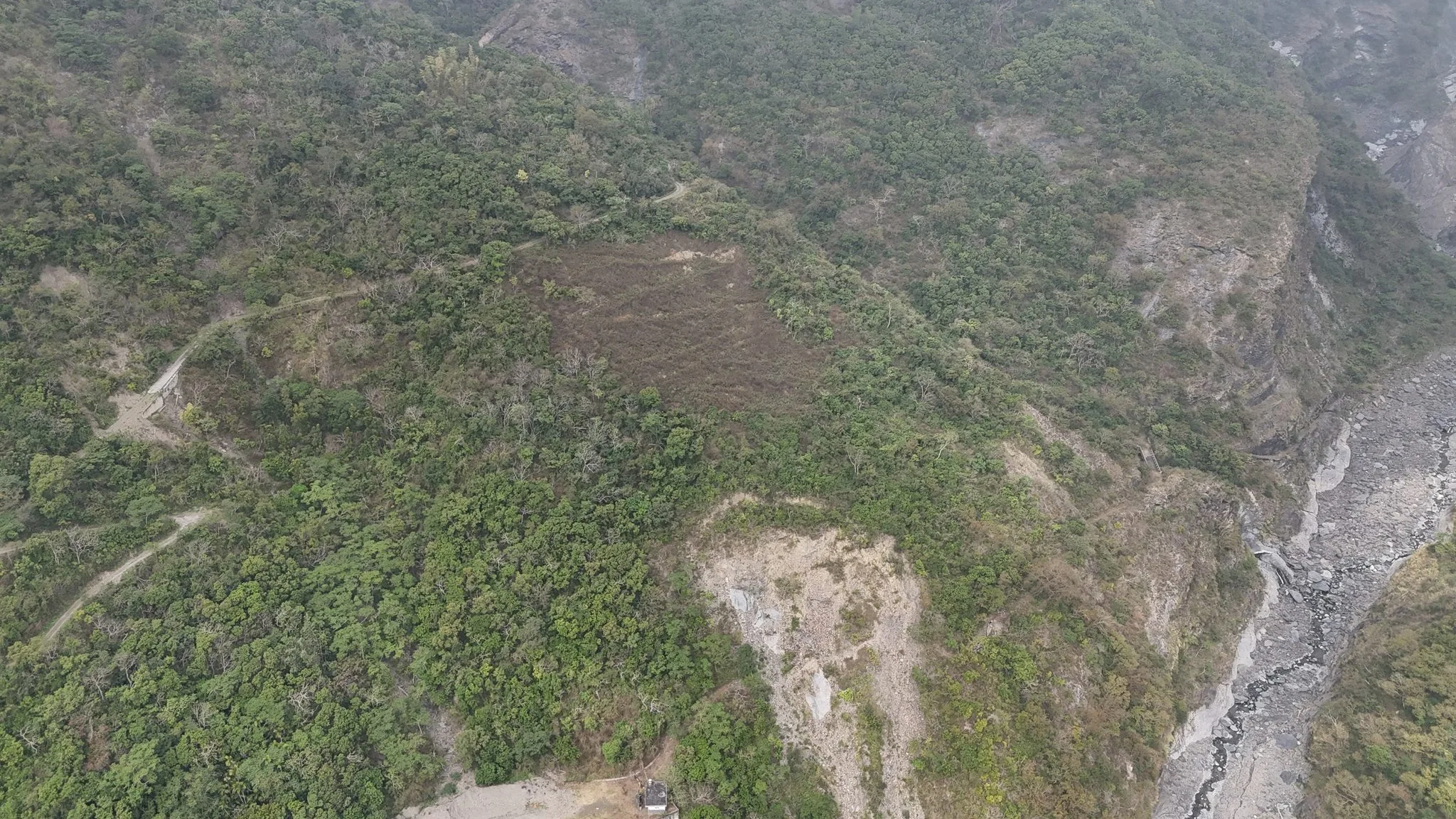
Here is an Aerial view from Meiyagu. The wrong road will take you up a super gnarly dirt road to a dead end. Do not go down it.
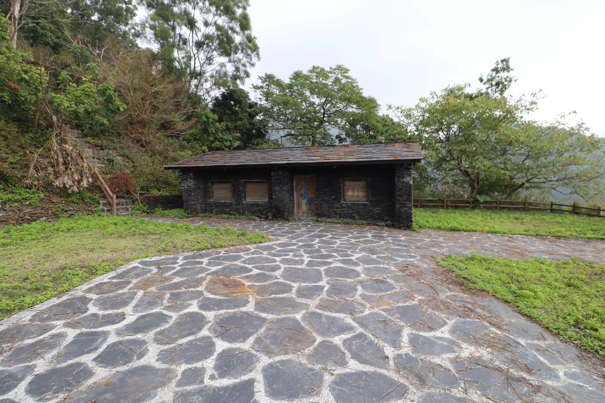
When we finally made it to Old Maolin, the place looked well kept. They had a replica stone house there; however, it said that no entry was allowed. As you can tell from Outrecording’s blog, sometimes this place is overgrown, sometimes it is freshly mowed. We were lucky to get the freshly mowed version, and it looks like they recently added this stone path.
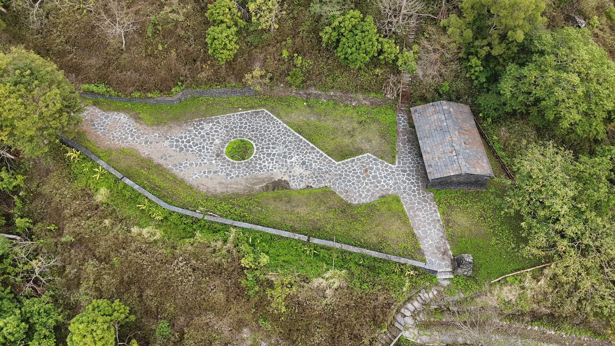
Aerial view from near the parking lot.
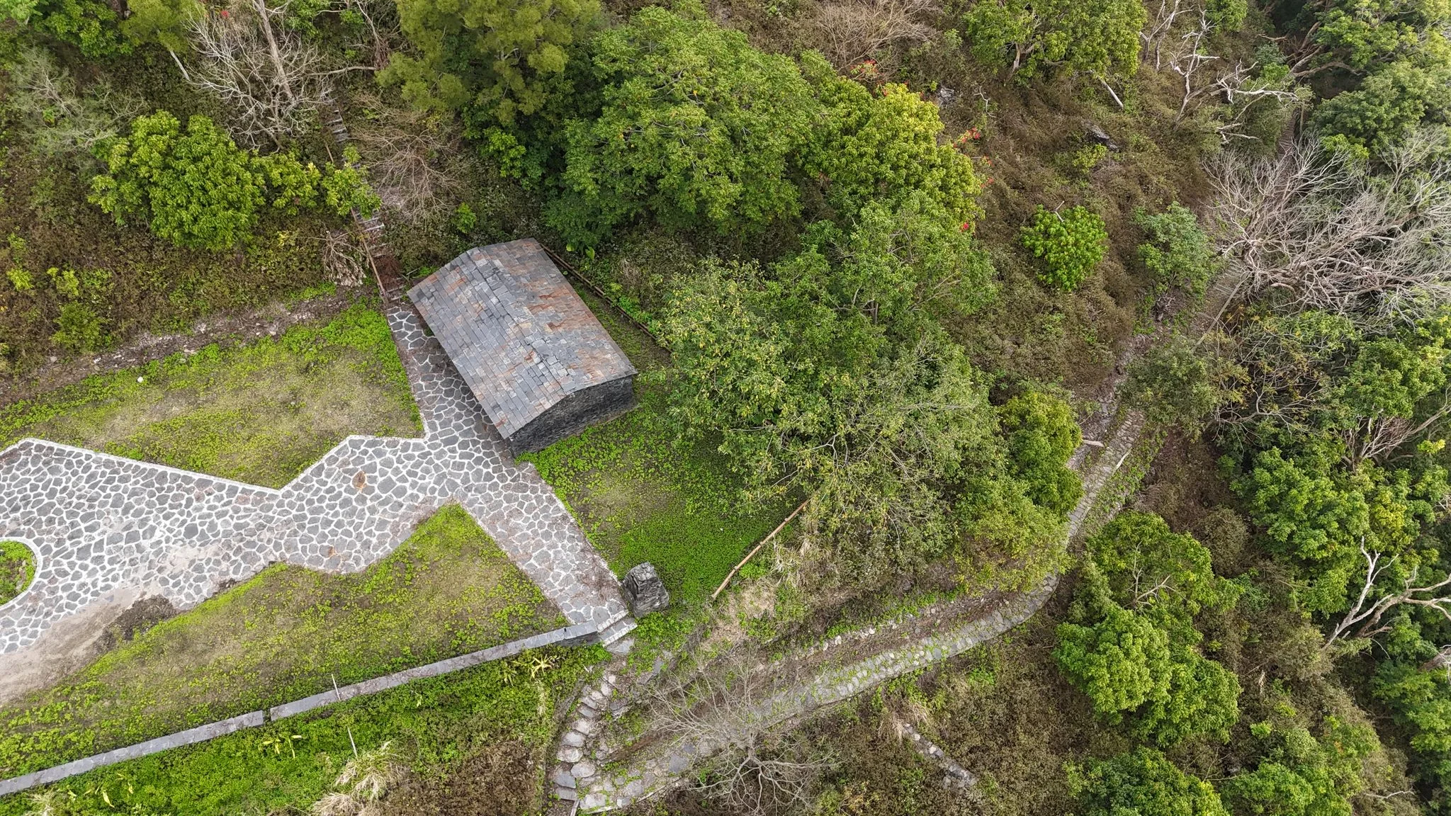
From the parking lot here, the trail goes down to the abandoned village.
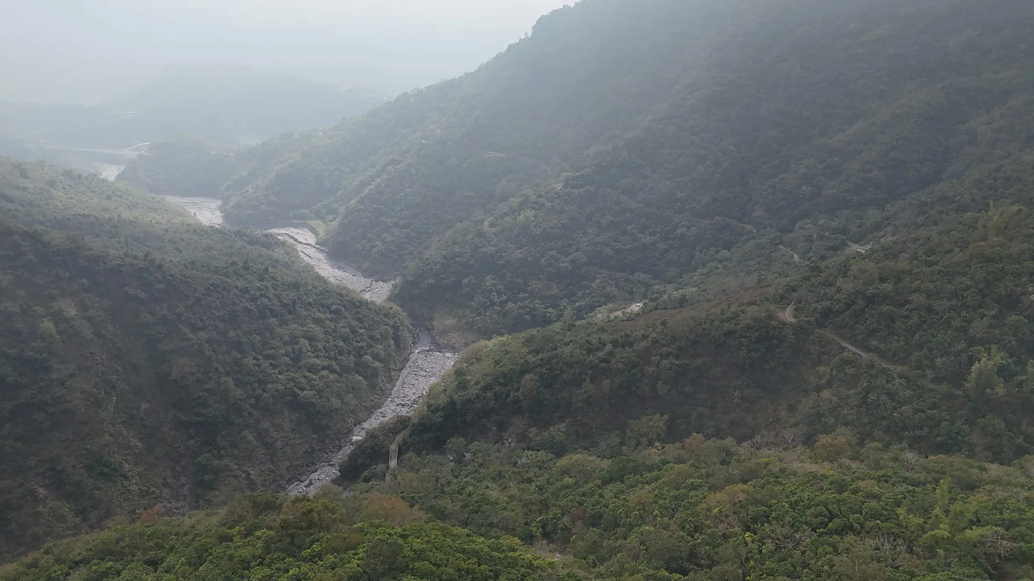
View looking down the valley from Old Maolin via drone.
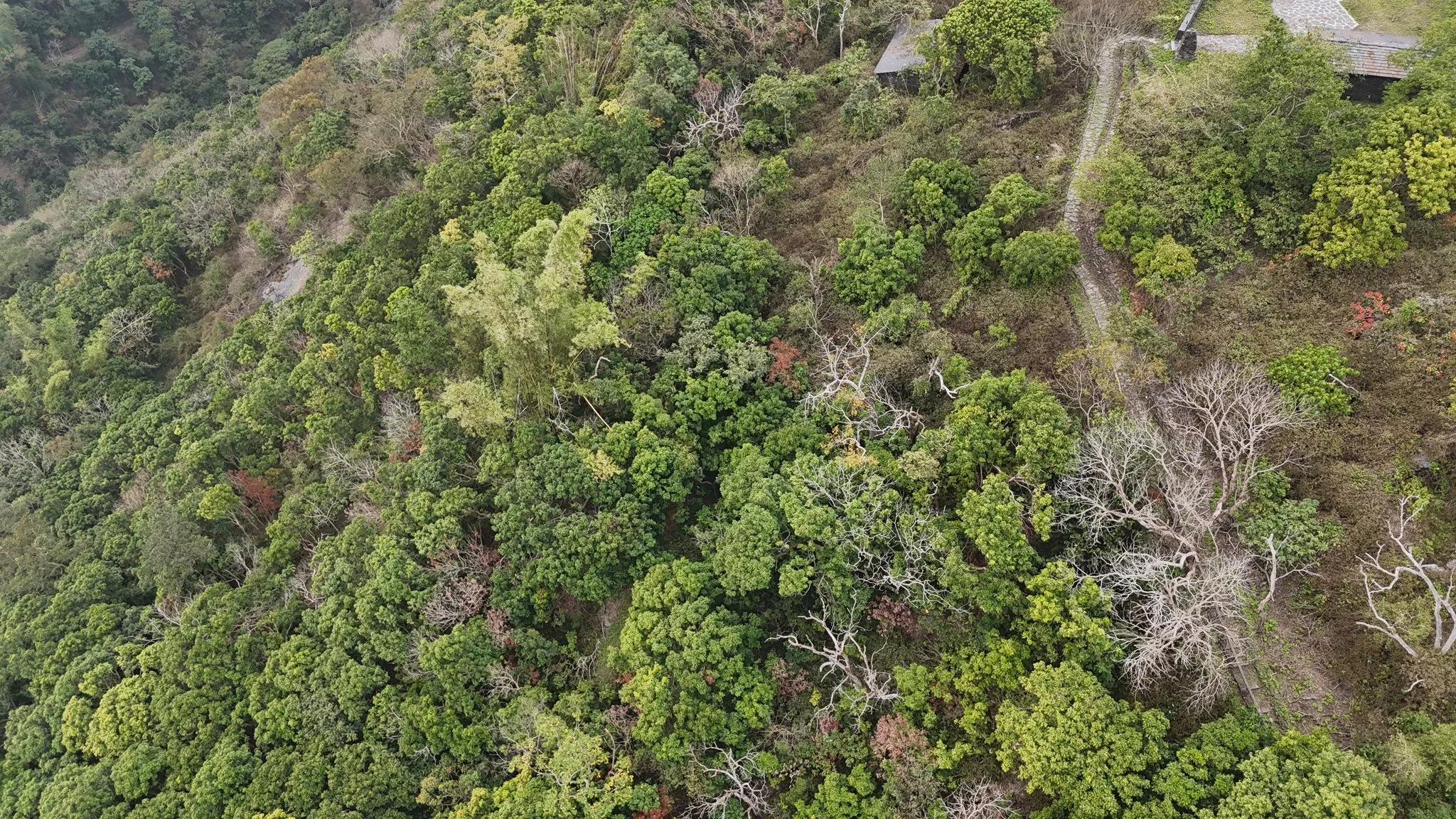
View looking down at old Maolin.
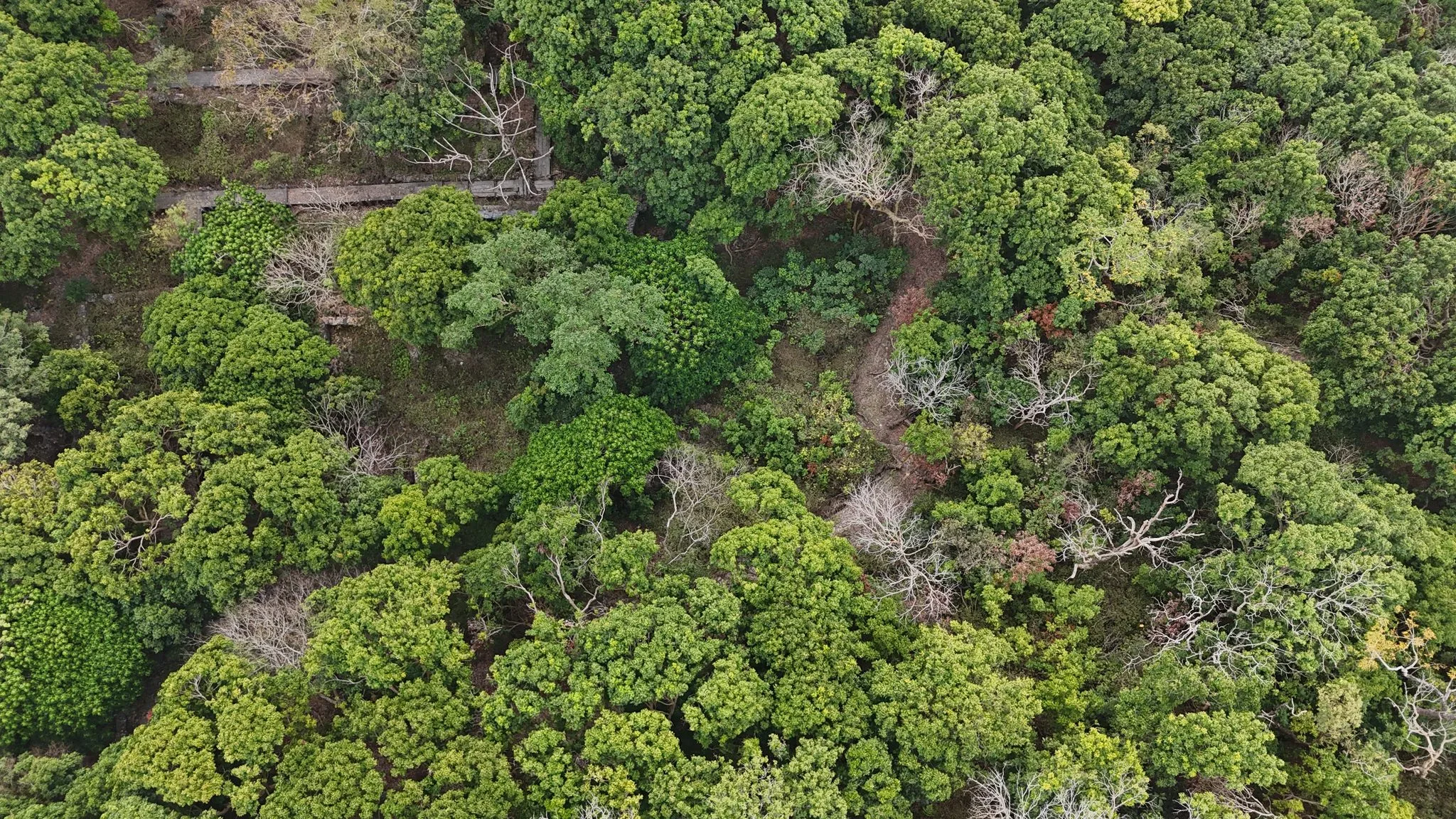
Much of the old village is now covered by trees.
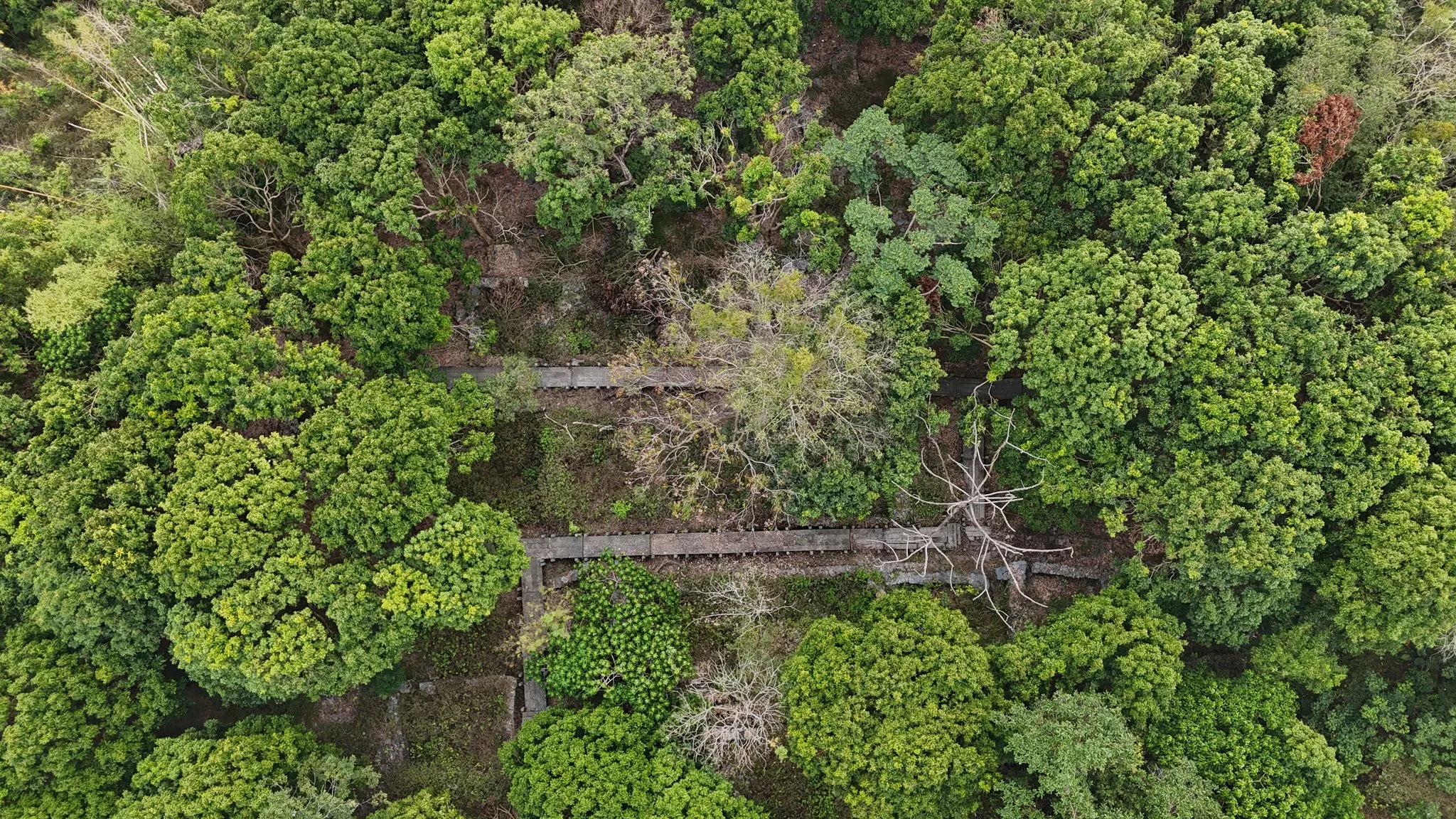
You can see they have made a boardwalk that goes around the village here.
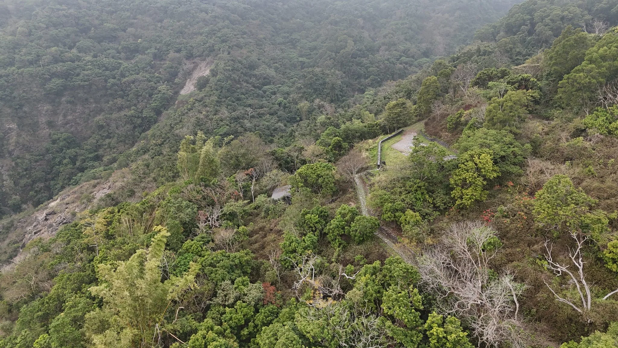
From this image, you can see the correct road going above that small landslide. The old road on Google Maps was likely covered by a landslide.
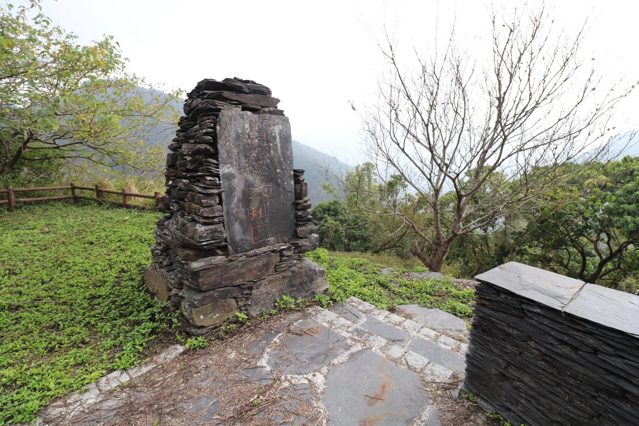
This sign says “Old Maolin Historical Site 舊茂林遺址區”
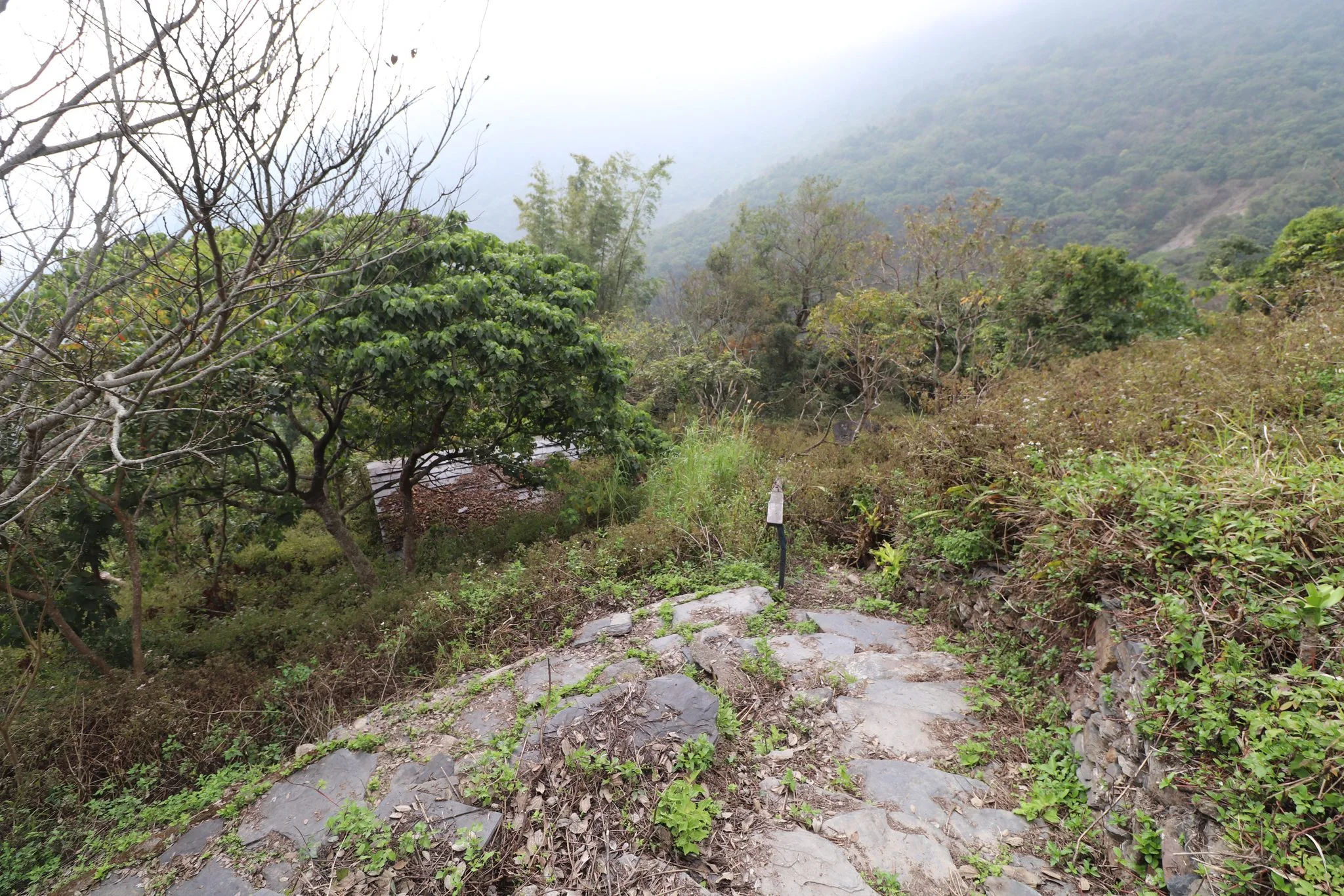
There is a stone path that leads down to the village here. The building below is a storage shed and is not accessible.
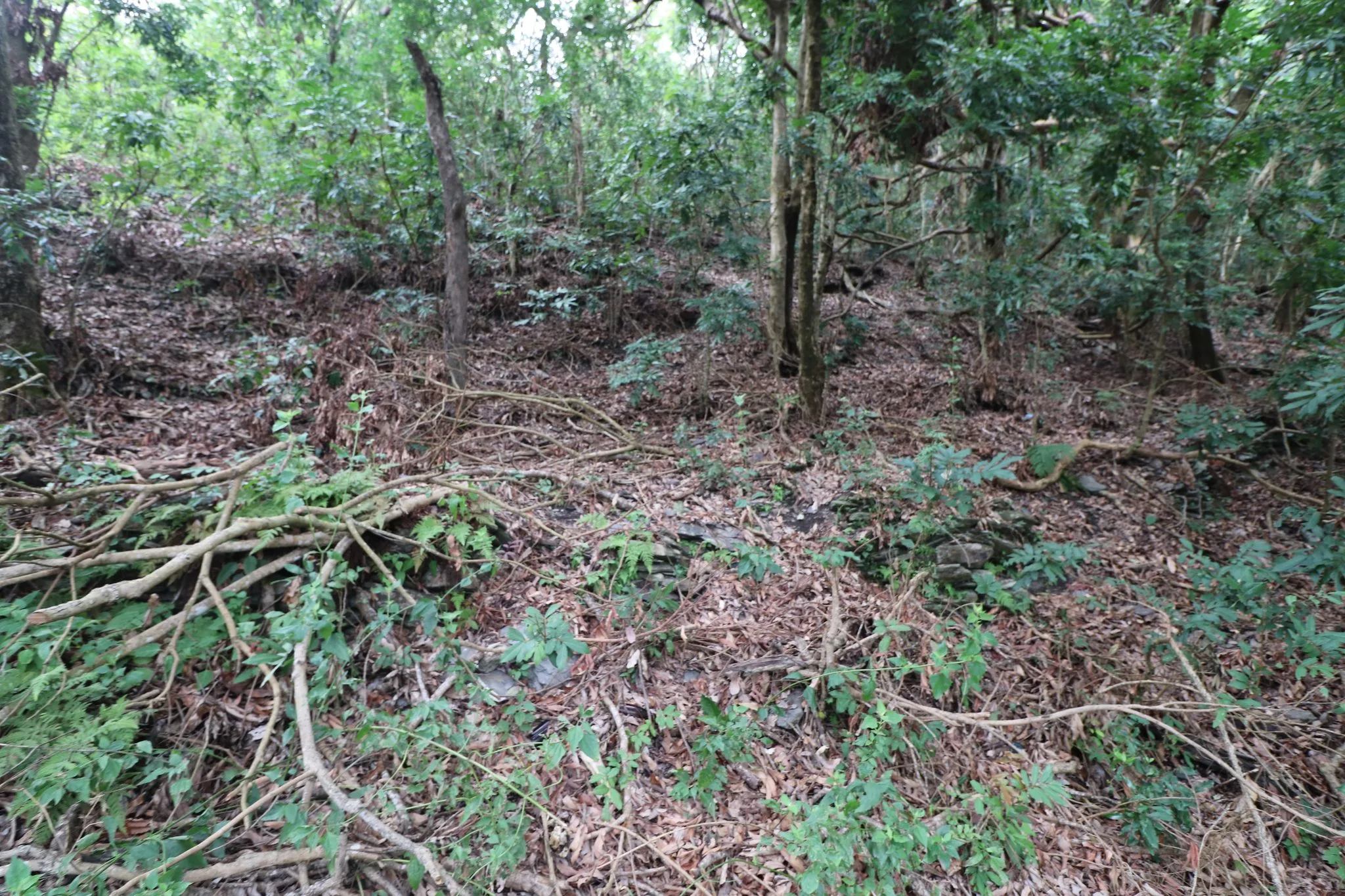
You can see some old stone walls here through the trees and leaves.
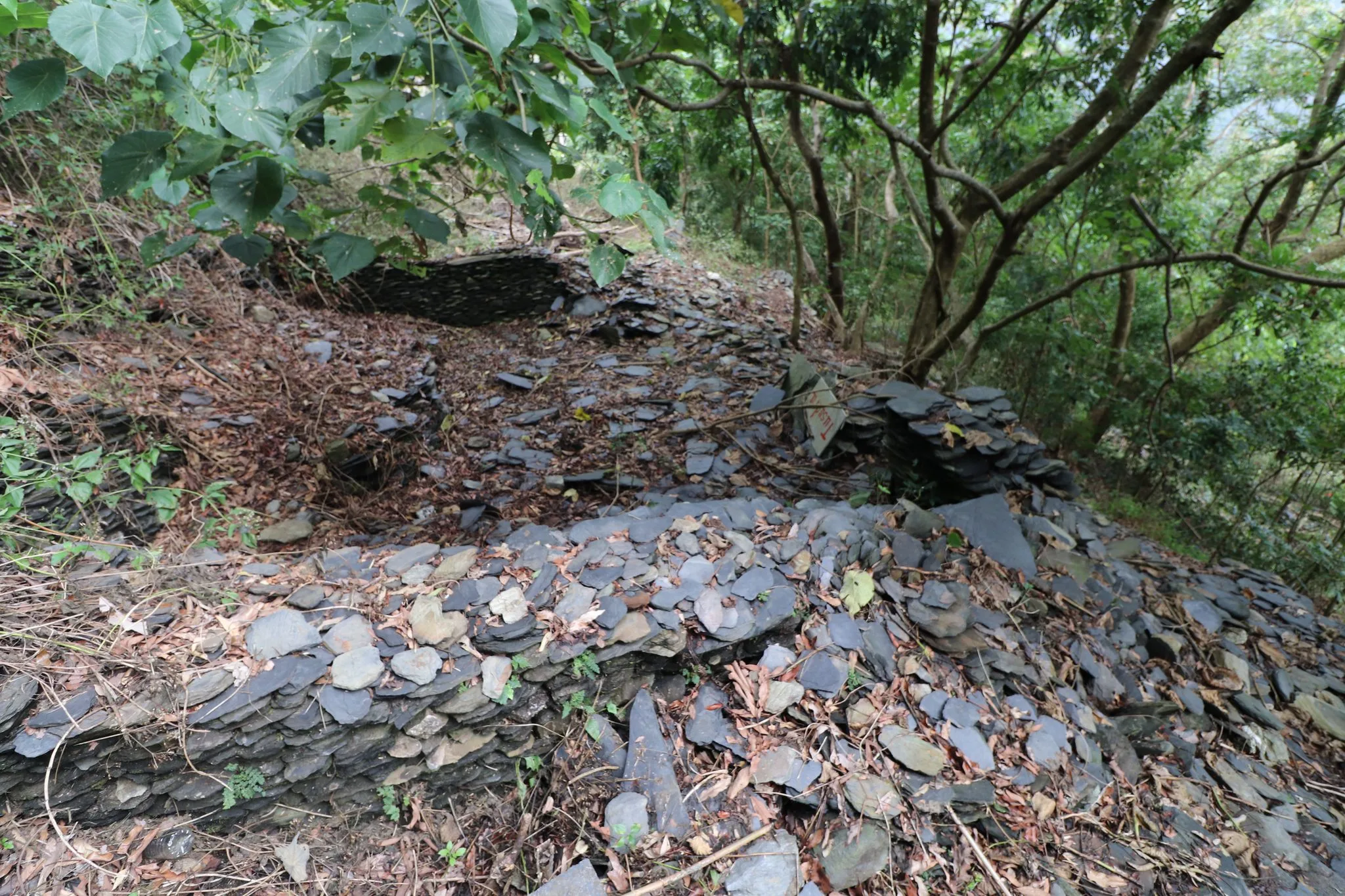
The Rukai, Paiwan, and Bunun tribes are known to build stone or slate houses. The reason they do this is that slate is easily accessible in Taiwan’s south central mountain range. The stones are easy to stack and make into a wall. However, these houses require wooden or straw roofs, and all of the roofs on these old houses have collapsed.
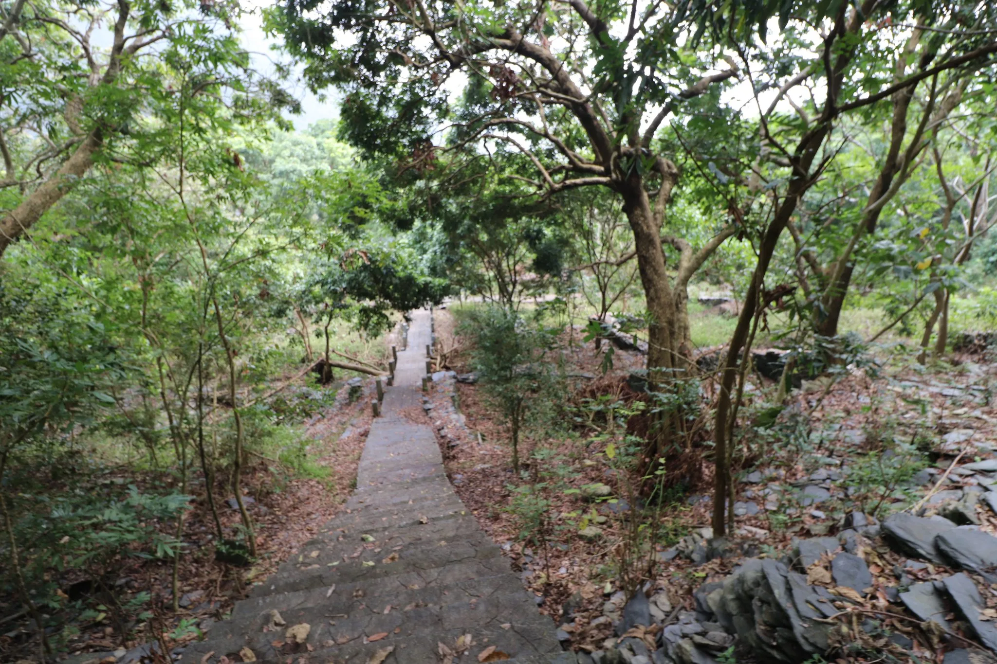
If you visit, I would advise that you be respectful and stay on the boardwalk.
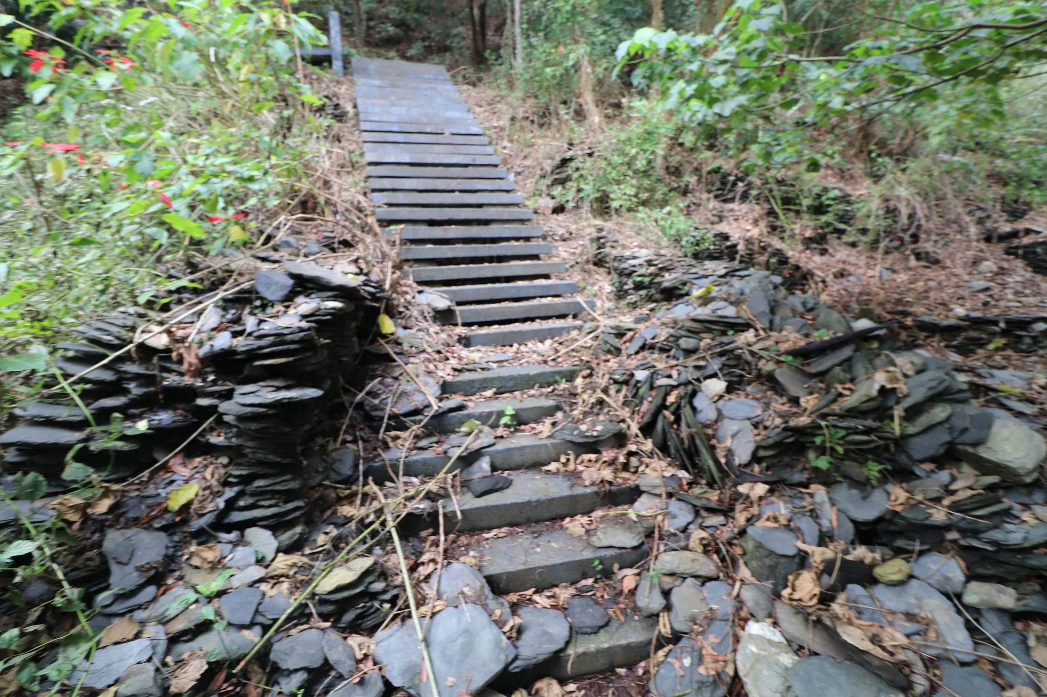
Some of the stone walls have ended up spilling onto the path.
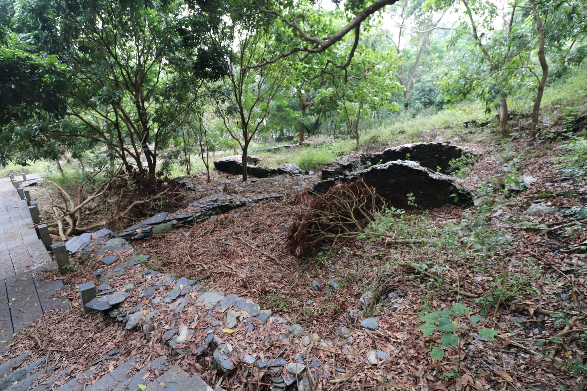
There are over 50 former stone houses here. All of them once had roofs. Even with a full roof, it doesn’t seem that the houses were very high.
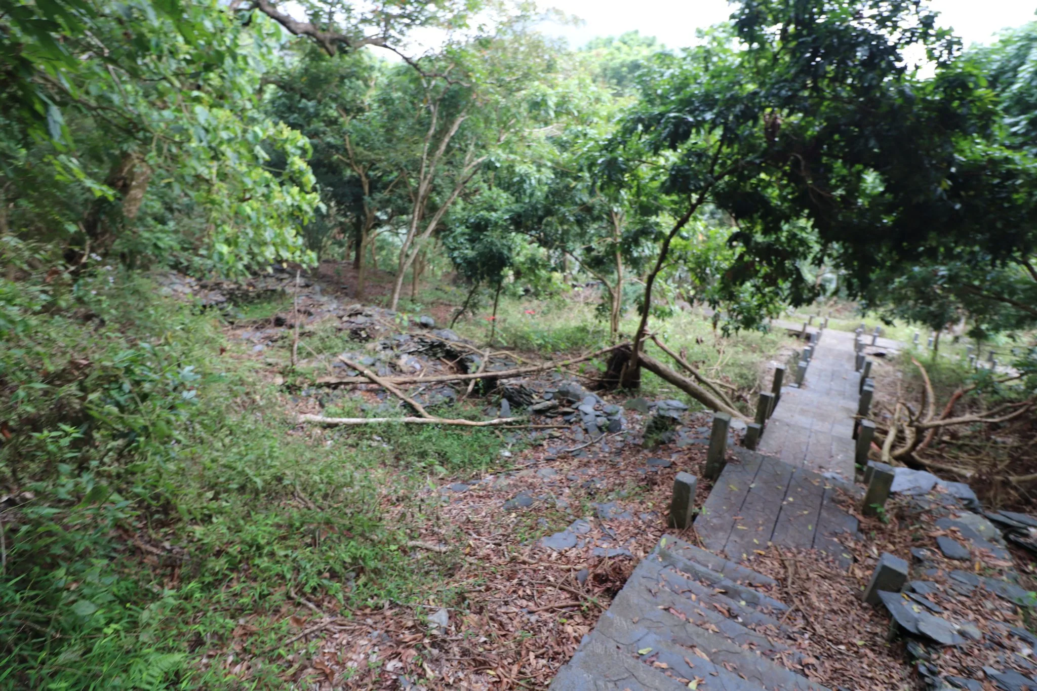
There are endless stories this village could tell. I imagine only a few people who once lived here are still alive and are pushing 100 years old.
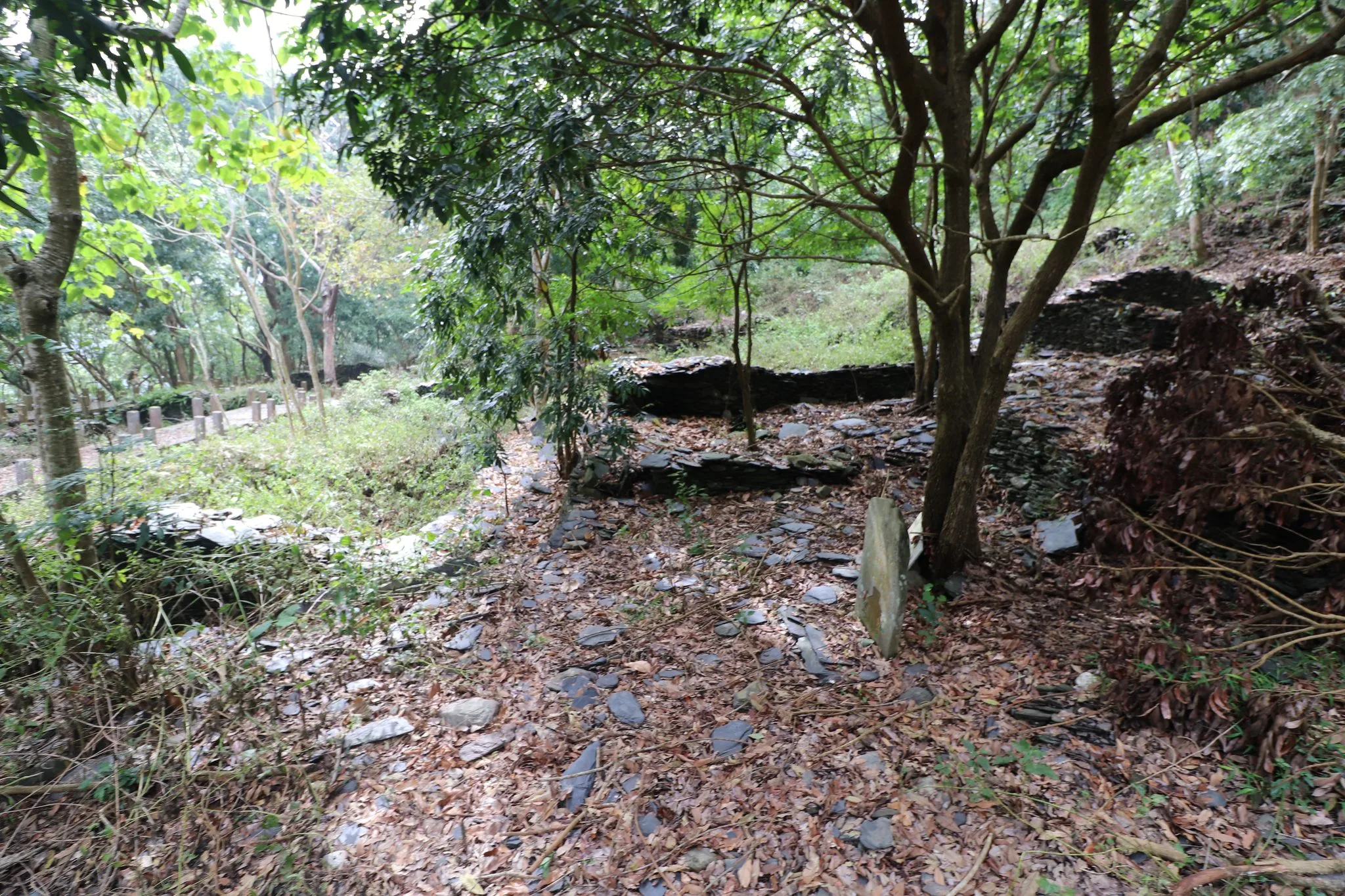
The remains of an old stone house with stones scattered around the ground.
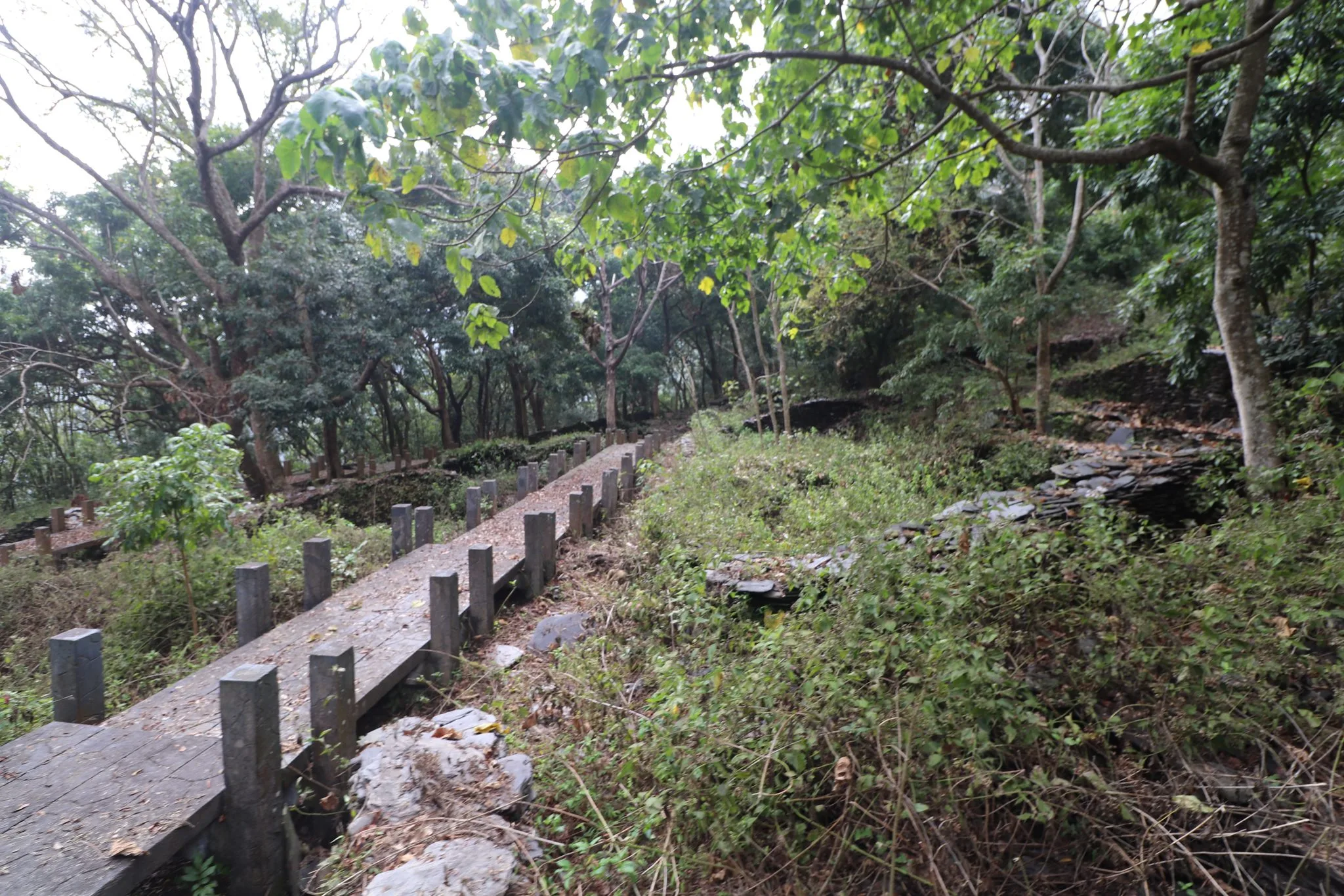
Before Typhoon Marokot, this area would have been much more easily accessible, and you would see a lot more regular tourists.
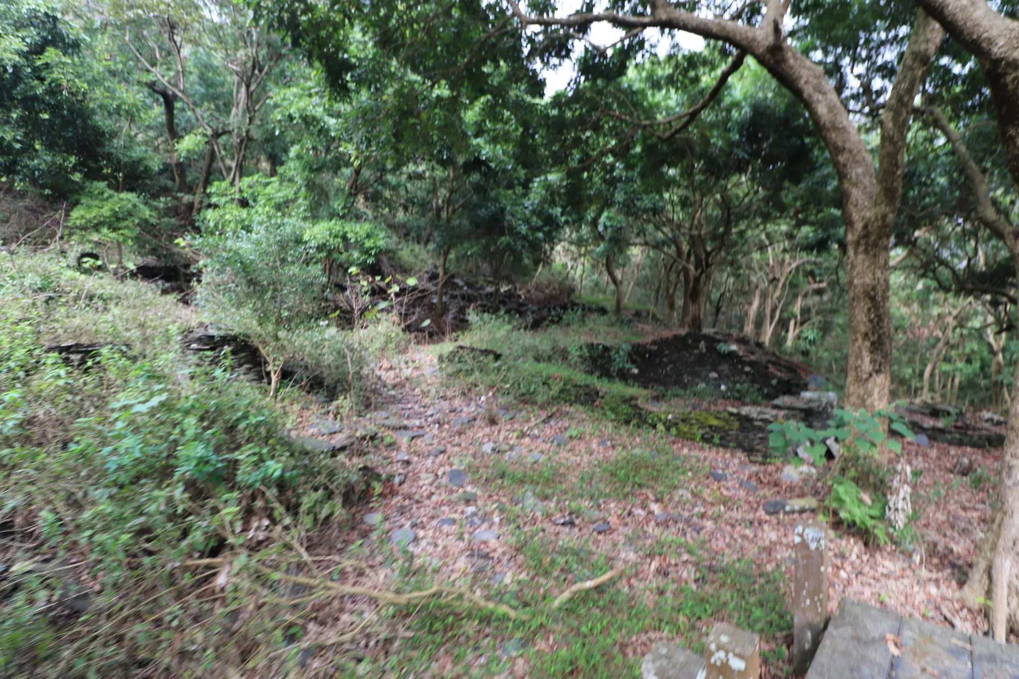
Also this entire mountainside used to be barren, but in the past 100 years the forest has grown back.
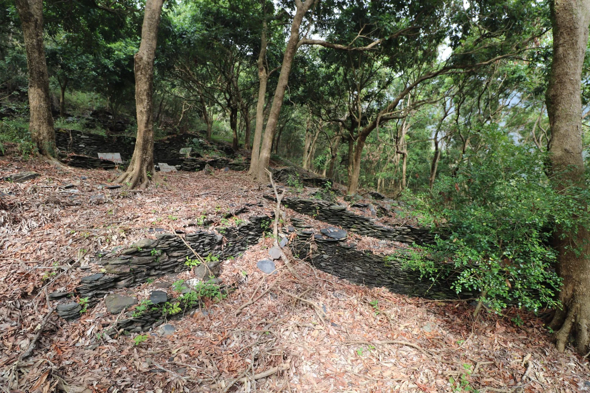
You can see that many of the houses were dug into the ground.
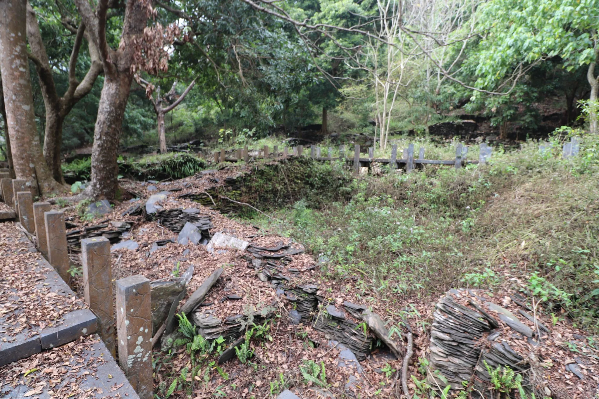
Some of the houses have little markers where family members have left a small shrine.
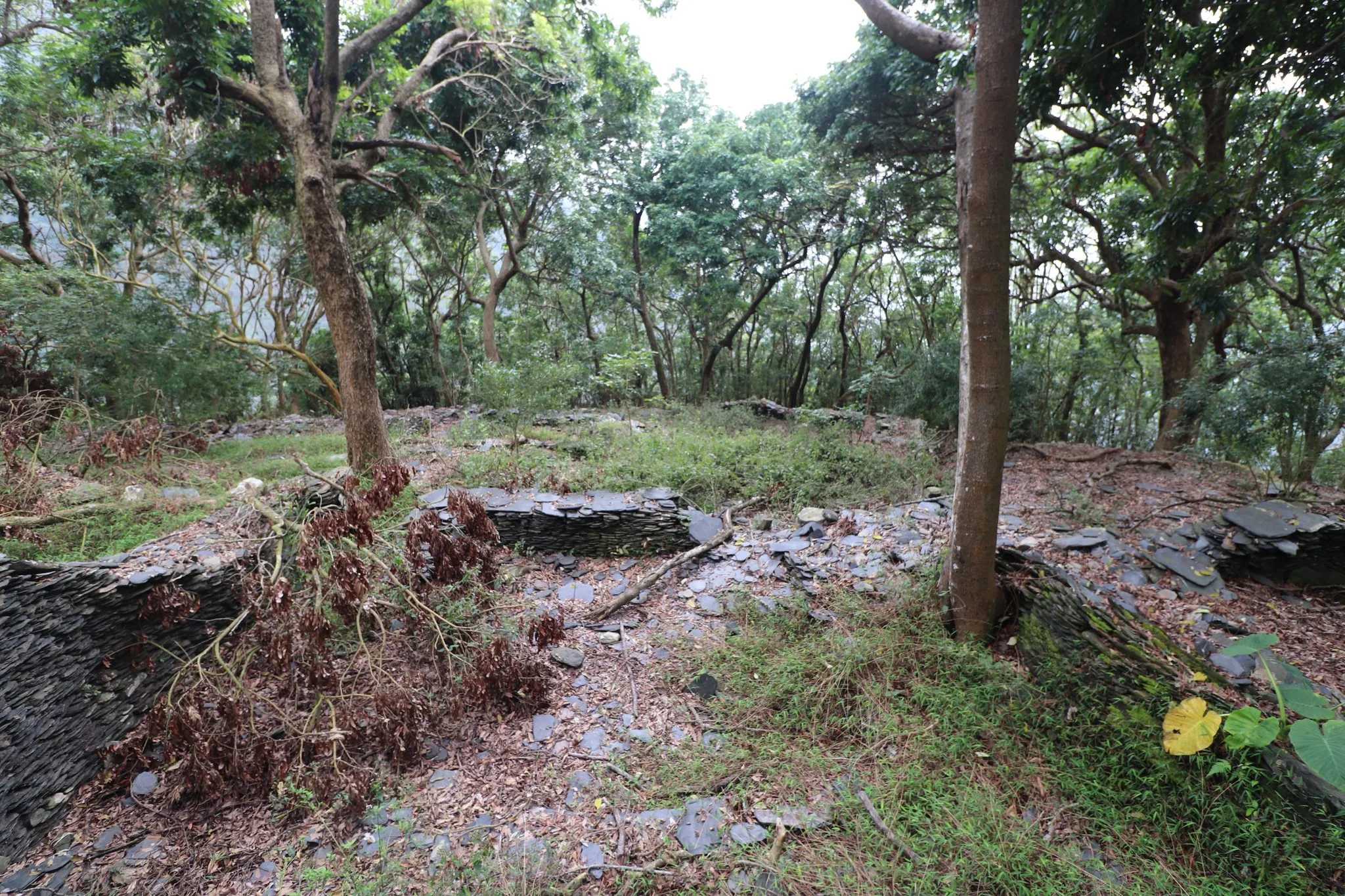
I imagine it is the family members of the tribe that come here and cut the grass around the village.
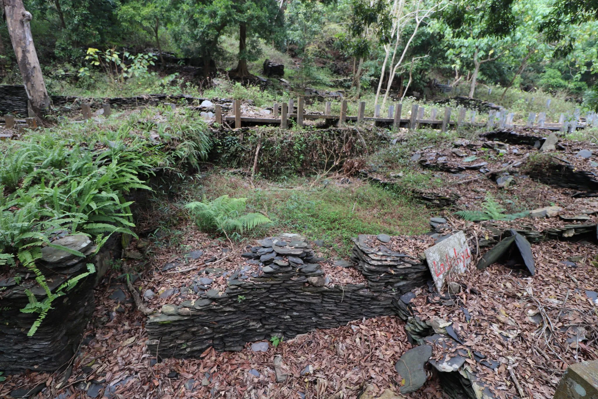
Some houses have the names of the family that once lived there on a plaque in red.
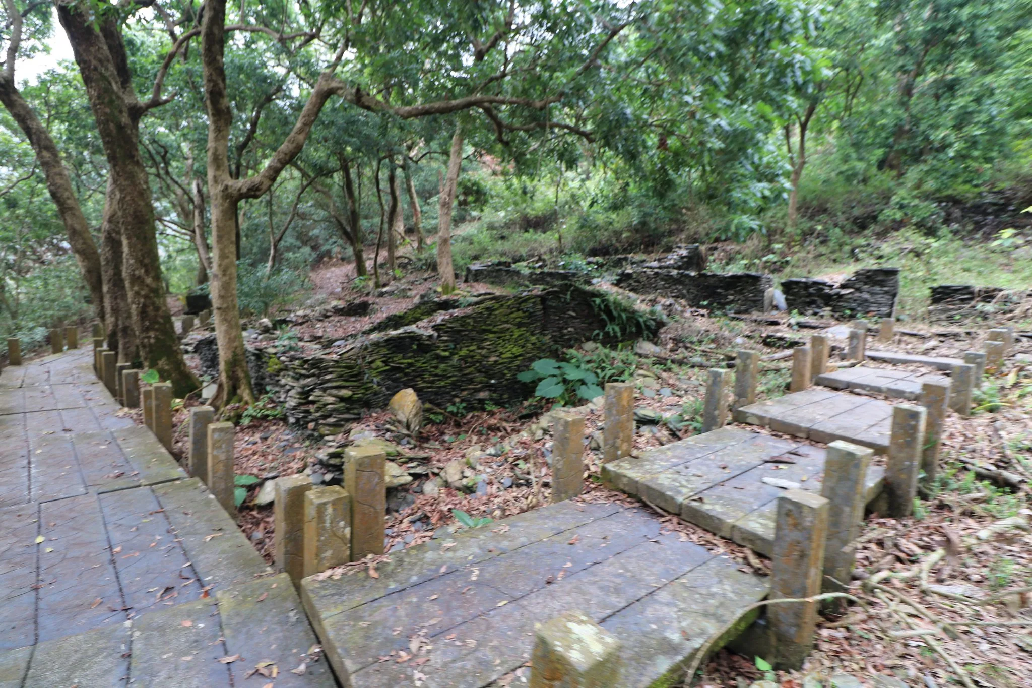
One of the better preserved stone houses.

A nicely preserved stone wall.
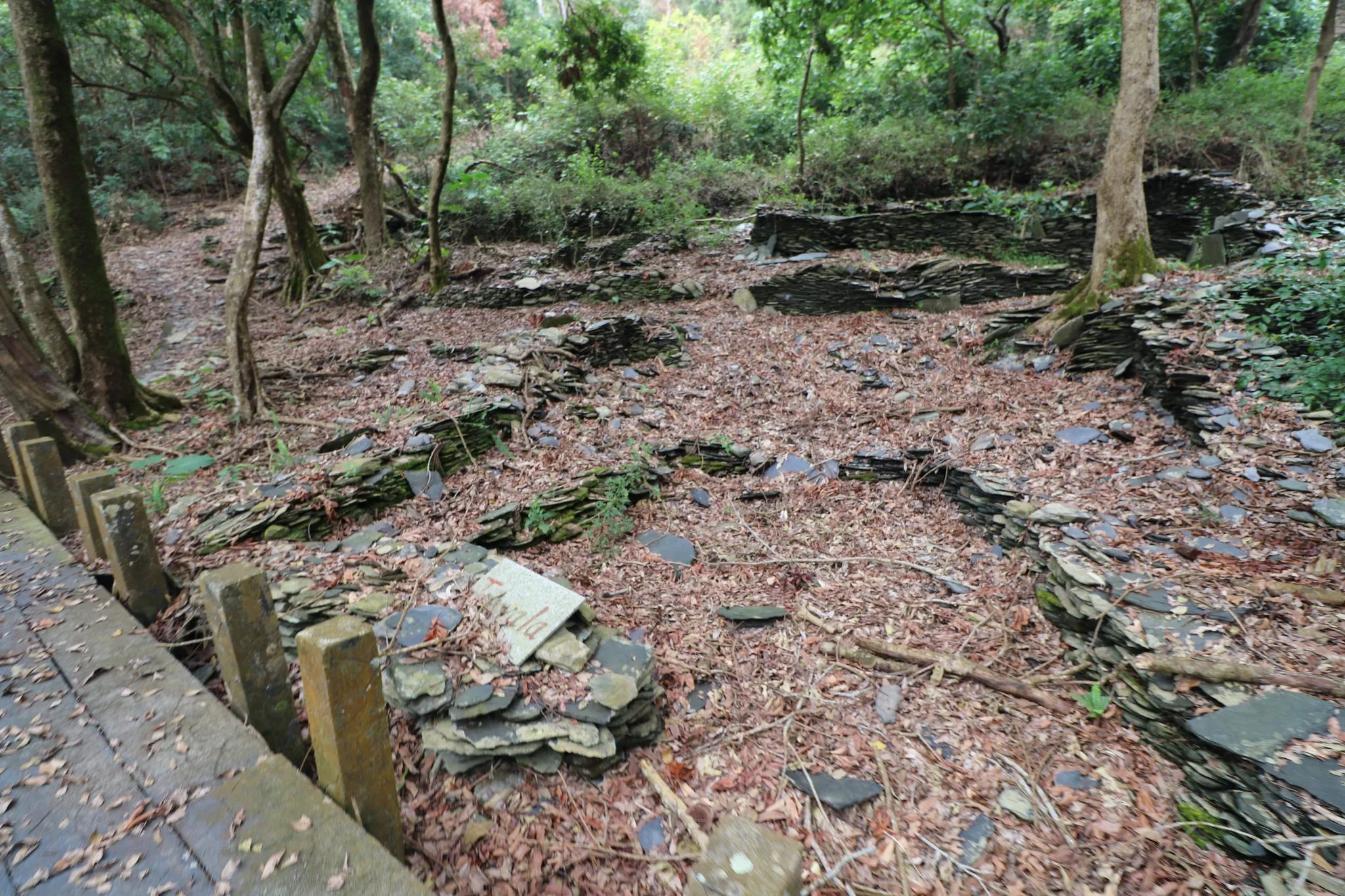
Another abandoned house.
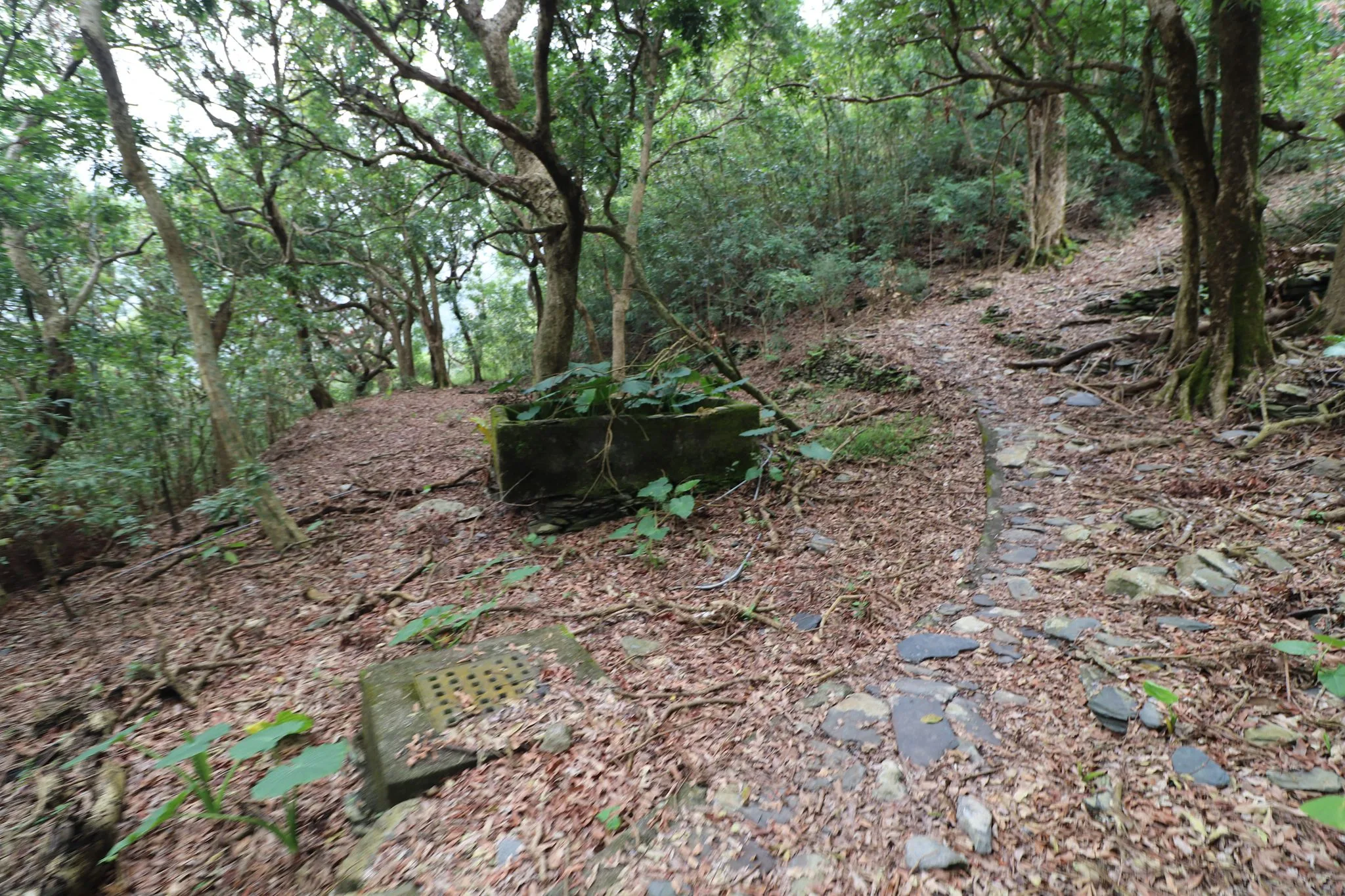
This is the old water tank, and there is also a runoff area.
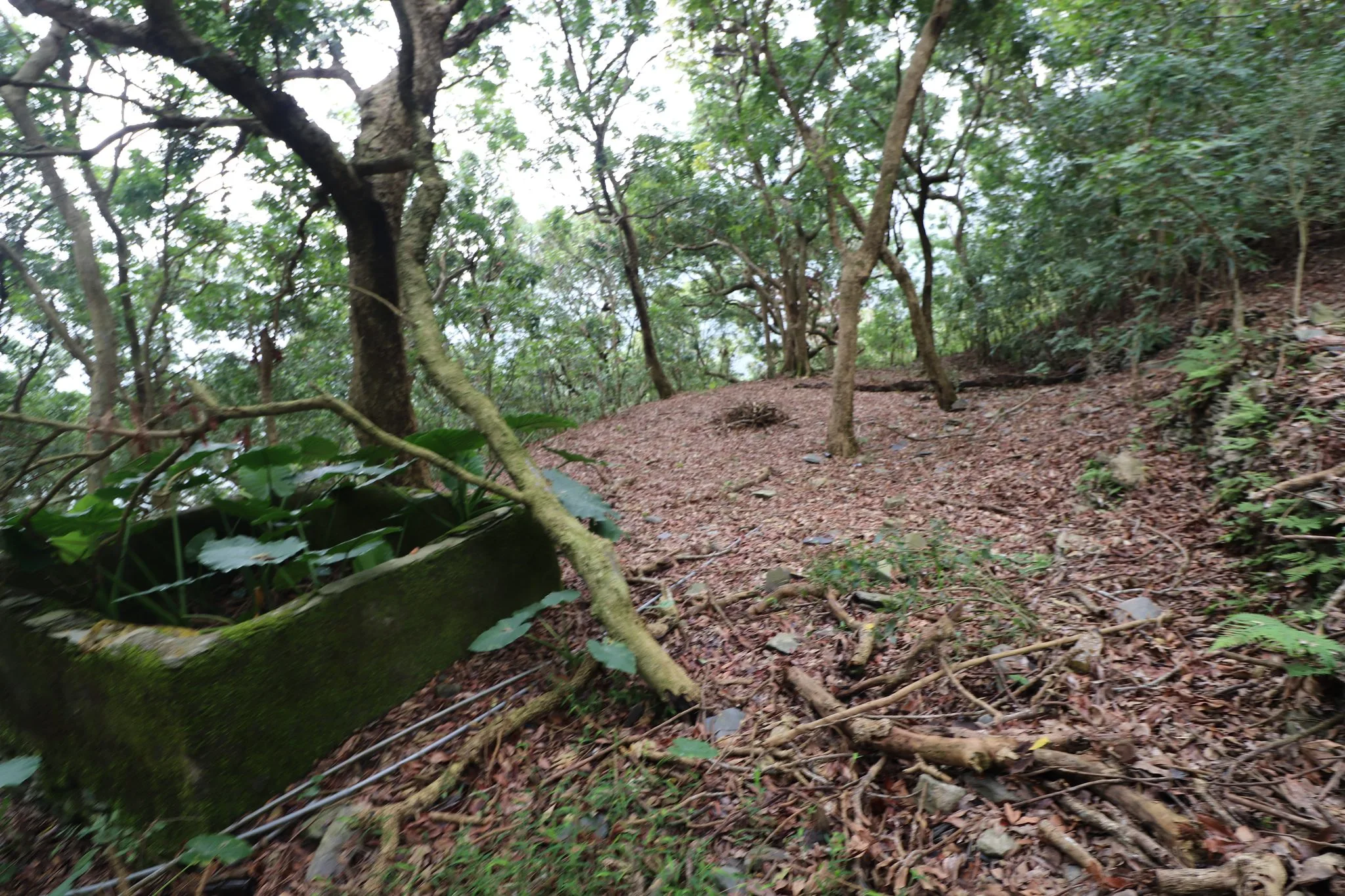
Another view of the area.
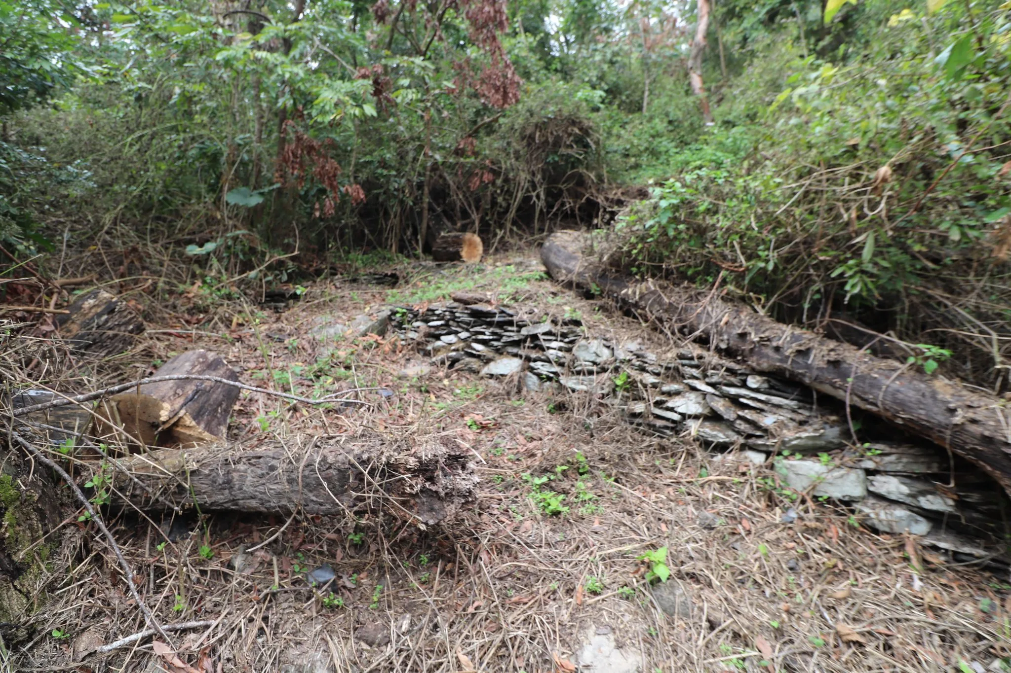
It looks like some trees fell here but were later sawed down.
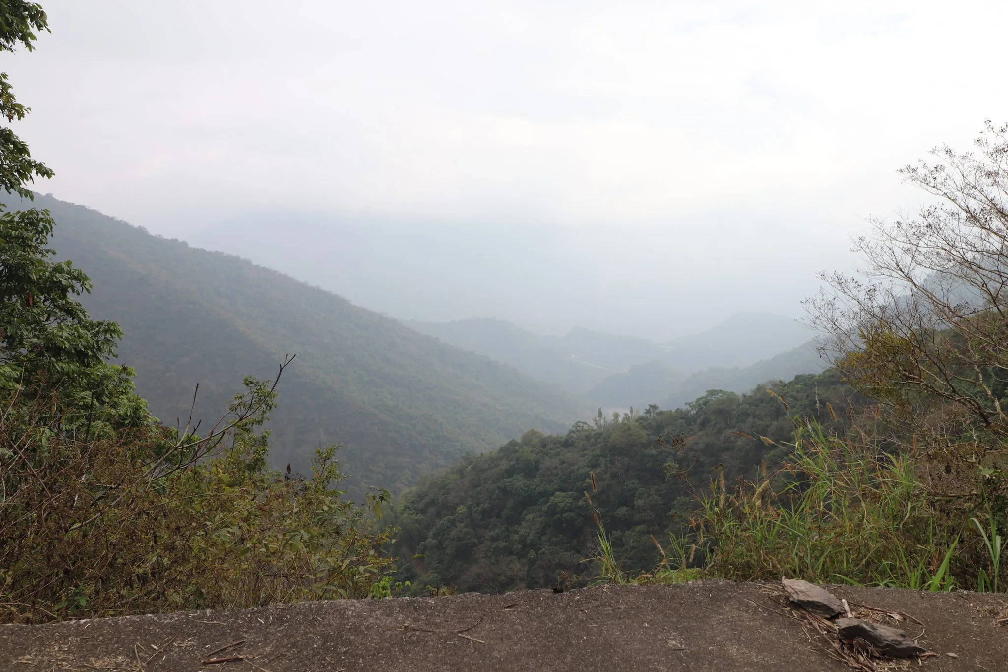
View of the area from the top of the road.
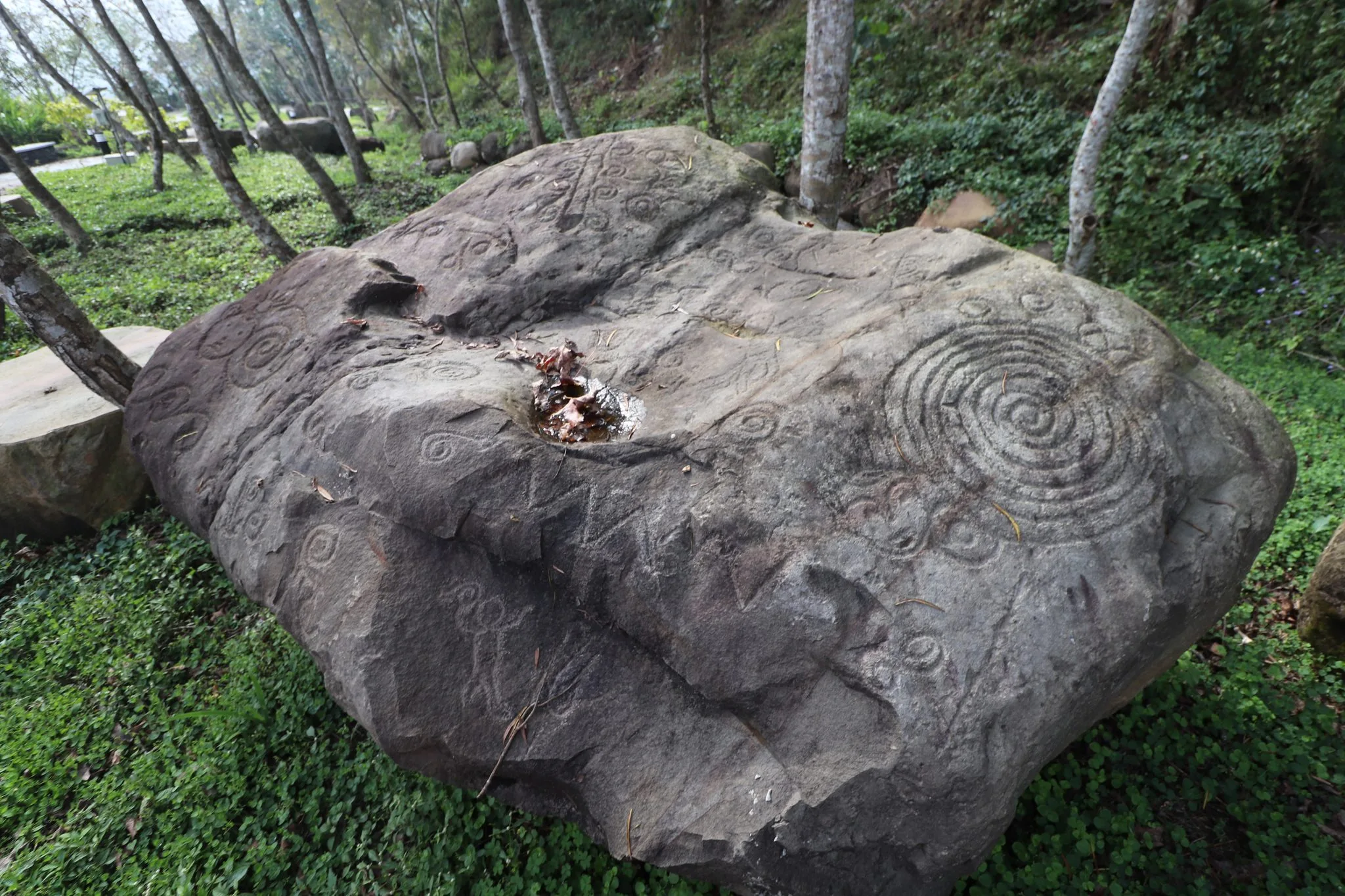
If you have time, go check out the Wanshan Carving replicas that are just above Wanshan Village. You can enjoy the carvings here without having to hike three days into the jungle.
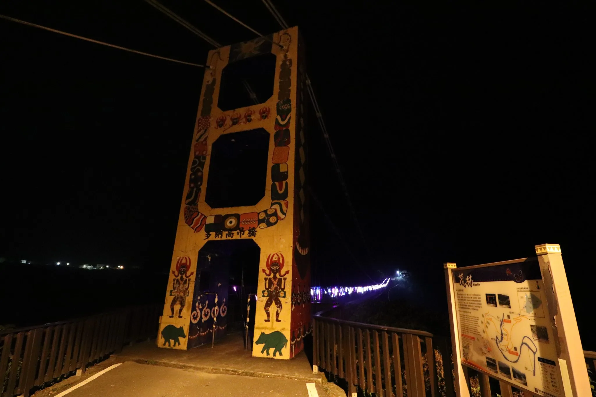
Also be sure to check out Duona Suspension Bridge during the day or night.
Also, be sure to check out our full guide to Maolin here.
You can check out our full travel guide to Kaohsiung here.
You can also check out our full travel guide to Taiwan here.