
Aowanda (aka Aowanda National Forest Recreation Area) was an ancient hunting ground for the Atayal Tribe and was an area for Japanese hydroelectric power development. Now it has been converted into a nature preserve with an easy hiking trail for the public to enjoy, and is now famous for its maple trees and cherry blossoms. You should definitely check out this high-mountain gem if you are in the area.
🛥️ Planning your trip to Nantou? ⛰️
Here are some top travel tips for you:
- Best time to visit: Winter or Autumn when you can see maple leaves and cherry blossoms
- How to get there: Taiwan Railway and Inter-City Bus
- Best place to stay: Kirin Villa or Jenq Yang Hotspring Hotel
- Book an entrance ticket for a discount and tours and activities in Nantou on Klook
- Stay connected with a local SIM
- Rent a car to explore distant sights
Background:
Aowanda National Forest Recreation Area, located in Qinai Village, Ren’ai Township, Nantou County, opened to the public in 1994 and is one of Taiwan’s most famous maple-viewing spots, known as the “Hometown of Maples.” Covering 2,787 hectares at elevations between 1,100 and 2,600 meters, the park sits on river terraces along the north bank of the Wanda River, surrounded by mountains and deep gorges. Within the area lies the Wanda Power Plant’s oval-shaped regulating pond, a 1.42-hectare artificial lake built in 1959 by Taipower as Taiwan’s earliest prototype of pumped-storage hydroelectricity. Though it no longer functions for power regulation, the site now serves as an educational feature managed by the Aowanda Nature Education Center, which was established in 2008 and certified by the Environmental Protection Administration in 2012 to promote environmental learning and share Taiwan’s early hydroelectric history.
Price:
Scenic Area Entrance: 200 NT
Parking: Around 100 NT per day for cars
You can book entrance tickets for a discount on Klook here or KKday here.
Hours:
8 AM to 5 PM
Trail Difficulty:
Easy. Also, much of the path is wheelchair friendly, but there is an incline.
The lowest part of the trail is 1220 meters, and the highest part is 1320 meters. So only 100 meters of gain, but 200 meters for the round trip.
Duration:
The entire trail is 4.7 KM round trip and takes about 2.5 hours to complete.
We took 3.5 hours to complete the round-trip trail, and we stopped and rested a lot.
Cherry Blossom Season:
Cherry Blossoms can be seen in the park from February to late March. Check out our full guide to Cherry Blossom Season in Taiwan here.
Maple Leaf Season
The maple leaf season is roughly from September to December.
Firefly Season
Firefly season is roughly from May to June. Check out our Taiwan firefly spotting guide here.
How to get around Nantou:
As always, we recommend renting a scooter as the best way to see Taiwan. However, you can also get a great deal of Nantou by taking the train to Taichung and then switching to an inter-city bus, or local bus. Getting around in a car is also a convenient option, as there is plenty of parking pretty much everywhere in this less crowded county.
Scooter Rental: Looking for scooter rental in Nantou? Search Klook here or KKday here to search for options. You can also check out our scooter rental guide here.
Car Rental: If you are looking for car rentals, you can also search Qeeq here, Klook here, KKday here. You can also check out our car rental guide here.
By Bus: You can book tickets to travel to Nantou via inter-city bus on Klook here.
By Train: You can book tickets to Taichung via high speed rail (HSR) on Klook here or KKDay here, or book tickets via the normal train (TRA) on Klook here, then switch to a bus to Nantou.
Bicycle Rental: Cycling is the best way to enjoy Taiwan’s landscapes if you have the time and energy. Looking for bicycle rentals in Taiwan? You can search on KKday here and search for tours on Klook here. You can also check out our Taiwan cycling guide here.
Tours:
You can find more tours of Aowanda on Klook here or KKday here.
There are many tours and activities available in Nantou such as river Tracing, paragliding, Shanlinxi Forest Recreation Area 杉林溪, Cona’s Chocolate Castle, Shuiyuan Suspension Bridge, JOJOZOO Park, and Aowanda Forest Recreation Area.
You can find more tours of Nantou on Klook here or KKday here.
Where to Stay:
You can book camp sites or cabins at Aowanda using their website here, but they are not the cheapest.
We have stayed at and recommend Jenq Yang Hotspring Hotel (you can book on Agoda here, Booking.com here, Trip.com here, or Klook here), a hot spring hotel near the mystical Lushan hot spring, and Maple Leaf Holiday Villa (you can book on Agoda here, Booking.com here, Trip.com here, or Klook here), a lodge with a great view and within walking distance of Cingjing Farm. I also have stayed at and recommend Kirin Villa (you can book on Agoda here), a mountain resort in Puli near Sun Moon Lake.
Looking for a hotel? Find out where to stay in our Taiwan hotels guide or search for the best hotel deals in Taiwan here. We recommend booking through Agoda here, which provides the best quality accommodation on the islands.
Map:
Check out the map above.
Drone Video
360 Degree Panoramas
Check out the 360 degree aerial panroamas below to get an overview of the area.
Aerial view from the peak above Aowanda Suspension Bridge 奧萬大吊橋 for your viewing pleasure. You can see Nenggao Peak and…
Posted by Foreigners in Taiwan 外國人在台灣 on Sunday, August 24, 2025
Aerial view from the Aowanda 奧萬大 visitor center. Aowanda is an ancient hunting ground for the Atayal Tribe and was an…
Posted by Foreigners in Taiwan 外國人在台灣 on Sunday, August 24, 2025
Aerial view from the former waterfall trail at Aowanda 奧萬大 which has been swept away by a recent Typhoon. The trail will…
Posted by Foreigners in Taiwan 外國人在台灣 on Sunday, August 24, 2025
Our Journey:
I have been to Aowanda once, and I was very impressed. It is a family-friendly park with easy hiking trails that put you close to nature, in one of Taiwan’s rare, easily accessible high-mountain ecosystems. You can explore the entire park in just one day, walking slowly. We did it with a five-year-old and made great time. It is definitely a fun day trip, or an overnight trip if you want to stay at the guest house or camp here.

Driving from Puli, we drove along the Wushe Reservoir, also known as Wanda Reservoir or Bihu, which is formed by the Wushe Dam along the Wushe Creek in Ren’ai Township of Nantou County. The main function of the reservoir is to provide hydroelectric power. The area is a beautiful, scenic location that is well worth a visit. Check out our full blog on Wushe Reservoir here.

This was our view coming up the road from Wushe Reservior. There are some amazing views here that are worth stopping for.

Some more great views along the way.
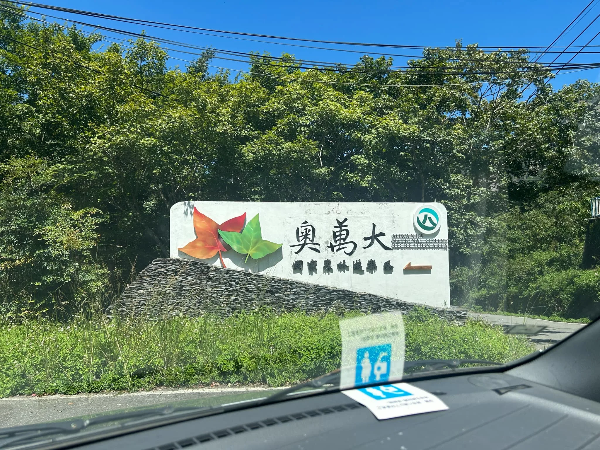
Entrance sign for Aowanda.

First view looking up toward Aowanda.

This is a view of the ridgeline near Nengaoshan and nearby peaks. There was great visibility when we visited.

Another view of the ridgeline near Nengaoshan.

In think this is Nenggaoshan South Peak. The trail from Aowanda eventually connects up with the Nenggaoshan ridgeline trail, but it requires a permit and application in advance.

Closer view of Aowanda.

Near the entrance to Aowanda, there are many tea plantations and mountain farms.

A bridge nearby.

Close-up view of Ren’ai Township on the way up to Qingjing Farm.
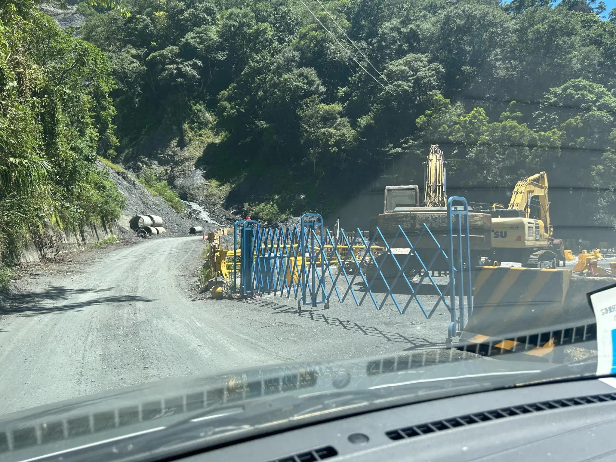
There had been some heavy rain in the months preceding our trip to Aowanda, and crews were still cleaning up some landslide debris along the way and repairing a bridge.

View looking up at the landslide that used to be the Aowanda Double Falls trail, which is now closed. One worker told me he doubted that the trail would ever reopen because the trail was built on former landslides that had built up over time.

11:20 AM: We finally made it to the entrance, where we paid the entrance fee.
Scenic Area Entrance: 200 NT
Parking: Around 100 NT per day for cars
You can book entrance tickets for a discount on Klook here or KKday here.

Another washed-out creek.
Aowanda Double Falls 奧萬大雙瀑

Even though the Aowanda double falls trail is currently closed, here is a view of the double falls via drone. It would look even better from the ground.

On the way to the parking lot, you can also see the retention basin, which was built to conserve electric power, and may or may not be operational now.

Map of Aowanda. You can see it consists of some looping trails that follow up a river to the Aowanda Suspension Bridge which is pretty much the end of the trail.

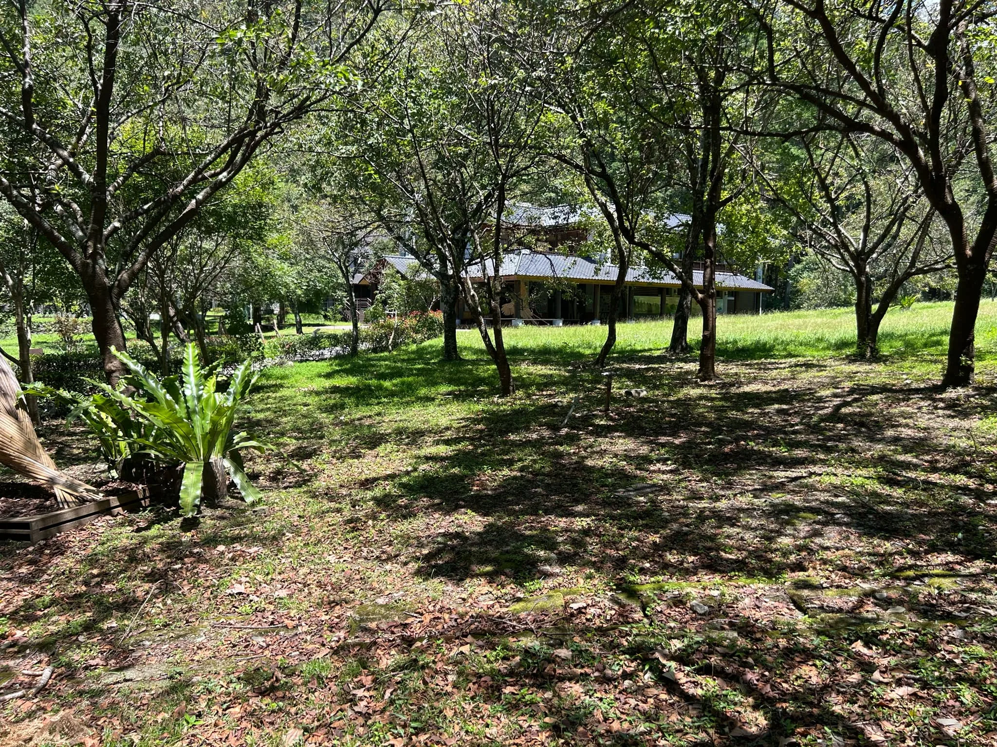
11:25 AM: We make it to Aowanda Visitor’s Center and parking lot.

Large grassy area to the side.

Close-up on the visitor’s center.

View from inside the visitor’s center courtyard.

Nearby are cabins that you can book on their website here, but they are not the cheapest.

Another map of the area and sites you can see here. Also, a nice elevation chart of the trail.

Close-up on the elevation chart. There are some ups and downs along the way, but nothing too hard. The lowest part of the trail is 1220 meters, and the highest part is 1320 meters. So only 100 meters of gain.
The entire trail is 4.7 KM round trip and takes about 2.5 hours to complete.

Inside, we saw some nice images of the different flora in the park.

You can see different colors and blooms depending on the season.

12:30: After having lunch at the visitor center, we move on with the hike. Here is the guesthouse and cafeteria.

View further up the road.

There is also a nice little pond here with a wooden bridge.

Lily pond.

Some dragonflies on grass.
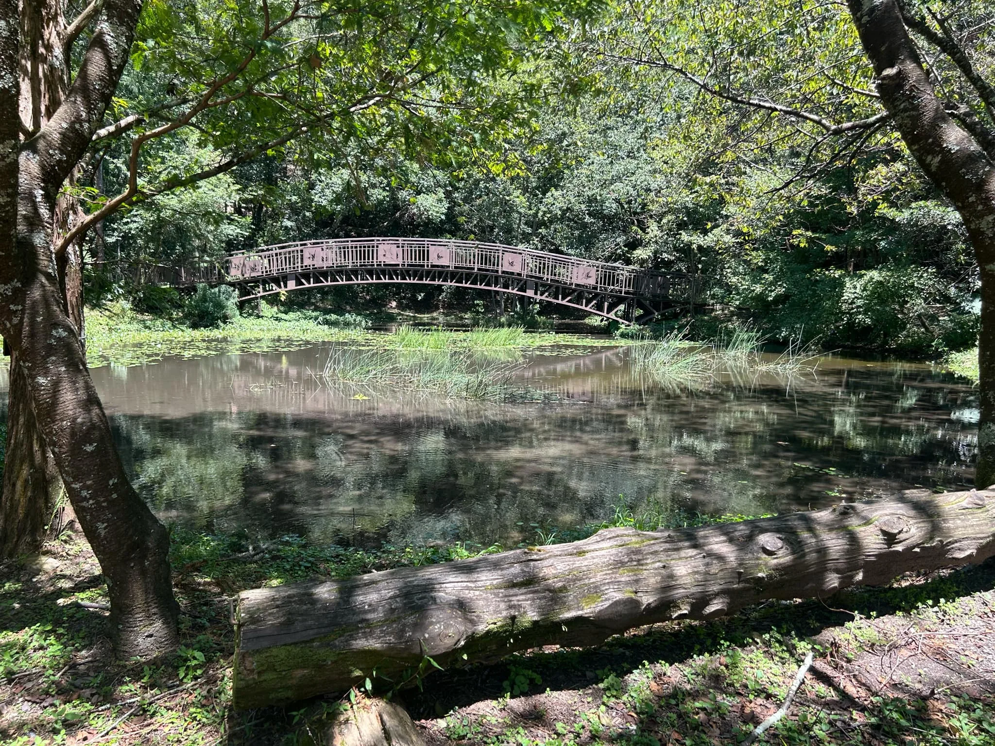
There is also a log here to rest on.

On the main flat area where the visitor’s center is, there is a wheelchair-friendly walkway where you can see cherry blossoms from roughly February to April.

View of the grassy plateau via drone.

View of the Qingshui Bridge, which was covered in a landslide during a recent Typhoon.

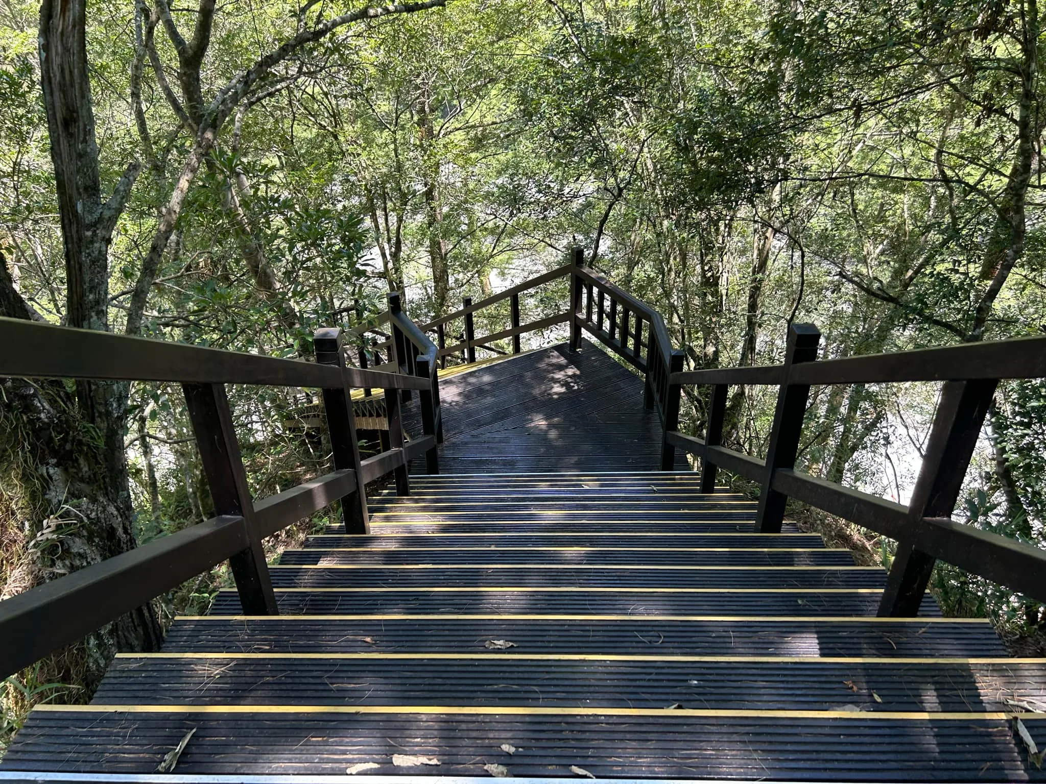
12:45: From the top of the plateau, the trail brings you to this wooden stairway. There is another way to get down via road to the south that does not require stairs, but it takes longer.

Viewing platform for birders.

View of the walk down. This is the steepest part of the trail, and goes down about 100 meters or 300 feet.
Another view on the way down.

From here, you can see Qingshui Bridge.

Concrete dam below.

Another view of the Qingshui Bridge.

The wooden trail here is on very high stilts.
Qingshui Bridge 清水橋

12:55: Wide view of the Qingshui Bridge. Not long ago, debris used to cover this bridge. They have only recently cleared the rubble and debris from the bridge, so it is now passable.

View upriver from the bridge.

View downriver from the bridge.

Another view looking upriver.

Now we are on the main trail again, looking back at the Qingshui Bridge.

View of the raging river below.

1:10 PM: Here is where the wheelchair friendly path ends. From here on out, there are unavoidable steps.

Closer view of the first steps.

View of the main path.

1:17 PM: Here we come to a junction. The forest here was recently damaged by wind from a Typhoon.

Wider view of the forest here.
Bird Viewing Platform 賞鳥平臺

1:20 PM: We finally made it to the bird viewing platform and stopped and took a rest.

View of the riverbed below.

Here, you can kind of see a maple forest that was buried by a landslide.

Closer view of the maple forest.

Some animals you might be able to see here.
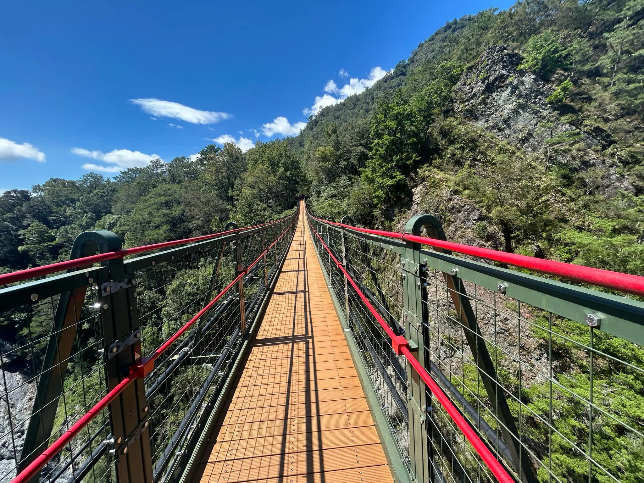
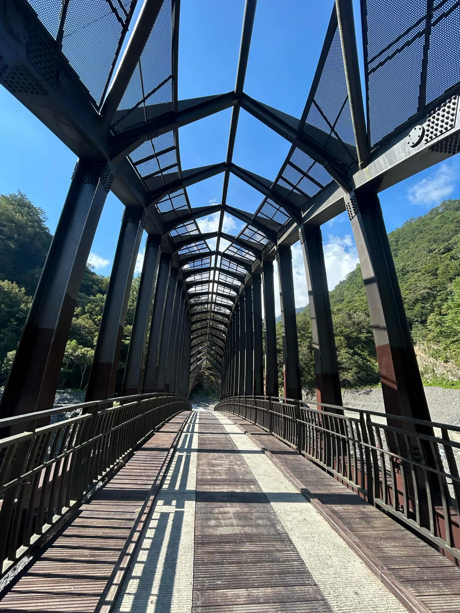
Aowanda Suspension Bridge 奧萬大吊橋

Aerial view from the Aowanda Suspension Bridge 奧萬大吊橋. The original bridge was built in 1994 by was washed out in 2006. The current bridge was built in 2008.

I flew my drone high above to get a better look.

View looking toward the south end of the Nenggaoshan Ridge.

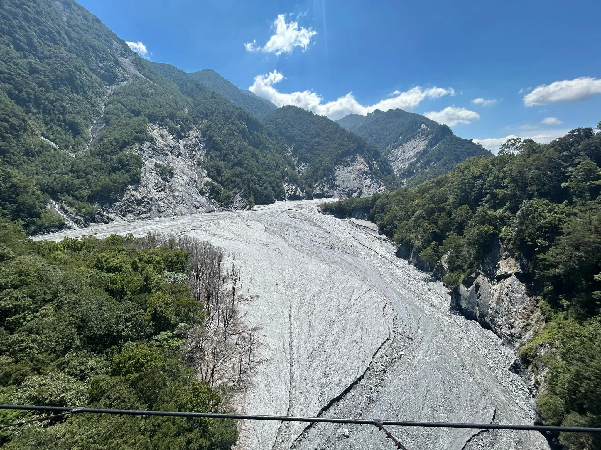
Behind Aowanda Suspension Bridge is a massive landslide that likely contributed to the huge amount of debris in the riverbed.

Aerial view of the Nenggaoshan Ridge, the backbone of Taiwan. It looks so close from here!

Another view looking toward the Aowanda Suspension Bridge.

Looking downstream at Aowanda with the full park in view. Amazing view.

2:00 PM: Onward we move toward the Pine Tree Zone.

Just so you know, there is a bathroom right behind the bird viewing platform here.

View of the Aowanda Suspension Bridge with the Nenggaoshan Ridge in the background. Now I am back to using my telephoto lens.

More stairs going up to the suspension bridge.

There is a bit of a slope going from the bird-watching platform.

Another view of the forest in front of the suspension bridge.

The original bridge that connected the Wanda North River to the maple forest area in Aowanda National Forest Recreational Area was unfortunately destroyed on August 22, 2007 when Typhoon Sepat ravaged Taiwan. In order to better serve visitors and maintain the scenery of pine-maple forests, the administration constructed the 180-meter long and 90-meter deep Aowanda Suspension Bridge, at a cost over NT$ 14 million to build. The suspension bridge was completed and inaugurated on July 4, 2009.
Due to safety considerations, no more than 110 visitors may cross the suspension bridge at a time. Thank you for your cooperation.

2:10 PM: View of the new suspension bridge built in 2009.

Here you can clearly see a maple forest that was buried and killed by a landslide near the riverbed. Those maple trees were originally planted for the park.

View of the Suspension Bridge and Nenggaoshan in the background.

View from the top of the bridge via drone.

2:11 PM: Horizontal view of the bridge with no one on it.

Blue copper stains from rocks nearby.

Closuep on Nengaoshan.

Wider view of Nengaoshan.

View of the raging riverbed below.

Slate rock that has been pushed up from the bottom of the ocean.

Another landslide valley on the other side of the riverbed.

Alluvial fan at the bottom of the valley.

Another view of Nenggao Ridge.

Some landslides below the ridgeline.

Dead maple trees from a former forest.

Wider view of the dead maple trees. They originally planted trees along the entire riverbed, many of which have since died due to landfalls and the riverbed filling up with too much debris.

View further upriver.

View of the suspension bridge from the other side.
View looking downriver from the suspension bridge.

View upriver.
View from the middle of the bridge.

View of the bridge with people on it walking toward the pine forest.
Pine Tree Zone 松林區

2:17 PM: First view of the natural pine forest on the other side of the bridge. Pine forests in Taiwan are not very common, but you can find them in rocky parts of the high mountains. They are the pioneers of the forest and can grow in harsh conditions that other trees cannot.

There is a circular trail that goes around the pine forest here.

Wider view of the pine forest.

Taiwan white pine. It’s an evergreen conifer species endemic to Taiwan, found mainly in mid- to high-elevation mountain areas. The tree is known for its tall, straight trunk and soft, long needles, and it’s often used for landscaping and reforestation.

Another view of the white pine forest.

This is a Paris Peacock 琉璃翠鳳蝶 (liú lí cuì fèng dié) Papilio paris nakaharai. Check out our Taiwan butterfly guide here.

View looking downriver from the pine forest.

Pine forest and viewing platform.

Another view of the pine forest.

And this is the end of the trail.

From here, you can climb up to Nenggaoshan if you have a permit.
Nenggao Andongjun Route (能高安東軍縱走)
A topographic map shows the entire route, including:
- Landmarks, campsites, and water sources (marked with icons).
- Elevation chart at the bottom, showing ascent and descent over ~34 km.
- Trail sign explanation (“How to Read Trail Signs”):
- Every 100 m a trail sign is placed.
- Example: CM320 means:
- “C” = Central Mountain Range trail
- “M” = main route
- “320” = distance marker (32.0 km)
- Warnings about steep or dangerous areas.
- Orange lines indicate side routes.
Trail Information:
- Total distance: about 34 km.
- Starts at Guangbaipai Monument (“Spread Light Across the Land”) (marker 157)
and ends at Aowanda Andongjun Intersection (marker 362). - Route passes through mountain ridges with steep and changing terrain.
- Trail signs with distance numbers appear every 100 m.
- Always check that the next sign number is correct to avoid getting lost.
Safety Tips:
- The altitude difference is significant (157 to 362), so watch for altitude sickness.
- Be cautious in bad weather and avoid unmarked side paths.
- Bring enough food, water, warm clothes, and a first aid kit.
- Boil or purify stream water before drinking.
- Camp only at designated sites.
- Carry out all waste. Toiletries, wet wipes, and tampons should be packed out.
If You Get Lost:
- Stay calm and stop walking.
- Mark your position and do not go off trail.
- Use your cell phone (dial 112) to contact rescuers.
- Make visual signals like breaking tree branches, tying cloth, or using whistles.
- Elevation profile shows trail points such as:
- Guangbaipai Monument
- South Peak
- East Peak
- Andongjun Intersection
- Aowanda side trail
- Symbols show campsites and water sources along the way.
“This display and the trail signs are maintained by the Chinese Taipei Alpine Association.
Please contact us for any issues or suggestions: www.mountaineering.org.tw”
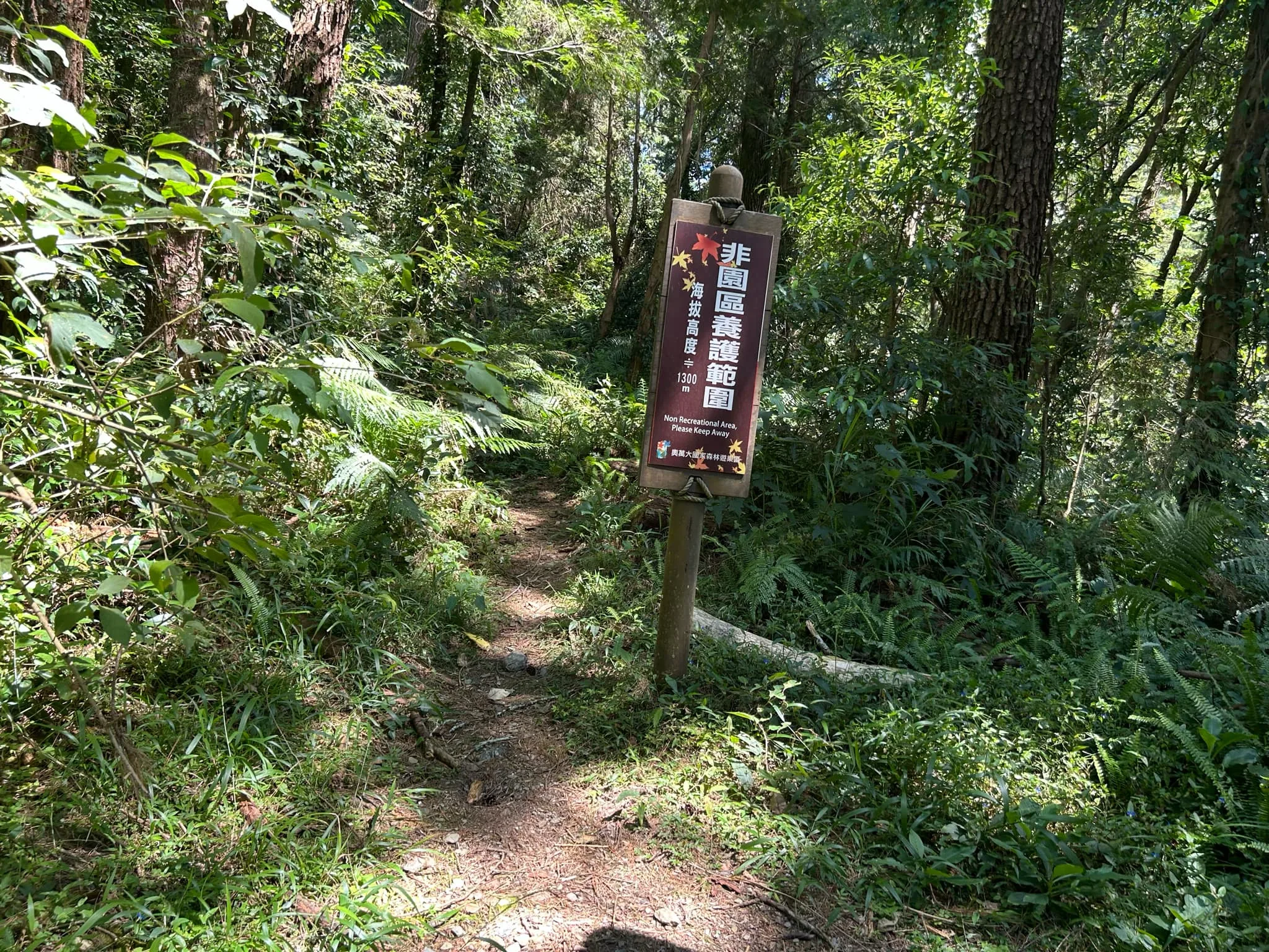
2:46 PM: This sign marks the end of the park. Passing this point is not permitted.
The Journey Back

2:47 PM: And this blog is still going. You thought it was over, but I’m still going to show you the photos on the journey back, and you are going to like it.
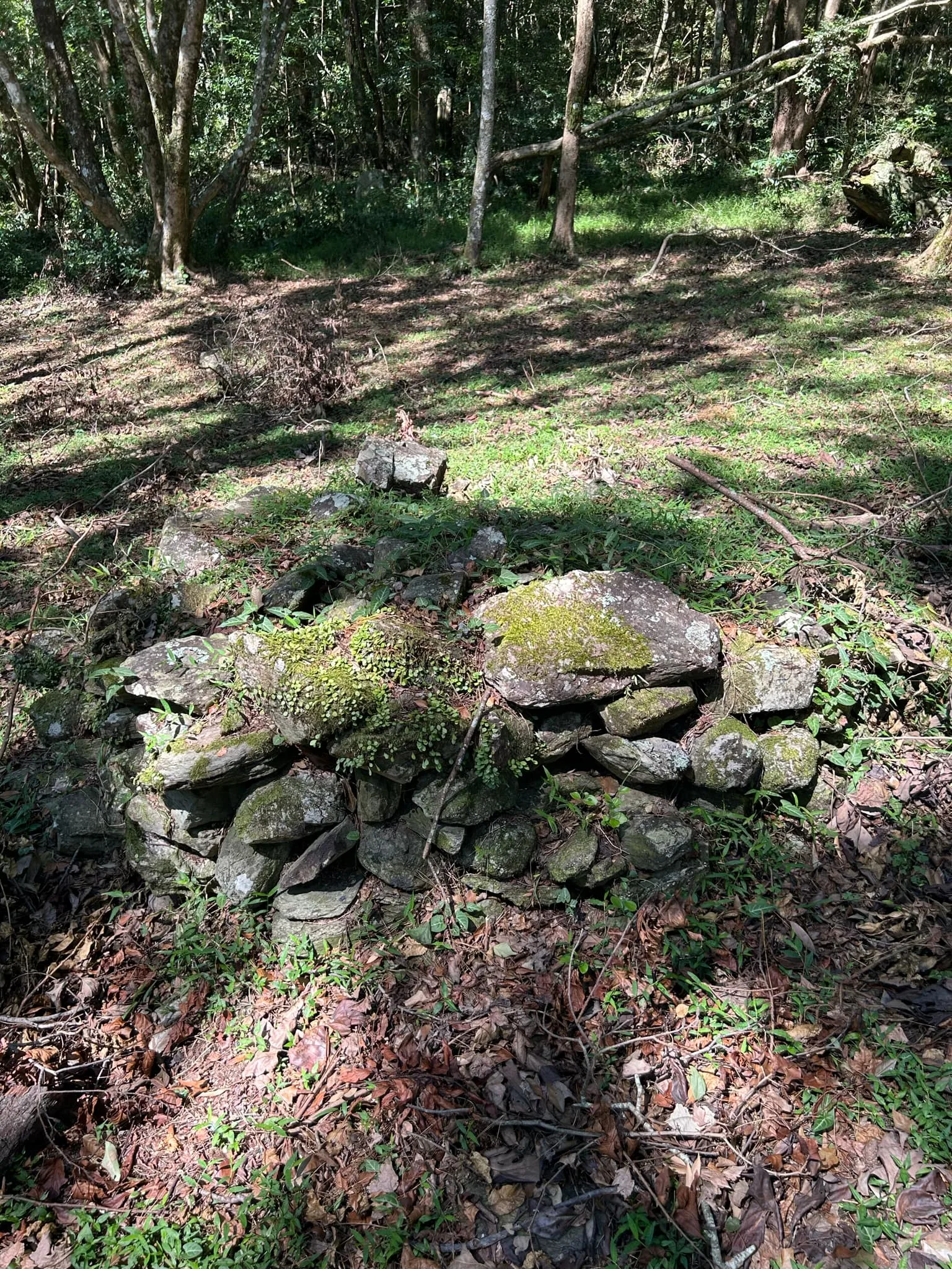
On the way back, I noticed this pile of stones. I think it may be something left over from an Atayal Village that once was perched on these slopes. We know it was an ancient hunting ground for the tribe. The Japanese forced tribal people down from the mountains all over the central mountain range. I beleive this flat bench above the river would have been a prime spot for an Atayal village.

Another pile of stones.
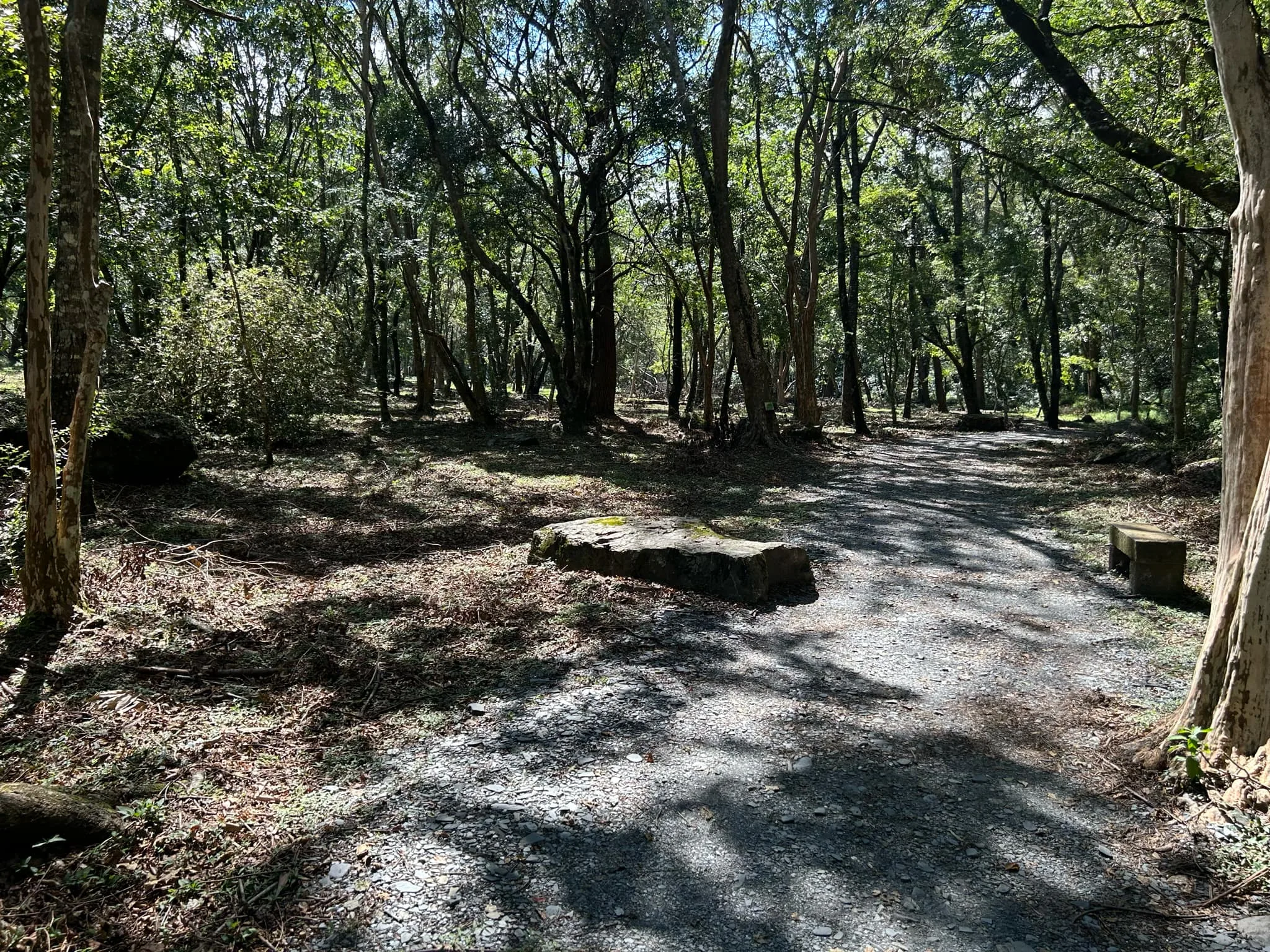
The path continues through the forest here.

Another view of the path here.

View of some kind of skipper.

Big stones in the forest are probably those that rolled down from the mountain.

Another view of the path through Aowanda.

Chinese Dart?

Another pile of rocks.

Lost in the woods.

Hand rail in the woods.

There is also a path that is blocked off, which used to go along the riverbed under some maple trees, but that trail has been washed out by fill from landslides.

3:01 PM: Back to the first set of steps.

Bamboo Treebrown 長紋黛眼蝶 (cháng wén dài yǎn dié) Zophoessa europa pavida

Staff Sergeant.

Cliff face in the woods.

Female staff Sergeant.

Male Staff Sergeant.

3:17 PM Qingshui Bridge Again. You can see a slight discoloration on the beams, which is from where the landslide once covered it!

To the right of this photo, you can also see where this trail once went but was washed away.

Those are some scary stairs.
Magu River Waterfall 瑪谷溪瀑布

The Magu River Waterfall was also once covered in rubble and was inaccessible in 2023. Now you can see it, but the whole trail is not complete.

Closeup on Magu River Waterfall.

View of Qingshui Bridge from Magu Waterfall.

Another type of butterfly that I have yet to identify.
View from the Qingshui Bridge. You can see where they painted over the damaged part.

Some people resting on the steps. But you do not have to climb up or down those steps to complete the trail. There is a road off to the left with a more gentle slope.

3:29 PM: We chose this walkway back because it was easier.

You can’t drive a car here, but it makes for an easier walk.

You can see here the road used to follow the riverbed out quite a ways, and a row of maple trees has died from too much riverbed debris.

Wider view of the old riverside maple trail.

Someone drove a truck out there for some reason.

Another view of the riverbed.

Fallen trees.

A backhoes digs.

A worker told me they were digging here to repair the water pipes that somehow feed into the Wanda Hydroelectric plant.

Electric cables to nowhere.

Interesting slate geology along the road.

More curvy slate rocks.
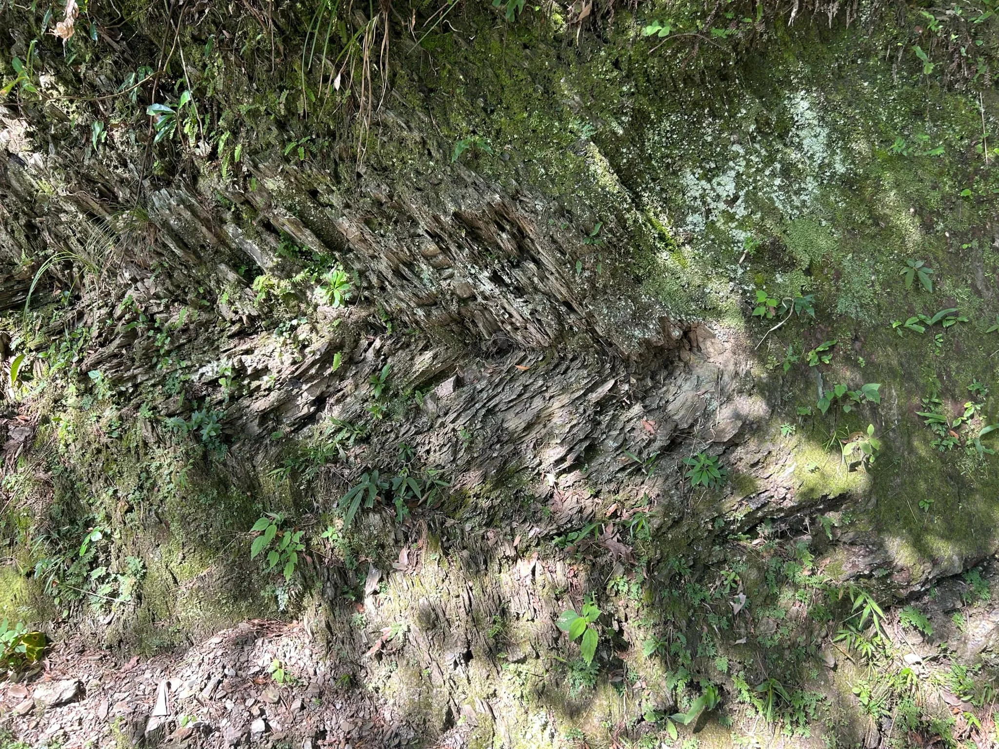
Zig-zag rocks.

Sadly, the fastest way to the parking lot was stairs, but fewer stairs than at Qingshui Bridge. We could have followed the road but it would have taken a long time to finish.

4:03 PM: We made it back to Aowanda Visitor’s Center. When we visited, there were only a few campsites available. I think they used to have more campsites that were destroyed in the landslide in 2023.

And we made it back to the Cherry Blossom Grove.
Aowanda Nature Center 奧萬大自然教育中心
Behind the cherry trees is the Aowanda Nature Center.

Giant wicket bird on display.

Here you can learn more about the ecology and history of Aowanda.

The geology of this area is primarily composed of slate, a fragile foliated rock formed through metamorphism. Slate debris washed down by river currents frequently gives the water a dark gray color. In addition, strong orogenic movement also created parallel banded folds, nearly vertical layers, or strata bowed up by tremendous pressure.
Ancient Wanda River bed remnants can be seen everywhere along the river terraces. The terraces often have a pebble layer, revealing the extreme fury of the orogenic movements and river-cutting forces in Taiwan. There are four layers of terraces in the recreation area. The Formosan Gum Forest Area is located on the first terrace; the Birdwatching Platform is on the second; the area between the Birdwatching Trail and Forest Classroom is on the third, and the Forest Park and Pine Forest areas are located on the last terrace.

The Aowanda National Forest Recreation Area is located southeast of Wushe in Renai Township, Nantou County at an elevation of 1,100 to 2,600 meters in a deep mountain valley, where strong winds are blocked by the topography. The leisure area itself sits on a river terrace at an elevation of 1,200–1,400 meters. With an average annual temperature of 19°C, the recreation area is warm in winter and cool in summer, making it one of the top summer retreats in central Taiwan. Aowanda is also ideal for environmental education with valleys, river terraces, waterfalls, pine forests, sweet gum and maple forests, wild birds, butterflies, and “forest showers.”

Traces of History
Back in the past, the forests in Aowanda were hunting grounds for the Atayal, Bunun, and Seediq ethnic groups. With changing lifestyles, however, these groups have changed from hunting to farming. In the early establishment period, tree seedlings were planted in small plant nurseries. Today, these seedlings have grown into forests that attract visitors who meander along the shaded trails.
Wanda hydroelectric Power Plant which was designed and built during the Japanese colonial era, is still in operation today after many construction, relocation, and expansion projects over the years. Part of the original power plant facilities have remained within the recreation area as an important testament to the early history of power development.

Formosan Gum Tree – When Will the Leaves Turn Red?
The recreation area, nestled against the Central Mountain Range, has secondary-growth subtropical and warm-temperate forests comprised mainly of tree species in the Fagaceae (beech and oak) and Lauraceae (laurel) families. Additionally, landslides, road construction, and other factors have also made way for pioneer species such as the Taiwan red pine (Pinus taiwanensis), Formosan alder (Alnus formosana), subcostate crape myrtle (Lagerstroemia subcostata), Taiwan zelkova (Lagerstroemia subcostata), and Formosan gum (Liquidambar formosana). Among them, maple and pine are the representative tree species. In late autumn, the massive Formosan gum forest turns from green to yellow, orange, orange-red, and finally to flaming red.

Beetle display.

Various insects you can see here.
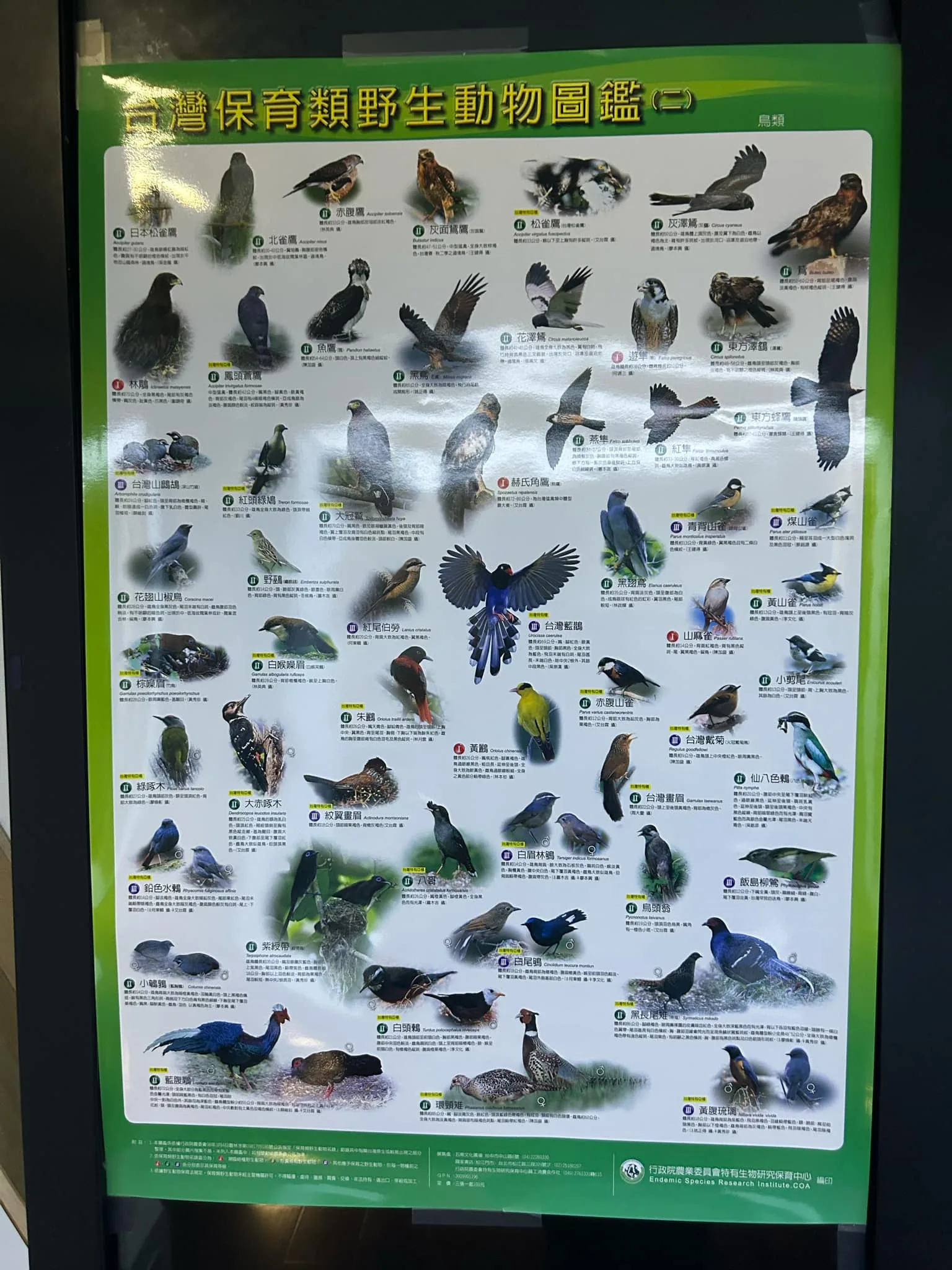
A chart with various birds you might see here.

Prevention of Destructive Forest Fires
When you are in the forest or outdoors for any purpose at any time, NEVER carelessly discard cigarette butts!
If you make a fire for outdoor cooking, barbecuing, or warmth, be sure to extinguish the fire before leaving.
If you discover any sparks, put it out immediately or it will turn into a disastrous forest fire.
NEVER make a fire in grassland or dry forest areas with abundant dry branches and fallen leaves.
How to Report a Forest Fire
If you notice any forest fire, report it by calling the Forestry Bureau’s free service line:
0800-000-930 (the “one forest fire” hotline)
0800-057-930 (the “one forest protection” hotline)
You can also call 119 and the fire department will transfer your message to the relevant forestry agency.
Setting Fires Is a Crime
(Articles 34, 53, and 56 of the Forestry Act)
Under the provisions of the Forestry Act, fires shall not be kindled in forest areas without permission. Violators are subject to a fine of up to NT$300,000. Anyone who sets a fire that accidentally destroys a forest is subject to a prison term of up to two years; a person who deliberately sets a fire faces a prison term of up to ten years. The violator will also bear civil responsibility for compensation for damages to the forest.
Report and Earn a Bonus
(Articles 34 and 35 of the Forest Protection Measures)
Reporting a fire and allowing for the apprehension of the perpetrator entitles the reporter to a bonus that will be determined by the competent authority to the extent of the case, the reward amounting to up to NT$100,000.
If you report a case of forest protection area fire protection, resulting in the apprehension of the perpetrator, the Forestry Bureau will issue the reporter a certificate of appreciation and a reward.

Burrowing beetle exhibit.
The Drive Out

On the drive out, we passed by Chuping Archaeological Site, which is the only well-preserved highland prehistoric village site on the island of Taiwan. Although the site is now just an empty field, you can still see the artifacts that are stored at the Museum of History and Philology at Academia Sinica. In this blog, we will explore the physical site as well as its historical and cultural significance…(read more)
Next we drove through the modern Aboriginal village of Chubing, which consists of a lot of these brick houses with metal roofs.

View looking up river near Chubing.

View downriver from Chubing.

Further down the stream here there is the Wujie Dam, which is pretty much totally silted in.

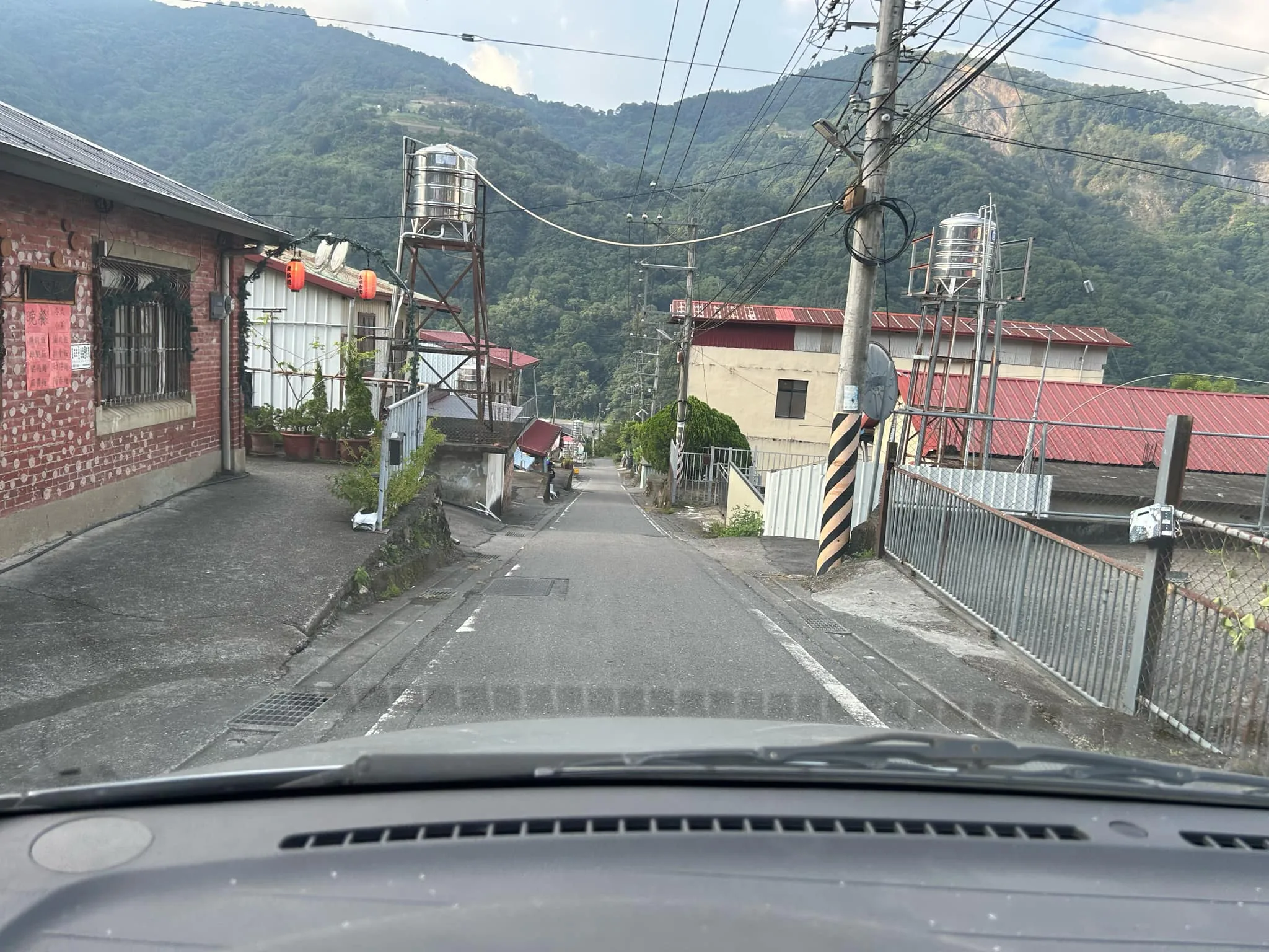
Next, we headed up a mountain toward Puli. Here is a view of Chubing Village from the side of the road.

Formosan Macaque on the side of the road.

Next we drove through a tunnel to get to Puli and the views were amazing on the other side.

Bridge in Puli.

Sunset over Puli.

Another view of the sunset over Puli.

View of the north side of town.

Hues of orange.

View toward Taichung.
And that concludes this blog. Thank you for reading, and stay tuned for more of our blogs on Nantou to come.
Scenic Area Entrance: 200 NT
Parking: Around 100 NT per day for cars
You can book entrance tickets for a discount on Klook here or KKday here.
There are many tours and activities available in Nantou, such as river Tracing, paragliding, Shanlinxi Forest Recreation Area 杉林溪, Cona’s Chocolate Castle, Shuiyuan Suspension Bridge, JOJOZOO Park, and Aowanda Forest Recreation Area.
You can find more tours of Nantou on Klook here or KKday here.
Check out our full guide to Nantou here.
Check out our full guide to Taiwan here.